
Bores
| coat of arms | Germany map | |
|---|---|---|
.png)
|
Coordinates: 54 ° 37 ' N , 9 ° 49' E |
|
| Basic data | ||
| State : | Schleswig-Holstein | |
| Circle : | Schleswig-Flensburg | |
| Office : | Süderbrarup | |
| Height : | 21 m above sea level NHN | |
| Area : | 30.15 km 2 | |
| Residents: | 1161 (Dec. 31, 2019) | |
| Population density : | 39 inhabitants per km 2 | |
| Postal code : | 24392 | |
| Area code : | 04641 | |
| License plate : | SL | |
| Community key : | 01 0 59 187 | |
| LOCODE : | DE 67B | |
| Office administration address: | Königstrasse 5 24392 Süderbrarup |
|
| Website : | ||
| Mayor : | Thomas Detlefsen ( CDU ) | |
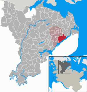
| Location of the municipality of Boren in the Schleswig-Flensburg district | ||
  |
||

Boren ( Danish Borne ) is a municipality in the Schleswig-Flensburg district on the Schlei in the fishing region in Schleswig-Holstein .


history
The region has been inhabited since the Neolithic Age, as indicated by 13 barrows in the municipality.
In the Danish time, the places of today's municipality were part of the Schliesharde (also Schleiharde , Danish Slisherred ).
The St. Marien Church was built in the first half of the 13th century. Since the baroque galleries and boxes were removed and the windows made smaller during renovations from 1938 to 1950, it has been preserved in a relatively Romanesque style . The painting, windows and the relief on the altar table are by Alwin Blaue . A wooden bell tower from 1693 stands a little apart. The local researcher Hans Nicolai Andreas Jensen was a pastor here from 1835 to 1845.
Incorporations
On February 1, 1974, the communities Ketelsby and Lindau were incorporated. On March 1, 2013, Ekenis and Kiesby joined them.
Districts
Boren consists of the districts Affegünt ( Danish Affergynt ), Akeby (Ågeby), Boren (Borne), Fahrtoft (Faartoft or Fårtoft), Grabbelwatt (Grabølvad), Güderott (Gyderød), Güderottstamm, Hegeholz (Hegnholt or Hegeholt), Hoheluft, Hürye (Hyrød), Ketelsby (Danish also Ketilsby ), Kleinboren (Lille Borne), Langschiff, Lindau (Lindå), Lindaufeld, Lindau-Gaarwang (Gaardvang), Lindaukamp (Kamp), Lindaunis (Lindånæs), Papenfeld, Petersfeld , Rehberg (Rebjerg), Uhlekuhl (Ulvekule) and Wrium (Vridam , also Vridom). There are a total of 31 individual villages and settlements.
With the merger in 2013 came the villages of Ekenis (Egenæs) - with Bicken ( Bikum ), Boknis (Bornæs or Bognæs), Ekenisfeld (Egenæsmark), Ekenislund (Egenæslund), Pageroe (Paverød), Wattlück (Vadlyk) - and Kiesby (Kisby) ) - with Bremswatt (Bremsvad), Kaltoft (Kalvtoft) and Kiesbyfeld (Kisbymark) - to the municipality of Boren.
Lindau, Lindau-Mühlenholz, Lindau Mühlenholz
In order to avoid confusion with other places of the same name, Lindau mill wood or Lindau mill wood is often used (especially in old documents). The reason is that the main road that leads through the district of Lindau is called Mühlenholz (Danish: Mølleskov ).
The Galerie Holländer windmill from 1837 was renovated in 1985 and is ready for use.
Lindaunis
In Lindaunis there is the Lindaunis Bridge , a bascule bridge with a steel lattice box construction for rail and road traffic. It is opened a quarter of an hour before every full hour during the day if required. The Flensburg – Kiel railway line crosses the bridge, which is also operated by the railway. Since the tracks on the single-lane structure run in the middle of the lane, road traffic has to wait for oncoming traffic as well as for trains passing through and when opening for ships. Lindaunis station was closed in 1987 and is now a restaurant.
Lindaunis was the place of residence and work of the hunting historian Hans Jessen , author a. a. the hunting history of Schleswig-Holstein.
Good Danish Lindau
The Danish Lindau estate (Danish: Lindaa ), which was built in 1415, has a manor house from the 15th century, which is unusual for the region. It is a single-storey brick hall building that is thatched and contains a knight's hall . It became known through film and television recordings, including for the television series Der Landarzt (since 1986).
In contrast to the earlier Gut Deutsch-Lindau, which was located further south in the Danish Wohld, the Gut Dänisch-Lindau was named.
Ekenis
Ekenis, a typical round village , was first mentioned in 1352. Since Ekenis is not recorded in the earth book of the Danish King Waldemar in 1231 , it is assumed that it was founded in the second half of the 13th century. Sites of flint daggers, flint points and several barrows from the Neolithic and Bronze Age bear witness to a settlement from this period. Furthermore, urn graves from the Roman Empire and remains of an Ice Age settlement have been found. Based on the field names it is assumed that the place was founded by Jutian farmers.
There were remains of a medieval castle in Pageroe . Margaret of Denmark bought the castle in 1406 and then had it demolished.
Kiesby
Kiesby was first mentioned in 1386. The place name means "the village or settlement of Kisi". The place is predominantly agricultural. In the relatively small town of Kiesby, two children's homes have established themselves, which is why the average age of the village residents is rather low.
politics
Community representation
After a commissioner appointed by the local supervisory authority (the last mayor of the old community of Boren) had performed the tasks of community council and mayor since the merger with Ekenis and Kiesby, a new community council was elected on May 26, 2013. Since then, the CDU and the constituency AWB have each had four of the eleven seats, while the Green Alternative List GAL has three.
coat of arms
Blazon : "In gold between two blue wave beams an oily fish (Schleischnäpel), about a blue fünfspeichiges wagon wheel, accompanied by a green right fünfhalmigen Garbe, left by a green oak leaf, topped with three golden acorns."
Historical reason: The coat of arms of the new municipality of Boren, created on March 1, 2013 through the merger of the former, independent municipalities of Boren, Ekenis and Kiesbye, picks up on the colors of the old municipalities. The central figure of the wagon wheel is taken from the coat of arms of the old municipality of Kiesbye. The five-spoke wheel is meant to stand across the board - and equally important - for trade, craft, agriculture and tourism. The number of spokes corresponds to the number of former municipalities and today's districts that form today's municipality of Boren as a result of the incorporations of 1974 (Ketelsby and Lindau) and 2013 (Ekenis and Kiesbye). The wave bars refer to the spring "Borne" near the Boren Thingplatz. The current place name Boren developed over the course of history from the Danish name “Borne”. The Schleischnäpel was the bread fish of the grinding trade in earlier times. It stands for the Schleiregion from Lindau to Ketelsby. The fish and wave beams come from the coat of arms of the old municipality of Boren. The sheaf tied from five ears of corn indicates agriculture, which still has a strong impact on the community today. The number five corresponds to the number of districts. The oak leaf is borrowed from the coat of arms of the old municipality of Ekenis. There is a reference to the oak forest in historical times. The three acorns symbolize the three old communities of Boren, Ekenis and Kiesbye.

From January 31, 2008 to February 28, 2013, the municipality of Boren carried the coat of arms on the right with the following blazon: “A blue cross in gold lined with blue. 1 a blue winged cross, 2 a blue oak branch with an acorn and two leaves, 3 two blue fish on top of each other and 4 three floating blue wavy bars. "
Historical reason: The coat of arms shows the symbol of the Dutch windmill from 1837 for the Lindau district, the oak for the Güderott district and the fish for the Lindaunis - Ketelsby Schleiregion. The “Borne” spring near the “Thinkplatz”, where the court was held and where the horses were watered in the Middle Ages, is symbolized by the wave beams. The place name Boren emerged from the Danish Borne.
economy
Large parts of the community are dominated by agriculture. A tourist center is located on the Lindauer Noor der Schlei.
Attractions

Personalities
- Metta von Schwaben (1636–1709), benefactress, conventual, prioress and the last of the von Schwawe family .
- Friedrich Valentiner (1756–1813), German mathematician and astronomer
- Johannes Bernhard (1846–1915), senior pastor in Lübeck
Web links
Individual evidence
- ↑ North Statistics Office - Population of the municipalities in Schleswig-Holstein 4th quarter 2019 (XLSX file) (update based on the 2011 census) ( help on this ).
- ↑ Boren Church ( Memento of the original from March 6, 2016 in the Internet Archive ) Info: The archive link was inserted automatically and has not yet been checked. Please check the original and archive link according to the instructions and then remove this notice.
- ^ Federal Statistical Office (ed.): Historical municipality directory for the Federal Republic of Germany. Name, border and key number changes in municipalities, counties and administrative districts from May 27, 1970 to December 31, 1982 . W. Kohlhammer GmbH, Stuttgart / Mainz 1983, ISBN 3-17-003263-1 , p. 184 .
- ↑ Johannes Kok: Det danske folkesprog i Sønderjylland , Volume 2, København 1867, p. 218
- ↑ Johannes Kok: Det danske folkesprog i Sønderjylland , Volume 2, København 1867, p. 449
- ↑ Jens P. Trap: Statistisk-topographisk beskrivelse af Hertugdømmet Slesvig , Volume 2, 1861-64, p. 532
- ^ M. Mørk Hansen: Kirkelig Statistics over Slesvig Stift: Med historiske og topografiske bemærkninger , Volume 2, Kjøbenhavn 1864, p. 411
- ^ M. Mørk Hansen: Kirkelig Statistics over Slesvig Stift: Med historiske og topografiske bemærkninger , Volume 2, Kjøbenhavn 1864, p. 411
- ↑ Jens Peter Trap: Statistisk-topographisk beskrivelse af hertugdømmet Slesvig , Kjøbenhavn 1864, p. 528
- ↑ Jens Peter Trap: Statistisk-topographisk beskrivelse af hertugdømmet Slesvig , Kjøbenhavn 1864, p. 529
- ↑ Schleswig-Holstein's municipal coat of arms
- ↑ Schleswig-Holstein's municipal coat of arms
Ahneby | Alt Bennebek | Arnis | Ausacker | Bergenhusen | Böel | Böklund | Bollingstedt | Bores | Borgwedel | Börm | Böxlund | Brodersby-Goltoft | Busdorf | Dannewerk | Dollerup | Dbodstedt | Eggebek | Ellingstedt | Invent | Esgrus | Fahrdorf | Free will | Gelting | Geltorf | Glücksburg (Baltic Sea) | Grödersby | Great Rheide | Großewiehe | Large voltage | Grundhof | Handewitt | Harrislee | Hasselberg | Havetoft | Hollingstedt | Holt | Hörup | Hürup | Husby | Hüsby | Idstedt | Jagel | Janneby | Jardelund | Jerrishoe | Jörl | Jübek | Kappeln | Folded wood | Klein Bennebek | Klein Rheide | Kronsgaard | Kropp | Long-crowned | Langstedt | Lindewitt | Loit | Lottorf | Lürschau | Maasbüll | Maasholm | Medelby | Meggerdorf | Meyn | Middle fishing | Mohrkirch | Munkbrarup | Neuberend | Nieby | Sneeze gray | Norderbrarup | Nordhackstedt | Nottfeld | Nübel | Oersberg | Oeversee | Osterby | Pommerby | Rabel | Raven wood | Rabenkirchen-Faulück | Ringsberg | Rügge | Saustrup | Schaalby | Schafflund | Scheggerott | Schleswig | Schnarup-Thumby | Schuby | Selk | Sieverstedt | Silberstedt | Sollerup | Soerup | Hatchback | Stack | Steinberg | Steinberg Church | Steinfeld | Sterup | Proud | Stoltebüll | Struxdorf | Süderbrarup | Süderfahrenstedt | Süderhackstedt | Taarstedt | Tarp | Tastrup | Tetenhusen | Tielen | Tolk | Treia | Twedt | Uelsby | Ulsnis | Wagersrott | Wallsbull | Wanderup | Wees | Weesby | Westerholz | Wohlde