
St. Leonhard (Nuremberg)
|
St. Leonhard
Statistical District 20 City of Nuremberg
Coordinates: 49 ° 26 '23 " N , 11 ° 3' 7" E
|
|
|---|---|
| Area : | 1.29 km² |
| Residents : | 14,717 (Dec. 31, 2015) |
| Population density : | 11,426 inhabitants / km² |
| Incorporation : | 1898 |
| Incorporated into: | Nuremberg |
| Postal code : | 90439 |
| Area code : | 0911 |
 Location of the statistical district 20 St.Leonhard
|
|
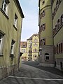
 Tenement house in St. Leonhard
|
|
St. Leonhard was incorporated into the city of Nuremberg as part of the municipality of Sündersbühl on January 1, 1898 and gave its name to the statistical district 20 in the western inner city belt .
location
The district is located southwest of Nuremberg's old town. It is roughly bounded by the Frankenschnellweg in the northeast, Schwabacher Strasse and Geisseestrasse or the parallel S-Bahn line in the southeast, Gustav-Adolf-Strasse in the west and Wallensteinstrasse and Rothenburger Strasse in the northwest. Neighboring districts are Gostenhof , Steinbühl and Sandreuth , Schweinau in the south and Großreuth near Schweinau and Sündersbühl .
| Neighboring statistical districts | |||||||||
|---|---|---|---|---|---|---|---|---|---|
|
.svg)
The northern part of the statistical district 20 is in the district 3470 Sündersbühl , the southern part in the district 3468 Schweinau .
history
The origin of the quarter is in the 14th century, when a Siechkobel was built there a good way outside the city walls, a place where the sick and lepers had to live. To avoid infection, the imperial city of Nuremberg strictly separated the sick from the healthy population in this way; other Siechkobels that were created during the same period were located in today's districts of St. Johannis , St. Peter and St. Jobst . The four medieval Nuremberg Siechkobels were institutions in which the sick and lepers were cared for, which were numerous in medieval Nuremberg after the Crusades. Today they would be called hospices for the dying.
The Leonharder Siechkobel was assembled with the Church of St. Leonhard and stood in the area of today's nave. The associated farm buildings were built on the site of today's parish hall. Like its counterpart in St. Johannis, the Siechkobel here was only responsible for the sick women.
At the end of the 18th century there were 7 properties in St. Leonhard. The high court exercised the imperial city of Nuremberg , which was contested by the Brandenburg-Ansbach Oberamt Cadolzburg and the Oberamt Schwabach . Landlords were the Deutschordenskommende Nürnberg (1 half courtyard), the Siechkobel St. Leonhard of the imperial city of Nuremberg (1 Siechkobel licensed, 1 school building) and the Nuremberg owners of Grundherr (2 houses), von Haller (1 estate) and von Scheurl (1 house ).
From 1796 St. Leonhard was administered by the Prussian Justice and Chamber Office Gostenhof . In 1806 St. Leonhard came to the Kingdom of Bavaria . As part of the parish edict , St. Leonhard was assigned to the Sündersbühl tax district formed in 1808 . It also belonged to the rural community Sündersbühl , which was founded in the same year . In voluntary jurisdiction, 1 property was subject to the Fischbach Patrimonial Court from 1822 to 1848 and 9 properties to the Großgründlach Patrimonial Court until 1823 . In 1898 St. Leonhard was incorporated into Nuremberg .
In the course of industrialization, St. Leonhard grew strongly. Numerous factories were built in neighboring Schweinau and the workers' accommodation required for this in St. Leonhard. Due to its proximity to workplaces, St. Leonhard has become a popular residential area. But because here, as in Schweinau, there were some unpopular systems, e.g. B. for sewage disposal, the area did not have the best reputation.
Since the 2000s, Leonhardspark has been created as a "small part of the city" on the site of the former slaughterhouse and cattle yard ("close to the city and yet in the countryside"), a newly designed area with apartments for senior citizens, students and trainees, with homes and social buildings and with water basins, green areas and a place for festivals and markets.
Architectural monuments
- Catholic parish church of St. Boniface
- Evangelical Lutheran Parish Church of St. Leonhard
- Former company building of the Nuremberg slaughterhouse and cattle yard
- Former elementary school
- Tenement houses
Population development
| year | 1818 | 1824 | 1840 | 1861 | 1871 | 1885 |
|---|---|---|---|---|---|---|
| Residents | 80 | 117 | 117 | * | 234 | 1153 |
| Houses | 9 | 10 | 9 | 78 | ||
| source |
religion
The place has been predominantly Protestant since the Reformation. The residents of the Evangelical Lutheran denomination are parish to St. Leonhard , the residents of the Roman Catholic denomination are parish to St. Boniface .
The church building

The church of St. Leonhard was consecrated on January 25, 1317 with the permission of Bishop Wulfing von Stubenberg, Prince-Bishop of Bamberg (1304-1318), by the Cistercian monk and wandering titular bishop Dytmarus von Gabulon. The initially small chapel initially had many patrons (Maria, Katharina, Margareta, Erasmus and finally Leonhard) until Leonhard prevailed as the patron saint. The church was donated by the vicar of St. Lorenz, Herrmann Schürstab, who came from the patrician family of Schürstab. In order to secure the financing of the church service, the rector of the Lorenz parish council, Pastor Walther, founded the necessary beneficiary foundation on February 18, 1362. This was done with the approval of Bishop Leupold von Bamberg. Immediately after Pastor Walther's death, the Nuremberg Council protested for fear of losing the Siechkobel to the Prince Diocese of Bamberg. Archbishop Leupold had to withdraw the permit in 1363 - shortly before his death. St. Leonhard remained tied to St. Lorenz. On August 18, 1446, almost 100 years later, Pastor Dr. Knörr again applied for a beneficiary foundation, now at the City Council of Nuremberg. This was approved on October 10, 1465 and notarized on October 25, 1483 with the death of the founder Dorothea Mörlin. In this document a rectory next to the church is mentioned for the first time. The parish office was still a vicariate of St. Lorenz.
Personalities
- Karl Hartmann (* 1869 in St. Leonhard, † 1971 in Bayreuth), teacher and historian
gallery

Apartment buildings on the corner of Orffstrasse and Kreutzerstrasse

The "Frankenstüberl" in Leopoldstrasse 18

The St. Leonhard Middle School in the north of the district
View into the school yard of the St. Leonhard School

High-rise residential building at Rothenburger Strasse 209
The Wallenstein Clinic, Rothenburger Str. 243

Tenement houses with the addresses Schweinauer Strasse 36–40

The “Little Labba” in Schweinauer Straße 50
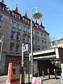
Exit to the St. Leonhard underground station

The “Seray Imbiss” in Schweinauer Strasse 35

The "Villa Leon" in Philipp-Koerber-Weg 1 in the extreme northeast of the district
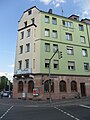
Corner house at Rothenburger Strasse 265


literature
- Johann Kaspar Bundschuh : St. Leonhard . In: Geographical Statistical-Topographical Lexicon of Franconia . tape 3 : I-Ne . Verlag der Stettinische Buchhandlung, Ulm 1801, DNB 790364301 , OCLC 833753092 , Sp. 331 ( digitized version ).
- Günther P. Fehring , Anton Ress , Wilhelm Schwemmer: The city of Nuremberg (= Bavarian art monuments . Volume 10 ). 2nd Edition. Deutscher Kunstverlag, Munich 1977, ISBN 3-422-00550-1 , p. 309-310, 341 ff .
- Wiltrud Fischer-Pache: Leonhard (district) . In: Michael Diefenbacher , Rudolf Endres (Hrsg.): Stadtlexikon Nürnberg . 2nd, improved edition. W. Tümmels Verlag, Nuremberg 2000, ISBN 3-921590-69-8 , p. 625 ( online ).
- Hanns Hubert Hofmann : Nuremberg-Fürth (= Historical Atlas of Bavaria, part Franconia I, 4). Commission for Bavarian State History, Munich 1954, DNB 452071224 , p. 137 ( digitized version ). Ibid. S. 244 ( digitized version ).
Web links
- District data sheet Nuremberg - Statistical District 20 St. Leonhard , as of 2015 (PDF; approx. 120 kB)
- St. Leonhard in the historical directory of the association for computer genealogy
- St. Leonhard / Schweinau civic association
- Parish Nuremberg - St. Leonhard - Schweinau
- District side St.Leonhard - Schweinau
- Media workshop Franconia: St. Leonhard - the misunderstood part of the city (video, running time: 28:50 minutes)
Individual evidence
- ^ City of Nuremberg, Office for Urban Research and Statistics for Nuremberg and Fürth (ed.): Statistical Yearbook of the City of Nuremberg 2016 . December 2015, ISSN 0944-1514 , 18 Statistical City Districts and Districts, p. 244–245 , p. 244 ( nuernberg.de [PDF; 6.3 MB ; accessed on November 1, 2017]).
- ^ Wilhelm Volkert (ed.): Handbook of Bavarian offices, communities and courts 1799–1980 . CH Beck, Munich 1983, ISBN 3-406-09669-7 , p. 602 .
- ^ City map service Nuremberg
- ↑ St. Leonhard in the Bavaria Atlas
- ^ City map service Nuremberg
- ↑ a b From the Siechkobel to the colorful district. Nürnberger Nachrichten of January 21, 2013, p. 10.
- ↑ Article about the history of the town of St. Leonhard ( Memento of the original from February 8, 2010 in the Internet Archive ) Info: The archive link was inserted automatically and has not yet been checked. Please check the original and archive link according to the instructions and then remove this notice. , Portal of BV Leonhard / Schweinau.
- ↑ HH Hofmann, p. 137.
- ↑ W. Fischer-Pache, p. 625.
- ↑ a b H. H. Hofmann, p. 244.
- ↑ Only inhabited houses are given. In 1818 these are known as fireplaces , in 1840 as houses , and from 1871 to 1885 as residential buildings.
- ↑ Alphabetical index of all the localities contained in the Rezatkkreis according to its constitution by the newest organization: with indication of a. the tax districts, b. Judicial Districts, c. Rent offices in which they are located, then several other statistical notes . Ansbach 1818, p. 79 ( digitized version ).
- ↑ Eduard Vetter (Ed.): Statistical handbook and address book of Middle Franconia in the Kingdom of Bavaria . Self-published, Ansbach 1846, p. 209 ( digitized version ).
- ^ Joseph Heyberger, Chr. Schmitt, v. Wachter: Topographical-statistical manual of the Kingdom of Bavaria with an alphabetical local dictionary . In: K. Bayer. Statistical Bureau (Ed.): Bavaria. Regional and folklore of the Kingdom of Bavaria . tape 5 . Literary and artistic establishment of the JG Cotta'schen Buchhandlung, Munich 1867, Sp. 1066 , urn : nbn: de: bvb: 12-bsb10374496-4 ( digitized ).
- ↑ Kgl. Statistical Bureau (ed.): Complete list of localities of the Kingdom of Bavaria. According to districts, administrative districts, court districts and municipalities, including parish, school and post office affiliation ... with an alphabetical general register containing the population according to the results of the census of December 1, 1875 . Adolf Ackermann, Munich 1877, 2nd section (population figures from 1871, cattle figures from 1873), Sp. 1232 , urn : nbn: de: bvb: 12-bsb00052489-4 ( digitized version ).
- ↑ K. Bayer. Statistical Bureau (Ed.): Localities directory of the Kingdom of Bavaria. According to government districts, administrative districts, ... then with an alphabetical register of locations, including the property and the responsible administrative district for each location. LIV. Issue of the contributions to the statistics of the Kingdom of Bavaria. Munich 1888, Section III, Sp. 1166 ( digitized version ).
.svg)
.svg)
Almoshof | Altenfurt | Bärenschanze | Pearwood | White lead | Boxing Village | Brunn | Book | Buchenbühl | Doos | Dutzendteich | Eberhardshof | Eibach | Eibacher Forest | Erlenstegen | Falkenheim | Fischbach | Open air settlement | Gaismannshof | Galgenhof | Gardens near Wöhrd | Gardens behind the fortress | Garden city | Gaulnhofen | Gebersdorf | Gerasmühle | Gibitzenhof | Gleißbühl | Gleißhammer | Glockenhof | Gostenhof | Greuth | Großgründlach | Großreuth near Schweinau | Großreuth behind the fortress | Gugelstrasse | Guntherstrasse | Hammer | Hasenbuck | Herpersdorf | Herrnhütte | Himpfelshof | Holzheim | Courtyards | Courtly | Hummelstein | St. Jobst | St. Johannis | Katzwang | Kettelersiedlung | Kleingründlach | Kleinreuth near Schweinau | Kleinreuth behind the fortress | Kleinweidenmühle | Klingenhof | Royal court | Koppenhof | Kornburg | Powerhouse | Settlement of war sacrifices | Krottenbach | Long water | Laufamholz | St. Leonhard | Leyh | Lichtenhof | Tan | Loher Moos | Lohhof | Lorenz | Ludwigsfeld | Maiach | Marienberg | Marienvorstadt | Maxfeld | Middle mill | Mögeldorf | Moorenbrunn | Mooshof | Muggenhof | Mühlhof | Net stall | Neukatzwang | Neulandsiedlung | Neunhof | Neuröthenbach | Neuselsbrunn | North Station | Northeast Station | Oberbürg | Obermühle | St. Peter | Pillenreuth | Pirckheimerstrasse | Rabus | Marshalling yard settlement | Rechenberg | Rehhof | Reichelsdorf | Reichelsdorfer Keller | Rennweg | Reutles | Rosenau | Röthenbach near Schweinau | Sandberg | Sandreuth | Sheep farm | Schmalau | Schnepfenreuth | Schniegling | Schoppershof | Schweinau | Sebald | Seeleinsbühl | Spitalhof | Quarries | Steinbühl | Stone slab | Sündersbühl | Tafelhof | Clay | Tullnau | Lower guarantee | Veilhof | Vistula Garden | Weigelshof | Weiherhaus | Werderau | Westfriedhof | Wetzendorf | Wöhrd | Worzeldorf | Zerzabelshof | Brick | Customs House
(0) Old town and closer inner city : (01) Old town, St. Lorenz | (02) Marienvorstadt | (03) Tafelhof | (04) Gostenhof | (05) Himpfelshof | (06) Old Town, St. Sebald | (07) St. Johannis | (08) Pirckheimerstraße | (09) Wöhrd • (1) Further inner city belt south : (10) Ludwigsfeld | (11) Glockenhof | (12) Guntherstrasse | (13) Galgenhof | (14) Hummelstein | (15) Gugelstrasse | (16) Steinbühl | (17) Gibitzenhof | (18) Sandreuth | (19) Schweinau • (2) Further inner city belt west / north / east : (20) St. Leonhard | (21) Sündersbühl | (22) Bärenschanze | (23) Sandberg | (24) Bielingplatz | (25) Uhlandstrasse | (26) Maxfeld | (27) Veilhof | (28) Tullnau | (29) Gleißhammer • (3) Southeastern outer city : (30) Dutzendteich | (31) Marshalling yard settlement | (32) Langwasser Northwest | (33) Langwasser Northeast | (34) Beuthener Strasse | (35) Altenfurt North | (36) Langwasser Southeast | (37) Langwasser Southwest | (38) Altenfurt, Moorenbrunn | (39) Nuremberg-Feucht business park • (4) Southern outer city : (40) Hasenbuck | (41) Marshalling yard | (42) Katzwanger Strasse | (43) Dianastraße | (44) Trier Street | (45) Garden City | (46) Werderau | (47) Maiach | (48) Katzwang, Reichelsdorf Ost, Reichelsdorfer Keller | (49) Kornburg, Worzeldorf • (5) South-western outskirts : (50) Hohe Marter | (51) Röthenbach West | (52) Röthenbach Ost | (53) Eibach | (54) Reichelsdorf | (55) Krottenbach, Mühlhof • (6) Western outer city : (60) Großreuth near Schweinau | (61) Gebersdorf | (62) Gaismannshof | (63) Courts | (64) Eberhardshof | (65) Muggenhof • (7) Northwest outer city : (70) Westfriedhof | (71) Schniegling | (72) Wetzendorf | (73) book | (74) clay | (75) Almoshof | (76) Kraftshof | (77) Neunhof | (78) Boxdorf | (79) Großgründlach • (8) Northeastern outer city : (80) Schleifweg | (81) Schoppershof | (82) Sheep Farm | (83) Marienberg | (84) brick | (85) Mooshof | (86) Buchenbühl | (87) Airport • (9) East outer city : (90) St. Jobst | (91) Erlenstegen | (92) Mögeldorf | (93) Schmausenbuckstrasse | (94) Laufamholz | (95) Zerzabelshof | (96) Fischbach | (97) Well