Esbareich
|
Esbareich Esbarèish |
||
|---|---|---|

|
|
|
| region | Occitania | |
| Department | Hautes-Pyrénées | |
| Arrondissement | Bagneres-de-Bigorre | |
| Canton | La Vallée de la Barousse | |
| Community association | Neste Barousse | |
| Coordinates | 42 ° 57 ' N , 0 ° 34' E | |
| height | 614-1,675 m | |
| surface | 8.68 km 2 | |
| Residents | 82 (January 1, 2017) | |
| Population density | 9 inhabitants / km 2 | |
| Post Code | 65370 | |
| INSEE code | 65158 | |
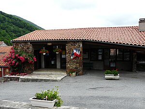
 Town hall (Mairie) of Esbareich |
||
Esbareich ( Gaskognisch Esbarèish ) is a French commune with 82 inhabitants (as of January 1, 2017) in the Hautes-Pyrénées department in the Occitanie region ; it belongs to the Arrondissement of Bagnères-de-Bigorre and the municipality of Neste Barousse . Its inhabitants are called Esbaraichais / Esbaraichaises .
geography
Esbareich is located around 51 kilometers southeast of the city of Tarbes in the east of the Hautes-Pyrénées department on the border with the Haute-Garonne department. The community consists of the village Esbareich and a few groups of houses and individual farmsteads. Large parts of the community are mountainous and forested. The L'Ourse de Sost runs through the municipality northwards and partially forms the municipality boundary. The highest point of the municipality is the Cap de Pouy de Hourmigé in the southeast of the municipality. In terms of traffic, the community is on the D22 and only a few kilometers west of the N125 .
history
The place is mentioned indirectly (de Stovarex ) by name for the first time around the year 980 in the Lézat copy book . In the Middle Ages, the place was within the county of Barousse in the Armagnac region , which in turn was part of the Gascogne province. The parish belonged to the district La Barthe from 1793 to 1801. In addition, Esbareich was within the canton of Mauléon-Barousse from 1793 to 2015 . The municipality has been part of the Bagnères-de-Bigorre arrondissement since 1801.
Population development
| year | 1793 | 1800 | 1846 | 1911 | 1921 | 1962 | 1968 | 1975 | 1982 | 1990 | 1999 | 2006 | 2014 |
| Residents | 396 | 379 | 599 | 405 | 241 | 104 | 97 | 60 | 47 | 53 | 61 | 91 | 80 |
| Sources: Cassini and INSEE | |||||||||||||
Attractions
- numerous typical regional houses and doors / gates
- Stone with relief from Gallo-Roman times
- Notre-Dame de l'Assomption village church from 1862
- the 25 meter long bridge over the Ourse de Sost
- old bread oven
- around a dozen village fountains
- Memorial to the Fallen
- Wegkreuz Croix de Crouzet and another crossroads west of the village
- former village school (now a guest house owned by the municipality)
- Claw stand with tiled roof
- Lavoir (wash house)
Web links
- Location of the place in France
- Esbareich on the side of the IGN
- Notre-Dame de l'Assomption village church
- Sights of the community


