
Capvern
| Capvern | ||
|---|---|---|
.svg)
|
|
|
| region | Occitania | |
| Department | Hautes-Pyrénées | |
| Arrondissement | Bagneres-de-Bigorre | |
| Canton | Neste, Aure et Louron (main town) | |
| Community association | Plateau de Lannemezan | |
| Coordinates | 43 ° 6 ′ N , 0 ° 19 ′ E | |
| height | 358-664 m | |
| surface | 21.84 km 2 | |
| Residents | 1,285 (January 1, 2017) | |
| Population density | 59 inhabitants / km 2 | |
| Post Code | 65130 | |
| INSEE code | 65127 | |
| Website | http://www.mairiecapvern.com/ | |
 Town hall (Mairie) of Capvern |
||

Capvern is a French town with 1,285 inhabitants (as of January 1, 2017) in the Hautes-Pyrénées department in the Occitanie region (before 2016: Midi-Pyrénées ). It belongs to the arrondissement of Bagnères-de-Bigorre and the canton of Neste, Aure et Louron (until 2015: canton of Lannemezan ). The inhabitants are called Capvernois .
geography
Capvern is located about 23 kilometers southeast of Tarbes on the Lannemezan plateau . The Baïse rises in the municipality . Capvern is surrounded by the neighboring communities of Lutilhous and Lagrange in the north, Campistrous in the north and northeast, Lannemezan in the east, Avezac-Prat-Lahitte in the southeast, Tilhouse in the south, Benqué-Molère in the southwest and Mauvezin in the west.
The former route nationale 117 (today's D817) and the autoroute A64 run through the municipality .
history
As Aquae Converanum already existed in the first century BC, the a settlement, thermal springs used in the region. The springs are still used today as a medicinal bath.
Population development
| year | 1962 | 1968 | 1975 | 1982 | 1990 | 1999 | 2006 | 2013 |
| Residents | 763 | 938 | 1,027 | 932 | 1,025 | 1,074 | 1,236 | 1,293 |
| Source: Cassini and INSEE | ||||||||
Attractions
- Saint-Pierre church
- Sainte-Trinité church from the 1960s, monument historique since 2006
- Thermal baths

Saint-Pierre church
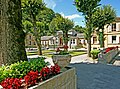
Thermal baths
.JPG)
