
Mouxy
| Mouxy | ||
|---|---|---|
.svg)
|
|
|
| region | Auvergne-Rhône-Alpes | |
| Department | Savoie | |
| Arrondissement | Chambery | |
| Canton | Aix-les-Bains-2 | |
| Community association | Grand Lac - Lac du Bourget | |
| Coordinates | 45 ° 41 ′ N , 5 ° 56 ′ E | |
| height | 349-1,530 m | |
| surface | 6.28 km 2 | |
| Residents | 2,234 (January 1, 2017) | |
| Population density | 356 inhabitants / km 2 | |
| Post Code | 73100 | |
| INSEE code | 73182 | |
| Website | www.mairie-mouxy.fr | |
_par_la_D913_(route_du_Revard)..jpg) Entrance to Mouxy, in the background the Mont Revard |
||

Mouxy is a French commune with 2,234 inhabitants (at January 1, 2017) in the department of Savoie in the region of Auvergne Rhône-Alpes . It belongs to the canton of Aix-les-Bains-2 in the Arrondissement of Chambéry .
geography
Mouxy is located at 420 m , near Aix-les-Bains , about 13 kilometers north of the city of Chambéry (as the crow flies). The village extends in the north-west of the Savoie department, on the western edge of the Bauges massif and at the foot of Mont Revard , in a panoramic position around 160 m above the lake level of Lac du Bourget .
The area of the 6.28 km² municipal area includes a section in the Alpine foothills. The western border runs more or less along the outskirts of Aix-les-Bains, on a terrace above the center. The area is drained by the village stream from Mouxy to the west to the Tillet and thus to the Lac du Bourget. To the east, the community area extends in a narrow strip over the initially gently rising slope of Mouxy. This is followed by the wooded steep slope of Mont Revard, which is characterized by striking, vertically sloping rock walls. On the high plateau of Mont Revard, Mouxy's highest point is reached at 1530 m .
Mouxy includes some new building quarters on the outskirts of Aix-les-Bains, the hamlet of Les Mentens ( 530 m ) on the slope of Mont Revard and several individual farms. Neighboring communities of Mouxy are Pugny-Chatenod in the north, Les Déserts in the east, Drumettaz-Clarafond in the south and Aix-les-Bains in the west.
history
The village appears for the first time in the 11th century under the name Ecclesia de Mauseu in the documents. The name probably goes back to the family name Mustius . Later forms of the name are Mauxie (1232) and Mouxie (1355). In the Middle Ages, the village was owned by the Lords of Grésy-sur-Aix. In its history, the parish of Mouxy was subordinate to different priests, first those of Saint-Paul and Saint-Hippolyte , then from 1344 to the Clarafont priory .
_qui_montait_autrefois_au_Mont_Revard..jpg)
In the 18th and 19th centuries, several water mills were in operation in Mouxy.
From 1892 to 1937 the steam-powered cogwheel railway Chemin de fer du Mont-Revard connected the town of Aix-les-Bains with the summit of Mont Revard, the route of which crossed the municipality of Mouxy and served it with a stop. Their function was taken over by a cable car in 1935 , which overcame the 845 meters in altitude from Mouxy to Mont Revard in a single span and significantly shortened the travel time. Its operations ceased in the spring of 1969 after it had become superfluous due to the expansion of the roads to Mont Revard.
population
With 2,234 inhabitants (as of January 1, 2017), Mouxy is one of the medium-sized communities in the Savoie department. After the population declined in the first half of the 20th century, there has been a marked increase in population since the early 1960s thanks to the attractive residential area. Since then, the number of inhabitants has more than tripled.
| Population development | ||||||||
|---|---|---|---|---|---|---|---|---|
| year | 1962 | 1968 | 1975 | 1982 | 1990 | 1999 | 2006 | 2016 |
| Residents | 688 | 746 | 822 | 910 | 1,308 | 1,523 | 1,842 | 2,241 |
Attractions
The village church of Mouxy was built in the 19th century. The Saint-Victor chapel is on the slope of Mont Revard at 893 m . The former oil mill is no longer in operation.

Mouxy village church

Mayor's Office ( Mairie ) and Mouxy Church

New buildings in the center of Mouxy
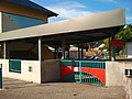
Primary school ( école primaire ) in Mouxy

.JPG)


Economy and Infrastructure
Mouxy was a predominantly agricultural village until well into the 20th century . In addition, there are various small and medium-sized businesses today. In the meantime the village has developed into a residential community. Many employed people are commuters who work in the larger towns in the area, especially in the Aix-les-Bains and Chambéry areas.
The place is well developed in terms of traffic. It is located on the D913 departmental road that leads from Aix-les-Bains via Mont Revard to Les Déserts. Further road connections exist with Drumettaz-Clarafond and Pugny-Chatenod. The next connection to the A41 motorway , which crosses the municipality, is around 7 km away.
Web links
Individual evidence
- ↑ A. Gros: Dictionnaire étymologique des noms de lieu de la Savoie . Belley, Imprimerie Aimé Chaduc, 1937, p. 313 (French, limited preview in Google Book search).
- ^ JJ Vernier: Dictionnaire topographique du département de la Savoie . Imprimerie Savoisienne, 1896, p. 539, 540 (French, online on BNF [accessed January 19, 2014]).
- ^ Research - Mouxy. In: Service de l'inventaire général du patrimoine culturel de Rhône-Alpes. Retrieved November 5, 2014 (French).
- ↑ French Statistics Institute ( www.insee.fr )
- ^ Mouxy - notice communale. In: cassini.ehess.fr. Retrieved October 20, 2014 (French).
- ^ Complete dossier on Mouxy. In: INSEE . Retrieved October 20, 2014 (French).