
Goldebek
| coat of arms | Germany map | |
|---|---|---|

|
Coordinates: 54 ° 41 ′ N , 9 ° 9 ′ E |
|
| Basic data | ||
| State : | Schleswig-Holstein | |
| Circle : | North Friesland | |
| Office : | Central North Friesland | |
| Height : | 12 m above sea level NHN | |
| Area : | 10.18 km 2 | |
| Residents: | 359 (Dec. 31, 2019) | |
| Population density : | 35 inhabitants per km 2 | |
| Postal code : | 25862 | |
| Area code : | 04673 | |
| License plate : | NF | |
| Community key : | 01 0 54 037 | |
| Office administration address: | Theodor-Storm-Strasse 2 25821 Bredstedt, Germany |
|
| Website : | ||
| Mayor : | Peter Jessen (ABCWG) | |
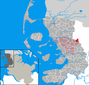
| Location of the community Goldebek in the district of North Friesland | ||
  |
||

Goldebek ( Danish : Goldebæk , North Frisian : Golbäk ) is a municipality in the district of North Friesland in Schleswig-Holstein .
geography
Geographical location
The municipality of Goldebek extends in the eastern area of the historical administrative district of the Nordergoesharde on Schleswig's Vorgeest . The course of the river Linnau flows on a short section through the northern municipality area and there forms the northern border to the neighboring municipality of Lindewitt in its also named district. It forms one of the two main tributaries of the Soholmer Au , which flows into the North Frisian Wadden Sea in Schlüttsiel .
Community structure
In addition to the eponymous village, Heinsbek ( Hegnsbæk , also Hejnsbæk ), Kolonie and Süderhuus (Danish Sønderhuse , also Sønder Lindaa ), as well as the farm settlement Goldebekfeld, are in the municipality.
Neighboring communities
Adjacent municipal areas of Goldebek are:
| Lindewitt | ||
| Goldelund |
.svg)
|
Lindewitt |
| Joldelund |
history
The place was first mentioned in 1321 as tho Goldbeck . The place name is possibly derived from the Danish words golde for barren and sandy soil and bek for brook. Another interpretation is from Danish. was for eunuch Eber from which to more recent bæk has been extended. The field name Heinsbeck probably comes from Danish. hegn for hedge .
On April 1, 1934, the parish county Joldelund was dissolved. All of their village communities, village communities and farmers became independent communities / rural communities, including Goldebek.
The mill stream still exists in the municipality today, but the mill was demolished in 1948.
politics
Community representation
Of the nine seats in the local council as a result of the election results which received the municipal elections in 2018 Wählergemeinschaft ABCWG for six seats, the voter community AcWG three. There was no change in the distribution of seats compared to the previous election in 2013.
mayor
Peter Jessen (ABCWG) was re-elected mayor for the 2018–2023 election period.
coat of arms
Blazon : “Divided by blue and green, humiliated by a golden oblique wave bar. Above a silver windmill with a high base, below a silver ox head. "
Economy and Infrastructure
General
The Goldebeks municipality is predominantly agricultural. In the meantime, the generation of regenerative energy by the Goldebek wind farm has also been added. Located to the east of the village, it comprises four wind turbines of the two-megawatt class.
traffic
The community area is accessed through the Schleswig-Holstein state road 12 on the way between Bredstedt and Wanderup . In Bredstedt there is a connection to the federal highway 5 , in Wanderup to the federal highway 200 . The state road leads directly to the south and past the village .
In public transport the transport composite Schleswig-Holstein , the connection is made through a bus line between Bredstedt and Flensburg about Lindewitt and Großenwiehe (bus R125). This runs every two hours .
Web links
Individual evidence
- ↑ North Statistics Office - Population of the municipalities in Schleswig-Holstein 4th quarter 2019 (XLSX file) (update based on the 2011 census) ( help on this ).
- ↑ Anders Bjerrum: Sydslesvigs stednavne , Vol. 4, Copenhagen 1979–1984. P. 425
- ↑ Johannes Kok: Det danske folkesprog i Sønderjylland , Volume 2, København 1867, page 171
- ↑ Jens Peter Trap: Statistisk-topographisk beskrivelse af hertugdømmet Slesvig , Kjøbenhavn 1864, p. 217
- ^ Housing directory Schleswig-Holstein 1987. (pdf) Retrieved on August 6, 2020 .
- ↑ Relation: Goldebek (1415665) at OpenStreetMap. Retrieved August 6, 2020 .
- ↑ Wolfgang Laur: Historisches Ortsnamelexikon von Schleswig-Holstein , 2nd edition, Neumünster 1992, p. 276
- ↑ Wolfgang Laur: Historisches Ortsnamelexikon von Schleswig-Holstein , 2nd edition, Neumünster 1992, p. 321
- ↑ Anders Bjerrum: Sydslesvigs stednavne , 4th bind, København 1979-1984. s. 425, 427
- ↑ State Statistical Office Schleswig-Holstein (Ed.): The population of the communities in Schleswig-Holstein 1867-1970 . State Statistical Office Schleswig-Holstein, Kiel 1972, p. 251 .
- ↑ Announcement of the municipal election results in the municipality of Goldebek. (pdf) Retrieved September 24, 2018 .
- ^ Minutes of the constituent meeting of the Goldebek municipal council. (pdf) Retrieved September 24, 2018 .
- ↑ Schleswig-Holstein's municipal coat of arms
- ↑ Timetable for bus route R126. (pdf) Accessed August 6, 2020 .
Achtrup | Ahrenshöft | Ahrenviöl | Ahrenviölfeld | Alkersum | Almdorf | Arlewatt | Aventoft | Bargum | Behrendorf | Bohmstedt | Bondelum | Bordelum | Borgsum | Bosbull | Braderup | Bramstedtlund | Bredstedt | Breklum | Dagebüll | Drage | Drelsdorf | Dunsum | Elisabeth-Sophien-Koog | Ellhöft | Emmelsbüll-Horsbüll | Narrow Sands | Fresendelf | Friedrich-Wilhelm-Lübke-Koog | Friedrichstadt | Galmsbüll | Garding | Garding, parish | Goldebek | Goldelund | Gröde | Grothusenkoog | Haselund | Hattstedt | Hattstedtermarsch | Högel | Spar | Hooge | Hörnum (Sylt) | Horstedt | Hude | Humptrup | Husum | Immenstedt | Joldelund | Kampen (Sylt) | Karlum | Katharinenheerd | Klanxbüll | Klixbull | Koldenbüttel | Kolkerheide | Kotzenbüll | Ladelund | Langeneß | Langenhorn | Leak | Lexgaard | List on Sylt | Löwenstedt | Lütjenholm | Midlum | Mildstedt | Fog | Neukirchen | Nieblum | Niebüll | Norddorf on Amrum | Norderfriedrichskoog | North beach | Norstedt | Ockholm | Oevenum | Oldenswort | Oldersbek | Olderup | Oldsum | Ostenfeld (Husum) | Oster-Ohrstedt | Osterhever | Pellworm | Poppenbüll | Ramstedt | Rantrum | Reußenköge | Risum-Lindholm | Rodenäs | Sankt Peter-Ording | Schwabstedt | Schwesing | Seeth | Simonsberg | Sollwitt | Sönnebüll | Sprakebull | Stadum | Stedesand | Struckum | South end | Süderhöft | Süderlügum | South March | Sylt | Tating | Tetenbull | Tinningstedt | Tönning | Tümlauer-Koog | Uelvesbüll | Uphusum | Utersum | Viöl | Vollerwiek | Vollstedt | World | Wenningstedt-Braderup (Sylt) | Wester-Ohrstedt | Westerhever | Westre | Winnert | Wipe | Witsum | Wittbek | Wittdün on Amrum | Joke word | Wobbenbüll | Wrixum | Wyk on Föhr