Colombier (Dordogne)
| Colombier | ||
|---|---|---|
|
|
||
| region | Nouvelle-Aquitaine | |
| Department | Dordogne | |
| Arrondissement | Bergerac | |
| Canton | Sud-Bergeracois | |
| Community association | Communauté d'agglomération Bergeracoise | |
| Coordinates | 44 ° 47 ' N , 0 ° 31' E | |
| height | 54-172 m | |
| surface | 7.03 km 2 | |
| Residents | 257 (January 1, 2017) | |
| Population density | 37 inhabitants / km 2 | |
| Post Code | 24560 | |
| INSEE code | 24126 | |
| Website | www.colombierenperigord.com | |
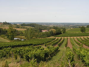
 Vineyards near Colombier |
||
Colombier is a French municipality with 257 inhabitants (at January 1, 2017) in the department of Dordogne in the region Nouvelle-Aquitaine (before 2016: Aquitaine ). The municipality belongs to the Arrondissement Bergerac and the canton Sud-Bergeracois (until 2015: canton Issigeac ).
The name in the Occitan language is Colombièr . It is derived from the Latin colombarium ( German dovecote ).
geography
Colombier is about eight km south-southeast and thus in the catchment area ( Aire urbaine ) of Bergerac in the Bergeracois region of the historic province of Périgord .
Colombier is surrounded by the neighboring communities:
| Bergerac | Saint-Nexans | |
| Monbazillac |

|
Conne-de-Labarde |
| Ribagnac | Bouniagues |
The municipality has the peculiarity of two Bourgs , Colombier and Labadie, which are about 500 m apart. In Colombier is the parish church and the castle, in Labadie the town hall, the school, the festival hall and the tennis court. In addition, 18 hamlets belong to the municipality.
Colombier is located in the catchment area of the Dordogne river .
The Gardonnette, one of its tributaries, marks the border to the south-western neighboring municipality of Ribagnac. Another tributary of the Dordogne, the Ruisseau de Lespinassat, has its source in the municipality, as does the Cavérieu, a tributary of the Conne.
history
Traces of an important village in Gallo-Roman times indicate that the site was first settled in the third century AD. At a place called Les Caraignes , traces of a villa and a Roman road , fragments of clay pots, a statuette and a treasure with around 3,000 coins have been found. Until 1588 Colombier was under the Baronate of Montcuq . Subsequently, Colombier, Monbazillac and Saint-Christophe formed a judicial district with the seat at the castle of Monbazillac. In 1608 a fort was built in the Colombier area to protect the castle. In 1761 the parish priest refused, with the approval of the Bishop of Sarlat, to accept a Protestant as sponsor for a bell. During the French Revolution , Pastor Chanut was prevented from reading mass . He first celebrated it in the adjacent forest, but was soon asked to refrain from doing so. Thereupon he took the required oath on the civil constitution of the clergy . In 1802 he became pastor of Monbazillac and ridiculed the unruly priests. The former national road from Paris to Barèges ran through the municipality. It was used by several French kings who traveled from Paris to Barèges or Dax .
Toponymy
Toponyms and mentions of Colombier were:
- Eccl. de Colombiera (1556, shield of the dioceses of Périgueux and Sarlat),
- Colombiers (1750, map by Cassini ),
- Colombier (1793 and 1801, Notice Communale and Bulletin des Lois, respectively ).
Population development
After the records began, the number of inhabitants rose to a peak of around 440 in the first half of the 19th century. In the following period, the size of the community decreased, reaching a relative high again in the first half of the 19th century at around 415 inhabitants, However, it then fell again with short recovery phases up to the 1980s to 195 inhabitants, before a moderate growth phase set in, which continues today.
| year | 1962 | 1968 | 1975 | 1982 | 1990 | 1999 | 2006 | 2010 | 2017 |
|---|---|---|---|---|---|---|---|---|---|
| Residents | 241 | 233 | 212 | 195 | 228 | 226 | 235 | 242 | 257 |
Town twinning
Colombier has been twinning with Notre-Dame-de-la-Merci in the Canadian province of Québec since 1996 .
Attractions
Parish Church of Saint-Pierre-et-Saint-Paul
The church, dedicated to Saints Peter and Paul , was built on the top of a hill in the 12th century and rebuilt in the 18th century. It has a flat apse with a choir , which is designed with a barrel vault . The main nave is covered by a ribbed vault, the two side chapels have a groined vault . The bell gable, covered with stone slabs, rests on a two meter thick wall and contains three bells. On the right behind the Renaissance- style entrance you will find a spiral staircase, on the left a small baptistery from the 16th century. The holy water font was created from a column of a former Roman temple . The church has been inscribed as a Monument historique since October 12, 1948 .
Jaubertie Castle
The castle got its name from a small river that flows through the estate. Traces of a camp from the Neolithic period have been found here. In the 12th century the site was known as a fiefdom . In the 16th century it became a hunting estate owned by King Henry IV of France , who gave it to his mistress Gabrielle d'Estrées in 1592 . From 1658 to 1858 the castle was owned by the Calbiac family, except during the French Revolution . Leon Beylet, Marie-Antoinette's personal physician , resided here during this time. He completed the building in the style of the Directoire together with a summer residence for his mistress, a dancer. The coat of arms above the entrance still bears the monogram "LB" today . From the end of the 18th century to the beginning of the 20th century, the castle underwent several renovations. The adjacent pavilions were separated from the main house at the beginning of the 19th century. The gable of the main facade was altered as a result of a fire in 1916. Since 1973 the property has been successively owned by members of the Ryman family. Facades and roofs of the castle, the pavilions, the dovecotes and the fountain have been inscribed together as Monument historique since July 12, 2004 .
Economy and Infrastructure
Viticulture is one of the most important economic factors in the municipality.
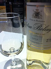
Colombier is located in the AOC des Bergerac with the appellations Bergerac and Côtes de Bergerac and des Monbazillac , a dessert wine .

total = 35
education
The municipality has a public preschool and elementary school with 43 pupils in the 2018/2019 school year.
sport and freetime
- The GR 6 long-distance hiking trail from Sainte-Foy-la-Grande ( Gironde department ) to Saint-Paul-sur-Ubaye ( Alpes-de-Haute-Provence department ) passes the center of Colombier.
- The Boucle autour de la vigne à Colombier circuit is 5.5 km long with a difference in altitude of 50 m. It leads from the center through the vineyards of the municipality.
- The A vélo autour de Monbazillac circular cycle route is 24 km long with a difference in altitude of 41 m. From Monbazillac it also runs through the center of Colombier.
traffic
The National Route 21 crosses the territory of the municipality and connects it with Bergerac in the north and Villeneuve-sur-Lot in the neighboring Lot-et-Garonne department . Colombier can also be reached via Routes départementales 13 and 14.
Web links
- Colombier on the Pays de Bergerac Tourisme website (French)
- Colombier on the Association of Local Authorities website (French)
- Information about Bergerac wines
- Information on Monbazillac wines
Individual evidence
- ↑ Le nom occitan des communes du Périgord ( fr ) Départementrat des Dordogne. Retrieved October 16, 2018.
- ^ A b Colombier ( fr ) Conseil régional d'Aquitaine. Archived from the original on September 9, 2016. Retrieved October 16, 2018.
- ^ Colombier - Découvrir ( fr ) Municipality of Colombier. Retrieved October 16, 2018.
- ^ Ma commune: Colombier ( fr ) Système d'Information sur l'Eau du Bassin Adour Garonne. Retrieved October 16, 2018.
- ^ Colombier - Histoire ( fr ) Municipality of Colombier. Retrieved October 16, 2018.
- ^ Paul Vicomte de Gourgues: Dictionnaire topographique du département de la Dordogne ( fr ) In: Dictionnaire topographique de la France . Imprimerie nationale. P. 80, 1873. Retrieved October 16, 2018.
- ^ France 1750 ( en ) David Rumsey Map Collection: Cartography Associates. Retrieved October 16, 2018.
- ↑ a b Notice Communale Colombier ( fr ) EHESS . Retrieved October 16, 2018.
- ↑ Populations légales 2006 Commune de Colombier (24126) ( fr ) INSEE . Retrieved October 16, 2018.
- ↑ Populations légales 2015 Commune de Colombier (24126) ( fr ) INSEE . Retrieved October 16, 2018.
- ^ Colombier - Accueil ( fr ) Municipality of Colombier. Retrieved October 16, 2018.
- ↑ Eglise ( fr ) Ministry of Culture and Communication . September 22, 2015. Accessed October 16, 2018.
- ↑ a b Colombier - Monuments ( fr ) Municipality of Colombier. Retrieved October 16, 2018.
- ^ Château de la Jaubertie ( fr ) Ministry of Culture and Communication . September 22, 2015. Accessed October 16, 2018.
- ^ Colombier - Vie économique ( fr ) Municipality of Colombier. Retrieved October 16, 2018.
- ↑ Institut national de l'origine et de la qualité: Rechercher un produit ( fr ) Institut national de l'origine et de la qualité . Retrieved October 16, 2018.
- ↑ Caractéristiques des établissements en 2015 Commune de Colombier (24126) ( fr ) INSEE . Retrieved October 16, 2018.
- ^ École maternelle et élémentaire ( fr ) National Ministry of Education. Retrieved October 16, 2018.
- ↑ GR6 - Randonnée de Ste Foy-la-Grande (Gironde) à Eyzies-de-Tayac-Sireuil (Dordogne) ( fr ) gr-infos.com. Retrieved October 16, 2018.
- ^ Boucle autour de la vigne à Colombier ( fr ) Institut national de l'information geographique et forestière (IGN). March 14, 2018. Retrieved October 16, 2018.
- ↑ A vélo autour de Monbazillac ( fr ) Institut national de l'information géographique et forestière (IGN). March 14, 2018. Retrieved October 16, 2018.


