
Leiningen (Hunsrück)
| coat of arms | Germany map | |
|---|---|---|

|
Coordinates: 50 ° 8 ' N , 7 ° 34' E |
|
| Basic data | ||
| State : | Rhineland-Palatinate | |
| County : | Rhein-Hunsrück district | |
| Association municipality : | Hunsrück-Middle Rhine | |
| Height : | 448 m above sea level NHN | |
| Area : | 5.75 km 2 | |
| Residents: | 703 (Dec. 31, 2019) | |
| Population density : | 122 inhabitants per km 2 | |
| Postal code : | 56291 | |
| Area code : | 06746 | |
| License plate : | SIM, GOA | |
| Community key : | 07 1 40 084 | |
| Community structure: | 4 districts | |
| Association administration address: | Rathausstrasse 1 56281 Emmelshausen |
|
| Website : | ||
| Local Mayor : | Frank Morschhauser | |
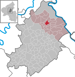
| Location of the local community of Leiningen in the Rhein-Hunsrück district | ||
  |
||


Leiningen is a municipality in the Rhein-Hunsrück district in Rhineland-Palatinate . It belongs to the Hunsrück-Mittelrhein community .
Geographical location
Leiningen is located on the heights of the Vorder Hunsrück approx. 15 km from the Rhine and Moselle and 30 km from Koblenz . There is a direct connection to the A 61 . From here there are numerous hiking trails and a direct connection to the Schinderhannes cycle path . The districts Lamscheid , Leiningen and Sauerbrunnen as well as the residential areas Reifenthal , St. Georgsquelle, Sankt Georg-Hof and Marienau belong to the local community .
history
The Counts of Leyen zu Gondorf were the local lords of Leiningen. With the occupation of the left bank of the Rhine in 1794 by French revolutionary troops , the place became French, in 1815 it was assigned to the Kingdom of Prussia at the Congress of Vienna . Since 1946 the place has been part of the then newly founded state of Rhineland-Palatinate.
Today's municipality was re-formed on June 7, 1969 during a regional reform under the name Leiningen-Lamscheid from the dissolved and until then independent municipalities of Leiningen and Lamscheid. On January 1, 1981, the community was renamed Leiningen.
politics
Municipal council
The council in Leiningen consists of twelve council members, who in the local elections on May 26, 2019 in a majority vote were elected, and the honorary mayor as chairman.
mayor
Local mayor is Frank Morschhäuser. In the local elections on May 26, 2019, he was confirmed in his office with 87.11% of the vote.
coat of arms
The coat of arms shows a shield base above a raised blue one, inside a silver pole, in silver a black bowl fountain with a split black water jet, accompanied on the right and left by a red jug.
The lower half of the shield reminds of the family of the Counts von der Leyen zu Gondorf , to whom Leiningen belonged. The upper half of the shield refers to the Leininger-Lamscheider Sauerbrunnen, which was already known in the 16th century for its good spring water . The jugs symbolize the shipping of water abroad around 1786.
See also
Web links
- Local community of Leiningen on the website of the Emmelshausen community
- Literature about Leiningen in the Rhineland-Palatinate state bibliography
Individual evidence
- ↑ State Statistical Office of Rhineland-Palatinate - population status 2019, districts, communities, association communities ( help on this ).
- ↑ State Statistical Office Rhineland-Palatinate (ed.): Official directory of the municipalities and parts of the municipality. Status: January 2018 [ Version 2020 is available. ] . S. 36 (PDF; 2.2 MB).
- ↑ Official municipality directory (= State Statistical Office of Rhineland-Palatinate [Hrsg.]: Statistical volumes . Volume 407 ). Bad Ems February 2016, p. 187 (PDF; 2.8 MB; see also p. 170).
- ↑ The Regional Returning Officer RLP: City Council Election 2019 Leiningen. Retrieved October 6, 2019 .
- ↑ The Regional Returning Officer RLP: direct elections 2019. see Hunsrück-Mittelrhein, Verbandsgemeinde, 15th line of results. Retrieved October 6, 2019 .

Alterkülz | Altweidelbach | Argenthal | Badenhard | Bärenbach | Belg | Belgweiler | Bell (Hunsrück) | Beltheim | Benzweiler | Bergenhausen | Bulging | Bickenbach | Beavers | Birkheim | Boppard | Braunshorn | Bubach | Book | Büchenbeuren | Budenbach | Damscheid | Dichtelbach | Dickenschied | Dill | Dillendorf | Dommershausen | Dörth | Ellern (Hunsrück) | Emmelshausen | Erbach | Fronhofen | Gehlweiler | Gemünden | Gödenroth | Gondershausen | Rooster | Halsenbach | Hasselbach | House Bay | Hedges | Heinzenbach | Henau | Hirschfeld | Hollnich | Holzbach | Horn | Hungenroth | Kappel | Karbach | Kastellaun | Keidelheim | Kirchberg (Hunsrück) | Kisselbach | Klosterkumbd | Kludenbach | Korweiler | Kratzenburg | Külz (Hunsrück) | Kümbdchen | Lahr | Laubach | Laudert | Laufersweiler | Lautzenhausen | Leiningen | Liebshausen | Lindenschied | Linger Hahn | Maisborn | Maitzborn | Mastershausen | Mengiffer | Mermuth | Metzenhausen | Michelbach | Mörschbach | Mörsdorf | Morshausen | Mill path | Mother difference | Nannhausen | Neuerkirch | Ney | Low cost | Niederburg | Niederkumbd | Low ears | Niedert | Niederweiler | Norath | Upper cost | Oberwesel | Ohlweiler | Oppertshausen | Perscheid | Pfalzfeld | Pleizenhausen | Ravengiersburg | Raversbeuren | Rayanders | Reckershausen | Empire | Rheinböllen | Riegenroth | Riesweiler | Rödelhausen | Rödern | Rohrbach | Roth | Sankt Goar | Sargenroth | Conclusion | Schnorbach | Schönborn | Torrent | Blacks | Simmern / Hunsrück | Sohren | Sohrschied | Expense red | Steinbach | Thörlingen | Tiefenbach | Death Red | Uhler | Unzenberg | Urbar | Utzenhain | Wahlbach | Wahlenau | Wiebelsheim | Womrath | Woppenroth | Würrich | Wüschheim | Zilshausen