
Maulichères
|
Maulichères Maulishèra |
||
|---|---|---|
|
||
| region | Occitania | |
| Department | Gers | |
| Arrondissement | Mirande | |
| Canton | Adour-Gersoise | |
| Community association | Armagnac Adour | |
| Coordinates | 43 ° 41 ′ N , 0 ° 5 ′ E | |
| height | 103-176 m | |
| surface | 6.18 km 2 | |
| Residents | 169 (January 1, 2017) | |
| Population density | 27 inhabitants / km 2 | |
| Post Code | 32400 | |
| INSEE code | 32244 | |
 Saint-Michel village church |
||

Maulichères ( Gascon : Maulishèra) is a French municipality with 169 inhabitants (at January 1, 2017) in the department of Gers in the region Okzitanien ; it belongs to the arrondissement of Mirande .
geography
Maulichères is around 14 kilometers east of the small town of Aire-sur-l'Adour in the west of the Gers department. It belongs to the Côtes de Saint-Mont wine region . The main bodies of water are the Le Pesqué and Palue streams , the Canal du Moulin and some small ponds. The most important supra-regional transport connection is the A65 autoroute (part of Europastraße 7 ), a few kilometers west of the municipality . Riscle is the closest bus stop on the 940 Aire-sur-l'Adour-Tarbes bus line.
Maulichères is surrounded by the neighboring communities of Saint-Martin-d'Armagnac in the north, Sarragachies in the east, Riscle in the southeast, Tarsac in the southwest and Caumont in the west.
history
The municipality is historically located within Gascony and belongs to the Bas-Armagnac region . From 1793 to 1801 Maulichères belonged to the district of Nogaro, from 1793 to 1801 and from 1802 to 2015 to the canton Riscle (1801-1802 to the canton of Barcelonne).
Population development
| year | 1793 | 1800 | 1821 | 1876 | 1891 | 1906 | 1962 | 1968 | 1975 | 1982 | 1990 | 1999 | 2006 | 2012 |
| Residents | 194 | 148 | 249 | 208 | 175 | 210 | 140 | 179 | 171 | 173 | 207 | 185 | 156 | 172 |
| Sources: Cassini and INSEE | ||||||||||||||
Attractions
- Village church of Saint-Michel from the 10th century
- Village cemetery

Village school

Mairie (Town Hall) of Maulichères
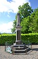
Memorial to the Fallen

View to the church entrance


