
Laveraët
|
Laveraët L'Agroet |
||
|---|---|---|
|
||
| region | Occitania | |
| Department | Gers | |
| Arrondissement | Mirande | |
| Canton | Pardiac-Rivière-Basse | |
| Community association | Bastides et Vallons du Gers | |
| Coordinates | 43 ° 32 ' N , 0 ° 13' E | |
| height | 155-273 m | |
| surface | 11.86 km 2 | |
| Residents | 108 (January 1, 2017) | |
| Population density | 9 inhabitants / km 2 | |
| Post Code | 32230 | |
| INSEE code | 32205 | |
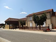
 Mairie Laveraët |
||

Laveraët (1801 with the spelling Laveract ; Occitan : L'Agroet ) is a French commune with 108 inhabitants (as of January 1, 2017) in the Gers department in the Occitania region . It belongs to the Arrondissement Mirande and the municipal association of Bastides et Vallons du Gers, founded in 2000 . The inhabitants call themselves Laveraëtois .
geography
The municipality of Laveraët is located in the Armagnac countryside , 40 kilometers north of Tarbes and 42 kilometers southwest of Auch . The terrain in the 11.86 km² municipal area is characterized by rolling hills and an alternation of fields, meadows and small forests. To the south, the Bouès river borders the commune. There are several small reservoirs in the municipality, which are used for flood protection and irrigation of the fields. Laveraët consists of several small individual farms and hamlets, which are mostly bastid-like on mountain ridges or hilltops. Near the hamlet of Téoulère in the far east of the municipality is the highest point at 273 m above sea level. Laveraët is surrounded by the neighboring communities of Mascaras in the north, Bassoues in the northeast, Saint-Christaud in the east, Monlezun in the south and Marciac in the west.
Population development
| year | 1962 | 1968 | 1975 | 1982 | 1990 | 1999 | 2009 | 2017 |
|---|---|---|---|---|---|---|---|---|
| Residents | 178 | 173 | 143 | 131 | 134 | 104 | 120 | 108 |
| Sources: Cassini and INSEE | ||||||||
Attractions
- Saint Martin Church
- Fallen memorial

St. Martin Church

Entrance of the Church of St. Martin
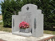
Fallen memorial
former school


Economy and Infrastructure
19 farms are located in Laveraët (grain cultivation, cattle, pig and poultry breeding).
Laveraët is away from the major national traffic flows. The D 943 road from Maubourguet to Auch runs through the municipality . There is a connection to the A65 autoroute 55 kilometers west of Laveraët . The train station in Auch, 42 kilometers away, offers connections to Toulouse , Eauze , Vic-en-Bigorre and Bon-Encontre .
supporting documents
- ↑ toponym on cassini.ehess.fr
- ↑ Laveraët on cassini.ehess.fr
- ↑ Laveraët on insee.fr
- ↑ Farms on annuaire-mairie.fr