
Traversères
|
Traversères Traversèras |
||
|---|---|---|
|
||
| region | Occitania | |
| Department | Gers | |
| Arrondissement | Mirande | |
| Canton | Astarac gimone | |
| Community association | Val de Gers | |
| Coordinates | 43 ° 32 ' N , 0 ° 39' E | |
| height | 175-291 m | |
| surface | 10.46 km 2 | |
| Residents | 71 (January 1, 2017) | |
| Population density | 7 inhabitants / km 2 | |
| Post Code | 32450 | |
| INSEE code | 32454 | |
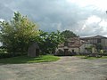
 View of Traversères |
||

Traversères ( Gascon : Traversèras) is a French municipality with 71 inhabitants (at January 1, 2017) in the department of Gers in the region Occitania (2015 Midi-Pyrénées ); it belongs to the arrondissement of Mirande and the municipal association Val de Gers . The residents call themselves Traversérois / Traverséroises .
geography
Traversères is located around 20 kilometers east of Mirande and 14 kilometers southeast of Auch in the south of the Gers department. The community consists of hamlets, numerous scattered settlements and individual farmsteads.
Neighboring communities are Boucagnères and Haulies in the north, Lartigue in the north-east and east, Faget-Abbatial in the east and south-east, Monferran-Plavès in the south, Ornézan in the south-west, Sansan in the west and Orbessan in the west and north-west.
history
The community area was already populated by people in the early days. This is proven by finds of hatchets from the Celtic period. Money and mosaics from a villa from the Gallo-Roman period were also found. In the Middle Ages, Aulin, Mauvesin, Montastruc (then Montastruc d'Astarac) and Traversères were located within the Kastlanei Durban of the County of Astarac in the historic Gascony landscape and shared its fate. From 1793 to 1801, all communities at that time belonged to the Auch district and the Seissan canton. From 1801 to 2015 the parish (and its predecessors) belonged to the arrondissement Auch. It has been in the Mirande arrondissement since 2015. All four communities belonged to the canton of Saramon from 1801 to 2015 . In 1821 the municipalities of Aulin (1821: 43 inhabitants), Mauvesin (1821: 8 inhabitants), Montastruc (1821: 104 inhabitants) and Traversères (1821: 66 inhabitants) united to form today's municipality.
Population development
The population development is typical for a French rural community. The population development between 1793 and 1891 is atypical. There was a first wave of emigration between 1846 and 1861. But then the population grew again and in 1891 was the same as in 1793. After 1891, a development typical of France followed with depopulation of the community (1891–1999: −73.3 percent), which lasted until 1999. Since then the population has only increased slightly.
| year | 1793 | 1806 | 1821 | 1846 | 1861 | 1891 | 1962 | 1968 | 1975 | 1982 | 1990 | 1999 | 2006 | 2011 | 2016 |
| Residents | 236 | 228 | 221 | 237 | 192 | 236 | 106 | 95 | 81 | 83 | 66 | 63 | 73 | 80 | 72 |
| Sources: today's municipality Sources: Cassini, Aulin Cassini, Mauvesin Cassini, Montastruc Cassini, Traversères and INSEE | |||||||||||||||
Attractions
- Village church Église de l'Assomption from the 19th century in Traversères
- Saint-Martin chapel in Aulin; partly from the 13th and 14th centuries
- Draw well in Traversères
- Dovecote (privately owned)
- several wayside crosses
- Memorial to the Fallen
Traversères village square

Église de l'Assomption church in Traversères

Saint-Martin chapel in Aulin

Memorial to the Fallen

Wayside cross in Aulin

Draw well in Traversères


traffic
The community is not on any major traffic connection. The most important regional traffic connections are the D929 west and the D40 east of the municipality. The D106, which runs through the town of Traversères, is of local importance.
Web links
- Information on the website of the Communauté de communes Val de Gers
- Traversères on the IGN side
- Saint-Martin chapel
- Location of the place and brief information
- Sights of Traversères on Le Patrimoine rural du Gers