Saint-Arroman (Gers)
|
Saint-Arroman Sent Arroman |
||
|---|---|---|
|
|
||
| region | Occitania | |
| Department | Gers | |
| Arrondissement | Mirande | |
| Canton | Astarac gimone | |
| Community association | Val de Gers | |
| Coordinates | 43 ° 26 ' N , 0 ° 31' E | |
| height | 192-304 m | |
| surface | 11.97 km 2 | |
| Residents | 137 (January 1, 2017) | |
| Population density | 11 inhabitants / km 2 | |
| Post Code | 32300 | |
| INSEE code | 32361 | |
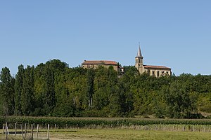
 View of Saint-Arroman |
||
Saint-Arroman ( Gascon : Sent Arroman) is a French commune with 137 inhabitants (as of January 1, 2017) in the Gers department in the Occitania region (until 2015 Midi-Pyrénées ); it belongs to the arrondissement of Mirande and the municipal association Val de Gers . The residents call themselves Saint-Arromanais / Saint-Arromanaises .
geography
Saint-Arroman is around 13 kilometers southeast of Mirande and 24 kilometers south-southwest of Auch in the south of the Gers department. The community consists of hamlets, numerous scattered settlements and individual farmsteads. The Sousson River crosses the parish in a northerly direction.
Neighboring communities are Clermont-Pouyguillès in the north, Lourties-Monbrun in the north-east, Esclassan-Labastide in the east and south-east, Samaran in the south, Lagarde-Hachan in the south-west, Saint-Élix-Theux in the west and Moncassin in the north-west.
Population development
| year | 1793 | 1800 | 1821 | 1831 | 1876 | 1962 | 1968 | 1975 | 1982 | 1990 | 1999 | 2006 | 2011 | 2016 |
| Residents | 533 | 518 | 585 | 458 | 416 | 165 | 173 | 163 | 154 | 132 | 126 | 138 | 132 | 138 |
| Sources: Cassini, Saint-Arroman Cassini, Clarens Cassini, Gaujac Cassini, Lembège and INSEE ; From 1793 to 1821, the municipality is already today | ||||||||||||||
