Saint-Bauzély
|
Saint-Bauzély Sent Bausèli |
||
|---|---|---|

|
|
|
| region | Occitania | |
| Department | Gard | |
| Arrondissement | Nîmes | |
| Canton | Calvisson | |
| Community association | Nîmes metropolis | |
| Coordinates | 43 ° 55 ' N , 4 ° 12' E | |
| height | 92–215 m | |
| surface | 5 km 2 | |
| Residents | 649 (January 1, 2017) | |
| Population density | 130 inhabitants / km 2 | |
| Post Code | 30260 | |
| INSEE code | 30233 | |
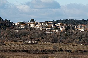
 View of Saint-Bauzély |
||
Saint-Bauzély is a French commune with 649 inhabitants (as of January 1, 2017) in the Gard department in the Occitanie region . The municipality belongs to the arrondissement of Nîmes and the canton of Calvisson (until 2015: canton of Saint-Mamert-du-Gard ). The inhabitants are called Bauzélyens .
geography
Saint-Bauzély is 16 kilometers northwest of Nîmes . Saint-Bauzély is surrounded by the neighboring communities of Montignargues in the north, La Rouvière in the east, Gajan in the southeast, Fons in the south and Montagnac in the west and northwest.
Population development
| year | 1962 | 1968 | 1975 | 1982 | 1990 | 1999 | 2006 | 2017 |
|---|---|---|---|---|---|---|---|---|
| Residents | 161 | 181 | 221 | 295 | 331 | 387 | 433 | 649 |
| Sources: Cassini and INSEE | ||||||||
Attractions
- protestant church
Web links
Commons : Saint-Bauzély - collection of images, videos and audio files
