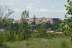
Théziers
| Théziers | ||
|---|---|---|

|
|
|
| region | Occitania | |
| Department | Gard | |
| Arrondissement | Nîmes | |
| Canton | Redessan | |
| Community association | Pont du Gard | |
| Coordinates | 43 ° 54 ' N , 4 ° 37' E | |
| height | 10-129 m | |
| surface | 11.34 km 2 | |
| Residents | 1,039 (January 1, 2017) | |
| Population density | 92 inhabitants / km 2 | |
| Post Code | 30390 | |
| INSEE code | 30328 | |
| Website | http://theziers.free.fr/ | |
 Théziers |
||
Théziers is a French commune with 1,039 inhabitants (as of January 1, 2017) in the Gard department of the Occitanie region .
geography
The municipality is located in the east of the Gard department, three to four kilometers from the Rhone . It is 25 kilometers from Nîmes and 20 kilometers from Avignon .
history
The area was settled by the Greeks in the 6th century BC. At that time the village was called Thédis (old Greek for construction , establishment ). Due to its location on a hill, the village was the site of a fortress or at least a fortified settlement in different epochs. The Celts also settled here during their invasions in the 2nd century BC and established a camp on the hills. The Romans drove out the Celts and founded a temple, on the site of which the Saint-Amant chapel would later be built. At the top of the hill there was a small Gallo-Roman village called Volpellières that had only a dozen inhabitants. There were around 300 to 400 houses below the castle that existed at that time. The place was then called Thédusia . The village was later conquered several times, by the Sarrazen in the 8th century . They destroyed the castle. In 736 the Sarrazenen were defeated by Karl Martell in the battle for Théziers and Montfrin . During the Middle Ages, the village and the fortress were owned by different rulers and were repeatedly destroyed in the course of several wars. The community was also badly hit by the plague that spread inland from Marseille . In 1630 it was decided to build a hospital in Théziers due to its strategically favorable location. The residents prayed to Rochus of Montpellier that he would free them from the plague. The village was actually spared. Since then, the saint has been commemorated in Théziers every year on August 16. Before the French Revolution, the village was in a disastrous economic situation. In the winter of 1788/1789 the Rhône was frozen over and the olive trees were destroyed. But they played an important role in the local economy: there were four or five oil mills in the village for the production of olive oil. There is still one of them today. The wheat harvest was also affected by the harsh winter at that time. During the French Revolution, Théziers did not use force. Agriculture recovered in the 19th century, but the most important grape variety was attacked by phylloxera. As a result, the creation of apricot groves, for which the village is known today, began. In 1942 the village was occupied by the Wehrmacht. German soldiers built bunkers on the hill. The harsh winter of 1956 again killed all the olive trees. After that the olive oil production was given up and one limited oneself to wine, grapes and apricots.
Culture and sights
- Church Saint-Grégoire from the 12th century
- Saint-Amant Chapel
- Former schools in the town center
Population development
| year | 1962 | 1968 | 1975 | 1982 | 1990 | 1999 | 2008 | 2017 |
| Residents | 640 | 678 | 659 | 674 | 844 | 883 | 1016 | 1039 |
