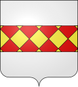
Codolet
| Codolet | ||
|---|---|---|

|
|
|
| region | Occitania | |
| Department | Gard | |
| Arrondissement | Nîmes | |
| Canton | Roquemaure | |
| Community association | Gard Rhodania | |
| Coordinates | 44 ° 5 ' N , 4 ° 35' E | |
| height | 27-50 m | |
| surface | 5.17 km 2 | |
| Residents | 660 (January 1, 2017) | |
| Population density | 128 inhabitants / km 2 | |
| Post Code | 30330 | |
| INSEE code | 30084 | |
| Website | http://www.codolet.fr/ | |
Codolet is a French commune with 660 inhabitants (as of January 1, 2017) in the Gard department in the Occitanie region ; it belongs to the arrondissement of Nîmes and the canton of Roquemaure (until 2015: canton of Bagnols-sur-Cèze ).
geography
Codolet is located between Cèze (western and southern borders) and Rhone (eastern border of the municipality) in the Côtes du Rhône wine-growing region . In the south, the Tave first flows into the Cèze and this then into the Rhône. Codolet is surrounded by the neighboring communities Chusclan in the north, Caderousse in the east, Laudun-l'Ardoise in the south and southwest and Orsan in the west.
Population development
| year | 1962 | 1968 | 1975 | 1982 | 1990 | 1999 | 2006 | 2017 |
| Residents | 381 | 393 | 386 | 433 | 458 | 558 | 673 | 660 |
| Sources: Cassini and INSEE | ||||||||
Attractions
- Saint-Michel church
- historical center
- Bridge over the Cèze
Web links
Commons : Codolet - collection of images, videos and audio files


