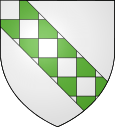
Bourdic
| Bourdic | ||
|---|---|---|

|
|
|
| region | Occitania | |
| Department | Gard | |
| Arrondissement | Nîmes | |
| Canton | Uzes | |
| Community association | Pays d'Uzès | |
| Coordinates | 43 ° 59 ′ N , 4 ° 20 ′ E | |
| height | 69-110 m | |
| surface | 7.34 km 2 | |
| Residents | 380 (January 1, 2017) | |
| Population density | 52 inhabitants / km 2 | |
| Post Code | 30190 | |
| INSEE code | 30049 | |
 Saint-Jean-Baptiste church |
||
Bourdic is a French commune with 380 inhabitants (as of January 1, 2017) in the Gard department in the Occitanie region . It belongs to the Arrondissement of Nîmes and the Canton of Uzès . Bihorel is a member of the Communauté de communes Pays d'Uzès .
geography
The municipality is located about 16 kilometers north of Nîmes . Neighboring communities are:
- Aubussargues in the north,
- Arpaillargues-et-Aureillac in the northeast,
- Blauzac in the southeast,
- Sainte-Anastasie in the south and
- Garrigues-Sainte-Eulalie to the west.
The municipality is crossed in a north-south direction by the river Bourdic of the same name .
Population development
| year | 1968 | 1975 | 1982 | 1990 | 1999 | 2006 | 2016 |
| Residents | 208 | 202 | 211 | 236 | 262 | 315 | 383 |
Attractions
- Église Saint-Jean-Baptiste , Romanesque-Byzantine church from the 12th century
economy
The community is located in a wine-growing region . The products are marketed in the Collines du Bourdic cooperative winery .
Web links
Commons : Bourdic - collection of images, videos and audio files
Individual evidence
- ↑ Archive link ( Memento from April 8, 2014 in the Internet Archive )
- ↑ http://www.bourdic.com/
