Uchaud
| Uchaud | ||
|---|---|---|

|
|
|
| region | Occitania | |
| Department | Gard | |
| Arrondissement | Nîmes | |
| Canton | Vauvert | |
| Community association | Rhôny Vistre Vidourle | |
| Coordinates | 43 ° 45 ' N , 4 ° 16' E | |
| height | 15-102 m | |
| surface | 8.8 km 2 | |
| Residents | 4,315 (January 1, 2017) | |
| Population density | 490 inhabitants / km 2 | |
| Post Code | 30620 | |
| INSEE code | 30333 | |
| Website | http://www.uchaud.fr/ | |
 Saint Paul Church |
||
Uchaud is a French commune with 4,315 inhabitants (as of January 1, 2017) in the Gard department in the Occitanie region .
geography
Uchaud is located in the hill country above a fertile plain on the River Vistre , about 14 kilometers southwest of Nîmes in the Vaunage landscape .
The neighboring communities of Uchaud are Nages-et-Solorgues in the north and northwest, Bernis in the east and northeast, Beauvoisin in the southeast, Vestric-et-Candiac in the south and southwest and Boissières in the west.
The A9 car route and the national route 113 run through the municipality . The train station of Vergeze-Codognan is from trains on the railway Tarascon-Sète-Ville served.
Population development
| year | 1962 | 1968 | 1975 | 1982 | 1990 | 1999 | 2006 | 2017 |
|---|---|---|---|---|---|---|---|---|
| Residents | 1056 | 1378 | 1904 | 2339 | 2699 | 3284 | 3799 | 4315 |
Attractions
- Saint-Paul church from the 12th century, rebuilt until the 19th century; the campanile has a pyramidal shape and dates from the 17th century
- Protestant church, built in the 19th century in neoclassical style
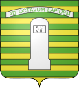
- Milestone on Via Domitia (from the time of Antoninus Pius), Monument historique since 1912
Personalities
- Robert de Joly (1887–1968), speleologist
Community partnerships
Uchaud has partnerships with the Spanish municipality of Totana in the Murcia region and with the Italian municipality of Capannoli in the province of Pisa (Tuscany) .
