
Nages-et-Solorgues
|
Nages-et-Solorgues Najas e Solòrgues |
||
|---|---|---|
.svg)
|
|
|
| region | Occitania | |
| Department | Gard | |
| Arrondissement | Nîmes | |
| Canton | Calvisson | |
| Community association | Rhôny Vistre Vidourle | |
| Coordinates | 43 ° 48 ' N , 4 ° 14' E | |
| height | 31-174 m | |
| surface | 6.18 km 2 | |
| Residents | 1,736 (January 1, 2017) | |
| Population density | 281 inhabitants / km 2 | |
| Post Code | 30114 | |
| INSEE code | 30186 | |
| Website | http://vaunage.net/nages.htm | |
 Town hall (Mairie) of Nages-et-Solorgues |
||

Nages-et-Solorgues ( Occitan : Najas e Solòrgues ) is a French commune with 1,736 inhabitants (as of January 1, 2017) in the Gard department in the Occitanie region . The municipality belongs to the arrondissement of Nîmes and the canton of Calvisson (until 2015: canton of Sommières ). The inhabitants are called nageois .
geography
Nages-et-Solorgues is about eleven kilometers west-southwest of Nîmes and about 14 kilometers north-northeast of Lunel . Nages-et-Solorgues is surrounded by the neighboring communities of Saint-Dionisy in the north, Langlade in the north and northeast, Bernis in the east and southeast, Uchaud in the southeast, Boissières in the south and Calvisson in the west.
Population development
| year | 1962 | 1968 | 1975 | 1982 | 1990 | 1999 | 2006 | 2017 |
|---|---|---|---|---|---|---|---|---|
| Residents | 278 | 327 | 451 | 715 | 1088 | 1295 | 1462 | 1736 |
| Sources: Cassini and INSEE | ||||||||
Culture and sights
- Old church, now Protestant, Romanesque building, built at the beginning of the 19th century
- Catholic Church Saint-Saturnin, built in 1840 in neo-Gothic style
- Prehistoric settlement remains ( Monument historique since 1913) and Celtic oppidum (Monument historique since 2006)
- town hall

protestant church

catholic church Saint-Saturnin
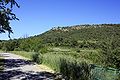
Oppidum of Nages


