
Moselle department
| Moselle | |
|---|---|
 |
  |
| region | Grand Est |
| prefecture | Metz |
| Sub-prefecture (s) |
Forbach Sarrebourg Sarreguemines Thionville |
| Residents | 1,043,522 (Jan. 1, 2017) |
| Population density | 168 inhabitants per km² |
| surface | 6,216.63 km² |
| Arrondissements | 5 |
| Community associations | 23 |
| Cantons | 27 |
| Communities | 725 |
|
President of the Department Council |
Patrick Weiten |
| ISO-3166-2 code | FR-57 |
 Location of the department of Moselle in the region Grand Est |
|
The department Moselle [ mɔˈzɛl ] (German Mosel ) is the French department with the serial number 57. It is located in the northeast of the country in the Grand Est region and is named after the river Mosel (French Moselle ). The capital of the department is Metz . The department is part of Lorraine and formed the Lorraine part of the German Reichsland Alsace-Lorraine from 1871 to 1918 , and from 1940 to 1944 the CdZ area of Lorraine of the NSDAP party division Westmark . In domestic German usage, the Moselle department is therefore widely equated with "Lorraine".
geography
The Moselle department borders in the north on the Grand Duchy of Luxembourg , in the northeast on the Federal Republic of Germany ( federal states Saarland and Rhineland-Palatinate ), in the southeast on the Alsatian department Bas-Rhin and in the south and west on the department Meurthe-et-Moselle .
history
In older times, the areas of today's department belonged to the bishopric of Metz (one of the Trois-Évêchés ), to the duchies of Lorraine , Bar , Luxembourg and the imperial city of Metz , which are represented in the coat of arms, as well as smaller lordships, and fell in the 16th to 18th centuries Century to the Kingdom of France . "Moselle", also called "Moselle Department" in German, is one of 83 departments that were established in 1790 at the time of the French Revolution . The department was designed much differently than it is today and divided into four "arrondissements": Metz, Briey, Sarreguemines and Thionville.


After the Franco-Prussian War , the Moselle department was dissolved on May 18, 1871 in accordance with the Peace of Frankfurt . The German Empire received the largest part and united it with the two arrondissements of Château-Salins and Saarburg (Sarrebourg) of the also dissolved department of Meurthe to form the Lorraine district of the newly formed realm of Alsace-Lorraine . Only a small part in the west, the Arrondissement Briey , remained with France and together with parts of the Département Meurthe formed the new Département Meurthe-et-Moselle .
The times of the Reichsland were marked by strong population shifts: The French elites left the district after 1871, so-called "Old Germans", i.e. H. Immigrants from other areas of the German Reich filled the gap, especially in the administrative and military sectors, but also workers in the up-and-coming industrial areas of the ore basin. As a result, on the eve of the First World War , the city of Metz had a German population majority of over 75%, but it formed a linguistic island because the immediate vicinity of the city remained Francophone.
For defense reasons, but above all because of the possession of heavy industry and the iron ore mines ( Minette ), the German victorious powers did not adhere to the Franco-German language border when the border was established in 1871. Francophone areas now also belonged to the new German Empire. The French-speaking residents received some concessions in the use of their French mother tongue in administration, the judiciary and schools. For 47 years the German Reichstag in Berlin also had a number of native French members of the Reichstag from Alsace-Lorraine. In 1915, however, almost all French place names were eliminated by renaming.
In the 1919 Treaty of Versailles , concluded after the First World War , the area came back to France. The administrative boundaries were retained because of the facts created in five decades and not reset to the status of 1870, the "District of Lorraine" was renamed "Département Moselle". The administrative connections to the traditionally German-speaking regions of Alsace were cut and the Moselle found itself in the context of a France that was strongly centralized towards Paris.
In the course of the Second World War , after the defeat of France ( armistice of June 22, 1940 ) , the Moselle area was in fact rejoined to the German Reich, placed under civil administration as the Lorraine CdZ area and, together with the Saarland and the Palatinate, was to form the " Gau Westmark " form. From the evacuation of the border population in 1939 to inner France, only some of those affected returned, now further population shifts followed. In November 1940 alone , the head of the civil administration, Josef Bürckel , expelled around 60,000 unpopular French-speaking Lorraine residents to Vichy France . German-speaking settlers were recruited. Despite certain autonomist and national sympathies among the Lorraine residents, some of whom grew up in the German Empire, the National Socialist policies of the dictator Hitler met with widespread reluctance and passive resistance. With the advance of the Allies, the German Wehrmacht had to withdraw in autumn 1944. From autumn 1944 to spring 1945 the region was a combat zone . In 1944, soldiers of the US Army first moved into the Moselle region, and the Wehrmacht held out in some villages until March 1945.
For many decades, coal mining and steel production played a central role in the Moselle department. In the 1970s and 1980s, however, both branches of industry lost more and more importance, especially the industrialized areas in the north and northeast of the department were hit hard by the steel and coal crises . In 1997, the closure of the iron ore mine in Audun-le-Tiche ended an era of over 100 years. In 2004, the La Houve colliery in Creutzwald was the last hard coal mine in France to be closed.
The department was part of the Lorraine region from 1960 to 2015 , which became part of the Grand Est region in 2016 .
population
language

Until recently, the German-French language border ran along a line from Thionville to Sarrebourg in the middle of the department . The German-speaking part is therefore also known as German-Lorraine . The native francophone inhabitants of the department traditionally spoke the Romance Lorraine , which is no longer used as a colloquial language even by the oldest generation. The German-Lorraine dialects of the native Germanophone residents of the department belong to the Moselle-Franconian and the Rhine-Franconian . After 1945 the German language was pushed out of the media and there was considerable pressure on the German-speaking population to give up their dialect and speak French. After many years of political affiliation with France and a resolute policy of Frenchization (French as the official and teaching language), the native German dialects are threatened with extinction. While the oldest generation still speaks German, the younger generations mostly use French as a colloquial language and pass it on to their children.
According to a survey from 1999, 17% of the residents in the Moselle department, which was only German-speaking in the north-eastern half, spoke a Franconian dialect. This means that the German dialects are less widespread here than in the two Alsatian departments of Bas-Rhin (46%) and Haut-Rhin (38%).
Cities
The most populous municipalities in the Moselle department are:
| city | Population (2017) |
Arrondissement |
|---|---|---|
| Metz | 116,429 | Metz |
| Thionville (Diedenhofen) | 40,701 | Thionville |
| Montigny-lès-Metz | 21,819 | Metz |
| Forbach | 21,552 | Forbach-Boulay-Moselle |
| Sarreguemines | 20,783 | Sarreguemines |
| Yutz (Jeutz) | 16,537 | Thionville |
| Hayange (Hayingen) | 15,811 | Thionville |
| Saint-Avold (Saint Avold) | 15,483 | Forbach-Boulay-Moselle |
| Woippy (Wappingen) | 14.214 | Metz |
| Creutzwald (Kreuzwald) | 13,095 | Forbach-Boulay-Moselle |
| Freyming-Merlebach (Freimingen-Merlenbach) | 12,818 | Forbach-Boulay-Moselle |
Other bigger places are:
|
|
|
politics
National emblem
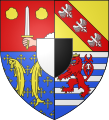
Departmental coat of arms (current)
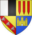
Departmental coat of arms (before 1871)

flag

logo
.svg)


- The coats of arms of important historical rulers in the area of today's Moselle department
Coat of arms of the bishopric of Metz

Coat of arms of the Duchy of Lorraine

Coat of arms of the Duchy of Bar

Coat of arms of the Duchy of Luxembourg

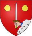
Coat of arms of the imperial city of Metz


Administrative division
Administrative structure from 2016

As part of an administrative reform, the arrondissements of Boulay-Moselle, Thionville-Ouest, Metz-Campagne and Château-Salins were dissolved and merged with the arrondissements of Forbach, Thionville-Est, Metz-Ville and Sarrebourg. Since then there are only five arrondissements.
There are 27 constituencies ( cantons ) and 725 communes in the department .
| Arrondissement | Cantons | Communities | Residents January 1, 2017 |
Area km² |
Density of population / km² |
Code INSEE |
|---|---|---|---|---|---|---|
| Forbach-Boulay-Moselle | 8th | 169 | 241,543 | 1,283.28 | 188 | 573 |
| Metz | 10 | 139 | 343,893 | 1,088.97 | 316 | 579 |
| Sarrebourg-Château-Salins | 3 | 230 | 92.057 | 1,966.92 | 47 | 575 |
| Sarreguemines | 3 | 83 | 98,684 | 935.91 | 105 | 576 |
| Thionville | 7th | 104 | 267,345 | 941.55 | 284 | 577 |
| Moselle department | 27 | 725 | 1,043,522 | 6,216.63 | 168 | 57 |
Administrative structure until 2015
The department was divided into nine arrondissements and 730 municipalities until 2015 :
| Arrondissement | Residents | Area (km²) |
Population density ( population / km²) |
Cantons | Communities |
|---|---|---|---|---|---|
| Boulay-Moselle (Bolchen) | 722 | 3 | 96 | ||
| Château-Salins (Salzburg) | 974 | 5 | 128 | ||
| Forbach | 561 | 7th | 73 | ||
| Metz-Campagne (Metz-Land) | 1,047 | 9 | 142 | ||
| Metz-Ville (Metz-City) | 42 | 4th | 1 | ||
| Sarrebourg (Saarburg) | 993 | 5 | 102 | ||
| Sarreguemines (Saargemünd) | 936 | 6th | 83 | ||
| Thionville-Est (Diedenhofen-Ost) | 686 | 6th | 75 | ||
| Thionville-Ouest (Diedenhofen-West) | 255 | 6th | 30th |
See also
- List of communes in the Moselle department
- List of cantons in the Moselle department
- List of associations of municipalities in the Moselle department
Attractions
- Metz with its Gothic cathedral , the Templar chapel , Ludwigsplatz and the La Cour d'Or museum .
- Malbrouck Castle in Manderen .
- The Fort Michel Berg , a Gros Ouvrage the Maginot Line.
- The castle of the Counts of Lorraine in Sierck-les-Bains .
- The medieval town of Rodemack .
- The Bitsch Citadel with the Peace Gardens and the Fort Simserhof artillery structure .
- The archaeological park in Bliesbruck - Reinheim (Eng. Bliesbrücken-Reinheim ).
- The Roman aqueduct at Jouy-aux-Arches .
- The Hackenberg in Veckring , part of the Maginot Line .
- The castle “La Grange” in Manom .
- The Chapelle des Cordeliers in Sarrebourg with the large glass window by Marc Chagall .
- Frescoes from around 1500 in the fortified church in Sillegny .
- The sloping ship elevator of the Canal de la Marne au Rhin in Saint-Louis - Arzviller .
- The home of Robert Schuman , the father of Europe , in Scy-Chazelles . Schuman lived in the house, which is now a museum, from 1926 until his death in 1963.
- A number of Lorraine farmhouses that have been converted into museums today, for example in Oberdorff or Gomelange .
- The Georges de la Tour museum in Vic-sur-Seille .
- The coal museum in Petite-Rosselle .
- The Faience Museum in Sarreguemines .
- The glass and crystal museum in Meisenthal .
- The crystal museum in Saint-Louis-lès-Bitche (German Münzthal-St. Louis ).
- The village of Dabo with the Dagsburg .
- The necropolis of Audun-le-Tiche
- And last but not least, the regional nature parks of the Northern Vosges ( Vosges du Nord ) and Lorraine ( Lorraine ). The latter includes an area with many ponds and lakes that are popular excursion destinations.
See also
literature
- Henri Hiegel: Le catholicisme social en Moselle de 1871 à 1918, in: Les Cahiers Lorrains NS 20 (1968), pp. 1-23, 33-44.
Web links
- Moselle department (French)
- Prefecture of the Moselle department (French)
- Literature on the Moselle department in the catalog of the German National Library
- Tourism Association of the French Moselle Region (Comité Départemental du Tourisme de la Moselle - CDT) (French)
- Economic development of the Moselle department (Moselle Développement)
Individual evidence
- ↑ [1] accessed on May 1, 2015
- ↑ which, in particular, with statements about the historical affiliation of "Lorraine" or the earlier proportion of German speakers "in Lorraine", invites gross confusion
- ^ Ferdinand Mentz: The Germanization of place names in Alsace-Lorraine . ( Memento of November 28, 2010 in the Internet Archive ) From: Journal of the General German Language Association, Volume 31, 1916, pp. 4–8 and 40–46
- ↑ Comité consultatif pour la promotion des langues régionales et de la pluralité linguistique intern : Redéfinir une politique publique en faveur des langues régionales et de la pluralité linguistique intern . July 2013, p. 94 (French, Rapport Langues de France - comité consultatif [accessed on April 16, 2017]).
- ↑ Etude sur le dialecte alsacien (PDF) Accessed April 16, 2017
01 Ain | 02 Aisne | 03 Allier | 04 Alpes-de-Haute-Provence | 05 Hautes-Alpes | 06 Alpes-Maritimes | 07 Ardèche | 08 Ardennes | 09 Ariège | 10 Aube | 11 Aude | 12 Aveyron | 13 Bouches-du-Rhône | 14 Calvados | 15 Cantal | 16 Charente | 17 Charente-Maritime | 18 Cher | 19 Corrèze | 21 Côte-d'Or | 22 Côtes-d'Armor | 23 Creuse | 24 Dordogne | 25 Doubs | 26 Drôme | 27 Your | 28 Eure-et-Loir | 29 Finistère | 30 Gard | 31 Haute-Garonne | 32 Gers | 33 Gironde | 34 Hérault | 35 Ille-et-Vilaine | 36 Indre | 37 Indre-et-Loire | 38 Isère | 39 Jura | 40 Landes | 41 Loir-et-Cher | 42 Loire | 43 Haute-Loire | 44 Loire-Atlantique | 45 Loiret | 46 Lot | 47 Lot-et-Garonne | 48 Lozère | 49 Maine-et-Loire | 50 Some | 51 Marne | 52 Haute-Marne | 53 Mayenne | 54 Meurthe-et-Moselle | 55 Meuse | 56 Morbihan | 57 Moselle | 58 Nièvre | 59 North | 60 Oise | 61 Orne | 62 Pas-de-Calais | 63 Puy-de-Dôme | 64 Pyrénées-Atlantiques | 65 Hautes-Pyrénées | 66 Pyrénées-Orientales | 67 Bas-Rhin | 68 Haut-Rhin | 69D Rhône | 69M Métropole de Lyon (from 2015) | 70 Haute-Saône | 71 Saône-et-Loire | 72 Sarthe | 73 Savoie | 74 Haute-Savoie | 75 Paris (from 1968) | 76 Seine-Maritime | 77 Seine-et-Marne | 78 Yvelines (from 1968) | 79 Deux-Sèvres | 80 Somme | 81 Tarn | 82 Tarn-et-Garonne | 83 Var | 84 Vaucluse | 85 Vendée | 86 Vienne | 87 Haute-Vienne | 88 Vosges | 89 Yonne | 90 Territoire de Belfort | 91 Essonne (from 1968) | 92 Hauts-de-Seine (from 1968) | 93 Seine-Saint-Denis (from 1968) | 94 Val-de-Marne (from 1968) | 95 Val-d'Oise (from 1968)
Overseas Departments (DOM)
971 Guadeloupe |
972 Martinique |
973 French Guiana |
974 Réunion |
976 Mayotte
Départements
20 Corse
dissolved after 1962 (until 1975) | 2A Corse-du-Sud (1976-2017) |
2B Haute-Corse (1976-2017) |
75 Seine (until 1967) |
78 Seine-et-Oise (until 1967)
Coordinates: 49 ° 6 ' N , 6 ° 26' E