
Korbach
| coat of arms | Germany map | |
|---|---|---|

|
Coordinates: 51 ° 16 ' N , 8 ° 52' E |
|
| Basic data | ||
| State : | Hesse | |
| Administrative region : | kassel | |
| County : | Waldeck-Frankenberg | |
| Height : | 375 m above sea level NHN | |
| Area : | 123.98 km 2 | |
| Residents: | 23,458 (Dec. 31, 2019) | |
| Population density : | 189 inhabitants per km 2 | |
| Postcodes : | 34497, 34513 | |
| Primaries : | 05631, 05636 , 02982 | |
| License plate : | KB, FKB, WA | |
| Community key : | 06 6 35 015 | |
| LOCODE : | DE KOH | |
| City structure: | 15 districts | |
City administration address : |
Stechbahn 1 34497 Korbach |
|
| Website : | ||
| Mayor : | Klaus Friedrich ( independent ) | |
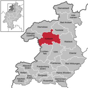
| Location of the city of Korbach in the Waldeck-Frankenberg district | ||
  |
||

The town of Korbach , since June 18, 2013 officially Hanseatic city of Korbach (formerly Corbach written track officially until February 1, 1935), is the county town of the district of Waldeck-Frankenberg in Hesse .
geography

Korbach is located in the Waldecker Gefilde , a field landscape in the Zechstein belt between the Rhenish Slate Mountains in the west and the Waldecker Wald in the east. The western districts are located in the eastern Sauerland mountain range .
The approximately 625 m highest point of Korbacher urban area is located in the extreme northwest, on the southern flank of the already Rothaargebirge counted Widdehagen whose 635 m -reach summit, however, already in the nearby town of Diemelsee is. The town's landscape landmark, however, is the Eisenberg (560 m) west of the city center, known for its wealth of gold-bearing ores . The core city is traversed by the Kuhbach (colloquially "Die Kuhbach" ), which drains south of the city into the Itter and then via Eder and Fulda into the Weser ; the north of the city, on the other hand, drains via the Twiste to Diemel . With an old town height of 366 to 392 m. ü. NHN, Korbach is the highest district town in Hesse.
In the Korbach Column , a crevice near Korbach, there were important fossil finds from the Upper Permian . These are the only Procynosuchus finds (also called "Korbach Dachshunds") in the northern hemisphere.
Thanks to their location in the Waldeck area, which used to be rich in partridges , the town's inhabitants were given the nickname "Feldhühnerchen".
Neighboring communities
The neighboring communities of the city of Korbach are Diemelsee , Lichtenfels , Twist valley , Vöhl , Waldeck and Willingen (Upland) all in the district of Waldeck-Frankenberg and Medebach (in the Hochsauerland district in North Rhine-Westphalia )
City structure
Korbach consists of the core city and 14 other districts. In addition to the city center, only the southeastern districts of Meineringhausen, Nieder-Ense and Strothe are on the Waldecker Tafel; the rest, however, in the valleys or on the heights of the Rothaargebirge, which runs out here.
| district | Residents, December 31, 2018 |
|---|---|
| Alleringhausen | 76 |
| Eppe | 609 |
| Goldhausen | 287 |
|
Helmscheid (with Dingeringhausen ) |
152 |
| Hillershausen | 299 |
| Korbach (city center) | 18,154 |
| Lelbach | 624 |
| Lengefeld | 473 |
| Meineringhausen | 951 |
| Nieder-Ense | 234 |
| Nieder-Schleidern | 170 |
| Nordenbeck | 183 |
| Ober-Ense | 185 |
| Rhena | 547 |
| Strothe | 214 |

history
Early history
Different views are expressed about the origin and meaning of the city name. There is agreement that the name is of Old Saxon origin. The oldest form is Curbecki (980). According to one view, the first syllable is said to have been formed from the Middle Low German "kurren, korren", which means something like the murmur of a brook. According to another opinion, the syllable "Cor" or "Cur" is derived from "Kür" and "küren", which means "choice" or "choose". Accordingly, Korbach was a chosen place on the brook, possibly also a meeting place on a brook, where the people chose a leader.
Curbechi was first mentioned in a document in 980, when the then King and later Emperor Otto II. Korbach, Lelbach, Rhena and three other places in what was then Ittergau , with Count Asicho from Ittergau and Nethegau as witnesses, in exchange for the districts of Meginrichesdorf and gave Memleben in Hassegau to the Corvey monastery . However, the first traces of settlement in the area of Kilian's Church are now dated to the time before Charlemagne , and a Saxon noble farm is said to have stood here. There are also indications of early settlements in the rest of the city. B. on the Wipperberg near Lengefeld.
Middle Ages and Early Modern Times
In 1188, the Paderborn bishop Bernhard II granted Korbach the city charter of Soest . Due to Korbach's location at the intersection of the Heidenstrasse (Cologne – Leipzig) and Weinstrasse (Frankfurt – Bremen) trade routes , handicrafts and trade developed rapidly, and Korbach flourished. The area of the (then) old town was soon no longer sufficient to accommodate all residents. The merchants therefore settled in two new cities, the upper and lower Neustadt, outside the city limits, which soon united to form a common city. In the 14th century the Kilian's Church was built in the old town and the Nikolaikirche in the new town .


In 1349, the knight Heinrich Megdevelt founded the first documented hospital in the city at the drinking gate leading to the Neustadt for the salvation of his and his relatives. Six poor and elderly people should live and be cared for there. The hospital was expanded in 1467 due to a foundation, subsequently renewed several times and moved to the Enser Tor in 1869 and then developed into a retirement and nursing home.
In 1349, Emperor (then still a Roman king) Charles IV visited the city. In 1377 the old and new towns were united; On the border between the two previously separated cities, the common town hall was built, which is still there today. In 1414 a double wall ring that surrounded the entire settlement was completed. Five city gates guarded the entrance to the city: the Tränketor, the Dalwigker Tor, the Enser Tor, the Lengefelder Tor and the Berndorfer Tor. Of these, only the Enser Tor remains today. The Padberg feud from 1413 to 1418 was the climax of the long border disputes and repeated attacks by the Lords of Padberg on the territory of the County of Waldeck and especially the city of Korbach. With this feud the clashes came to a temporary end.
Korbach joined the Hanseatic League and was first mentioned in 1469 as a member of the Hanseatic League. It was thus one of the geographically southernmost cities of the Hanseatic League. The Korbach merchants traded in cloth, furs and beer, as well as gold and other metals from the surrounding area. Korbach was the only Hanseatic city in what is now the state of Hesse.
With the Reformation , the city and the entire county of Waldeck became Protestant . Even today, Korbach is still largely Protestant, although since the 19th century more and more Catholics have moved into the city and built the two Catholic churches, the older St. Mary's Church and the modern St. Joseph's Church. In addition, the western districts on the border with North Rhine-Westphalia are almost entirely (Hillershausen) or to a large extent (Nieder-Schleidern, Eppe) Catholic.
During the Thirty Years' War Korbach repeatedly had to make high contributions to troops passing through. By the end of the war only half of the houses were still habitable and the number of residents had dropped from 2,600 to 1,100. A big fire in 1664 destroyed almost all houses; Today there is only one half-timbered house "Im Katthagen" in Korbach, which was built before this fire in 1593. The Gothic stone churches and the stone warehouses, however, have been well preserved.
During the Seven Years' War on July 10, 1760, a battle north of the city broke out near Korbach between the French and a Brunswick-Hessian-British troop.
Modern times
Only towards the end of the 18th century did modest prosperity return; the city reached its first economic boom at the end of the 19th century. This was largely due to the opening of the Twist Valley Railway in 1893, which from 1897 provided a connection to Kassel with the Volkmarsen – Vellmar railway . Louis Peter , born in Alleringhausen , founder of Peters Union AG in Frankfurt am Main (formerly Mitteldeutsche Gummiwarenfabrik L. Peter AG ), built the Korbach branch in 1907. The Hanoverian Continental AG took over the Peters Union in 1929 .
The city was spared major damage in both world wars. After the Second World War , the population increased sharply due to refugees and displaced persons from the former German eastern regions .
On March 29, 1961, an Air Force F-104 “Starfighter” crashed on the outskirts, not far from the Korbach – Berndorf railway line and Flechtdorfer Strasse . People were not harmed. Pilot and observer were able to save themselves with the ejector seat. It was the first crash of a Bundeswehr F-104.
Incorporations
As part of the regional reform in Hesse , on July 1, 1970, the previously independent communities of Alleringhausen, Eppe, Goldhausen, Helmscheid, Hillershausen, Lengefeld, Meineringhausen, Nieder-Schleidern, Rhena and Strothe were incorporated into the city of Korbach on a voluntary basis . On December 31, 1970 Nieder-Ense, Nordenbeck and Ober-Ense were added. Lelbach followed on October 1, 1971.
Population development
Source: Historical local dictionary
| • 1620: | 547 houses |
| • 1650: | 235 houses |
| • 1738: | 327 houses |
| • 1770: | 338 houses, 1765 inhabitants |
| Korbach: Population from 1770 to 2015 | ||||
|---|---|---|---|---|
| year | Residents | |||
| 1770 | 1,765 | |||
| 1800 | ? | |||
| 1834 | 2,390 | |||
| 1840 | 2,439 | |||
| 1846 | 2,258 | |||
| 1852 | 2,302 | |||
| 1858 | 2,292 | |||
| 1864 | 2,415 | |||
| 1871 | 2.411 | |||
| 1875 | 2,442 | |||
| 1885 | 2,540 | |||
| 1895 | 2,590 | |||
| 1905 | 2,859 | |||
| 1910 | 4,424 | |||
| 1925 | 5,678 | |||
| 1939 | 7,731 | |||
| 1946 | 10,402 | |||
| 1950 | 12,074 | |||
| 1956 | 13,530 | |||
| 1961 | 15,084 | |||
| 1967 | 16,572 | |||
| 1971 | 22,895 | |||
| 1980 | 22,486 | |||
| 1990 | 22,171 | |||
| 1995 | 24,033 | |||
| 2000 | 24,515 | |||
| 2005 | 24,384 | |||
| 2010 | 23,581 | |||
| 2015 | 23,515 | |||
| Data source: Historical municipality register for Hesse: The population of the municipalities from 1834 to 1967. Wiesbaden: Hessisches Statistisches Landesamt, 1968. Other sources: The figures after 1970 contain the places incorporated into Hesse as part of the regional reform . | ||||
politics
City Council
The local elections on March 6, 2016 produced the following results, compared to previous local elections:
| Parties and constituencies |
% 2016 |
Seats 2016 |
% 2011 |
Seats 2011 |
% 2006 |
Seats 2006 |
% 2001 |
Seats 2001 |
||
|---|---|---|---|---|---|---|---|---|---|---|
| SPD | Social Democratic Party of Germany | 31.2 | 10 | 34.7 | 13 | 36.3 | 13 | 39.9 | 15th | |
| CDU | Christian Democratic Union of Germany | 24.7 | 8th | 26.9 | 10 | 32.6 | 12 | 32.3 | 12 | |
| GREEN | Alliance 90 / The Greens | 10.0 | 3 | 17.3 | 6th | 7.7 | 3 | 5.7 | 2 | |
| FWG | Free community of voters | 17.6 | 5 | 12.4 | 5 | 13.3 | 5 | 12.4 | 5 | |
| FDP | Free Democratic Party | 9.5 | 3 | 6.7 | 2 | 6.8 | 3 | 6.3 | 2 | |
| The active citizens | The active citizens | 7.0 | 2 | - | - | - | - | - | - | |
| REP | The Republicans | - | - | 1.9 | 1 | 3.3 | 1 | 3.4 | 1 | |
| total | 100.0 | 31 | 100.0 | 37 | 100.0 | 37 | 100.0 | 37 | ||
| Voter turnout in% | 45.1 | 45.3 | 44.9 | 51.9 | ||||||
Town twinning
Since 1963 Korbach has had a town twinning with the French Avranches in the department of Manche . Waltershausen in Thuringia followed as another twin town after reunification in 1990 . Korbach also maintains partnerships with the Polish Pyrzyce (Pyritz) and the Czech Vysoké Mýto (Hohenmauth).
traffic
Korbach lies on the federal highways 251 ( Kassel - Brilon ) and 252 ( Marburg - Paderborn ), which briefly overlap on the Korbach bypass . There is no direct connection to the motorway network in the urban area; the next motorway connections are on the A 44 at Diemelstadt or Zierenberg , each about 30 km away. The city is also connected to Medebach and Diemelsee via state roads .


The Korbach Central Station (officially designated as such since 2018) is a railway junction where three railway lines meet today: one to the northwest, which runs as the Uplandbahn via Willingen to Brilon-Wald ; one to the south, which runs via Frankenberg to Marburg ( Untere Edertalbahn and Burgwaldbahn ); and one to the northeast, which is part of the Warburg – Sarnau railway line and a branch via Volkmarsen to Kassel . A fourth route used to lead south-east via Waldeck to Wabern . It is shut down as the Ederseebahn in the Korbach− Bad Wildungen section ; The Ederseebahn cycle path , which was laid out from 2008 to 2012, is now between Korbach and Buhlen . The line to Kassel reopened on October 4, 1998 (one of the first examples of line reactivation at the time). The 31-kilometer-long Korbach – Frankenberg line was closed at the end of the 1980s. The short section from Korbach to Korbach Süd was used again on September 29, 1999. The entire Untere Edertalbahn from Korbach to Frankenberg, which also connects the Kellerwald-Edersee National Park , has been in operation again since September 11, 2015 .
Until the 1980s, there were continuous long-distance train connections to Amsterdam , Hamburg and Frankfurt am Main, among others .
Korbach has, remarkable for a city of this size, two train stations on the same railway line, both of which are in operation. In order to make the old town and the southeastern part of the city easier to reach, the “Korbach Süd” stop was built 1.5 km south of the main train station. Despite modernization measures along the railway line to Kassel, the consequences of the earlier closure are still noticeable. In addition, the route via Bad Arolsen and Volkmarsen is a considerable detour.
In 1997, a city bus concept was introduced in Korbach with now five ring lines , some of which overlap . These buses run every 40 minutes and meet at the main station every 20 minutes. Important destinations such as the city center, the city hospital or the school center are connected to several lines.
There is an airfield with restaurants in Korbach . In addition to a 600 m long grass runway for sport aircraft, a 200 m long runway is available for paragliding. The airfield, one of the oldest in Germany, is a popular destination and is visited by hundreds of pilots from all over Europe every year.

schools
- Alte Landesschule Korbach (ALS), grammar school
- Vocational schools in Korbach and Bad Arolsen (BSK):
-
Ev. Fröbelseminar Korbach :
- Technical school for social pedagogy
- Higher vocational school for social assistance
- Louis-Peter-Schule Korbach (LPS), secondary and secondary school
- Siegfried Line School, elementary school
- Marker width, elementary school
- Humboldt school, elementary school and support level
- Berlin school, elementary school
- Enser Tor School, Elementary School
- Paul Zimmermann School, special needs school
Culture and sights


- Kilian's Church (1450) and Nikolaikirche (1460) - well-preserved Gothic hall churches , which were built by the citizens of the old town (St. Kilian) and the new town (St. Nikolai) in peaceful competition. The Kilian's Church is more richly decorated than the Nikolaikirche. Worth seeing in both churches is an altar by the Korbach Franciscan painter , in the Nikolaikirche the magnificent wall grave (epitaph) made of alabaster, marble and limestone for Prince Georg Friedrich von Waldeck and at the Kilian's Church the south portal. The tower of the Kilian's Church can be climbed.
- Korbach Monastery - founded in 1487 as a Franciscan Observant Monastery, but dissolved again in 1546/1566. In 1579 the Counts of Waldeck founded a state grammar school that had been planned for years, the old state school.
- Alte Landesschule : The Korbacher Gymnasium, founded as a humanistic school for scholars in 1579 by the Counts of Waldeck and, especially in its early days, maintained close relationships with the University of Marburg (founded in 1527), was located at the site of the former Franciscan Observant Monastery for almost 400 years until 1971 in the Klosterstrasse. In 1971 a new building was moved into on Solinger Strasse. The name "Old State School" was retained. The grammar school is one of the oldest in Hesse and is still in operation today. Today part of the vocational schools in Korbach / Bad Arolsen are housed in the buildings.
- Freilichtbühne Korbach e. V. - Open-air theater with a stage in Schießhagen. Every year the approximately 150 active members stage two plays, an evening play for adults and a children's play. In addition to the summer season, members are also involved in other events such as the medieval market in autumn.
- The Korbach Column , accessible to visitors , on the coast of the prehistoric Zechstein Sea . The Korbach Column is one of the most important sites for fossils from the Permian Period in the world . The most important finds are mammal-like reptiles (therapsids), which are to be regarded as the link between reptiles and mammals and are considered to be the forerunners of both mammals and dinosaurs. Fossils of the Procynosuchus , which scientifically substantiate the existence of the contiguous supercontinent Pangea , are unique on the European mainland .
- The Wolfgang-Bonhage-Museum Korbach is the Korbach local museum next to the Kilianskirche. It was renovated and expanded in the 1990s and provides information about the town's history, gold mining in the Eisenberg and the Korbach column.
- A replica of a medieval pillory in the old town's old market.
- Well-preserved city wall and a restored old town with many half-timbered houses - one of the Roland statues, which is rare in Hesse, is located at the town hall .

- The Tylenturm is a medieval defense tower from the late 13th or early 14th century. After receiving its typical roof and a staircase again in 1996, the approximately 31 m high tower is now used as a lookout tower.
- The Kümpe , medieval wells that supplied the city with water. Four fountains are still preserved today: in Lengefelderstrasse (so-called Feldhühnerchenbrunnen), at Kilian's Church, at the town hall and on the old market. Today's stone bowls are, however, creations of the 19th century.
- Several medieval stone houses (warehouses)
- The bronze “night watchman” in the pedestrian zone
- The Dalwigker waiting southeast of Korbach near the hamlet of My Ringshausen is a 11 m high former watch-tower , which can be climbed as a lookout after a renovation in the 1990s.
- The Eisenberg castle ruins (with the Georg Viktor tower , a 22.5 m high observation tower and a gold educational trail),
- A gold mine from the 12th-17th centuries Century at the Eisenberg is today a visitor mine .
- Medieval city tour every first Saturday of the month (April-December)
Public facilities
- Korbach District Court
- City library
- Youth center
- outdoor pool
- Indoor swimming pool
- movie theater
Festivals
- Gold and Pottery Market (May)
- Free shooting (June), every three years
- Kiliansmarkt (June)
- Old Town Culture Festival (June / July)
- Art Night (July)
- historical medieval market (October)
- Korbach Christmas market with advent calendar (December)
- Hessentag 1997 and 2018
Others
- Partridge
- Song of the partridges , Korbacher song
Personalities
mayor
Other


- Daniel Angelocrater (1569-1635), theologian
- Jochen Behle (* 1960), cross-country skier
- Friedrich Bender (1826–1908), member of the Waldeck state parliament
- August Bier (1861–1949), surgeon
- Horst Bingel (1933–2008), writer
- Friedhelm Brusniak (* 1952), music teacher
- Axel Bürgener (* 1944), General
- Christian Karl Josias von Bunsen (1791–1860), diplomat and scholar
- Louis Friedrich Christian Curtze (1807–1870), educator, philologist, theologian, historian, writer
- Carl Curtze (1807–1855), Waldeck consistorial councilor
- Friedrich Christian Delius (* 1943), writer
- Karl Dissel (1857–1923), philologist and high school teacher
- Friedrich Wilhelm Ebersbach (1805–1847), lawyer and Waldeck country estate
- Robert Ebersbach (1842–1892), lawyer and Waldeck member of the state parliament
- Alfred Ehrentreich (1896–1998), reform pedagogue, headmaster and author
- Thomas Emde (* 1959), artist
- Julius Christoph Georg Engelhard (1795–1860), pharmacist and member of parliament
- Florian Gärtner (* 1968), film director and screenwriter
- Judith Gärtner (* 1972), Protestant theologian and Old Testament scholar
- Rudolf Goclenius the Elder (1547–1628), professor of philosophy, logic, metaphysics and ethics, witch theorist
- Wilhelmine Halberstadt (1776–1841), educator and writer
- Ludwig von Hanxleden (1821–1891), 1862–1884 mayor of the city of Korbach
- Wilhelm von Hanxleden (1789–1869), President of the Waldeck state parliament
- Friedhelm Hase (* 1949), legal scholar
- Elke Heidenreich (* 1943), writer
- Thomas Henke (* 1972), media artist
- Karin Jäger (* 1961), cross-country skier
- Manfred Jassmann (* 1952), former boxing professional
- Reinhard Kleinschmit (1820–1863), lawyer and politician
- Reinhard Köhler (1818–1866), politician
- Dirk Kramer (* 1960), Nordic combined skier, cross-country skier and ski jumper
- Sven Kramer (* 1968), actor, screenwriter and director
- Herbert Kronke (* 1950), lawyer
- Hermann Kümmell (1852–1937), surgeon
- Heinrich Küttler (1863–1924), master coppersmith and politician (DDP)
- Daniel May (* 1981), member of the Hessian state parliament
- Katrin Meyerhöfer (* 1979), table tennis player
- Jenna Mohr (* 1987), ski jumper
- Christian Moris Müller (* 1975), director
- Jack Nasher -Awakemian (* 1979), business psychologist, qualified lawyer and professor
- Louis Peter (1841–1921), entrepreneur and honorary citizen of Korbach
- Matthias Reim (* 1957), singer
- Johann Rinck (last quarter of the 14th century - 1466), Cologne merchant and councilor
- Friedhelm Rost (* 1944), judge at the Federal Labor Court
- Wilhelm Schleicher (politician) (1810–1890), Waldeck official and politician
- Marc Schlömer (* 1977), sports reporter and football commentator
- Karl-Heinz Schmidt (* 1940), former member of the Hessian state parliament
- Heinrich August Schumacher (1683–1760), historian and educator
- Heinrich Vollrat Schumacher (1861-1919), writer
- Robert Schumacher (1804–1887), member of the state parliament in Waldeck-Pyrmont, 1853 to 1863 mayor of Korbach
- Heinrich Leonhard Schurzfleisch (1664–1722), lawyer, historian and librarian
- Konrad Samuel Schurzfleisch (1641–1708), historian, polyhistor and librarian
- Rainer Schüttler (* 1976), tennis professional (from Eppe, a district of Korbach)
- Wilhelm Adolf Scribonius (1550–1600), philosopher, physician, teacher, witch theorist
- Lothar Stengel-von Rutkowski (1908–1992), doctor , poet and advocate of National Socialist racial hygiene and from 1958 to 1972 medical officer of the Waldeck district in Korbach
- Stefan Stricker (* 1963), travesty artist
- Ulrich Sude (* 1956), former soccer goalkeeper and coach
- Georg Christian Wilhelm Vesper (1802–1880), mayor of Korbach and Waldeck country estate
- Ludwig Vesper (1806–1863), businessman and politician
- Robert Waldeck (1837–1913), President of the Waldeck-Pyrmont Landtag
- Wilhelm Waldeck (1815–1870), lawyer and member of parliament in Waldeck
- Max Waldeck (1878–1970), ministerial official in the transport sector
- Max Waldschmidt (1874–1931), doctor and Waldeck politician (DNVP)
- Oswald Waldschmidt (1879–1949), magistrate and Waldeck politician (DNVP)
- Ernst Welteke (* 1942), former President of the Bundesbank
- Otto Wilke (1937-2018), politician (FDP)
- Jakob Wittgenstein (1819–1890), merchant, patron and politician, founder of the “Jacob Wittgenstein'schen pension scheme” in Korbach
- Michael Witter (* 1951), diplomat
- Carl Winterberg (1812–1872), Waldeck head of government
literature
- Wolfgang Medding: Korbach - The history of a German city . 2nd Edition. Wilhelm Bing Verlag, Korbach 1980, DNB 800792793 .
- Wolfgang Medding: Monuments and art treasures of the 1000-year-old city of Korbach. Korbach approx. 1980, DNB 800509919 .
Web links
- Korbach, Waldeck-Frankenberg district. Historical local dictionary for Hessen. In: Landesgeschichtliches Informationssystem Hessen (LAGIS).
- History of the city of Korbach. In: Website of the city of Korbach.
Individual evidence
- ↑ Hessian State Statistical Office: Population status on December 31, 2019 (districts and urban districts as well as municipalities, population figures based on the 2011 census) ( help ).
- ↑ http://www.hna.de/lokales/korbach-waldeck/hansestadt-korbach-land-kuendigt-verleihung-zusatznamens-2870387.html
- ↑ List of changes to station names
- ↑ Districts and residents. In: Website of the Hanseatic City of Korbach. Accessed August 2020.
- ^ Walter Heinemeyer: Korbach's beginnings in the power play of the Franks and Saxons . In: History sheets for Waldeck. 73rd Volume (1985), p. 21 [24].
- ^ A b Wolfgang Medding: Korbach - The history of a German city. 2nd unchanged edition. 1980, p. 10.
- ^ Imperial certificate from 980 wording - certificate excerpt from korbach.de
- ↑ Hans Osterhold: My city, Korbach buildings tell stories. sprenger pressure, Korbach 2001.
- ↑ www.916-starfighter.de
- ↑ Incorporation of the municipalities of Alleringhausen, Eppe, Goldhausen, Helmscheid, Hillershausen, Lengefeld, Meineringhausen, Nieder-Schleidern, Rhena and Strothe into the city of Korbach, Waldeck district from June 19, 1970 . In: The Hessian Minister of the Interior (Ed.): State Gazette for the State of Hesse. 1970 No. 27 , p. 1366 , item 1326 ( online at the information system of the Hessian state parliament [PDF; 6.0 MB ]).
- ^ Incorporation of the communities of Nordenbeck, Nieder-Ense and Ober-Ense into the town of Korbach in the Waldeck district on January 5, 1971 . In: The Hessian Minister of the Interior (Ed.): State Gazette for the State of Hesse. 1971 No. 3 , p. 110 , point 115 ( online at the information system of the Hessian state parliament [PDF; 5.5 MB ]).
- ^ Federal Statistical Office (ed.): Historical municipality directory for the Federal Republic of Germany. Name, border and key number changes in municipalities, counties and administrative districts from May 27, 1970 to December 31, 1982 . W. Kohlhammer, Stuttgart / Mainz 1983, ISBN 3-17-003263-1 , p. 407-408 .
- ↑ a b Korbach, Waldeck-Frankenberg district. Historical local dictionary for Hessen. (As of October 16, 2018). In: Landesgeschichtliches Informationssystem Hessen (LAGIS).
- ↑ population development. In: Budget 2018. City of Korbach, p. Preliminary report VIII , archived from the original ; accessed on June 2, 2018 .
- ^ Result of the municipal election on March 6, 2016. Hessian State Statistical Office, accessed in April 2016 .
- ^ Hessian State Statistical Office: Result of the municipal elections on March 27, 2011
- ^ Hessian State Statistical Office: Result of the municipal elections on March 26, 2006
- ^ The active citizens on the Internet
- ↑ Korbacher Roland
- ↑ a b Height information according to measurements taken privately
- ↑ Tylenturm on HNA Regiowiki
- ↑ Dalwigker Warte on warttuerme.de

Allendorf (Eder) | Bad Arolsen | Bad Wildungen | Battenberg (Eder) | Bromskirchen | Burgwald | Diemelsee | Diemelstadt | Edertal | Frankenau | Frankenberg (Eder) | Gemünden (Wohra) | Haina (monastery) | Hatzfeld (Eder) | Korbach | Lichtenfels | Rosenthal | Twist valley | Vöhl | Volkmarsen | Waldeck | Willingen (Upland)
Alleringhausen | Eppe | Goldhausen | Helmscheid | Hillershausen | Lelbach | Lengefeld | Meineringhausen | Nieder-Ense | Nieder-Schleidern | Nordenbeck | Ober-Ense | Rhena | Strothe