Saint-Maur (Gers)
|
Saint-Maur Sent Maur |
||
|---|---|---|
|
|
||
| region | Occitania | |
| Department | Gers | |
| Arrondissement | Mirande | |
| Canton | Mirande-Astarac | |
| Community association | Cœur d'Astarac en Gascogne | |
| Coordinates | 43 ° 29 ′ N , 0 ° 21 ′ E | |
| height | 170-290 m | |
| surface | 13.84 km 2 | |
| Residents | 142 (January 1, 2017) | |
| Population density | 10 inhabitants / km 2 | |
| Post Code | 32300 | |
| INSEE code | 32393 | |
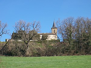
 Saint-Maur village church |
||
Saint-Maur ( Gascon : Sent Maur) is a French commune with 142 inhabitants (as of January 1, 2017) in the Gers department in the Occitanie region (until 2015 Midi-Pyrénées ); it belongs to the Arrondissement of Mirande and the municipality of Cœur d'Astarac en Gascogne . The residents call themselves Saint-Mauriens / Saint-Mauriennes .
geography
Saint-Maur is about seven kilometers southwest of Mirande and 27 kilometers southwest of Auch in the south of the Gers department. The community consists of hamlets, numerous scattered settlements and individual farmsteads. In parts of the river Osse forms the western boundary of the municipality.
Neighboring municipalities are Monclar-sur-Losse in the north, Saint-Martin in the northeast, Berdoues in the east, Ponsampère in the southeast, Bazugues in the south, Laas and Marseillan in the west and bars in the northwest.
history
In the Middle Ages, Saint-Maur and Soules lay in the Kastlanei Moncassin within the county of Astarac in the historic Gascon region and shared their fate. The place was once a pilgrimage center around a Benedictine monastery that has now disappeared. Saint-Maur and Soules belonged to the Mirande district from 1793 to 1801. Since 1801, Saint-Maur and Soules have been assigned to the arrondissement of Mirande and belonged to the canton of Mirande from 1793 to 2015 . The municipality has only existed in its current form since 1822. At that time, the former municipality of Saint-Maur (1821: 194 inhabitants) merged with the municipality of Soules (1821: 187 inhabitants) to form today's municipality.
Population development
The population development is typical for a French rural community. Developments between 1793 and 1821, with strong growth, and strong rural exodus from 1876 onwards are normal. After a low point in 1975, two growth phases followed between 1975 and 1982 and since 1990.
| year | 1793 | 1821 | 1831 | 1876 | 1962 | 1968 | 1975 | 1982 | 1990 | 1999 | 2006 | 2011 | 2016 |
| Residents | 299 | 381 | 327 | 320 | 136 | 132 | 89 | 111 | 103 | 111 | 121 | 129 | 146 |
| today's municipality Sources: Cassini, Saint-Maur Cassini, Soules and INSEE | |||||||||||||
Attractions
- Saint-Maur village church
- Madonna statue
- three wayside crosses
- Memorial to the Fallen
- Memorial to members of the Resistance who died on June 8, 1944
traffic
The Route nationale 21 crosses the municipality. The place Saint-Maur is on the D505. An important regional link is the road south towards Bazugues and Ponsampère.
Web links
- Saint-Maur on the side of the IGN
- Saint-Maur village church
- Location of the place and brief information
- Sights of Saint-Maur on Le Patrimoine rural du Gers
