
Bismark (Altmark)
| coat of arms | Germany map | |
|---|---|---|

|
Coordinates: 52 ° 40 ′ N , 11 ° 33 ′ E |
|
| Basic data | ||
| State : | Saxony-Anhalt | |
| County : | Stendal | |
| Height : | 55 m above sea level NHN | |
| Area : | 289.45 km 2 | |
| Residents: | 8143 (Dec. 31, 2019) | |
| Population density : | 28 inhabitants per km 2 | |
| Postcodes : | 39628, 39629 | |
| Primaries : | 039080, 039083, 039089, 039320, 039324, 039325, 039328 | |
| License plate : | SDL, HV, OBG | |
| Community key : | 15 0 90 070 | |
| City structure: | 20 localities | |
City administration address : |
Breite Strasse 11 39629 Bismark |
|
| Website : | ||
| Mayoress : | Annegret Schwarz | |
| Location of the town of Bismark (Altmark) in the Stendal district | ||
 _in_SDL.png) |
||

.JPG)
Bismark (Altmark) is a town in the heart of the Altmark , located in the Stendal district in northern Saxony-Anhalt , Germany. The medieval Liche spots and pilgrimage swung in the early modern period to the city. In the modern age, it consolidated the central local function for the surrounding villages. This led via the intermediate stage of administrative communities to the establishment of the unified community .
geography
Geographical location
Bismark (Altmark) lies in the middle of the Altmark . The distance from the core city to the district town of Stendal is around 22 km in a south-easterly direction, and around 60 km to the south to the state capital Magdeburg .
City structure
The unified municipality Stadt Bismark (Altmark) is divided into the following localities (postcodes in brackets) and districts (with residential places in brackets).
- Badingen (39628) with the OT Badingen (with the WP Neuhof ) and Klinke
- Berkau (39629) with the OT Berkau and Wartenberg
- Bismark (39629) with the OT Bismark, Arensberg , Döllnitz and Poritz
- Bust (39629) with the OT bust
- Dobberkau (39629) with the OT Dobberkau and Möllenbeck (with the WP Katharinenhof)
- Garlipp (39628) with the OT Garlipp
- Grassau (39628) with the OT Grassau, Bülitz and Grünenwulsch
- Hohenwulsch (39629) with the OT Hohenwulsch, Beesewege , Friedrichsfleiß , Friedrichshof (other place name Schmoor)
- Holzhausen (39629) with the OT Holzhausen
- Käthen (39628) with the OT Käthen (with the WP Bahnhof Vinzelberg and Deetzerwarthe )
- Kläden (39628) with the OT Klaeden and Darnewitz
- Koenigde (39629) with the OT Koenigde
- Kremkau (39629) with the OT Kremkau
- Meßdorf (39629) with the OT Meßdorf, Biesenthal , Schönebeck and Späningen
- Querstedt (39628) with the OT Querstedt and Deetz
- Schäplitz (39628) with the OT Schäplitz
- Schernikau (39628) with the OT Schernikau (with the WP Hof Muhlund) and Belkau
- Schinne (39628) with the OT Schinne
- Schorstedt (39629) with the OT Schorstedt and Grävenitz
- Steinfeld (Altmark) (39628) with the OT Steinfeld and Schönfeld
Neighboring communities
| Osterburg (Altmark) | ||
| Calf (mildness) |
.svg)
|
Rochau |
| Guards | Stendal |
Surface shape and floors
Bismark nestles in a depression opening to the northeast in the middle of a wide plain with fertile soil .
history
Little has been handed down about the history of the town up to 1676, as a conflagration in that year destroyed the whole town with the town church and town hall .
Origin and development of the place name
The place name is made up of two parts of the word, of which the second, "-mark", goes back to the Old High German term for area, area, borderland. For the first part of the word "Bis-", however, there are competing derivations:
On the one hand the derivation from Biese can be found . The river name probably originates from Dutch and means rush in German. The word was introduced by the immigrants when they were settled there by Albrecht the Bear (* around 1100) around 1100 to drain the piping .
The second derivation refers to the Biscopesmark ('Bishop's Area '), an agricultural exclave of the Bishop of Havelberg near Werben on the left bank of the Elbe in the Diocese of Halberstadt . This was intended as the basis of nutrition for the diocese of Havelberg when riots broke out there and an orderly diet was not possible. This is clear from the Latin document of 20./21. October 1209, in which Albrecht II , Margrave of Brandenburg confirmed that possession of Sigibodo , Bishop of Havelberg as property. The Altmark-Blätter , the local supplement of the Altmark Zeitung , published a corresponding study on April 15, 2006.
Over the centuries the place name showed the usual variations. The Landbuch der Mark Brandenburg from 1375 wrote it in the forms "Bysmarke" and "Bismark". Then it was called “Biszmarck” in 1687 and “Bismark” in 1804. In 1936 the town was given the addition "(Altmark)" to make it easier to differentiate.
The Bismarck family with their best-known representative Otto von Bismarck probably borrowed their name from the local town.
middle Ages

In the 12th century, the future Altmark included the German East Settlement , which here increasingly assumed the character of a state development of the Mark Brandenburg . During that high medieval phase, the village of Bismark was built on the road from Kalbe to Stendal, protected by a castle . It left no written traces. The associated small mound was preserved in the gardens of the houses at Alte Straße 37/38 (heavily removed and changed, still 3 to 4 m high, remnants of a ditch that had been pulled around in 1753, finds of blue-gray shards from the 13th century, legend of a golden one Cradle). In 1209 Albrecht II issued a certificate in Biskopesmarck (see the chapter on the origin of the place name ). The so named area belonged to the bishop of Havelberg . Klaus Werner von Bismarck doubted in the above. Altmark leaves the equation of the exhibition site with the local settlement. In this case it was first mentioned in 1263 with the personal name nicolaus de bismarke .
Now a patch , Bismark was surrounded by a fortification of walls and ditches . Entrance and exit were provided by the Kalbesche Tor in the west, the Stendal in the east and the Gardelegen in the south. Inside there was a rectangular plan with a west-east main street. The parallel street, which was added later, led from the city center to the west. Between the two was the rectangular market square with the town hall attested in 1413 . To the east, the church square was connected to the parish church . It was subordinate to the Archdiaconate called Balsamann in the Diocese of Halberstadt .
According to the legend of the golden louse, its bishop stayed here several times. He took part in the pilgrimage to Bismark. She gave birth in the year 1350, just as the Black Death moved into northern Germany . From the churchyard, the so-called Holy Road led out of the fortification, a little bit to the south to the pilgrimage church of the Holy Cross . During the late Middle Ages , a mass brawl broke out one day due to excessive beer consumption . Thereupon the church ordered the pilgrimage to end forever.

The von Alvensleben family acquired the bailiwick , castle and town of Kalbe in 1324, one year after the end of the Brandenburg Interregnum , and Bismark in the late 14th century. During the time of the Wittelsbach family, individual, separate parts accumulated to form the administrative unit and Altmark landscape . Due to the ownership structure, Bismark came as an exclave to the Landreiterei Salzwedel before Perver Tor (later Arendsee district ). The above-mentioned people who sat in the castle held the higher and lower jurisdiction in their media locality (opposite of immediately sovereign ) . They granted the right to hold a fair , as evidenced by the site money mentioned in 1370 . The same tax was paid by bakers and butchers for their permanent sales benches. Mainly, however, the Stedichen lived from agriculture and animal husbandry .
The Landbuch der Mark Brandenburg from 1375 spoke of the plebano in Bysmarke (' Pastor in Bismark', see town church ) and of Rule in Bismark , Rule (the citizen took 1 wispel of oats from the full farmer Hans Polkow from Erxleben near Osterburg and 3 counts from Klein Möringen , 8 pfennigs a). The Urbar did not provide more information about the village. The surrounding area, most of today's districts , however, received a more or less detailed village register . Only Deetz and Klinke were missing ( Friedrichsfleiß and Neuhof did not yet exist). All were in the dominion of Bartensleben (later Stendalischer Kreis ), the only exception was Käthen in the Landreiterei Tangermünde ( Tangermündescher Kreis ).
Bismark stayed in the Middle Ages for a long time, probably never received a formal granting of town charter , and in 1449 showed clear village tax ratios . In addition to the town hall already listed, it gained further urban elements. The (city) council consisted of a councilor in 1464 , then two such and the mayor . The brewing industry benefited from the fair and even more from the through traffic via Deetzer Warte . In 1471 21 out of 75 citizens owned the brewing rights . They joined together in a guild that privileged the local lords in 1491 . As early as 1486 they issued the guild regulations for bakers, then in 1501 for potters . Citizens of cities also went to the fair. In 1494, garment tailors and cloth makers from Osterburg , Stendal and Tangermünde paid around 5 guilders for this. Since such festivals lasted longer, there was enough time for business.
Modern times
During the Thirty Years War , Bismark suffered several looting. The ramparts were leveled around 1700 .
Incorporations
Outside the city, only various brickworks were initially included . In 1844, the brewer Christoph Mundt built the Mundtsche Ziegelei establishment 1 ⁄ 8 Prussian mile southeast on a field . Then there was talk of living space: 1895 brickworks, 1905 brickworks and 1931 Timmer brickworks on Wartenberger Chaussee. 1973 made the incorporations of Arensberg , Döllnitz and Poritz .
In 2009, 19 municipal councils (the respective date in brackets) passed a territorial change agreement. The Saxony-Anhalt Ministry of the Interior approved the application of June 29th on August 5th and published the district of Stendal as the lower municipal supervisory authority on August 12th. When it came into force on January 1, 2010, the contract dissolved the municipalities listed below and the Bismark / Kläden administrative community . The new unified community called Stadt Bismark (Altmark) was created .
- Badingen (June 18, 2009)
- Berkau (June 15, 2009)
- Bismark (Altmark) (June 4, 2009)
- Bust (June 18, 2009)
- Dobberkau (June 23, 2009)
- Garlipp (June 17, 2009)
- Grassau (June 25, 2009)
- Hohenwulsch (June 2, 2009)
- Holzhausen (June 11, 2009)
- Käthen (June 15, 2009)
- Kläden (June 11, 2009)
- Kings (June 25, 2009)
- Kremkau (June 11, 2009)
- Meßdorf (June 4, 2009)
- Querstedt (June 22, 2009)
- Schäplitz (June 22, 2009)
- Schernikau (June 23, 2009)
- Schorstedt (June 9, 2009)
- Steinfeld (Altmark) (June 11, 2009)
The incorporated city and now Bismark formed a local council with 9 members including the local mayor . The other localities proceeded analogously. As a result of the merger, the area of Bismark (Altmark) increased from 33 to 274 km², and the number of inhabitants increased two and a half times.
On September 1, 2010, the community of Schinne was added, which had been co-administered by Bismark (Altmark) since January 1 of the same year.
Population development
During the Middle Ages , no more than 500 to 600 people lived in Bismark.
|
|
|
Supporting documents:
politics
City council
The municipal council election on May 26, 2019 brought the following result:
| Party / group of voters | be right | Share of votes | Seats |
|---|---|---|---|
| Free voter community Bismark | 2533 | 21.5% | 4th |
| General Free Community of Voters | 2528 | 21.5% | 4th |
| Christian Democratic Union of Germany | 2169 | 18.4% | 4th |
| The left | 1175 | 10.0% | 2 |
| Social Democratic Party of Germany | 1142 | 9.7% | 2 |
| Independent voter community Dobberkau | 803 | 6.8% | 1 |
| Voting Community Berkau | 439 | 3.7% | 1 |
| Hohenwulsch voter community | 416 | 3.5% | 1 |
| Individual applicants | 310 | 2.6% | 1 |
mayor
.png)
On June 7, 2009, Verena Schluesselburg was elected mayor in the first ballot and Annegret Schwarz was elected as her successor on October 23, 2016.
coat of arms
The unified municipality of Bismark (Altmark) does not have its own approved coat of arms . It is up to the city council to decide.
For the village of Bismark the description of the coat of arms reads : “ Split by silver and gold ; in front a red eagle armed with gold at the slit, behind a red rose with a golden clump , green leaf and stem. "
Half the heraldic animal on the heraldic right side of the shield - the Brandenburg eagle indicated that the Altmark belonged to the Mark Brandenburg . The natural rose probably came from the coat of arms of von Alvensleben , to which Bismark belonged for centuries. A seal from 1494 swapped the two fields .
Culture and sights
The chapters of the same name for the individual districts contain further details.
Theaters and museums
- Heimatstube Bismark, in the Bürgerhaus Bismark, Breite Straße 49, exhibition on the city's history and Wilhelm Lüdecke , open on request
- Information center for the Hohenwulsch nature trail , with tree museum, apiary, nesting boxes, animal preparations, barbecue and playground, open by appointment
Buildings
A city fire in 1676 incinerated all of Bismark. In 1709 the state ordered that the thatched roofs be abolished, as far as the citizens' assets allowed this. The citizens resisted with the argument that no house could have a stone roof. Accordingly, straw continued to cover two thirds of the 100 houses in 1801, all of them half-timbered houses . Presumably arson started the city fire of 1803. He destroyed 19 houses, including their barns and stables , and 35 families lost their belongings. The damaged main street was then straightened and widened between Marktplatz and Döllnitzschem Tor (initially called Kalbesches Tor).
- The Deetzer waiting is one of two surviving altmärk een Landwehr - Wart towers .

- The Golden Laus - a field stone erne church tower ruin - is the symbol of Bismark. Only this remained of the pilgrimage church to the Holy Cross . According to legend, it was built on the spot where a shining cross fell from the sky one night. In fact, the Magdeburg Schöppenchronik reports on crowds of pilgrims who moved to “bismarke” around the middle of the 14th century at the time of the great plague in order to receive protection and healing from a miraculous cross. They came to pray and they sacrificed to reinforce their prayers. Finally, according to the chronicle, people were beaten and murdered because of the offerings and the pilgrimage dried up. It can be assumed that the church was ultimately no longer used and fell into disrepair. The remaining masonry of the nave was removed at the beginning of the 19th century.
- The ruin has always been known as the "Golden Louse". The legend tells that in ancient times a huge louse was held captive up in the tower, tied to a golden chain. She had to be fed a pound of meat a day, and she also drank wine. The devil or at least some hellish creature was in her. Another explanation is much closer to the truth. Accordingly, the remainder of a golden Latin inscription could be read on the ruins for a long time: LAUS DEO (Praise to God). In view of the rich offerings, the vernacular then coined the name "Golden Louse" in an ironic manner.
- The first maintenance measures were carried out on the tower, which was badly damaged at the end of the 19th century, and a wooden staircase was installed. In 1912 the heavily weathered outer walls were thoroughly renovated. As early as 1916, cracks formed on the north and south sides of the tower, which steadily widened. The cause was the sloping east wall, which was missing the support after the nave was demolished. In addition, their foundation, which consisted only of loosely poured stones, was completely inadequate. This deficiency and the damage were permanently removed with great technical effort in 1934 and the structure could be climbed again. In the 1990s, the louse had to be closed again due to the risk of the stairs breaking.
- A very successful fundraising campaign then enabled the necessary repair and reopening of the golden louse in 1998. The fundraising campaign was continued for further conservation measures. In 2004 the Golden Louse Association was formed with the aim of promoting and supporting the preservation of the monument. That succeeded admirably. In 2005 the tower was completely and thoroughly renovated. The association managed to arouse public interest in the venerable building and to make it an attractive part of the local cultural life. A group of figures inside the building, sculptured by Heinz-Werner Pfister, illustrates the legend and history of the Golden Louse in an impressive way. The association also enables guided tours.
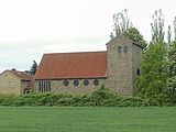
- The town church Bismark was from the 1st half of the 13th century as a Romanesque three ship owned basilica built. The conversion of the very short nave in the 14th century into a stepped hall left striking traces (recessed inner walls of the aisles, square attachments of the otherwise round pillars of the central nave). According to the Landbuch der Mark Brandenburg , the pastor received 14 bushels of rye and barley from Schinne around 1375, the equivalent of 0.5833 counts . The town fire of 1676 destroyed the church including the tower and bells . Gebhard von Alvensleben paid for the new casting of the latter . The patron saint also supervised the reconstruction in 1677. The enlargement of numerous windows in the 19th century changed the shape noticeably. A restoration took place in 1904. The Evangelical Church is the oldest preserved building in the city.
Honorary and small monuments

- Wimenty Musial (1908–1942) and Antonina Tuczkow (1924–1941) pay tribute to granite name plaques on their graves in the city cemetery. They became victims of forced labor during the Nazi era .
- Bismarck-Stein Bismark, street of youth
- Distance stones in Grassau , Käthen , Schernikau , Schorstedt , Schäplitz and Schönfeld
- Cenotaph for the victims of war and violence in Späningen, Biesenthaler Straße, commemorates the fallen and missing of the 1st and 2nd World War, renovated in 2019
- Elise and Otto Hampel memorial stone Bismark, inaugurated on October 27, 2019
- War memorials Bismark (in front of the town church) and Schinne (main street)
Recreation
- "Kolk" outdoor pool in Bismark, Döllnitzer Straße 24
- Hohenwulsch nature trail , numerous educational boards about local nature, three circular courses over 3 km, 7 km and 13 km
- Schäferweg, 17 km long circular wall path , from Kläden via Grünenwulsch , Bülitz , Beesewege , Garlipp and Schäplitz back to Kläden, incline-free, natural, paved and asphalt paths
- Forest swimming pool Dobberkau / Möllenbeck, Am Mühlenberg
Regular events
- Steinfeld clinkstone run: on the last Saturday in May, People's sports day for runners, walkers and Walker, award in several categories clinkstone Cup, named after popular name of the nearby highest boulder of megalithic tomb in Steinfeld , initiated in 2009 to 800-year-old village jubilee
- International Messdorf Music Festival: Saturday evenings in August / September, final concert on the day of German unity and Advent concert on the second Thursday of Advent , concert series with organists, soloists, instrumental and vocal ensembles, since 1999
- Steinfeld farmers' market: on the last Saturday in September, market with regional products, traditional handicrafts and cultural program, since 1995
- Kladen Advent market: on the first Sunday in Advent, around the Schlossplatz, with a fairytale forest including Christmas post office and fairytale aunt, numerous dealers, as well as a stage program and other events, since 1992
Economy and Infrastructure

Companies
In 1889 a dairy was built on Stendaler Straße . After the first cheese was made in 1948, a cheese factory developed. It was continued until 1992, most recently as the Bismark dairy cooperative. A poultry slaughterhouse operated from 1959 to 1991 emerged from a closed canning factory.
traffic
Regular buses run by the Regionalverkehrsbetriebe Westsachsen (RVW) under the brand name stendalbus and the Personenverkehrsgesellschaft Altmarkkreis Salzwedel mbH (PVGS).
The station Bismark (Altm) was on the railway line Hohenwulsch-calving . The last train ran on June 9, 2001, after which the train service was stopped. The nearest train station is Hohenwulsch on the Stendal – Uelzen railway line . By incorporations also are the breakpoints Steinfeld (b Stendal) , Kläden (Kr Stendal) and Meßdorf (since 10 December 2017, longer served) on the bismarkischen city.
Religions
The 2011 census in the European Union showed that of the 9,012 inhabitants of the city of Bismark (Altmark) around 38% belonged to the Protestant and around 3% to the Catholic Church.
- The Protestant town church marks the center of the village. Your parish belongs to the Stendal parish in the Stendal-Magdeburg provost of the Evangelical Church in Central Germany .
- The New Apostolic Church is located in Kirchhofstrasse. It belongs to the New Apostolic Church of Central Germany .
- The former Catholic Holy Cross Church on Bahnhofstrasse was built in 1954/55. The Pfarrvikarie oversaw the from 1987 Kuratie in Meßdorf with. As of 2010, Heilig Kreuz zu Bismark was under the parish of Sankt Anna zu Stendal . At the end of 2014 the church was profaned .
- The pilgrimage church of the Holy Cross dates from around 1200 (see Golden Louse ).

Parish church and war memorial of Bismark

New Apostolic Church
Holy Cross Church

Golden louse 1914


,_Sachsen-Anhalt_-_Ruine_goldene_Laus_(Zeno_Ansichtskarten).jpg)
Personalities

Honorary citizen
- 1895: Otto von Bismarck
sons and daughters of the town
- Richard Herzig (* 1851 in Schinne ; † 1934), architect and diocesan master builder of the Hildesheim diocese
- Wilhelm Lüdecke (* 1868; † 1938), composer and music publisher
- Richard Meyer (* 1893; † 1974), NSDAP politician
- Elise Hampel (* 1903 as Elise Lemme ; † 1943), she and her husband Otto Hampel wrote postcards with anti-war slogans and appeals against the National Socialist tyranny, displayed them in Berlin apartment buildings, both were executed on April 8, 1943 in the Berlin-Plötzensee prison , Hans Fallada processed her fate in the novel Everyone dies for himself
- Christel Aschmoneit-Lücke (* 1944), FDP politician, member of the Schleswig-Holstein State Parliament (1992-2005)
- Eduard Stapel (* 1953; † 2017), LSVD spokesman (1990-2006)
literature
- Ute Bednarz, Folkhard Cremer and others (editing): Georg Dehio. Saxony-Anhalt I. District of Magdeburg . In: Georg Dehio. Saxony-Anhalt (= Dehio Association , Association of State Monument Preservators in the Federal Republic of Germany [Hrsg.]: Georg Dehio. Handbook of German Art Monuments ). 2 volumes, Deutscher Kunstverlag, Munich / Berlin 2002, ISBN 3-422-03069-7 .
- Manfred Bensing , Karlheinz Blaschke , Karl Czok , Gerhard Kehrer, Heinz Machatschek: Bismark . In: Heinz Göschel (Hrsg.): Lexicon cities and coats of arms of the German Democratic Republic . 3rd edition, Bibliographisches Institut, Leipzig 1985, DNB 860113086 , p. 54.
- Helmut Kurt Block (Hrsg.): Bismark-Kläden and surrounding area (= Kulturförderverein Östliche Altmark eV [Hrsg.]: The knowledge of the region . Volume 2). Edition Kulturförderverein Östliche Altmark, Altenzaun 2007, ISBN 978-3-9811747-0-0 .
- Hartmut Bock , Barbara Fritsch, Lothar Mittag, Johannes Müller (authors), Juraj Lipták (photographs): Great stone graves in the Altmark . State Office for Monument Preservation and Archeology Saxony-Anhalt, Halle an der Saale 2006, ISBN 3-939414-03-4 .
- Lieselott Enders : The Altmark. History of a Kurmark landscape in the early modern period (end of the 15th to the beginning of the 19th century) (= Klaus Neitmann [Hrsg.]: Publications of the Brandenburg State Main Archives . Volume 56). Berliner Wissenschafts-Verlag, Berlin 2008, ISBN 978-3-8305-1504-3 .
- Paul Grimm : The prehistoric ramparts of the districts of Halle and Magdeburg (= Wilhelm Unverzagt [Hrsg.]: Handbook of prehistoric ramparts and weir systems . Part 1; Institute for prehistory and early history of the German Academy of Sciences in Berlin [ Ed.]: Writings of the Section for Prehistory . Volume 6). Akademie-Verlag, Berlin 1958, DNB 451671341 .
- Günther GA Marklein, Gudrun Wolter: Bismark. From Badingen to Steinfeld (= the archive images series ). 1st edition, Sutton Verlag, Erfurt 2009, ISBN 978-3-86680-469-2 .
- Peter P. Rohrlach: Historical local lexicon for the Altmark (= historical local lexicon for Brandenburg . Part XII; Klaus Neitmann [Hrsg.]: Publications of the Brandenburg State Main Archive . Volume 68; Publications of the State Archives Administration of the State of Saxony-Anhalt. Series A. Sources for History of Saxony-Anhalt . Volume 23). 2 volumes, Berliner Wissenschafts-Verlag, Berlin 2018, ISBN 978-3-8305-3743-4 .
- Johannes Schultze (Hrsg.): The land book of the Mark Brandenburg of 1375 (= Brandenburg land books . Volume 2; publications of the historical commission for the province of Brandenburg and the imperial capital Berlin . Volume VIII, 2). Commission publisher von Gsellius, Berlin 1940 ( digitized version in Potsdam University Library ; almost all districts of Bismark described).
- Berent Schwineköper : Bismark . In: Berent Schwineköper (Hrsg.): Handbook of the historical sites of Germany. Province of Saxony Anhalt (= manual of the historical sites in Germany . Volume 11). 2nd, revised and supplemented edition, Alfred Kröner Verlag, Stuttgart 1987, ISBN 3-520-31103-8 , pp. 43-44.
Web links
Individual evidence
- ↑ State Statistical Office Saxony-Anhalt, population of the municipalities - as of December 31, 2019 (PDF) (update) ( help ).
- ↑ a b Landkreis Stendal (Ed.): Official Journal for the Landkreis Stendal . 19th year, No. 17, Stendal August 12, 2009, pp. 192–201 ( full text in Stendal district [PDF; 7.1 MB; accessed on December 14, 2019]).
- ↑ a b StBA: Area changes from January 1st to December 31st, 2010 .
- ^ State Statistical Office Saxony-Anhalt (ed.): Directory of municipalities and parts of municipalities. Territorial status: 1.4.2013 . Halle an der Saale May 2013, 15090070 Bismark (Altmark), Stadt, pp. 112–113 ( full text in the Federal Statistical Office [PDF; 1.6 MB; accessed on January 10, 2020]).
- ↑ a b c d e Heinz Göschel (Ed.): Bismark . In: Lexicon cities and coats of arms of the German Democratic Republic . 3rd edition, Bibliographisches Institut, Leipzig 1985, p. 54.
- ^ A b c Peter P. Rohrlach: Historical local dictionary for the Altmark. Volume 1: A-K . Berliner Wissenschafts-Verlag, Berlin 2018, ISBN 978-3-8305-3743-4 , Bismark (Altmark). 4. First written mention, p. 244.
- ↑ a b c Johannes Schultze (ed.): The land book of the Mark Brandenburg from 1375 . Commission publisher von Gsellius, Berlin 1940, Antiqua marchia. [Tangermünde Circle]. Schinne, pp. 375–379, Storbeke dabit… plebano in Bysmarke 14 modios siliginis et ordei,…: p. 376.
- ↑ a b Johannes Schultze (ed.): The land book of the Mark Brandenburg from 1375 . Commission publisher von Gsellius, Berlin 1940, Antiqua marchia. Hii sunt redditus in villis domἱcellorum de Bertensleve, pp. 285-330, Rule: Erxleben near Osterburg, p. 293; Klein Möringen p. 323.
- ↑ Administrative region of Magdeburg (Ed.): Official Gazette of the Government of Magdeburg . Magdeburg August 10, 1936, ZDB -ID 3766-7 , No. 462, p. 144.
- ^ Ernst Eichler , Hans Walther : City name book of the GDR . 1st edition, Bibliographisches Institut, Leipzig 1986, ISBN 3-323-00007-2 , The city names of the GDR from A – Z. Bismark, p. 56.
- ^ Lieselott Enders: The Altmark . Berliner Wissenschafts-Verlag, Berlin 2008, ISBN 978-3-8305-1504-3 , A. Political history. I. Becoming the region in the Middle Ages. 1. From the Duchy of Saxony to the Mark Brandenburg, pp. 31–41.
- ↑ a b c d e f g h Peter P. Rohrlach: Historical local dictionary for the Altmark. Volume 1: A-K . Berliner Wissenschafts-Verlag, Berlin 2018, ISBN 978-3-8305-3743-4 , Bismark (Altmark). 3. Form of settlement, p. 244.
- ^ Paul Grimm: The prehistoric and early historical castle walls of the districts of Halle and Magdeburg . Akademie-Verlag, Berlin 1958, appendix. I. Catalog of the prehistoric and early historical castle walls. Magdeburg district. Circle calf. 881 Bismark, p. 356.
- ^ Adolph Friedrich Riedel : Codex diplomaticus Brandenburgensis. 1. main part. 3rd volume . In: Codex diplomaticus Brandenburgensis . Collection of documents, chronicles and other sources for the history of the Mark Brandenburg and its rulers . 41 volumes, F. H. Morin, Berlin 1843, XIX. The cathedral chapter at Havelberg. Certificates. XII. The Margrave Albrecht confirms to the diocese, chapter and the church of Havelberg, all awards of his father and grandfather and adds several new possessions in the Altmark to the diocese, in the year 1209, p. 89-91, Acta sunt hec Biscopesmarck: p. 91 .
- ^ A b c Peter P. Rohrlach: Historical local dictionary for the Altmark. Volume 1: A-K . Berliner Wissenschafts-Verlag, Berlin 2018, ISBN 978-3-8305-3743-4 , Bismark (Altmark). 6. Rulership, p. 245.
- ↑ a b c d e Berent Schwineköper: Bismark . In: Handbook of the historical sites of Germany. Province of Saxony Anhalt . 2nd edition, Alfred Kröner Verlag, Stuttgart 1987, ISBN 3-520-31103-8 , pp. 43-44.
- ^ A b c Peter P. Rohrlach: Historical local dictionary for the Altmark. Volume 1: A-K . Berliner Wissenschafts-Verlag, Berlin 2018, ISBN 978-3-8305-3743-4 , Bismark (Altmark). 7. Economic and social structure, pp. 245–250.
- ^ Peter P. Rohrlach: Historical local dictionary for the Altmark. Volume 1: A-K . Berliner Wissenschafts-Verlag, Berlin 2018, ISBN 978-3-8305-3743-4 , Bismark (Altmark). 8. Ecclesiastical Constitution, pp. 250–251.
- ↑ a b Ingeborg Drewitz (Ed.): Märkische Sagen. Berlin and the Mark Brandenburg . 1st edition, Eugen Diederichs Verlag, Düsseldorf / Cologne 1979, ISBN 3-424-00658-0 , The Altmark. The golden louse at Bismark, p. 263.
- ^ Joachim Stephan: City and Citizens . In: Clemens Bergstedt, Heinz-Dieter Heimann , Knut Kiesant, Peter Knüvener, Mario Müller, Kurt Winkler (eds.): In dialogue with robber barons and beautiful Madonnas. The Mark Brandenburg in the late Middle Ages . 1st edition, Lukas Verlag für Kunst- und Geistesgeschichte, Berlin 2011, ISBN 978-3-86732-118-1 , clergy, Jews and Slavs, pp. 245–247, here p. 246.
- ^ Peter P. Rohrlach: Historical local dictionary for the Altmark. Volume 1: A-K . Berliner Wissenschafts-Verlag, Berlin 2018, ISBN 978-3-8305-3743-4 , Bismark (Altmark). 9. Monuments, p. 251.
- ^ Norbert Gossler: The Marienberg near Lenzen. History of a sanctuary of the 15th / 16th centuries Century between pilgrimage and fairground events . In: Jiři Fajt, Wilfried Franzen, Peter Knüvener (eds.): The Altmark from 1300 to 1600. A cultural region in the field of tension between Magdeburg, Lübeck and Berlin . 1st edition, Lukas Verlag für Kunst- und Geistesgeschichte, Berlin 2011, ISBN 978-3-86732-106-8 , pp. 267–272, here p. 271, column 2.
- ^ Adriaan von Müller : The archeology of Berlin. From the ice age to the medieval city . Gustav Lübbe Verlag, Bergisch Gladbach 1986, ISBN 3-7857-0430-5 , Fleischer: p. 344.
- ↑ a b c d Lieselott Enders: The Altmark . Berliner Wissenschafts-Verlag, Berlin 2008, ISBN 978-3-8305-1504-3 , C. The urban society. I. The cities at the turn of the Middle Ages to the early modern period. 2. The media cities. Main Food Branches, pp. 818-819.
- ↑ a b Joachim Stephan: The Vogtei Salzwedel . Peter Lang, Frankfurt am Main 2006, ISBN 3-631-54808-7 , Der Adel. Noble families with documented rights in the Vogtei Salzwedel. Alvensleben, pp. 104-105.
- ↑ Johannes Schultze : The Mark Brandenburg. 2nd volume. The mark under the rule of the Wittelsbachers and Luxembourgers (1319–1415) . In: The Mark Brandenburg . 5 volumes, 4th edition, Duncker & Humblot, Berlin 2011, ISBN 978-3-428-13480-9 , I. The mark under the Wittelsbach house. 1. The dispute about the inheritance (1319–1323), pp. 9–24, here p. 24.
- ^ Peter P. Rohrlach: Historical local dictionary for the Altmark. Volume 1: A-K . Berliner Wissenschafts-Verlag, Berlin 2018, ISBN 978-3-8305-3743-4 , Kalbe (Milde). 6. Rulership, p. 1119.
- ↑ Rosemarie Baudisch: Geographical foundations and historical-political structure of Brandenburg . In: Ingo Materna , Wolfgang Ribbe (Ed.): Brandenburg history . Akademie Verlag, Berlin 1995, ISBN 3-05-002508-5 , landscapes. Altmark, p. 22.
- ↑ a b Gerd Heinrich (arrangement), K. Bremer, H.-J. Nitschke, Ch. Tolkmitt (cartography), G. Preuss (cartolithography and reproduction): Die Mark Brandenburg 1319–1575. Territorial development . Scale 1: 650,000. Department III, In: Historical Commission to Berlin at the Friedrich-Meinecke-Institute of the Free University of Berlin (Ed.): Historical hand atlas of Brandenburg and Berlin . Walter de Gruyter & Co., Berlin 1971.
- ↑ a b Johannes Schultze: The land book of the Mark Brandenburg from 1375 . Commission publisher von Gsellius, Berlin 1940, table of contents, pp. V – VI.
- ↑ Johannes Schultze (ed.): The land book of the Mark Brandenburg from 1375 . Commission publisher von Gsellius, Berlin 1940, description of the Mark Brandenburg 1373, pp. 1–5, von Alvensleben: p. 3.
- ↑ Helmut Assing: The sovereignty of the Ascanians, Wittelsbachers and Luxembourgers (mid-12th to early 15th century) . In: Ingo Materna, Wolfgang Ribbe (Ed.): Brandenburg history . Akademie Verlag, Berlin 1995, ISBN 3-05-002508-5 , The changes in social relationships. New approaches and crisis symptoms in the economy, constitution and jurisprudence, pp. 149–157, Schlossgesierter: p. 149.
- ^ Mr. Nolte: place and person directory . In: Johannes Schultze (ed.): The land book of the Mark Brandenburg from 1375 . Commission publisher von Gsellius, Berlin 1940, Bismark Kr.Stendal, p. 416.
- ↑ a b Johannes Schultze (ed.): The land book of the Mark Brandenburg from 1375 . Kommissionsverlag von Gsellius, Berlin 1940, Antiqua marchia, pp. 285–411, Mestorpe, pp. 285–286; Spenyghe, pp. 286-287; Scernekow, pp. 296-297; Sconevelde, pp. 297-298; Brisedal, p. 297; Wardenberghe, pp. 299-300; Holthusen, pp. 300-301; Berkowe, p. 301; Querstede, p. 302; Steinvelde, pp. 303-304; Garlipp, p. 312; Bysewede, pp. 312-313; Schardstede, p. 316; Lutken Wultzkow, pp. 317-318; Bůditz, p. 318; Hogen Wultzkow, p. 318; Grevenitze, p. 319; Kremko, p. 319; Cloden, pp. 319-320; Ossemor, p. 321; Mollenbeke, p. 321; Dolnitz, pp. 321-322; Portz, p. 322; Bust, p. 322; Arnsberge, p. 322; Schonebeke, p. 322; Kongede, p. 324; Schepelitz, p. 324; Belkow, p. 327; Grassow, p. 327; Dobberkow, p. 328; Bodinge, p. 328; Schinne, pp. 328-330; Coten, p. 355; Schynne, p. 375; Schinne, pp. 375-379.
- ^ Mr. Nolte: place and person directory . In: Johannes Schultze (ed.): The land book of the Mark Brandenburg from 1375 . Commission publisher von Gsellius, Berlin 1940, pp. 412–457.
- ^ Peter P. Rohrlach: Historical local dictionary for the Altmark . Berliner Wissenschafts-Verlag, Berlin 2018, ISBN 978-3-8305-3743-4 , Friedrichsfleiß nö Bismark, pp. 702–703; Neuhof (5) ssö Bismark, p. 1570.
- ↑ Evamaria Engel : The oppida of the Brandenburg land book of 1375 . In: Evamaria Engel, Konrad Fritze , Johannes Schildhauer (Hrsg.): Hansische Stadtgeschichte - Brandenburgische Landesgeschichte . Verlag Hermann Böhlaus Successor, Weimar 1989, ISBN 3-7400-0071-6 , pp. 57-78.
- ^ Stephan Albrecht : Medieval town halls in Germany. Architecture and function . Wissenschaftliche Buchgesellschaft, Darmstadt 2004, ISBN 978-3-534-13837-1 , I. The art and cultural-historical position of the medieval town hall. 1. Function. 1.2 The functions of the town hall. The town hall as a farm building, pp. 22–24, Markets by time: p. 22.
- ^ Peter P. Rohrlach: Historical local dictionary for the Altmark. Volume 1: A-K . Berliner Wissenschafts-Verlag, Berlin 2018, ISBN 978-3-8305-3743-4 , Bismark (Altmark). 1. Nature and Constitution, pp. 243–244.
- ^ Peter P. Rohrlach: Historical local dictionary for the Altmark. Volume 1: A-K . Berliner Wissenschafts-Verlag, Berlin 2018, ISBN 978-3-8305-3743-4 , Bismark (Altmark). 10. Population figures, p. 251 (years 1722 to 2006).
- ^ Unified community of the city of Bismark (Altmark) (Ed.): Citizen courier. Official notice and announcement sheet . Volume 8, No. 3, Bismark (Altmark) April 26, 2013, population figures, p. 2 (as of April 8, 2013).
- ^ Unified community of the city of Bismark (Altmark) (Ed.): Citizen courier. Official notice and announcement sheet . 15th year, no. 6, Bismark (Altmark) June 28, 2019, election results and names of the selected applicants, Unity Community Council, pp. 3–4.
- ↑ Annegret Schwarz was elected the next unified mayor on October 23, 2016 . In: Stadt Bismark (Altmark) (accessed December 11, 2019).
- ↑ Heinz Göschel (Ed.): Small collection of heraldic terms . In: Lexicon cities and coats of arms of the German Democratic Republic . 3rd edition, Bibliographisches Institut, Leipzig 1985, Schild, p. 549.
- ↑ Rosemarie Baudisch: Geographical foundations and historical-political structure of Brandenburg . In: Ingo Materna , Wolfgang Ribbe (Ed.): Brandenburg history . Akademie Verlag, Berlin 1995, ISBN 3-05-002508-5 , landscapes. Altmark, p. 22.
- ↑ a b Lieselott Enders: The Altmark . Berliner Wissenschafts-Verlag, Berlin 2008, ISBN 978-3-8305-1504-3 , C. The urban society. V. Urban construction. 3. Building stock and urban sanitation. Bismark, p. 1163.
- ↑ a b c d Peter P. Rohrlach: Historical local dictionary for the Altmark. Volume 1: A-K . Berliner Wissenschafts-Verlag, Berlin 2018, ISBN 978-3-8305-3743-4 , Bismark (Altmark). 9. Monuments, p. 251.
- ↑ a b Lieselott Enders: The Altmark . Berliner Wissenschafts-Verlag, Berlin 2008, ISBN 978-3-8305-1504-3 , C. The urban society. V. Urban construction. 2. Spiritual buildings. Kirchen, pp. 1150–1154, Bismark: p. 1153.
- ^ Database census 2011, Bismark (Altmark), Stadt, Religion .
- ↑ Axel Junker: Bismarker Church will be auctioned . In: Franz Kadell (editor-in-chief): Volksstimme . June 22, 2015 (accessed January 25, 2019).
Aland | Altmark Height | Altmark wipes | Arneburg | Bismark (Altmark) | Eichstedt (Altmark) | Goldbeck | Hassel | Havelberg | Hohenberg-Krusemark | Iden | Kamern | Klietz | Osterburg (Altmark) | Rochau | Sandau (Elbe) | Schollene | Schönhausen (Elbe) | Seehausen (Altmark) | Stendal | Tangerhütte | Tangermünde | Advertise (Elbe) | Wust-Fischbeck | Zehrental