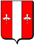
Lalœuf
| Lalœuf | ||
|---|---|---|

|
|
|
| region | Grand Est | |
| Department | Meurthe-et-Moselle | |
| Arrondissement | Nancy | |
| Canton | My au Saintois | |
| Community association | Pays du Saintois | |
| Coordinates | 48 ° 28 ' N , 6 ° 1' E | |
| height | 279-405 m | |
| surface | 10.68 km 2 | |
| Residents | 291 (January 1, 2017) | |
| Population density | 27 inhabitants / km 2 | |
| Post Code | 54115 | |
| INSEE code | 54291 | |
 Saint-Remy church in the Puxe district |
||
Lalœuf is a French commune with 291 inhabitants (as of January 1, 2017) in the Meurthe-et-Moselle department in the Grand Est region (until 2015 Lorraine ). It belongs to the Arrondissement of Nancy and the Canton of Meine au Saintois (until 2015: Canton Vézelise ).
geography
Lalœuf is located about 32 kilometers south-southwest of Nancy in the Saintois countryside . Lalœuf is surrounded by the neighboring communities Dolcourt in the north and north-west, Goviller in the north, Vitrey in the east and north-east, Ognéville in the east, Thorey-Lyautey in the south and south-east, Battigny in the south and south-west, Gélaucourt in the west and Favières in the west and north-west.
Population development
| year | 1962 | 1968 | 1975 | 1982 | 1990 | 1999 | 2006 | 2017 |
|---|---|---|---|---|---|---|---|---|
| Residents | 253 | 229 | 185 | 180 | 207 | 233 | 284 | 291 |
| Sources: Cassini and INSEE | ||||||||
Attractions
- Saint-Remy church in the Puxe district from the 12th century, monument historique since 1926
Web links
Commons : Lalœuf - collection of images, videos and audio files
