Neuviller-sur-Moselle
| Neuviller-sur-Moselle | ||
|---|---|---|

|
|
|
| region | Grand Est | |
| Department | Meurthe-et-Moselle | |
| Arrondissement | Nancy | |
| Canton | My au Saintois | |
| Community association | Pays du Saintois | |
| Coordinates | 48 ° 30 ′ N , 6 ° 17 ′ E | |
| height | 239-360 m | |
| surface | 6.71 km 2 | |
| Residents | 235 (January 1, 2017) | |
| Population density | 35 inhabitants / km 2 | |
| Post Code | 54290 | |
| INSEE code | 54399 | |
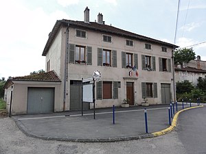
 Mairie Neuviller-sur-Moselle |
||
Neuviller-sur-Moselle is a French commune in the department of Meurthe-et-Moselle in the region of Grand Est (2015 Lorraine ). It belongs to the Arrondissement of Nancy . The community has 235 inhabitants (as of January 1, 2017).
geography
Neuviller is located on the Moselle and the parallel Canal des Vosges , about 25 kilometers south of Nancy at an altitude between 239 and 360 m above sea level. The municipality covers 6.71 km².
Population development
| year | 1962 | 1968 | 1975 | 1982 | 1990 | 1999 | 2007 | 2017 |
| Residents | 309 | 306 | 323 | 261 | 266 | 252 | 248 | 235 |
Personalities
- Leopold Philipp Karl zu Salm (1620–1663), Wild- and Rheingraf and Prince zu Salm from the Salm-Neufville line.
- Antoine-Martin Chaumont de La Galaizière (1697–1783), Chancellor of Lorraine 1737–1768, resided in Neuviller Castle.
Web links
Commons : Neuviller-sur-Moselle - Collection of images, videos and audio files

