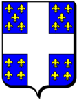
Tonnoy
| Tonnoy | ||
|---|---|---|

|
|
|
| region | Grand Est | |
| Department | Meurthe-et-Moselle | |
| Arrondissement | Nancy | |
| Canton | Lunéville-2 | |
| Community association | Pays du Sel et du Vermois | |
| Coordinates | 48 ° 33 ' N , 6 ° 15' E | |
| height | 229-369 m | |
| surface | 12.35 km 2 | |
| Residents | 698 (January 1, 2017) | |
| Population density | 57 inhabitants / km 2 | |
| Post Code | 54210 | |
| INSEE code | 54527 | |
| Website | http://www.mairie-tonnoy.fr/ | |
 Look at Tonnoy |
||
Tonnoy is a French commune with 698 inhabitants (as of January 1, 2017) in the Meurthe-et-Moselle department in the Grand Est region (until 2015 Lorraine ). Tonnoy belongs to the arrondissement of Nancy and the canton of Lunéville-2 (until 2015: canton of Saint-Nicolas-de-Port ).
geography
Tonnoy is located about 15 kilometers south-southeast of Nancy on the Moselle . On the western municipal boundary leading shipping canal Canal des Vosges along. Tonnoy is surrounded by the neighboring communities of Burthecourt-aux-Chênes in the north, Coyviller in the northeast, Ferrières in the east, Velle-sur-Moselle in the south and southeast, Crévéchamps in the south, Benney in the west and southwest and Flavigny-sur-Moselle in the west and Northwest.
Population development
| year | 1962 | 1968 | 1975 | 1982 | 1990 | 1999 | 2006 | 2017 |
| Residents | 395 | 327 | 428 | 575 | 607 | 635 | 716 | 698 |
| Sources: Cassini and INSEE | ||||||||
Attractions
- Saint-Laurent church from the 15th century
- Saudronviller Castle from the 18th century
- Tonnoy Castle from the 14th century with remains from the 16th century
- several houses from the 15th and 16th centuries
Web links
Commons : Tonnoy - collection of images, videos and audio files


