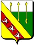
Montauville
| Montauville | ||
|---|---|---|

|
|
|
| region | Grand Est | |
| Department | Meurthe-et-Moselle | |
| Arrondissement | Nancy | |
| Canton | Pont-à-Mousson | |
| Community association | Bassin de Pont-à-Mousson | |
| Coordinates | 48 ° 54 ' N , 6 ° 1' E | |
| height | 193-376 m | |
| surface | 16.19 km 2 | |
| Residents | 1,056 (January 1, 2017) | |
| Population density | 65 inhabitants / km 2 | |
| Post Code | 54700 | |
| INSEE code | 54375 | |
Montauville is a French commune with 1,056 inhabitants (as of January 1, 2017) in the Meurthe-et-Moselle department in the Grand Est region (before 2016: Lorraine ). It belongs to the Arrondissement of Nancy and the Canton of Pont-à-Mousson (until 2015: Canton Dieulouard ). The inhabitants are called Montauvillois .
geography
Montauville is about 16 miles north-northwest of Nancy . Montauville is surrounded by the neighboring communities of Norroy-lès-Pont-à-Mousson in the north, Pont-à-Mousson and Maidières in the east, Blénod-lès-Pont-à-Mousson in the south-east, Jezainville in the south, Martincourt in the south-west, Mamey in the West and south-west and Fey-en-Haye to the west and north-west.
The municipality is located in the Lorraine Regional Nature Park .
Population development
| year | 1962 | 1968 | 1975 | 1982 | 1990 | 1999 | 2006 | 2017 |
| Residents | 700 | 793 | 846 | 951 | 1078 | 1092 | 1162 | 1056 |
| Sources: Cassini and INSEE | ||||||||
Attractions
- 19th century church of Sainte-Marie-Madeleine
- French national cemetery from the First World War

