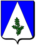
Bouxières-sous-Froidmont
| Bouxières-sous-Froidmont | ||
|---|---|---|

|
|
|
| region | Grand Est | |
| Department | Meurthe-et-Moselle | |
| Arrondissement | Nancy | |
| Canton | Pont-à-Mousson | |
| Community association | Bassin de Pont-à-Mousson | |
| Coordinates | 48 ° 57 ' N , 6 ° 6' E | |
| height | 179-394 m | |
| surface | 7.71 km 2 | |
| Residents | 369 (January 1, 2017) | |
| Population density | 48 inhabitants / km 2 | |
| Post Code | 54700 | |
| INSEE code | 54091 | |
Bouxières-sous-Froidmont is a French commune with 369 inhabitants (as of January 1, 2017) in the Meurthe-et-Moselle department in the Grand Est region (before 2016 Lorraine ). It belongs to the Arrondissement of Nancy and the Canton of Pont-à-Mousson .
geography
Bouxières-sous-Froidmont is located about 32 kilometers north-north-west of Nancy and about 18 kilometers south-south-west of Metz between the Moselle and Seille . Bouxières-sous-Froidmont is surrounded by the neighboring communities of Lorry-Mardigny in the north, Cheminot in the north and east, Lesménils in the south and south-east, Pont-à-Mousson in the south-west and Champey-sur-Moselle in the west.
The A31 autoroute runs through the municipality .
Population development
| year | 1962 | 1968 | 1975 | 1982 | 1990 | 1999 | 2006 | 2013 |
| Residents | 187 | 198 | 187 | 200 | 239 | 266 | 263 | 296 |
| Source: Cassini and INSEE | ||||||||
Attractions
- Nativité-de-la-Vierge church
- Notre-Dame pilgrimage chapel from the 19th century
- Remnants of an old Roman road
Web links
Commons : Bouxières-sous-Froidmont - Collection of images, videos and audio files

