List of bridges in Hamburg
With around 2500 bridges in Hamburg , the city is one of the most bridges in Europe . Due this high number of bridges in Hamburg due to its location in the inland delta of the River Elbe and the lowlands of Alster and Bille along with numerous tributaries, canals and channels . Added to this is the expansion of the port and its connection to a dense road and rail network that bridges the many waterways. Another special feature is as elevated railway -developed subway , which runs above ground for the most part and thus many bridges around the city. Frequently cited comparisons with other bridge-rich cities such as Amsterdam or Venice are misleading, as Hamburg with 755 km² is significantly larger than Amsterdam (219 km²) or Venice (414 km²) and this alone can make the absolute number higher.
Definition and counting of bridges
The exact number of bridges in Hamburg is not known. Counting bridges is considered difficult if only because there are different definitions of what a bridge is. According to the Hamburg State Office for Roads, Bridges and Waters (LSBG), a vehicle bridge that has a clearance of at least two meters and a pedestrian bridge that has a span of at least five meters is considered a vehicle bridge . However, if an overpass is more than 80 meters wide, it is a tunnel . The Deutsche Bahn, on the other hand, defines everything that has a span of more than two meters as a bridge, so that larger signal brackets over tracks are part of it.
According to official statistics, the city of Hamburg had 2496 bridges in 2004, 1256 of which were looked after by the LSBG, 354 were under the management of the Hamburg Port Authority (HPA) including the bridges of the port railway , 477 bridges belong to the German authorities Bahn, 396 to the Hamburger Hochbahn and 13 to the AKN Railway . Private bridges, for example in Hagenbeck's zoo or on factory sites, were not included. On the other hand, pipe bridges , i.e. the superstructures for district heating and water pipes , or larger sign holders over motorways and the anti-glare structures over the airport bypass in Fuhlsbüttel are nominally part of this inventory.
Of the 2500 or so bridges, almost 400 had an official name in 2007. Some names have emerged from the names of the streets or watercourses along which they are located, while port bridges are often named after one of their endpoints, for example the mooring pontoons to which they lead.
Alphabetical list
Names that are written in bold denote bridges in the street directory of the city of Hamburg, street names are in italics after former bridges over meanwhile filled canals and canals or demolished bridges, which also appear in the street directory, as well as in bold italics for bridge names that cannot be found in the street directory . Bridges without names are not listed.
A.
| photo | Name, brief description | use | (First) construction | District, location |
|---|---|---|---|---|
|
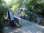
Achterdiekbrücke (Hein-Wulff Bridge) crosses the Gose Elbe between the Neuengammer Hinterdeich and the Kirchwerder Hausdeich near the village of Achterdiek. It is a steel truss bridge of the Vierländer Eisenbahn, in 1977 it was converted for car traffic and renamed Hein-Wulff-Brücke . |
Street | 1911 |
Neuengamme , Kirchwerder ( 53 ° 25 ′ 42 ″ N, 10 ° 12 ′ 18 ″ E ) |
|
Achterweidenbrücke led in the course of the street Achterweide over the Müggenburger Canal (harbor bridge) |
Street |
Veddel ( 53 ° 31 ′ 2 ″ N, 10 ° 2 ′ 27 ″ E ) |
||
|
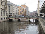
Adolphsbrücke (A037) leads over the Alsterfleet |
Street | 1843 |
Hamburg-Altstadt , Neustadt ( 53 ° 33 ′ 2 ″ N, 9 ° 59 ′ 23 ″ E ) |

|
Alfredstrasse Bridge Stone bridge; runs via the Lübeck Railway and the S-Bahn between the Landwehr and Berliner Tor stations . The bridge is a listed building. |
Street | 1901 |
Borgfelde ( 53 ° 33 ′ 31 ″ N, 10 ° 1 ′ 54 ″ E ) |
|
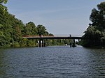
Allermöher church bridge leads between Allermöher Deich and Reitbrooker Vorderdeich over the Dove Elbe . |
Street | 1980 |
Reitbrook , Allermöhe ( 53 ° 28 ′ 54 ″ N, 10 ° 7 ′ 43 ″ E ) |

|
Alster Bridge leads in the course of the street Trillup over the Oberalster |
Street |
Lemsahl-Mellingstedt ( 53 ° 41 ′ 0 ″ N, 10 ° 6 ′ 59 ″ E ) |
|

|
Alsterdorfer Bridge This bridge runs along the Alsterdorfer Damm over the Skagerrak Canal . |
Street | 1914 |
Alsterdorf ( 53 ° 36 ′ 37 ″ N, 10 ° 0 ′ 12 ″ E ) |
|
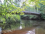
Alsterparkbrücke leads from the Alsterwanderweg over the Alster to the Alsterpark |
Footpath |
Ohlsdorf , Fuhlsbüttel ( 53 ° 37 ′ 43 ″ N, 10 ° 1 ′ 40 ″ E ) |
|

|
Old Harburg Elbe Bridge (A123) oldest Süderelbbrücke . The bridge is a listed building. |
Footpath | September 30, 1899 |
Wilhelmsburg , Harburg ( 53 ° 28 ′ 24 ″ N, 9 ° 59 ′ 42 ″ E ) |

|
Old Holstenstrasse railway bridge Railway bridge on the Hamburg-Berlin route over Alte Holstenstrasse, steel beam bridge |
railroad | 1935 |
Bergedorf ( 53 ° 29 ′ 26 ″ N, 10 ° 12 ′ 29 ″ E ) |

|
Altenwallbrücke (A141) leads over the Mönkedammfleet between Graskeller and Mönkedamm |
Street | 1842/1844 |
Hamburg old town ( 53 ° 32 ′ 57 ″ N, 9 ° 59 ′ 16 ″ E ) |

|
Altmannbrücke (A163) bridges the tracks south of the main station and connects Steinstraße with Kurt-Schumacher-Allee. |
Street |
St. Georg , Hammerbrook ( 53 ° 33 ′ 1 ″ N, 10 ° 0 ′ 28 ″ E ) |
|

|
Altona jetty Access bridge to the pontoon system; In 1995 the pier was relocated from the Altonaer Holzhafen to the fish auction hall, the bridge originates from the former pier Roßhöft. |
Access | 1907 |
Altona old town ( 53 ° 32 ′ 40 ″ N, 9 ° 57 ′ 7 ″ E ) |
|
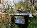
At the Pollhofsbrücke (A411) this bridge leads over the Brookwetterung . |
Street |
Bergedorf ( 53 ° 28 ′ 45 ″ N, 10 ° 13 ′ 47 ″ E ) |
|

|
Andreas Meyer Bridge leads over the Moorfleeter Canal . The namesake Andreas Meyer (1837–1901) was a senior engineer in Hamburg's structural engineering. |
Street | 1963/1965 |
Billbrook ( 53 ° 31 ′ 30 ″ N, 10 ° 4 ′ 8 ″ E ) |

|
Argentina Bridge (A621) leads along the Reiherdamm over the Reiherstieg ; previously the second Reiherstieg swing bridge stood here from 1907 . |
Street |
Kleiner Grasbrook , Steinwerder ( 53 ° 31 ′ 41 ″ N, 9 ° 58 ′ 36 ″ E ) |
|

|
Arndtstrasse Bridge leads along the Arndtstraße over the Uhlenhorster Canal |
Street | 1911 |
Uhlenhorst ( 53 ° 34 ′ 25 ″ N, 10 ° 1 ′ 7 ″ E ) |

|
Assmann Canal Bridge leads at the end of the Vogelhüttendeich over the Assmann Canal ; Concrete slab construction. |
Street | 1924 |
Wilhelmsburg ( 53 ° 30 ′ 56 ″ N, 9 ° 59 ′ 52 ″ E ) |
B.
| photo | Name, brief description | use | (First) construction | District, location |
|---|---|---|---|---|
|
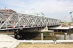
Baaken Bridge since 2011: Magdeburg Bridge; the Versmannstrasse leads over the Magdeburg harbor ; (Harbor bridge) |
Street |
HafenCity ( 53 ° 32 ′ 28 ″ N, 10 ° 0 ′ 3 ″ E ) |
|
|
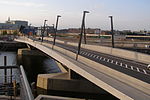
Baakenhafenbrücke across the Baakenhafen |
Street |
HafenCity ( 53 ° 32 ′ 22 ″ N, 10 ° 0 ′ 29 ″ E ) |
|

|
Baakenpark Bridge connects Versmannstraße via Baakenhafen with Baakenpark |
Footpath |
HafenCity ( 53 ° 32 ′ 20 ″ N, 10 ° 0 ′ 49 ″ E ) |
|

|
Bachstrasse Bridge runs along Bachstrasse / Barmbeker Strasse ( Bundesstrasse 5 ) over the Osterbek Canal |
Street |
Winterhude , Uhlenhorst , Barmbek-Süd ( 53 ° 34 ′ 55 ″ N, 10 ° 1 ′ 10 ″ E ) |
|

|
Baker's Bridge leads over the Alster in the course of the Saseler Damm |
Street |
Poppenbüttel ( 53 ° 39 ′ 22 ″ N, 10 ° 5 ′ 14 ″ E ) |
|
|
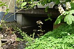
Bahnhofstrasse Bridge Leads the Rahlstedter Bahnhofstraße and the Rahlstedter Uferweg near the Rahlstedter Liliencornteich over the Wandse , reinforced concrete construction |
Street | 1977/1979 |
Rahlstedt ( 53 ° 35 ′ 58 ″ N, 10 ° 9 ′ 10 ″ E ) |

|
Barmbeker Ring Bridge (B764) leads as an extension of Dennerstraße over Fuhlsbüttler Straße and joins Lauensteinstraße; Reinforced concrete structure |
Street | 1970/1971 |
Barmbek-Nord ( 53 ° 35 ′ 55 ″ N, 10 ° 2 ′ 29 ″ E ) |

|
Barmbeker road bridge runs in the course of Barmbeker Straße; Reinforced concrete structure. |
Street |
Winterhude ( 53 ° 35 ′ 16 ″ N, 10 ° 1 ′ 0 ″ E ) |
|

|
Beesenlandbrücke Crosses the southern entrance of the Peutekanal . The bridge is a listed building. The railway operation has meanwhile ceased, the footpath over the bridge is closed due to dilapidation. |
Railway / bike path |
Veddel ( 53 ° 31 ′ 21 ″ N, 10 ° 1 ′ 38 ″ E ) |
|

|
Bekassinenau Bridge This road bridge runs along the street Bekassinenau over the underground line 1 . The Hamburg artist Ernst Hanssen designed the lettering on the railing and the surrounding artistic ironwork . |
Street |
Farmsen-Berne ( 53 ° 37 ′ 19 ″ N, 10 ° 8 ′ 3 ″ E ) |
|

|
Bellevue Bridge crosses the Goldbek Canal in the course of the Bellevue street |
Street |
Winterhude ( 53 ° 34 ′ 57 ″ N, 10 ° 0 ′ 10 ″ E ) |
|
|
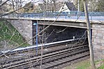
Bernese Bridge (B846) crosses the underground line 1 as an extension of the Fasanenweg. The Hamburg artist Ernst Hanssen designed the lettering on the railing and the surrounding artistic ironwork . |
Street |
Rahlstedt , Farmsen-Berne ( 53 ° 37 ′ 43 ″ N, 10 ° 8 ′ 31 ″ E ) |
|

|
Billbrook Canal Bridge leads over the Billbrook Canal in the course of the Moorfleeter Straße |
Street |
Billbrook ( 53 ° 31 ′ 51 ″ N, 10 ° 5 ′ 42 ″ E ) |
|

|
Billhorner Bridge as an extension of the New Elbe Bridge, the B 75 crosses the Billhafen Canal and the Entenwerder Haken |
Street |
Rothenburgsort ( 53 ° 32 ′ 4 ″ N, 10 ° 1 ′ 42 ″ E ) |
|

|
Billwerder Kirchenstegbrücke leads from Billwerder Billdeich with the Billwerder Kirchensteg over the Bille into the Boberger Niederung |
Footpath |
Billwerder ( 53 ° 30 ′ 55 ″ N, 10 ° 7 ′ 42 ″ E ) |
|

|
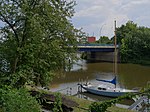
Binnenhafenbrücke (B852) connects the Baumall with the Rödingsmarkt and crosses the inland port at the mouth of the Alster |
Street |
Hamburg-Altstadt , Neustadt ( 53 ° 32 ′ 41 ″ N, 9 ° 59 ′ 0 ″ E ) |
|
|
The blue bridge leads over the Bille with the Horner ramp . One of originally three (red, blue and green), today six Billebrücken (brown, yellow and black bridge), which are painted in different colors for orientation. It is debatable whether the choice of color should make it easier for river boats or workers to find their way around. |
Street |
Horn , Billbrook ( 53 ° 32 ′ 23 ″ N, 10 ° 5 ′ 1 ″ E ) |
|

|
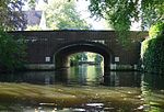
Bleichenbrücke (B395) leads between the Neuer Wall and the Große Bleichen across the Bleichenfleet; already built as a wooden bridge in 1718; Architect Johann Hermann Maack . The bridge is a listed building. |
Street | 1844/1845 |
Neustadt ( 53 ° 33 ′ 6 ″ N, 9 ° 59 ′ 19 ″ E ) |
|
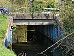
Flower road bridge leads over the towpath canal |
Streets | 1919 |
Winterhude ( 53 ° 35 ′ 4 ″ N, 9 ° 59 ′ 59 ″ E ) |
|
Boberger Furtweg Bridge leads with the Boberger Furtweg over the Bille . |
Street |
Lohbrügge , Billwerder ( 53 ° 30 ′ 26 ″ N, 10 ° 9 ′ 44 ″ E ) |
|

|
Buoy dam bridge crosses the Bille between the Billwerder Billdeich and the Bojewiese. |
Street |
Lohbrügge , Billwerder ( 53 ° 30 ′ 9 ″ N, 10 ° 10 ′ 16 ″ E ) |
|

|
Bujewiesenbrücke cross the Bille in the course of the street Auf der Bojewiese |
Street |
Lohbrügge , Bergedorf , Billwerder ( 53 ° 29 ′ 48 ″ N, 10 ° 10 ′ 40 ″ E ) |
|

|
Bombay Bridge crosses the northern New York ring |
Footpath |
Winterhude ( 53 ° 36 ′ 14 ″ N, 10 ° 1 ′ 5 ″ E ) |
|

|
Stock Exchange Bridge (B448) former bridge, spanned the Reichenstraßenfleet, which was filled in in 1877; today only street name |
Street | 1844 |
Hamburg old town ( 53 ° 32 ′ 55 ″ N, 9 ° 59 ′ 33 ″ E ) |

|
Borsigbrücke leads along the Borsigstrasse over the Tiefstack Canal . The bridge is a listed building. |
Street |
Billbrook , Rothenburgsort ( 53 ° 32 ′ 2 ″ N, 10 ° 4 ′ 19 ″ E ) |
|
|
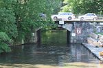
Borsteler Bridge crosses the Tarpenbek with the Eppendorfer Landstrasse . The bridge is a listed building. |
Street |
Eppendorf ( 53 ° 35 ′ 50 ″ N, 9 ° 59 ′ 20 ″ E ) |
|

|
Braband Bridge runs along the Brabandstrasse over the Braband Canal . The bridge is a listed building. |
Street |
Alsterdorf ( 53 ° 36 ′ 47 ″ N, 10 ° 0 ′ 38 ″ E ) |
|
|
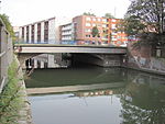
Bramfeld Bridge leads with the Bramfelder Straße over the Osterbek Canal |
Street |
Barmbek-Süd , Barmbek-Nord ( 53 ° 35 ′ 1 ″ N, 10 ° 2 ′ 49 ″ E ) |
|
|
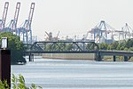
Brandenburg Bridge (B783) leads from Niederfelder Ufer over the Veddel Canal |
Street |
Kleiner Grasbrook ( 53 ° 31 ′ 27 ″ N, 9 ° 59 ′ 27 ″ E ) |
|

|
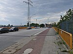
Brown Bridge (B563) leads with the street of the same name over the Bille. The bridge railings of originally three, now six Billebrücken (red, brown, blue, green, yellow and black bridges) are painted in different colors for orientation. It is debatable whether the choice of color should make orientation easier for river boats or workers. |
Street |
Hamm , Rothenburgsort ( 53 ° 32 ′ 45 ″ N, 10 ° 3 ′ 39 ″ E ) |
|
|
Bredow Bridge (B581) leads with the Bredowstraße over the Tidekanal |
Street |
Billbrook ( 53 ° 31 ′ 41 ″ N, 10 ° 4 ′ 40 ″ E ) |
|

|
Brennerhof Bridge (B834) leads with the street Brennerhof over the federal highway 1 |
Street |
Moorfleet ( 53 ° 30 ′ 26 ″ N, 10 ° 4 ′ 57 ″ E ) |
|

|
Brooksbrücke (B853) leads over the Zollkanal between the streets Bei den Mühren and Brook. The bridge is a listed building. |
Street |
Hamburg-Altstadt , HafenCity ( 53 ° 32 ′ 40 ″ N, 9 ° 59 ′ 23 ″ E ) |
|

|
Brooktorkaibrücke leads with the Brooktorkai road over the connecting canal between Brooktorhafen and Brooksfleet. The bridge is a listed building. |
Street |
HafenCity ( 53 ° 32 ′ 40 ″ N, 9 ° 59 ′ 56 ″ E ) |
|

|
June 17th Bridge (B998) connects Wilhelmsburg and Harburg over the Süderelbe and lies between the old Harburg Elbbrücke and the Europabrücke ; it was built under the name Süderelbbrücke and got its name after the uprising of June 17, 1953 |
Street | 1935-1937 |
Wilhelmsburg , Harburg ( 53 ° 28 ′ 25 ″ N, 9 ° 59 ′ 44 ″ E ) |

|
Bullerdeichbrücke leads with the street Bullerdeich over the flood basin |
Street |
Hammerbrook ( 53 ° 32 ′ 37 ″ N, 10 ° 2 ′ 0 ″ E ) |
|
|
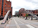
Busan Bridge (B897) leads across Magdeburg harbor from Osakakai / Störtebekerufer to Elbtorpromenade; originally Magdeburg Bridge, from 1871 to 1931 Meyerstraßenbrücke , renovated and renamed in 2011 as part of the redesign and connection of the Elbtorquartier. |
Footpath | 1931 |
HafenCity ( 53 ° 32 ′ 35 ″ N, 9 ° 59 ′ 58 ″ E ) |

|
Busbrook Bridge runs south of the Berne underground station over the tracks of the U 1, between Berner Heerweg and Kriegkamp |
Street |
Farmsen-Berne ( 53 ° 37 ′ 35 ″ N, 10 ° 8 ′ 20 ″ E ) |
|
|
Buxtehude Bridge leads with the Buxtehuder Straße over the Seevekanal |
Street |
Harburg ( 53 ° 27 ′ 30 ″ N, 9 ° 59 ′ 18 ″ E ) |
C / D
| photo | Name, brief description | use | (First) construction | District, location |
|---|---|---|---|---|

|
Cremon Bridge A pedestrian bridge that runs between the Kleiner Burstah and the wooden bridge over Willy-Brandt-Straße. Cremon was the name of a marshland island that has now been heaped up. |
Footpath | Old Town ( 53 ° 32 ′ 50 ″ N, 9 ° 59 ′ 20 ″ E ) | |

|
Curslacker Kirchenbrücke (C077) leads between Curslacker Deich and Neuengammer Hausdeich over the Dove Elbe |
Street |
Curslack , Neuengamme ( 53 ° 26 ′ 51 ″ N, 10 ° 13 ′ 39 ″ E ) |
|

|
Danish Bridge Leads along the Kieler Strasse over the Mühlenau . The bridge, built in 1805, is a listed building. |
Road bridge | 1805 |
Eidelstedt ( 53 ° 36 ′ 20 ″ N, 9 ° 54 ′ 33 ″ E ) |

|
Dag Hammarskjold Bridge Leads from Dag-Hammarskjöld-Platz at Dammtorbahnhof via Marseiller Straße and Dammtorstraße and ends in Hans-Grahl-Weg in Gustav-Mahler-Park |
Footpath |
Neustadt , St. Pauli ( 53 ° 33 ′ 36 ″ N, 9 ° 59 ′ 23 ″ E ) |
|

|
Dakar Bridge This pedestrian bridge crosses the Überseering with the Dakarweg. Many of the pedestrian bridges in City Nord are named after overseas trading centers. |
Footpath |
Winterhude ( 53 ° 36 ′ 10 ″ N, 10 ° 1 ′ 30 ″ E ) |
|

|
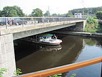
Dammbrücke This bridge leads with the Alsterdorfer Damm over the Alster. The bridge is a listed building. |
Street |
Alsterdorf ( 53 ° 36 ′ 42 ″ N, 10 ° 0 ′ 4 ″ E ) |
|
|
Deelbo Bridge leads between Alsterkrugchaussee and Bebelallee over the Alster |
Street |
Alsterdorf ( 53 ° 36 ′ 8 ″ N, 9 ° 59 ′ 34 ″ E ) |
|

|
Thief Pond Bridge runs east of the Diebsteich S-Bahn station across a body of water |
Footpath |
Altona-Nord ( 53 ° 34 ′ 8 ″ N, 9 ° 56 ′ 5 ″ E ) |
|

|
Dorotheenstrasse Bridge leads with Dorotheenstrasse over the Goldbek Canal |
Street |
Winterhude ( 53 ° 35 ′ 2 ″ N, 10 ° 0 ′ 27 ″ E ) |
|

|
Dradenau Bridge (D259) leads with the Dradenaustrasse over the tracks of the Waltershofer Hafenbahn |
Street |
Waltershof ( 53 ° 30 ′ 54 ″ N, 9 ° 54 ′ 43 ″ E ) |
|

|
Third Heidenkamps Bridge leads with the Heidenkampsweg over the southern canal |
Street |
Hammerbrook ( 53 ° 32 ′ 46 ″ N, 10 ° 1 ′ 47 ″ E ) |
|
|
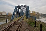
Third lift bridge leads at its eastern end over the Hove Canal |
railroad |
Veddel ( 53 ° 30 ′ 56 ″ N, 10 ° 3 ′ 10 ″ E ) |
E.
| photo | Name, brief description | use | (First) construction | District, location |
|---|---|---|---|---|

|
Eggers Mindt Bridge leads along the Heinrich-Stubbe-Weg over the Dove Elbe. The bridge was named after the Curslacker and Neuengammer parish chairmen Caesar Eggers and Nikolaus Mindt. |
Street |
Curslack , Neuengamme ( 53 ° 26 ′ 49 ″ N, 10 ° 13 ′ 48 ″ E ) |
|

|
Eichbaum Bridge leads with the Hans-Duncker-Straße over the federal highway 25 |
Street |
Allermöhe ( 53 ° 29 ′ 12 ″ N, 10 ° 6 ′ 56 ″ E ) |
|

|
Eilbeker Bridge leads with the road Eilbektal over the Eilbek |
Street |
Barmbek-Süd ( 53 ° 34 ′ 29 ″ N, 10 ° 3 ′ 20 ″ E ) |
|

|
Eilbekwiesenbrücke leads south of the former porter's house of the Eilbek hospital across the Eilbek |
Footpath |
Barmbek-Süd ( 53 ° 34 ′ 27 ″ N, 10 ° 3 ′ 10 ″ E ) |
|

|
Eimsbütteler Bridge this bridge leads between the federal highway and Osterstraße over the Isebek Canal . The bridge is a listed building. |
Street |
Eimsbüttel ( 53 ° 34 ′ 24 ″ N, 9 ° 57 ′ 50 ″ E ) |
|

|
Railway bridges Norderelbe |
railroad | (1872) / 1927 |
Hamburg-Altstadt , HafenCity , Kleiner Grasbrook ( 53 ° 31 ′ 59 ″ N, 10 ° 1 ′ 22 ″ E ) |

|
Elbberg Bridge leads over the tracks of the Altona harbor railway . The bridge is a listed building. |
Street |
Altona old town ( 53 ° 32 ′ 43 ″ N, 9 ° 55 ′ 55 ″ E ) |
|

|
Ellerholzbrücke (E297) leads between the Reiherstieg Bridge and the Argentina Bridge over the Reiherstieg |
Street |
Kleiner Grasbrook , Steinwerder , Wilhelmsburg ( 53 ° 31 ′ 39 ″ N, 9 ° 58 ′ 36 ″ E ) |
|

|
Ellerholzschleusenbrücke crosses the Ellerholzschleuse in the course of the Ellerholzbrücke road; two single bridges for the two lock chambers |
Street |
Steinwerder ( 53 ° 31 ′ 35 ″ N, 9 ° 58 ′ 24 ″ E ) |
|

|
Ellerntorsbrücke (E161) crosses the Herrengrabenfleet between Düsterstraße and Admiralitätstraße . The bridge is a listed building. |
Street | 1530 |
Neustadt ( 53 ° 33 ′ 0 ″ N, 9 ° 59 ′ 6 ″ E ) |

|
Eppendorfer Bridge leads over the Isebek Canal in the course of the Eppendorfer Baum . The bridge is a listed building. |
Street | 1927 |
Harvestehude ( 53 ° 35 ′ 1 ″ N, 9 ° 59 ′ 3 ″ E ) |
|
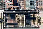
Ericus Bridge leads over the Ericusgraben / Brooktorhafen. The bridge is a listed building. |
Footpath |
HafenCity ( 53 ° 32 ′ 40 ″ N, 10 ° 0 ′ 11 ″ E ) |
|
|
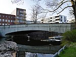
Ernst-Mantius-Brücke leads with Ernst-Mantius-Straße over the Bille. Ernst Mantius (1838–1897) was Bergedorf's mayor. |
Street |
Bergedorf ( 53 ° 29 ′ 27 ″ N, 10 ° 12 ′ 41 ″ E ) |
|

|
Ernst-Merck-Brücke leads with Ernst-Merck-Straße over the tracks of the main train station. Ernst Merck (1811–1863) was a Hamburg politician. |
Street | 1988 |
Hamburg-Altstadt , St. Georg ( 53 ° 33 ′ 17 ″ N, 10 ° 0 ′ 20 ″ E ) |
|
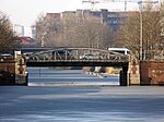
First breakout bridge leads in the course of the Ausschläger way over the middle canal (see also the second Ausschläger bridge over the south canal) |
Street |
Hammerbrook , Borgfelde ( 53 ° 33 ′ 3 ″ N, 10 ° 2 ′ 9 ″ E ) |
|

|
First Bank Bridge leads with Banksstraße over the lock canal (extension of the central canal). The Second Banks Bridge no longer exists. In the further course of the street it led over the southern canal (today the wholesale market area). |
Street |
Hammerbrook ( 53 ° 32 ′ 40 ″ N, 10 ° 0 ′ 48 ″ E ) |
|

|
First Borstelmann Bridge crosses the central canal with the Borstelmannsweg between Eiffestrasse and Wendenstrasse |
Street |
Hamm ( 53 ° 33 ′ 3 ″ N, 10 ° 3 ′ 12 ″ E ) |
|

|
First diagonal bridge crosses the central canal |
Street |
Hamm ( 53 ° 33 ′ 0 ″ N, 10 ° 3 ′ 33 ″ E ) |
|

|
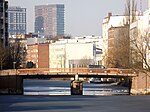
First Greven Bridge crosses the Mittelkanal in the course of the Grevenweg |
Street |
Hammerbrook , Borgfelde , Hamm ( 53 ° 33 ′ 6 ″ N, 10 ° 2 ′ 28 ″ E ) |
|
|
First Luisenbrücke leads along the Luisenweg over the Mittelkanal |
Street |
Hamm ( 53 ° 33 ′ 5 ″ N, 10 ° 2 ′ 54 ″ E ) |
|

|
First Osterbrook Bridge crosses the Mittelkanal with the street Osterbrook between Eiffestraße and Wendenstraße. Formerly a road bridge, only rebuilt as a pedestrian bridge after the war. |
Footpath and bike path |
Hamm ( 53 ° 33 ′ 1 ″ N, 10 ° 3 ′ 24 ″ E ) |
|

|
First Peuter Bridge is the northern of the two Peuter bridges and leads with the Peutestrasse over the Peutekanal . The original bridge from 1912 ( photo ), which was replaced by a new building in 2014–2014, was a listed building. |
Street |
Veddel ( 53 ° 31 ′ 34 ″ N, 10 ° 1 ′ 49 ″ E ) |
|

|
First cross channel bridge is the western of the two cross channel bridges and leads over the cross channel in the course of Stillhorner Damm. |
Road, railroad |
Kleiner Grasbrook , Steinwerder ( 53 ° 31 ′ 57 ″ N, 9 ° 58 ′ 43 ″ E ) |
|
|
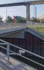
The first Rugenberger Schleusenbrücke leads along the Rugenberger Damm over the northern chamber of the Rugenberger Schleuse |
Street |
Waltershof ( 53 ° 31 ′ 24 ″ N, 9 ° 56 ′ 4 ″ E ) |
|

|
First city dike bridge leads in the train of the street Stadtdeich over the lock canal (extension of the central canal). The second Stadtdeichbrücke no longer exists. In the further course of the street it led over the southern canal (today the wholesale market area). |
Street |
Hammerbrook ( 53 ° 32 ′ 38 ″ N, 10 ° 0 ′ 38 ″ E ) |
|

|
Eschenhof Bridge (E300) leads in the course of the street Pollhof over the federal highway 25 |
Street |
Bergedorf ( 53 ° 28 ′ 36 ″ N, 10 ° 13 ′ 53 ″ E ) |
|
|
|
Europe bridge (E308) crosses the Süderelbe in the course of the Wilhelmsburger Reichstraße and lies between the bridge of June 17th and the Harburg railway bridge |
Street / Elbe bridge |
Wilhelmsburg , Harburg ( 53 ° 28 ′ 25 ″ N, 9 ° 59 ′ 45 ″ E ) |
|
|
Europastraßenbrücke is in the street directory of Hamburg, but does not exist |
Wilhelmsburg |
F.
| photo | Name, brief description | use | (First) construction | District, location |
|---|---|---|---|---|

|
Ferry bridge Fährhausstraße in Uhlenhorst crosses the Hofweg Canal over this 21 m long arch bridge . |
Street |
Uhlenhorst ( 53 ° 34 ′ 33 ″ N, 10 ° 0 ′ 52 ″ E ) |
|

|
Fährhausbrücke connects the streets Tewessteg and Winterhuder Quai over the Alster for pedestrians |
footbridge |
Eppendorf , Winterhude ( 53 ° 35 ′ 37 ″ N, 9 ° 59 ′ 35 ″ E ) |
|

|
Fährstrasse Bridge leads in the course of Fährstrasse over the Small Canal , which connects the Vering Canal with the Ernst-August Canal |
Street |
Wilhelmsburg ( 53 ° 31 ′ 1 ″ N, 9 ° 58 ′ 55 ″ E ) |
|

|
Feenteichbrücke Arched bridge built by Franz Andreas Meyer in stone construction with artistically designed parapets and pointed arch-like recesses. The Feenteichbrücke spans the connection between the Feenteich and the Outer Alster. The bridge is a listed building. |
Street | 1884 |
Uhlenhorst ( 53 ° 34 ′ 19 ″ N, 10 ° 0 ′ 32 ″ E ) |

|
Fernsichtbrücke Arch bridge made of brick, which was built by Fritz Schumacher and spans the Rondeel Canal on the northern bank of the Outer Alster, which connects it with the Rondeel pond . |
Street | 1927/28 |
Winterhude ( 53 ° 34 ′ 51 ″ N, 10 ° 0 ′ 10 ″ E ) |
|
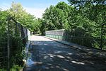
Feuerbergstrasse Bridge A road bridge that crosses the S1 and S11 tracks in the Ohlsdorf district . |
Street |
Alsterdorf , Ohlsdorf ( 53 ° 36 ′ 48 ″ N, 10 ° 1 ′ 51 ″ E ) |
|

|
Finkenwerder Brücke (F312) Bridge in the course of Finkenwerder Strasse, in the system of the Waltershof motorway exit |
Street |
Waltershof ( 53 ° 30 ′ 50 ″ N, 9 ° 54 ′ 37 ″ E ) |
|

|
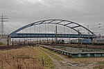
Finkenwerder Ringbrücke-Ost (F348) runs in the course of the Finkenwerder Ring over railway tracks and runs in the intersection area of Finkenwerder Straße and Dradenaustraße, in the system of the motorway exit Waltershof |
Street |
Waltershof , Altenwerder ( 53 ° 30 ′ 49 ″ N, 9 ° 54 ′ 44 ″ E ) |
|
|
Finkenwerder Ringbrücke-Süd (F347) leads in the course of the Finkenwerder Ring over railway tracks, in the system of the Waltershof motorway exit |
Street |
Waltershof , Altenwerder ( 53 ° 30 ′ 44 ″ N, 9 ° 54 ′ 35 ″ E ) |
|

|
Finkenwerder Ringbrücke-West (F346) leads in the course of Finkenwerder Ring over railway tracks and ends in Finkenwerder Straße, in the system of the Waltershof motorway exit |
Street |
Waltershof , Altenwerder ( 53 ° 30 ′ 47 ″ N, 9 ° 54 ′ 26 ″ E ) |
|

|
Freihafenelbbrücke Norderelbbrücke in the former free port area; two-storey steel construction. The bridge is a listed building. |
Street | 1926 |
HafenCity , Kleiner Grasbrook ( 53 ° 31 ′ 59 ″ N, 10 ° 1 ′ 20 ″ E ) |

|
Friedrichsberger Bridge Friedrichsberger Straße crosses the Wandse in the Barmbek-Süd district over this bridge . The bridge is a listed building. |
Street |
Barmbek-Süd ( 53 ° 34 ′ 24 ″ N, 10 ° 3 ′ 0 ″ E ) |
G
| photo | Name, brief description | use | (First) construction | District, location |
|---|---|---|---|---|

|
Gas works bridge A girder bridge over which a traffic-calmed section of Osterbekstraße crosses a small side course of the Osterbek Canal. |
Street |
Barmbek-Süd ( 53 ° 35 ′ 2 ″ N, 10 ° 1 ′ 42 ″ E ) |
|

|
Yellow bridge this girder bridge leads over the Bille in the commercial and industrial area near Rothenburgsort. One of originally three, today six Billebrücken (red, brown, blue, green, yellow and black bridges), the railings of which are painted in different colors. It is unclear whether the choice of color should make orientation easier for river boats or workers. |
Street |
Billbrook ( 53 ° 32 ′ 16 ″ N, 10 ° 5 ′ 56 ″ E ) |
|
|
The Gepidenbrücke crossed the Tarpenbek as part of the Gepidenweg between Bayernweg and the airport runway and was demolished in the course of the renaturation of the Tarpenbek |
no longer exists | Niendorf | ||

|
Glockenhausbrücke (G426) leads in the course of Billwerder Billdeich over the federal motorway 1 |
Street |
Billwerder ( 53 ° 31 ′ 10 ″ N, 10 ° 7 ′ 19 ″ E ) |
|
|
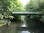
Goebenbrücke leads over the Isebek Canal along Goebenstrasse . Double bridge |
Bike path |
Eimsbüttel ( 53 ° 34 ′ 29 ″ N, 9 ° 58 ′ 2 ″ E ) |
|

|
Goebenbrücke leads over the Isebek Canal along Goebenstrasse Double bridge |
Footpath |
Eimsbüttel ( 53 ° 34 ′ 29 ″ N, 9 ° 58 ′ 2 ″ E ) |
|

|
Goernebrücke Goernestrasse in Winterhude crosses the Alster over this arched bridge. The bridge is a listed building. |
Street |
Eppendorf , Winterhude ( 53 ° 35 ′ 18 ″ N, 9 ° 59 ′ 50 ″ E ) |
|

|
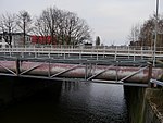
Graskellerbrücke leads between the Alten Wall and the Neuer Wall over the Alsterfleet; historical bridge, before 1838 there was already a wooden bridge at this location |
Street | 1838 |
Hamburg-Altstadt , Neustadt ( 53 ° 32 ′ 58 ″ N, 9 ° 59 ′ 12 ″ E ) |
|
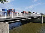
Grevenhofbrücke leads over the Grevenhof Canal in the course of the Reiherdamm |
Street |
Steinwerder ( 53 ° 31 ′ 58 ″ N, 9 ° 58 ′ 9 ″ E ) |
|
|
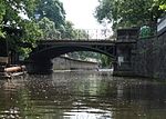
Grevenhof Canal Bridge leads over the Grevenhof Canal in the course of Ellerholzdamm |
Street |
Steinwerder ( 53 ° 31 ′ 59 ″ N, 9 ° 58 ′ 22 ″ E ) |
|
|
Grillparzerbrücke crosses between the streets Am Langenzug and Grillparzerstraße over the Hofweg Canal , the bridge is a listed building. |
Street | 1893 |
Uhlenhorst ( 53 ° 34 ′ 41 ″ N, 10 ° 0 ′ 50 ″ E ) |

|
Großheidesteg leads along the Großheidestrasse over the Osterbek Canal |
Footpath |
Winterhude , Barmbek-Süd ( 53 ° 35 ′ 4 ″ N, 10 ° 1 ′ 41 ″ E ) |
|

|
Green bridge connects Billwerder Steindamm in Hammerbrook across the Bille with Großmannstrasse in Rothenburgsort . One of originally three, today six Billebrücken (red, brown, blue, green, yellow and black bridges), the railings of which are painted in different colors. It is unclear whether the choice of color should make orientation easier for river boats or workers. |
Street |
Hammerbrook , Rothenburgsort ( 53 ° 32 ′ 36 ″ N, 10 ° 2 ′ 30 ″ E ) |
|

|
Gustav-Freytag-Brücke leads with Gustav-Freytag-Straße over the Hofweg Canal to the Hofweg |
Street |
Uhlenhorst ( 53 ° 34 ′ 25 ″ N, 10 ° 0 ′ 54 ″ E ) |
H
| photo | Name, brief description | use | (First) construction | District, location |
|---|---|---|---|---|

|
Hachmann Bridge leads over the Roßkanal in the course of Hachmannstrasse . Hachmannstrasse is named after the former mayor Gerhard Hachmann . The bridge is a listed building. |
Street |
Steinwerder ( 53 ° 31 ′ 14 ″ N, 9 ° 57 ′ 10 ″ E ) |
|

|
Neck bridge The Halskestrasse crosses the tidal channel over the Halskebrücke . It is named after the inventor and entrepreneur Johann Georg Halske . |
Street |
Billbrook ( 53 ° 31 ′ 34 ″ N, 10 ° 4 ′ 25 ″ E ) |
|

|
Hammer stone dam bridge The bridge leads the Hammer Steindamm over the tracks of the S-Bahn and the Hamburg-Lübeck railway line and also provides access to the Hasselbrook train station . |
Street | 1856 |
Eilbek ( 53 ° 33 ′ 54 ″ N, 10 ° 3 ′ 27 ″ E ) |

|
Hanover Bridge Hannoversche Straße is the connection between Harburg train station and the Süderelbe. It gave the Hanover Bridge its name. |
Street |
Harburg ( 53 ° 27 ′ 30 ″ N, 9 ° 59 ′ 23 ″ E ) |
|

|
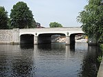
Hansabrücke The Dessauer Straße leads over the Hansabrücke over a branch canal between the Hansahafen - after which the bridge is named - and the Saale harbor. |
Street |
Kleiner Grasbrook ( 53 ° 31 ′ 28 ″ N, 10 ° 0 ′ 33 ″ E ) |
|
|
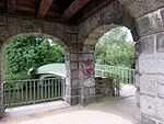
Hasenberg Bridge Bridge built by Hamburg's chief construction director Fritz Schumann, over which the “Am Hasenberge” road crosses the Alster. The bridge is a listed building. |
Street | 1913 |
Ohlsdorf ( 53 ° 37 ′ 22 ″ N, 10 ° 1 ′ 42 ″ E ) |
|
Hayn's Park Bridge This pedestrian bridge between the Alster and the Eppendorfer Mühlenteich connects Hayns Park with the park on the Meenkwiese. |
Footpath | 1956 |
Eppendorf ( 53 ° 35 ′ 48 ″ N, 9 ° 59 ′ 22 ″ E ) |

|
Hebebrand Bridge (H730) This bridge leads Hebebrandstraße over S-Bahn tracks in the Barmbek-Nord district . |
Street | 1973/74 |
Winterhude , Barmbek-Nord ( 53 ° 36 ′ 27 ″ N, 10 ° 1 ′ 57 ″ E ) |

|
Heerwegbrücke (H772) This bridge crosses the A25 between Holtenklinke and the Eschenhof settlement. |
Street |
Bergedorf , Curslack ( 53 ° 28 ′ 33 ″ N, 10 ° 14 ′ 24 ″ E ) |
|

|
Heiligengeist Bridge (H266) This bridge was designed and built by Franz Andreas Meyer and is a listed building. |
Street | 1883/1885 |
Hamburg-Altstadt , Neustadt ( 53 ° 32 ′ 56 ″ N, 9 ° 59 ′ 10 ″ E ) |

|
Heilwig Bridge Arched bridge built by Hamburg's chief construction director Fritz Schumacher, over which Heilwigstrasse crosses the Isebek Canal. |
Street | 1925-1926 |
Harvestehude ( 53 ° 35 ′ 5 ″ N, 9 ° 59 ′ 38 ″ E ) |

|
Heinrich Stubbe Bridge A reinforced concrete bridge that leads the Heinrich-Stubbe-Weg over the Neuengammer collecting ditch. |
Street | 1966 |
Neuengamme , Kirchwerder ( 53 ° 25 ′ 10 ″ N, 10 ° 12 ′ 8 ″ E ) |

|
Heinz-Gärtner-Bridge (H860) Pedestrian bridge that leads over the Osterbek Canal at Johannes-Prassek-Park . The bridge is named after the social democrat and resistance fighter Heinz Gärtner . |
Footpath | 2013 |
Hamburg-Winterhude , Barmbek-Süd ( 53 ° 35 ′ 0 ″ N, 10 ° 1 ′ 30 ″ E ) |

|
Hellbrookstrasse Bridge This bridge leads Hellbrookstrasse in the Hamburg district of Barmbek-Nord over the Barmbek branch canal. The bridge is a listed building. |
Street | 1913 |
Winterhude , Barmbek-Nord ( 53 ° 35 ′ 27 ″ N, 10 ° 2 ′ 2 ″ E ) |

|
Herbert Weichmann Bridge The bridge, like the road over it, is named after the Hamburg mayor Herbert Weichmann . It leads over the Uhlenhorster Canal . The bridge is a listed building. |
Street |
Uhlenhorst ( 53 ° 34 ′ 22 ″ N, 10 ° 0 ′ 48 ″ E ) |
|

|
Hermann Keesenberg Bridge (H827) With this bridge, Neuenfelder Straße crosses the railway tracks south of the Wilhelmsburg S-Bahn station. It is named after a Wilhelmsburg local historian. |
Street |
Wilhelmsburg ( 53 ° 29 ′ 49 ″ N, 10 ° 0 ′ 21 ″ E ) |
|

|
Herrengrabenbrücke This bridge is named after the street Herrengraben, whose name goes back to a ditch in which in the 16th century. Mayors and councilors had fishing rights. The bridge is a listed building. |
Street |
Neustadt ( 53 ° 32 ′ 54 ″ N, 9 ° 59 ′ 2 ″ E ) |
|

|
Hindenburgbrücke Over the Hindenburgbrücke - formerly "Borgwegbrücke" - the Hindenburgstrasse crosses the Alster between the Skagerrak Canal and the Braband Canal . |
Street |
Alsterdorf ( 53 ° 36 ′ 43 ″ N, 10 ° 0 ′ 35 ″ E ) |
|

|
Elevated road bridge This bridge leads the Hamburger Hochstrasse over the Pepermölenbek . |
Street |
Altona old town ( 53 ° 32 ′ 51 ″ N, 9 ° 57 ′ 14 ″ E ) |
|

|
Hofwegbrücke The bridge, classified as a cultural monument, is named after the Hofweg that leads over it. The Uhlenhorster Canal meets the Hofweg Canal under the Hofweg Bridge . |
Street |
Uhlenhorst ( 53 ° 34 ′ 23 ″ N, 10 ° 0 ′ 55 ″ E ) |
|

|
Hogrevestieg Bridge A pedestrian bridge over which the Hogrevestieg crosses the Wandse shortly after the Holzmühlenteich. |
Footpath |
Wandsbek ( 53 ° 34 ′ 40 ″ N, 10 ° 4 ′ 38 ″ E ) |
|

|
High Bridge (H539) The Hohe Brücke bridges the Nikolaifleet between Kajen and Bei dem Neuen Krahn. The bridge is a listed building. |
Street | since the 13th century |
Hamburg old town ( 53 ° 32 ′ 42 ″ N, 9 ° 59 ′ 15 ″ E ) |

|
Hoheluftbrücke The Hoheluftbrücke connects the districts of Grindel and Hoheluft. |
Street | first in 1884, today's bridge in 1962/63 |
Harvestehude ( 53 ° 34 ′ 43 ″ N, 9 ° 58 ′ 34 ″ E ) |

|
Hohenfeld Bridge This bridge leads the streets An der Alster and Mundsburger Damm over the Hohenfelder Bay. The bridge is a listed building. |
Street |
Hohenfelde ( 53 ° 33 ′ 47 ″ N, 10 ° 0 ′ 58 ″ E ) |
|

|
Dutch brookfleet bridge The bridge is named after the Dutch Brook Street. It leads over the Holländischbrookfleet. The bridge is a listed building. |
Street |
HafenCity ( 53 ° 32 ′ 43 ″ N, 9 ° 59 ′ 59 ″ E ) |
|

|
Holstenhofweg Bridge With this bridge, the Holstenhofweg crosses railway tracks in Jenfeld. |
Street |
Jenfeld , Tonndorf ( 53 ° 34 ′ 33 ″ N, 10 ° 6 ′ 13 ″ E ) |
|
|
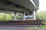
Holstenkamp Bridge The bridge is named after the Holstenkamp and crosses train tracks north of the Diebsteich station. |
Street |
Stellingen ( 53 ° 34 ′ 25 ″ N, 9 ° 55 ′ 54 ″ E ) |
|

|
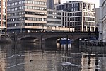
Holtenklinker Bridge In the vicinity of the Holtenklinke settlement, this bridge leads the Curslacker Heerweg over the Brookwetterung . |
Street |
Bergedorf , Curslack ( 53 ° 28 ′ 38 ″ N, 10 ° 14 ′ 27 ″ E ) |
|
|
Wooden bridge (H606) A stone three-arch bridge that was built by Johann Hermann Maack after the great fire . The bridge leads over Nikolaifleet and is a listed building. |
Street | 1846/47 |
Hamburg Old Town ( 53 ° 32 ′ 48 ″ N, 9 ° 59 ′ 21 ″ E ) |

|
Holzhafen bascule bridge This bridge connects Konsul-Ritter-Straße and Lotsekai. The bridge is a listed building. |
Street | 1930 |
Heimfeld ( 53 ° 28 ′ 8 ″ N, 9 ° 58 ′ 51 ″ E ) |

|
Holzmühlenstrasse bridge This bridge runs between Walddörferstrasse and Wandsbeker Zollstrasse over the Wandse . |
Street |
Wandsbek ( 53 ° 34 ′ 43 ″ N, 10 ° 4 ′ 54 ″ E ) |
|

|
Hop cart bridge With this bridge the street crosses the Wandse at the Hopfenkarre . |
Street |
Wandsbek ( 53 ° 34 ′ 50 ″ N, 10 ° 5 ′ 42 ″ E ) |
|

|
Horner Wegbrücke A reinforced concrete bridge over the tracks of the freight bypass between Hamburg-Hamm and -Horn . |
Street |
Hamm , Horn ( 53 ° 33 ′ 20 ″ N, 10 ° 4 ′ 3 ″ E ) |
|
|
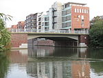
Hufnerstrasse Bridge This bridge is named after Hufnerstraße, which crosses the Osterbek Canal with this bridge . |
Street |
Barmbek-Süd , Barmbek-Nord ( 53 ° 35 ′ 6 ″ N, 10 ° 2 ′ 32 ″ E ) |
|

|
Humboldt Bridge A pedestrian bridge that extends south of Humboldtstrasse over Oberaltenallee and Hamburger Strasse to the Hamburger Meile shopping center. |
Footpath |
Uhlenhorst ( 53 ° 34 ′ 16 ″ N, 10 ° 1 ′ 45 ″ E ) |
I / J
| photo | Name, brief description | use | (First) construction | District, location |
|---|---|---|---|---|

|
Illies Bridge With this bridge the Alsterwanderweg crosses the Alster between the Alte Landstrasse and the Wellingsbütteler Landstrasse. |
Footpath |
Ohlsdorf ( 53 ° 38 ′ 8 ″ N, 10 ° 3 ′ 0 ″ E ) |
|
|
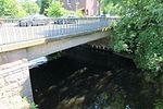
Island bridge A reinforced concrete bridge over a branch of the Alster. It is named after the Alsterdorfer Inselstraße. |
Street |
Alsterdorf ( 53 ° 36 ′ 10 ″ N, 9 ° 59 ′ 32 ″ E ) |
|

|
Isebrücke This bridge is named after the Isebek Canal , the bridge crosses it and connects Oderfelder Straße in Harvestehude with Iseplatz in Eppendorf. |
Street |
Harvestehude ( 53 ° 35 ′ 6 ″ N, 9 ° 59 ′ 18 ″ E ) |
|

|
Jaffe Davids Canal Bridge With this bridge, the Vogelhüttendeich road crosses the Jaffe-Davids Canal in Wilhelmsburg. |
Street |
Wilhelmsburg ( 53 ° 30 ′ 50 ″ N, 10 ° 0 ′ 15 ″ E ) |
|

|
Jahnbrücke (J118) The Jahnbrücke is a road bridge near City Nord , which was built to cross an unrealized city motorway (northern extension of the A 25 ). |
Street |
Winterhude , Barmbek-Nord ( 53 ° 36 ′ 2 ″ N, 10 ° 1 ′ 54 ″ E ) |
|

|
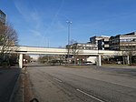
Johan van Valckenburgh Bridge The footbridge, named after the fortress construction engineer Johan van Valckenburgh , crosses the moat in the Planten un Blomen park in Hamburg . The bridge is a listed building. |
Footpath | 1962 |
Neustadt ( 53 ° 33 ′ 33 ″ N, 9 ° 59 ′ 10 ″ E ) |
|
Jokohama Bridge A pedestrian bridge in the City Nord , which leads over the Überseering. |
Footpath |
Winterhude ( 53 ° 36 ′ 9 ″ N, 10 ° 1 ′ 2 ″ E ) |
|

|
Maiden Bridge A listed pedestrian bridge that crosses the Zollkanal in the port of Hamburg. |
Footpath | 1887-1888 |
Hamburg-Altstadt , HafenCity ( 53 ° 32 ′ 43 ″ N, 9 ° 59 ′ 42 ″ E ) |
K
| photo | Name, brief description | use | (First) construction | District, location |
|---|---|---|---|---|

|
Calcutta Bridge This pedestrian bridge over the Überseering is - like many of the pedestrian bridges in the City Nord - named after the Indian port city based on Hamburg's overseas trade relations. |
Footpath |
Winterhude ( 53 ° 36 ′ 15 ″ N, 10 ° 1 ′ 3 ″ E ) |
|

|
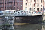
Kannengießer Bridge With this bridge, the street Am Wandrahm crosses a small canal between the Zollkanal and the Wandrahmsfleet. The bridge is a listed building. |
Street | 1885 |
HafenCity ( 53 ° 32 ′ 41 ″ N, 9 ° 59 ′ 41 ″ E ) |
|
Kannengießerortbrücke This bridge crosses the Wandrahmsfleet between the Neuer Wandrahm and the St. Annenufer. |
Street |
HafenCity ( 53 ° 32 ′ 41 ″ N, 9 ° 59 ′ 44 ″ E ) |
|

|
Karlstrasse Bridge One of the bridges that cross the Hofweg Canal from Hofweg . |
Street |
Uhlenhorst ( 53 ° 34 ′ 29 ″ N, 10 ° 0 ′ 53 ″ E ) |
|

|
Karl von Thielen Bridge (K627) A track crossing near the Wilhelmsburg S-Bahn station, which is named after the railway minister Karl von Thielen (1832–1906). |
Street | 1999 |
Wilhelmsburg ( 53 ° 30 ′ 8 ″ N, 10 ° 0 ′ 25 ″ E ) |

|
Katharinenbrücke (K099) A bridge over the Katharinenfleet near the Nikolaifleet . |
Street |
Hamburg old town ( 53 ° 32 ′ 46 ″ N, 9 ° 59 ′ 36 ″ E ) |
|

|
Käthnerort Bridge Pedestrian bridge that leads over the Osterbek Canal . |
Footpath |
Barmbek-Süd , Barmbek-Nord ( 53 ° 35 ′ 7 ″ N, 10 ° 2 ′ 19 ″ E ) |
|

|
Kattrepelsbrücke (K108) former bridge, spanned the Reichenstraßenfleet, which was filled in in 1877; today only street name |
Street |
Hamburg Old Town ( 53 ° 32 ′ 55 ″ N, 9 ° 59 ′ 58 ″ E ) |
|
|
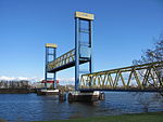
Kattwyk Bridge (K546) This steel truss bridge is the largest lift bridge in Germany, designed for both rail and road traffic and connects the districts of Wilhelmsburg and Moorburg. |
Road, railroad | 1973 |
Wilhelmsburg , Moorburg ( 53 ° 29 ′ 40 ″ N, 9 ° 57 ′ 6 ″ E ) |

|
Kedenburgstrasse Bridge With this bridge, the street of the same name crosses the Wandse . The street is named after a pastor from Wandsbeck. |
Street |
Wandsbek ( 53 ° 34 ′ 42 ″ N, 10 ° 5 ′ 12 ″ E ) |
|

|
Kehrwiedersteg A bridge that crosses the Kehrwiedersfleet in Hamburg's inland port. |
HafenCity ( 53 ° 32 ′ 36 ″ N, 9 ° 59 ′ 13 ″ E ) |
||

|
Kennedy Bridge (K133) Initially built under the name “New Lombard Bridge” , this girder bridge designed by Bernhard Hermkes was renamed “Kennedy Bridge” in 1963. The bridge is a listed building. |
Street | 1953 |
St. Georg , Rotherbaum ( 53 ° 33 ′ 28 ″ N, 9 ° 59 ′ 53 ″ E ) |

|
Kersten Miles Bridge This bridge is named after a 15th century Hamburg mayor. It leads the Seewartenstrasse over the Helgoländer Allee. The bridge is a listed building. |
Street |
Neustadt , St. Pauli ( 53 ° 32 ′ 51 ″ N, 9 ° 58 ′ 16 ″ E ) |
|

|
Kibbelstegbrücken These bridges lead over the Kehrwiederbrooksfleet and are not listed in the street directory. |
Footpath |
Hamburg-Altstadt , HafenCity ( 53 ° 32 ′ 38 ″ N, 9 ° 59 ′ 35 ″ E ) |
|

|
Kirchenheerwegbrücke This bridge leads the street of the same name over the southern Kirchwerder collecting ditch. |
Street |
Kirchwerder ( 53 ° 24 ′ 42 ″ N, 10 ° 11 ′ 29 ″ E ) |
|

|
Kirchwerder Landweg Bridge The Kirchwerder Landweg crosses the Gose Elbe with this bridge . |
Street |
Neuengamme , Kirchwerder ( 53 ° 26 ′ 43 ″ N, 10 ° 10 ′ 30 ″ E ) |
|

|
Klärchenbrücke The Klärchenbrücke leads the street of the same name in the Winterhude district over the Leinpfad Canal . |
Street |
Winterhude ( 53 ° 35 ′ 17 ″ N, 9 ° 59 ′ 56 ″ E ) |
|

|
Kleekamp Bridge With this bridge, the Kleekamp crosses the tracks near the Fuhlsbüttel underground station. |
Street |
Fuhlsbüttel ( 53 ° 37 ′ 58 ″ N, 10 ° 1 ′ 33 ″ E ) |
|

|
Small wall frame bridge A bridge over a small canal between Wandrahmfleet and Zollkanal . |
Street |
HafenCity ( 53 ° 32 ′ 45 ″ N, 9 ° 59 ′ 55 ″ E ) |
|

|
Klosteralleebrücke This bridge leads the street of the same name over the Isebek Canal to the Lehmweg. The bridge is a listed building. |
Street |
Harvestehude ( 53 ° 34 ′ 51 ″ N, 9 ° 58 ′ 47 ″ E ) |
|

|
Köhlbrand Bridge (K545) The bridge, designed by Egon Jux and standing on 75 pillars, also hangs from two 135 m high pylons, is 3.94 km long, 54 m high and connects the districts of Waltershof and Steinwerder. The bridge is a listed building. |
Street | 1974 |
Steinwerder , Waltershof , Wilhelmsburg ( 53 ° 31 ′ 18 ″ N, 9 ° 56 ′ 20 ″ E ) |

|
Körnerstraßenbrücke This bridge leads the street of the same name near Mühlenkamp over the Mühlenkamp Canal. |
Street |
Winterhude ( 53 ° 34 ′ 46 ″ N, 10 ° 0 ′ 44 ″ E ) |
|

|
Kornhausbrücke (K595) This bridge crosses the Zollkanal at the end of the Brandstwiete. The granary was a large storage facility for grain to cover bottlenecks, e.g. B. to be prepared for sieges. The bridge is a listed building. |
Street |
Hamburg-Altstadt , HafenCity ( 53 ° 32 ′ 46 ″ N, 9 ° 59 ′ 50 ″ E ) |
|
|
Kornweidenbrücke With this road the Kornweide crossed the Wilhelmsburger Reichsstraße. |
Street |
Wilhelmsburg ( 53 ° 28 ′ 54 ″ N, 9 ° 59 ′ 50 ″ E ) |
||

|
Krapphofschleusenbrücke This bridge leads the Schleusendamm over the Krapphofschleuse . |
Street |
Allermöhe ( 53 ° 28 ′ 6 ″ N, 10 ° 11 ′ 20 ″ E ) |
|

|
Krausestraßenbrücke This bridge leads the street of the same name over the Osterbek Canal . The bridge is a listed building. |
Street |
Dulsberg , Barmbek-Nord ( 53 ° 35 ′ 1 ″ N, 10 ° 3 ′ 16 ″ E ) |
|

|
Krug coupling bridge Reinforced concrete structure with three clamped arches, decorated with colored reliefs and clinker ceramics, designed by the architect Gustav Leo and built under the supervision of Fritz Schumacher . The bridge spans the estuary of the Outer Alster and connects the districts of Winterhude and Harvesterhude. The bridge is a listed building. |
Street | 1927/28 |
Harvestehude ( 53 ° 34 ′ 48 ″ N, 9 ° 59 ′ 57 ″ E ) |

|
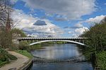
Kuhmühlenbrücke The street of the same name crosses the Mundsburg Canal with this bridge. The cow mill was a water mill that was demolished in 1874. The bridge is a listed building. |
Street |
Uhlenhorst , Hohenfelde ( 53 ° 33 ′ 57 ″ N, 10 ° 1 ′ 29 ″ E ) |
|
|
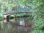
Kuhmühlenteichbrücke A railway bridge over the Kuhmühlenteich. |
Subway | 1911/12 |
Uhlenhorst , Hohenfelde ( 53 ° 33 ′ 57 ″ N, 10 ° 1 ′ 34 ″ E ) |
|
Kühnbrücke The Kühnbrücke is a pedestrian bridge that crosses the Alster and connects the districts of Hummelsbüttel and Wellingsbüttel . |
Street |
Ohlsdorf ( 53 ° 38 ′ 0 ″ N, 10 ° 2 ′ 30 ″ E ) |
|

|
Kulenstückbrücke Between the streets Twisselwsch and Grellkamp this bridge leads over the Bornbach. |
Street |
Langenhorn ( 53 ° 39 ′ 20 ″ N, 9 ° 59 ′ 52 ″ E ) |
|

|
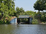
Kupferdammbrücke The street of the same name crosses the Wandse with this bridge . |
Street |
Farmsen-Berne ( 53 ° 35 ′ 42 ″ N, 10 ° 7 ′ 9 ″ E ) |
|
|
Kurfürstenbrücke The bridge crosses the Alte Schleusengraben , which flows into the Dove Elbe here . The name is probably derived from the former development. There were seven huts that were called "Electors". |
Street |
Curslack , Allermöhe ( 53 ° 28 ′ 2 ″ N, 10 ° 11 ′ 44 ″ E ) |
L.
| photo | Name, brief description | use | (First) construction | District, location |
|---|---|---|---|---|

|
Ladenbeker-Furtweg Bridge (L330) With this bridge, the street of the same name crosses the Bille east of the Boberger Niederung . |
Street |
Lohbrügge ( 53 ° 29 ′ 51 ″ N, 10 ° 10 ′ 53 ″ E ) |
|

|
Landscheidewegbrücke The Ochsenwerder Landscheideweg crosses the Ochsenwerder Schöpfwerkgraben in the Vierlanden southeast of Hamburg with the Landscheidewegbrücke. The bridge has the bridge number 146. |
Street |
Ochsenwerder ( 53 ° 28 ′ 2 ″ N, 10 ° 5 ′ 3 ″ E ) |
|

|
Langenhorner market bridge With this bridge, Tangstedter Landstrasse crosses the subway tracks at the Langenhorn-Markt stop. The bridge was repaired in summer 2015 and was given a new road surface that prevents the formation of ruts. |
Street | Repair in 2015 |
Langenhorn ( 53 ° 38 ′ 58 ″ N, 10 ° 1 ′ 2 ″ E ) |

|
Langenzugbrücke Arch bridge between the Long Zug and the Outer Alster. Over the pillars are balconies with z. T. decorated bridge railing. Below the right balcony - depending on the direction of view - there are tiled, empty niches. The bridge is a listed building. |
Street | 1864 |
Winterhude , Uhlenhorst ( 53 ° 34 ′ 39 ″ N, 10 ° 0 ′ 36 ″ E ) |

|
Long wiping bridge An Alster bridge for pedestrians and cyclists. |
Footpath | 1914 |
Wellingsbüttel , Poppenbüttel ( 53 ° 38 ′ 30 ″ N, 10 ° 4 ′ 1 ″ E ) |

|
Legienbrücke With the Legienbrücke, Legienstrasse crosses the tracks southeast of the subway station of the same name. |
Street |
Horn , Billstedt ( 53 ° 32 ′ 47 ″ N, 10 ° 5 ′ 53 ″ E ) |
|
|
Lighter Canal Bridge A former bridge, demolished in the course of backfilling the Lighter Canal in 2001-2004 and replaced by a simple road or rail section. |
Steinwerder ( 53 ° 31 ′ 37 ″ N, 9 ° 58 ′ 4 ″ E ) |
|||
|
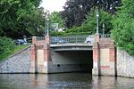
Towpath bridge The towpath bridge leads the street of the same name over the towpath canal. The bridge is a listed building. |
Street |
Winterhude ( 53 ° 35 ′ 34 ″ N, 9 ° 59 ′ 41 ″ E ) |
|

|
León Bridge (L397) The Leon Bridge crosses the Brooktorhafen between Dar-es-Salaam-Platz and the Maritime Museum . |
Footpath |
HafenCity ( 53 ° 32 ′ 37 ″ N, 9 ° 59 ′ 58 ″ E ) |
|

|
Liebigbrücke With this bridge, the street of the same name crosses the Tiefstack Canal south of the Bille . The bridge is a listed building. |
Street |
Billbrook , Rothenburgsort ( 53 ° 32 ′ 10 ″ N, 10 ° 4 ′ 24 ″ E ) |
|

|
Litzowstrasse Bridge Litzowstrasse crosses the Wandse over this road bridge near the Hamburg State Archives . |
Street |
Wandsbek ( 53 ° 34 ′ 34 ″ N, 10 ° 4 ′ 5 ″ E ) |
|

|
Lokstedt Bridge over the Tarpenbek |
Street |
Groß Borstel ( 53 ° 36 ′ 19 ″ N, 9 ° 58 ′ 0 ″ E ) |
|
|
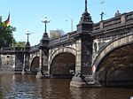
Lombard Bridge (L243) This railway and road bridge leads over the Alster. |
Street |
Hamburg-Altstadt , Neustadt , St. Georg , Rotherbaum ( 53 ° 33 ′ 25 ″ N, 9 ° 59 ′ 50 ″ E ) |
|
|
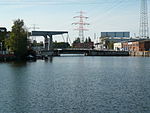
Pilot bridge runs along Konsul-Ritter-Straße over the Ziegelwiesenkanal |
Street |
Harburg , Heimfeld ( 53 ° 28 ′ 5 ″ N, 9 ° 58 ′ 55 ″ E ) |
M.
| photo | Name, brief description | use | (First) construction | District, location |
|---|---|---|---|---|

|
Magdeburg Bridge leads Versmannstrasse over Magdeburg harbor ; (Harbor bridge) |
Street |
HafenCity ( 53 ° 32 ′ 28 ″ N, 10 ° 0 ′ 3 ″ E ) |
|

|
Mahatma Gandhi Bridge (M447) This bridge named after the Indian politician connects between Kaiserkai and Sandtorkai and crosses the Sandtorhafen. |
Street |
HafenCity ( 53 ° 32 ′ 31 ″ N, 9 ° 59 ′ 7 ″ E ) |
|

|
Manila Bridge Pedestrian bridge over the Überseering. The City Nord bridges are named after overseas trading centers. |
Footpath |
Winterhude ( 53 ° 36 ′ 25 ″ N, 10 ° 1 ′ 22 ″ E ) |
|

|
Manstein Bridge The street of the same name crosses the Isebek Canal with the Manstein Bridge . |
Street |
Eimsbüttel , Harvestehude ( 53 ° 34 ′ 34 ″ N, 9 ° 58 ′ 13 ″ E ) |
|

|
Maria Louisen Bridge The Maria-Louisen-Brücke leads the street of the same name over the Leinpfad Canal in Hamburg-Winterhude. |
Street |
Winterhude ( 53 ° 35 ′ 5 ″ N, 9 ° 59 ′ 53 ″ E ) |
|

|
Marion-Gräfin-Dönhoff-Brücke The footbridge connects the Alster arcades with the Alter Wall over the Alster . |
Footpath | 2018 |
Hamburg-Altstadt , Neustadt ( 53 ° 33 ′ 4 ″ N, 9 ° 59 ′ 26 ″ E ) |
|
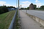
Market Canal Bridge filled, only one pipe opening left; led the Peutestrasse over the market canal |
Street |
Veddel ( 53 ° 31 ′ 39 ″ N, 10 ° 1 ′ 31 ″ E ) |
|

|
Maxstrasse Bridge With this bridge, the street of the same name crosses the Eilbek Canal. The bridge is a listed building. |
Street |
Barmbek-Süd , Eilbek ( 53 ° 34 ′ 22 ″ N, 10 ° 2 ′ 50 ″ E ) |
|

|
Meenk Bridge The Meenkwiese street crosses the Alster over the Meenkbrücke . The bridge is a listed building. |
Street |
Eppendorf , Winterhude ( 53 ° 35 ′ 56 ″ N, 9 ° 59 ′ 29 ″ E ) |
|

|
Mellingbek Bridge (M389) The street Poppenbüttler Berg crosses the Mellingbek west of the Alster loop in Poppenbüttel with this bridge . |
Street | 1977 |
Poppenbüttel , Lemsahl-Mellingstedt ( 53 ° 40 ′ 16 ″ N, 10 ° 5 ′ 16 ″ E ) |

|
Butchers Bridge With this bridge, Wilhelm-Metzger-Strasse crosses the Alster between the Insel Canal and the Skagerrak Canal in Alsterdorf . |
Street |
Alsterdorf ( 53 ° 36 ′ 22 ″ N, 9 ° 59 ′ 42 ″ E ) |
|

|
Michaelisbrücke (M182) A pedestrian bridge over the Herrengrabenfleet . At this point there was originally a road bridge built in the 1880s that was destroyed in the Second World War. |
Neustadt ( 53 ° 32 ′ 58 ″ N, 9 ° 59 ′ 4 ″ E ) |
||

|
Mittelkanalbrücke |
Hammerbrook ( 53 ° 32 ′ 45 ″ N, 10 ° 1 ′ 1 ″ E ) |
||

|
Mittlerer Landweg Bridge This bridge crosses the southern railway trench near the Mittlerer Landweg S-Bahn station. |
Street |
Allermöhe , Billwerder ( 53 ° 29 ′ 39 ″ N, 10 ° 7 ′ 39 ″ E ) |
|

|
Moorfleeter motorway bridge Norderelbbrücke on the A 1 |
Highway | 1962 | Moorfleet , Wilhelmsburg |

|
Moorfleeter Bridge The bridge is named after Moorfleeter Straße. With this you cross the federal highway 5 . |
Street | 1969 |
Billstedt ( 53 ° 32 ′ 20 ″ N, 10 ° 5 ′ 59 ″ E ) |

|
Moorfurthbrücke The bridge crosses the Goldbek Canal and connects the Poßmoorweg with the Goldbekufer. |
Street |
Winterhude ( 53 ° 35 ′ 5 ″ N, 10 ° 0 ′ 35 ″ E ) |
|

|
Moorkanalbrücke The bridge is a listed building. |
Street |
Veddel ( 53 ° 31 ′ 7 ″ N, 10 ° 2 ′ 36 ″ E ) |
|

|
Moorreyenbrücke over the Raakmoorgraben |
Street |
Langenhorn ( 53 ° 38 ′ 41 ″ N, 10 ° 1 ′ 30 ″ E ) |
|

|
Moorstrasse Bridge A bridge over the station canal. It is named after the moor path that leads through the moor east of the Seevekanal. |
Street |
Harburg ( 53 ° 27 ′ 26 ″ N, 9 ° 59 ′ 18 ″ E ) |
|

|
Moorwerder motorway bridge Süderelbbrücke on the A 1 |
Highway |
Wilhelmsburg , Harburg ( 53 ° 28 ′ 27 ″ N, 10 ° 1 ′ 23 ″ E ) |
|

|
Moses-Mendelsohn Bridge (M433) A footbridge over the southern ramp of the seaport bridge. Named after the philosopher Moses Mendelssohn . |
Harburg ( 53 ° 27 ′ 47 ″ N, 9 ° 58 ′ 38 ″ E ) |
||

|
Müggenburger Hafenbahnbrücke The bridge crosses the Müggenburger pass near the S-Bahn station Veddel-Ballinstadt . |
railroad |
Kleiner Grasbrook ( 53 ° 31 ′ 19 ″ N, 10 ° 0 ′ 39 ″ E ) |
|

|
Müggenburger Zollhafenbrücke The customs port of the same name, over which the bridge leads, connects the Spreehafen and the Müggenburger Kanal. |
Street |
Veddel ( 53 ° 31 ′ 19 ″ N, 10 ° 1 ′ 29 ″ E ) |
|

|
Muharrem Acar Bridge The bridge was named after a Turkish immigrant in order to honor a generation of immigrants on his behalf. |
Footpath |
Wilhelmsburg ( 53 ° 29 ′ 52 ″ N, 10 ° 0 ′ 22 ″ E ) |
|

|
Mühlenbachbrücke The Mühlenbachbrücke crosses the Glinder Au in the Billstedt district . |
Billstedt ( 53 ° 31 ′ 48 ″ N, 10 ° 7 ′ 47 ″ E ) |
||
|
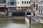
Mühlenbrücke The Mühlenbrücke crosses the Mönkedammfleet between Mönkedamm and the Great Burstah. |
Street |
Hamburg old town ( 53 ° 32 ′ 56 ″ N, 9 ° 59 ′ 28 ″ E ) |
|

|
Mühlenkampbrücke Arch bridge connecting Uhlenhorst and Winterhude. It is named after the Mühlenkamp. |
Street | 1900 |
Winterhude , Uhlenhorst ( 53 ° 34 ′ 46 ″ N, 10 ° 0 ′ 48 ″ E ) |

|
Mühlenstrasse Bridge The weir below the Mühlenstrasse bridge delimits the mill pond and marks the end of the Wandse, behind which the Eilbek begins. |
Street |
Wandsbek ( 53 ° 34 ′ 30 ″ N, 10 ° 3 ′ 32 ″ E ) |
|

|
Mundsburger Brücke With a width of 55 meters, the Mundsburger Brücke is the widest road bridge in Hamburg. It is 15 meters short to qualify as a tunnel. The bridge is a listed building. |
Street |
Uhlenhorst , Hohenfelde ( 53 ° 33 ′ 56 ″ N, 10 ° 1 ′ 11 ″ E ) |
N
| photo | Name, brief description | use | (First) construction | District, location |
|---|---|---|---|---|

|
Nettelnburger Brücke (N216) With this bridge the Nettelnburger Strasse crosses the Landscheidefleet in Allermöhe. |
Street |
Bergedorf , Allermöhe , Neuallermöhe ( 53 ° 28 ′ 40 ″ N, 10 ° 11 ′ 5 ″ E ) |
|
|
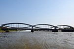
New bridge over the Elbe Norderelbbrücke on the B 4 / B 75; Reinforced concrete structure; not listed in the street directory. The bridge is a listed building. |
Street | 1884/1887 |
Rothenburgsort , Veddel ( 53 ° 31 ′ 55 ″ N, 10 ° 1 ′ 34 ″ E ) |
|
For Neuenfeld road bridge see Hermann Keesenberg Bridge |
Street | Wilhelmsburg | ||
|
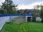
Neuengammer Blue Bridge Between the Neuengammer Hausdeich and the Curslacker Deich, this bridge leads over the Dove Elbe . |
Street |
Curslack , Neuengamme ( 53 ° 26 ′ 15 ″ N, 10 ° 14 ′ 13 ″ E ) |
|

|
Neuengammer Durchstichbrücke A reinforced concrete bridge built in 1934 over the Neuengammer Durchstich, a canal between the Dove Elbe and the Gose Elbe. |
Street | 1934 |
Neuengamme ( 53 ° 27 ′ 50 ″ N, 10 ° 11 ′ 42 ″ E ) |

|
Neuengammer Hausdeichbrücke This bridge is named after the Neuengammer Hausdeich. A dike on which the houses are located is called a “house dike”. |
Street |
Neuengamme ( 53 ° 26 ′ 7 ″ N, 10 ° 14 ′ 15 ″ E ) |
|
|
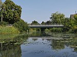
Neuengammer Hinterdeichbrücke This bridge is named after the Hinterdeich in Neuengamme. At Achterdeich it leads over the Neuengammer breakthrough. |
Street |
Neuengamme ( 53 ° 26 ′ 56 ″ N, 10 ° 10 ′ 27 ″ E ) |
|
|
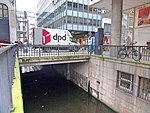
Neuerwallbrücke An inconspicuous bridge in downtown Hamburg. With it, the popular Neuer Wall shopping street crosses a small connecting canal between Alsterfleet and Bleichenfleet. |
Street |
Neustadt ( 53 ° 33 ′ 5 ″ N, 9 ° 59 ′ 24 ″ E ) |
|

|
Neuerwegsbrücke (N223) Between the streets Am Sandtorkai and St. Annenfleet , this bridge leads over the St. Annenfleet . in downtown Hamburg. |
Street |
HafenCity ( 53 ° 32 ′ 39 ″ N, 9 ° 59 ′ 47 ″ E ) |
|

|
New Vering Canal Swing Bridge The name of the Vering Canal goes back to Hermann Vering, who opened up the surrounding area for settlement. |
Street |
Wilhelmsburg ( 53 ° 30 ′ 38 ″ N, 9 ° 59 ′ 2 ″ E ) |
|

|
New York Bridge One of the many pedestrian bridges in the North City , the names of which are reminiscent of the major overseas trading centers. |
Footpath |
Winterhude ( 53 ° 36 ′ 10 ″ N, 10 ° 1 ′ 10 ″ E ) |
|

|
Niederbaumbrücke (N233) A bridge between the baumall and the free port. |
Street |
HafenCity , Neustadt ( 53 ° 32 ′ 37 ″ N, 9 ° 58 ′ 57 ″ E ) |
|

|
Niedernfelder Brücke A bridge near the Veddel-Ballinstadt S-Bahn station , which separates the Saale harbor from the Spreehafen . |
Street |
Kleiner Grasbrook ( 53 ° 31 ′ 23 ″ N, 10 ° 0 ′ 34 ″ E ) |
|

|
Niendorfer Brücke The Niendorfer Brücke was built in 1878 and reinforced in 1953. She crosses the Tarpenbek |
Street | 1878 |
Groß Borstel ( 53 ° 36 ′ 36 ″ N, 9 ° 57 ′ 54 ″ E ) |

|
Nikolaibrücke With this bridge Willy-Brandt-Straße crosses Nikolaifleet. |
Street |
Hamburg Old Town ( 53 ° 32 ′ 50 ″ N, 9 ° 59 ′ 35 ″ E ) |
|

|
Norderlochbrücke This bridge is named after the Norderloch waterway - which connects Steinwerder with the ferry canal. |
Road, railroad |
Steinwerder ( 53 ° 32 ′ 16 ″ N, 9 ° 58 ′ 6 ″ E ) |
|

|
Nordkanalbrücke (N195) A bridge between Amsinckstrasse and Nordkanalstrasse . It is named after the North Canal, which has since been filled in. |
Street |
Hammerbrook ( 53 ° 32 ′ 52 ″ N, 10 ° 0 ′ 45 ″ E ) |
|

|
Nordmarkstrasse Bridge The street of the same name crosses the Wandse with this bridge. |
Street |
Tonndorf ( 53 ° 35 ′ 9 ″ N, 10 ° 6 ′ 34 ″ E ) |
O
| photo | Name, brief description | use | (First) construction | District, location |
|---|---|---|---|---|

|
Oberbaumbrücke (O202) This bridge crosses the Oberhafen and connects the streets Poggenmühle and Deichtorplatz. The bridge is a listed building. |
Street |
Hamburg-Altstadt , HafenCity ( 53 ° 32 ′ 47 ″ N, 10 ° 0 ′ 14 ″ E ) |
|

|
Oberhafenbrücke This bridge crosses the Oberhafen between Stockmeyerstraße and Stadtdeich. |
Road, railroad |
HafenCity , Hammerbrook ( 53 ° 32 ′ 43 ″ N, 10 ° 0 ′ 25 ″ E ) |
|

|
Ochsenwerder Landstraßenbrücke Over this bridge the Ochsenwerder Landstraße crosses the Tatenberger Hauptgraben in the Vierlanden. The bridge has the bridge number 143. |
Street |
Tatenberg ( 53 ° 29 ′ 7 ″ N, 10 ° 4 ′ 20 ″ E ) |
|

|
Odemannbrücke The bridge is named after the street Odemanns Heck and leads it over the Dove Elbe . |
Street |
Curslack , Neuengamme ( 53 ° 26 ′ 49 ″ N, 10 ° 13 ′ 15 ″ E ) |
|

|
Öjendorfer Bridge The bridge leads over the subway tracks at Billstedt station. |
Street |
Billstedt ( 53 ° 32 ′ 31 ″ N, 10 ° 6 ′ 34 ″ E ) |
|

|
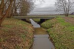
Ölmühlenwegbrücke This bridge leads the street of the same name over the Wandse . |
Street |
Wandsbek , Tonndorf ( 53 ° 34 ′ 58 ″ N, 10 ° 6 ′ 7 ″ E ) |
|
|
Oortkatenwegbrücke With this bridge the street of the same name leads to the northern Ochsenwerder collecting ditch. The word “Oort” means “corner” because there was a bend in the dike at this point. |
Street |
Ochsenwerder ( 53 ° 27 ′ 34 ″ N, 10 ° 6 ′ 37 ″ E ) |
|

|
Osakabrücke A pedestrian bridge that leads over the New York Ring in the North of the City. |
Footpath |
Winterhude ( 53 ° 36 ′ 8 ″ N, 10 ° 1 ′ 5 ″ E ) |
|

|
Eastern station canal bascule bridge Bascule bridge over the eastern station canal. Connects Veritaskai and Neuländer Straße. The bridge is a listed building. |
Street |
Harburg ( 53 ° 27 ′ 57 ″ N, 9 ° 59 ′ 24 ″ E ) |
|

|
Otto Sill Bridge (O206) Otto Sill was Hamburg's senior construction director from 1964 to 1971. The bridge named after him leads over the Alsterfleet near the Baumall underground station. |
Street |
Hamburg-Altstadt , Neustadt ( 53 ° 32 ′ 40 ″ N, 9 ° 59 ′ 1 ″ E ) |
P
| photo | Name, brief description | use | (First) construction | District, location |
|---|---|---|---|---|

|
Pappelalleebrücke Between the S-Bahn stations Hasselbrook and Wandsbeker Chaussee , this bridge runs over the tracks of the S-Bahn and the freight bypass and connects the districts of Eilbek and Marienthal. |
Street |
Eilbek , Marienthal ( 53 ° 34 ′ 6 ″ N, 10 ° 3 ′ 39 ″ E ) |
|

|
Parkseebrücke Via the Parkseebrücke the Südring at the Goldbek Canal crosses the tributary of the Stadtparksee in Hamburg's Stadtpark . |
Street |
Winterhude ( 53 ° 35 ′ 28 ″ N, 10 ° 1 ′ 30 ″ E ) |
|

|
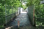
Paul-Bäumer-Brücke (P257) leads over the Zeppelinstraße (B 433) |
Footpath and bike path |
Fuhlsbüttel ( 53 ° 38 ′ 0 ″ N, 10 ° 0 ′ 35 ″ E ) |
|
|
Paul Stritter Bridge This bridge is named after a pastor. Paul Stritter (1863-1946) was also director of the Alsterdorfer Anstalten . |
Footpath |
Alsterdorf ( 53 ° 36 ′ 48 ″ N, 10 ° 1 ′ 42 ″ E ) |
|

|
Pickhubenbrücke The Pickhubenbrücke leads over the "Kleine Fleet" in the Speicherstadt. |
Street |
HafenCity ( 53 ° 32 ′ 40 ″ N, 9 ° 59 ′ 44 ″ E ) |
|

|
Pinkert Bridge With this bridge the Pinkertweg crosses the industrial canal . |
Street |
Billbrook ( 53 ° 31 ′ 39 ″ N, 10 ° 5 ′ 2 ″ E ) |
|

|
Poelchaukampbrücke With this bridge, the street of the same name crosses the Mühlenkamp Canal . |
Street |
Winterhude ( 53 ° 34 ′ 54 ″ N, 10 ° 0 ′ 37 ″ E ) |
|

|
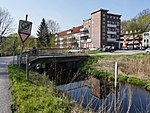
Poggenmühlenbrücke With this bridge, the street of the same name crosses the Wandrahmsfleet in Hamburg's Speicherstadt. A water mill stood here between 1555 and 1865, which was used as a fulling and punching mill. The street name developed from the name. |
Street |
HafenCity ( 53 ° 32 ′ 46 ″ N, 10 ° 0 ′ 8 ″ E ) |
|
|
Pollhofsbrücke A bridge that crosses the Brookwetterung in the area of the same name . |
Street |
Bergedorf ( 53 ° 28 ′ 44 ″ N, 10 ° 13 ′ 57 ″ E ) |
|

|
Postbrücke A bridge that crosses the Bleichenfleet. It is named after the nearby post office, which was built in 1846 and now serves as an office building. |
Street |
Neustadt ( 53 ° 33 ′ 9 ″ N, 9 ° 59 ′ 27 ″ E ) |
|

|
Powder Tower Bridge(P216)The bridge is a listed building. |
Street |
Neustadt ( 53 ° 32 ′ 52 ″ N, 9 ° 59 ′ 0 ″ E ) |
R.
| photo | Name, brief description | use | (First) construction | District, location |
|---|---|---|---|---|

|
Randersweidebrücke This bridge leads the street of the same name over the Kampbille. The name Randersweide refers to a "pasture that lies on a border". |
Street |
Bergedorf ( 53 ° 28 ′ 48 ″ N, 10 ° 11 ′ 54 ″ E ) |
|

|
Rathenaubrücke This bridge was originally called "Westliche Skagerrakbrücke" and leads over the Skagerrak Canal in the Alsterdorf district. The bridge was named after the writer and politician Walther Rathenau in 1958. |
Street |
Alsterdorf ( 53 ° 36 ′ 25 ″ N, 9 ° 59 ′ 49 ″ E ) |
|

|
Ratsmühlendammbrücke The street of the same name crosses the Alster with this bridge. |
Street |
Ohlsdorf , Fuhlsbüttel ( 53 ° 37 ′ 34 ″ N, 10 ° 1 ′ 44 ″ E ) |
|
|
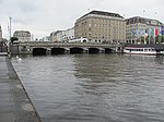
Reesendammbrücke The bridge is a listed building. |
Street. |
Hamburg-Altstadt , Neustadt ( 53 ° 33 ′ 8 ″ N, 9 ° 59 ′ 38 ″ E ) |
|

|
Reginenortbrücke spans the western entrance of the Müggenburg Canal. The bridge is a listed building. The railroad has now ceased and the footpath across the bridge is closed. |
railroad |
Veddel ( 53 ° 31 ′ 17 ″ N, 10 ° 1 ′ 41 ″ E ) |
|

|
Reichstag Bridge This bridge crosses the Insel Canal and connects the Kugelfang and Inselstrasse streets. It was named in memory of the Hamburg Reichstag delegate Wilhelm Metzger (SPD). Originally there was a wooden bridge here - from 1914 onwards, which was replaced by a reinforced concrete bridge in 1954. |
Street |
Alsterdorf ( ) |
|

|
Reiherstiegbrücke This bridge crosses the Reiherstieg near the Ellerholzbrücke. |
railroad |
Kleiner Grasbrook , Steinwerder ( 53 ° 31 ′ 38 ″ N, 9 ° 58 ′ 36 ″ E ) |
|

|
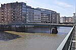
Reiherstieg bascule bridge Neuhöfer Straße crosses the Reiherstieg with this bridge. |
Street |
Wilhelmsburg ( 53 ° 30 ′ 45 ″ N, 9 ° 58 ′ 17 ″ E ) |
|
|
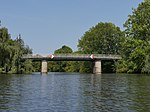
Reimersbrücke (R124) With this bridge the Reimerstwiete crosses the Nikolaifleet. Allegedly it is the oldest, but certainly one of the oldest bridges in Hamburg. |
Footpath |
Hamburg Old Town ( 53 ° 32 ′ 47 ″ N, 9 ° 59 ′ 29 ″ E ) |
|
|
Reitbrooker Mühlenbrücke (R141) This bridge was built in 1976 and connects the Reitbrooker Deich with the Allermöher Deich. It leads over the Dove Elbe. |
Street |
Reitbrook , Allermöhe ( 53 ° 28 ′ 3 ″ N, 10 ° 10 ′ 23 ″ E ) |
|

|
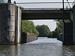
Reiterbrücke This pedestrian bridge leads the Alsterwanderweg over the Alster. In the past it was mainly used by sport riders. These were wealthy Hamburgers who kept their horses in the riding stables of the farmers of Klein-Borstel. |
Street |
Fuhlsbüttel ( 53 ° 37 ′ 58 ″ N, 10 ° 2 ′ 7 ″ E ) |
|
|
Reitschleusenbrücke The bridge leads from Ochsenwerder into the nature reserve "Die Reit". The naming is based on this. |
Street |
Ochsenwerder , Reitbrook ( 53 ° 28 ′ 35 ″ N, 10 ° 6 ′ 14 ″ E ) |
|

|
Rentzelstrasse Bridge The bridge is named after Rentzelstrasse. It crosses the tracks of the long-distance railway and the S-Bahn near the Hamburg television tower. |
Street |
St. Pauli , Rotherbaum ( 53 ° 33 ′ 50 ″ N, 9 ° 58 ′ 37 ″ E ) |
|

|
Rethe bascule bridge , as a replacement for the Rethe lift bridge . | Road, foot / bike path, railroad | 2016 |
Wilhelmsburg ( 53 ° 30 ′ 14 ″ N, 9 ° 57 ′ 58 ″ E ) |

|
Richardstraße Bridge The bridge is a listed building. |
Street | around 1900 |
Uhlenhorst , Barmbek-Süd ( 53 ° 34 ′ 11 ″ N, 10 ° 2 ′ 16 ″ E ) |

|
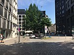
Robert Schuman Bridge (R435) Originally built as the Wandsbeker Rathausbrücke , since 1988 named after Robert Schuman ; spans the tracks of the Hamburg-Lübeck railway line along Ring 2 and is only accessible for motor vehicles; There is a tunnel under the tracks for pedestrians and cyclists. |
Street |
Wandsbek , Marienthal ( 53 ° 34 ′ 8 ″ N, 10 ° 4 ′ 23 ″ E ) |
|
|
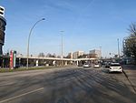
Roland's Bridge (R265) former bridge, spanned the Reichenstraßenfleet, which was filled in in 1877; today only street name |
Street |
Hamburg old town ( 53 ° 32 ′ 55 ″ N, 9 ° 59 ′ 40 ″ E ) |
|
|
Rönnhaidbrücke The Rönnhaidbrücke was built between 1969 and 1970. It is a pedestrian bridge that connects the Hamburger Meile shopping center with the Hamburger Straße subway station. |
Footpath |
Barmbek-Süd ( 53 ° 34 ′ 32 ″ N, 10 ° 2 ′ 8 ″ E ) |
|

|
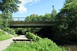
Roosen Bridge This bridge is named after the Roosen family who owned the surrounding area - including a park - between 1832 and 1920. |
Street |
Neustadt ( 53 ° 32 ′ 40 ″ N, 9 ° 58 ′ 51 ″ E ) |
|
|
Rosenbrookbrücke Double bridge over the Tarpenbek , part of Ring 2 |
Street |
Groß Borstel ( 53 ° 36 ′ 9 ″ N, 9 ° 59 ′ 10 ″ E ) |
|

|
Roßbrücke With this street the Roßweg crosses the Roßkanal. It connects Neuhof with Steinwerder. |
Street |
Steinwerder ( 53 ° 31 ′ 22 ″ N, 9 ° 56 ′ 32 ″ E ) |
|

|
Red Bridge (R305) One of originally three, today six Billebrücken (red, brown, blue, green, yellow and black bridges), which have been painted in different colors since ancient times to make it easier for peasants who are unfamiliar with reading. |
Street |
Billstedt , Billbrook ( 53 ° 31 ′ 53 ″ N, 10 ° 6 ′ 43 ″ E ) |
|

|
Rückersbrücke This bridge is named after the Rückersweg. It crosses the central canal. |
Street |
Hamm ( 53 ° 32 ′ 58 ″ N, 10 ° 3 ′ 51 ″ E ) |
S.
| photo | Name, brief description | use | (First) construction | District, location |
|---|---|---|---|---|

|
Saarland Bridge The name of this bridge reminded of the annexation of the Saarland to the German Empire in 1935. |
Street | 1916 |
Winterhude ( 53 ° 35 ′ 5 ″ N, 10 ° 2 ′ 1 ″ E ) |

|
Sachsenbrücke (S006) The bridge crosses the Saale harbor between Dessauer Straße and Am Seehafen. |
Street |
Kleiner Grasbrook ( 53 ° 31 ′ 41 ″ N, 10 ° 0 ′ 53 ″ E ) |
|

|
Sand bridge The sand bridge was designed by Franz Andreas Meyer. |
Street | 1887 |
HafenCity ( 53 ° 32 ′ 37 ″ N, 9 ° 59 ′ 24 ″ E ) |

|
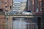
Saseler Strasse Bridge A bridge over the subway between the Ringstrasse and the Berner Heerweg. |
Street |
Farmsen-Berne , Rahlstedt ( 53 ° 37 ′ 53 ″ N, 10 ° 8 ′ 44 ″ E ) |
|
|
Schaarsteinwegbrücke (S087) The bridge is a listed building. |
Street |
Neustadt ( 53 ° 32 ′ 45 ″ N, 9 ° 58 ′ 55 ″ E ) |
|

|
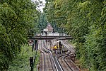
Schaartorbrücke (S089) The bridge leads the street of the same name over the Alsterfleet. |
Street |
Hamburg old town ( 53 ° 32 ′ 44 ″ N, 9 ° 59 ′ 0 ″ E ) |
|
|
Schäferhofbrücke With this bridge, the street of the same name crosses the subway between Fuhlsbüttel-Nord and Langenhorner Markt. |
Street |
Langenhorn ( 53 ° 38 ′ 35 ″ N, 10 ° 1 ′ 1 ″ E ) |
|

|
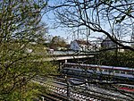
Leaning Bridge A bridge that crosses the Dove Elbe at an oblique angle - hence the name. |
Street |
Curslack , Neuengamme ( 53 ° 27 ′ 51 ″ N, 10 ° 12 ′ 5 ″ E ) |
|
|
Schiffbeker Bridge The Schiffbeker Weg crosses the subway with this bridge. Schiffbek was a village that passed into the hamlet of Hamburg-Billstedt with two others . |
Street |
Billstedt ( 53 ° 32 ′ 38 ″ N, 10 ° 6 ′ 14 ″ E ) |
|

|
Schlachthofbrücke (S918) When the Harburg train station was built, this bridge was also built. It was named after a slaughterhouse that stood northeast of the train station. |
Street |
Harburg , Wilstorf ( 53 ° 27 ′ 17 ″ N, 9 ° 59 ′ 32 ″ E ) |
|

|
Schleemer Bridge With this bridge, Schleemer Weg crosses the subway. This is named after the abandoned Schleem settlement, which lay between Schiffbek and Steinbek . |
Street |
Billstedt ( 53 ° 32 ′ 25 ″ N, 10 ° 6 ′ 50 ″ E ) |
|
|
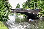
Schleidenbrücke The bridge is a listed building. |
Street |
Winterhude , Barmbek-Süd , Barmbek-Nord ( 53 ° 35 ′ 5 ″ N, 10 ° 2 ′ 1 ″ E ) |
|

|
Schleusenbrücke (S203) The Schleusenbrücke leads as an extension of Poststrasse over the Alsterfleet to the Rathausmarkt. |
Neustadt , Hamburg-Altstadt ( 53 ° 33 ′ 5 ″ N, 9 ° 59 ′ 31 ″ E ) |
||

|
Schleusendammbrücke With this bridge, the street of the same name crosses the Dove Elbe or the Dove-Elbe-Schleuse, to which the name refers. |
Street |
Neuengamme , Allermöhe ( 53 ° 28 ′ 0 ″ N, 10 ° 11 ′ 24 ″ E ) |
|

|
Schleusengrabenbrücke With this bridge, Bergedorfer Straße crosses the Schleusengraben , after which the bridge is named. |
Street |
Bergedorf ( 53 ° 29 ′ 17 ″ N, 10 ° 12 ′ 30 ″ E ) |
|

|
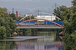
Smuggling Bridge This bridge crosses Schmuggelstieg the Tarpenbek . |
Footpath |
Langenhorn ( 53 ° 40 ′ 53 ″ N, 9 ° 59 ′ 58 ″ E ) |
|
|
Schurzalleebrücke A bridge over the Bille Canal. It is named after the Schurz Avenue, the American US-turn by the publicist Carl Schurz named |
Street |
Rothenburgsort ( 53 ° 32 ′ 11 ″ N, 10 ° 4 ′ 2 ″ E ) |
|

|
Schwanenwikbrücke The bridge is a listed building. |
Street |
Uhlenhorst , Hohenfelde ( 53 ° 33 ′ 56 ″ N, 10 ° 1 ′ 1 ″ E ) |
|

|
Black bridge leads the Heidenkampsweg over the Bille . The bridge railings of originally three, now six Billebrücken (red, brown, blue, green, yellow and black bridges) are painted in different colors. It is unclear whether the choice of color should make orientation easier for river boats or workers in the industrial park. |
Street |
Hammerbrook , Rothenburgsort ( 53 ° 32 ′ 33 ″ N, 10 ° 1 ′ 58 ″ E ) |
|
|
Seehafenbrücke (S892), one of the few with 3 ramps and a T-junction on the bridge. It connects Harburger Hafen with Harburger City by crossing the B 73 and the Niederelbebahn . In addition, there is a pedestrian crossing from Blohmstrasse to the B 73. The bridge is a listed building. |
Street |
Harburg , Heimfeld ( 53 ° 27 ′ 53 ″ N, 9 ° 58 ′ 42 ″ E ) |
|

|
Sengelmannbrücke The street of the same name crosses the Alster with this bridge. |
Street |
Alsterdorf , Ohlsdorf ( 53 ° 36 ′ 55 ″ N, 10 ° 1 ′ 5 ″ E ) |
|

|
Serrahnbrücke This bridge leads the Alte Holstenstraße over the Bille above the Serrahn (Bergedorfer Hafen). |
Street |
Bergedorf ( 53 ° 29 ′ 22 ″ N, 10 ° 12 ′ 35 ″ E ) |
|

|
S (c) hanghaibrücke (S945) With this bridge the Shanghaiallee crosses the Brooktorhafen in Hamburg-Hafencity . |
Street |
HafenCity ( 53 ° 32 ′ 39 ″ N, 10 ° 0 ′ 6 ″ E ) |
|

|
Sierichstrasse Bridge This girder bridge leads Sierichstrasse over the Goldbek Canal . |
Street |
Winterhude ( 53 ° 35 ′ 0 ″ N, 10 ° 0 ′ 20 ″ E ) |
|

|
Singapore Bridge Pedestrian bridge that leads over Überseering in City Nord. |
Footpath |
Winterhude ( 53 ° 36 ′ 18 ″ N, 10 ° 1 ′ 30 ″ E ) |
|

|
Skagerrak Bridge The Skagerrak Bridge leads Rathenaustraße over the Skagerrak Canal. The bridge is a listed building. |
Street |
Alsterdorf ( 53 ° 36 ′ 41 ″ N, 10 ° 0 ′ 32 ″ E ) |
|
|
Slamatjenbrücke With this bridge the Ludwig-Erhardt-Straße crosses the Alsterfleet. The name of the bridge, first mentioned in the 17th century, suggests prostitution, because slam stands for dirt or mud and matje stands for girls. |
Street |
Hamburg-Altstadt , Neustadt ( 53 ° 32 ′ 53 ″ N, 9 ° 59 ′ 6 ″ E ) |
|
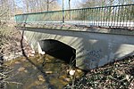
|
Sonnenwegbrücke The street of the same name crosses the Wandse with this bridge . |
Street |
Tonndorf ( 53 ° 35 ′ 34 ″ N, 10 ° 7 ′ 20 ″ E ) |
|
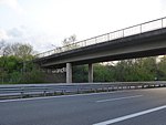
|
Speckenwegbrücke With this bridge, the street of the same name crosses the federal motorway. |
Street |
Bergedorf ( 53 ° 28 ′ 10 ″ N, 10 ° 15 ′ 36 ″ E ) |
|

|
Spreehafenbrücke This bridge at the Spreehafen connects Klütjenfelder Strasse and Klütjenfelder main dike . |
Street |
Kleiner Grasbrook ( 53 ° 31 ′ 26 ″ N, 9 ° 58 ′ 59 ″ E ) |
|

|
St. Annenbrücke The street of the same name crosses the Wandrahmfleet with this bridge. |
Street | 1885 |
HafenCity ( 53 ° 32 ′ 41 ″ N, 9 ° 59 ′ 51 ″ E ) |

|
St. Pauli Landungsbrücken The bridges are under monument protection. |
Investors |
St. Pauli ( 53 ° 32 ′ 43 ″ N, 9 ° 58 ′ 5 ″ E ) |
|

|
Stadthallenbrücke (S912) The Stadthallenbrücke was built between 1914 and 1916 under the Hamburg construction director Fritz Schumacher and named after the town hall , which was demolished in 1952. |
Street |
Winterhude ( 53 ° 35 ′ 30 ″ N, 10 ° 1 ′ 53 ″ E ) |
|
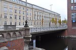
|
Stadthausbrücke This bridge, near which there is also an S-Bahn station of the same name, connects Hamburg's old town with Hamburg's Neustadt. |
Street |
Neustadt ( 53 ° 33 ′ 2 ″ N, 9 ° 59 ′ 9 ″ E ) |
|

|
Steintorbrücke The bridge is named after a city gate that stood nearby. At the main station it runs over the tracks of the long-distance and S-Bahn. |
Street |
St. Georg ( 53 ° 33 ′ 7 ″ N, 10 ° 0 ′ 26 ″ E ) |
|

|
Sternbrücke leads diagonally across the intersection of Max-Brauer-Allee /Stresemannstraße; as a railway bridge not listed in the street directory. |
railroad | 1873 |
Altona old town , Sternschanze ( 53 ° 33 ′ 41 ″ N, 9 ° 57 ′ 18 ″ E ) |

|
Stub Canal Bridge The bridge crosses the Stub Canal between the Saarlandstrasse underground station and the Barmbek underground and suburban railway station. |
Street |
Barmbek-Nord ( 53 ° 35 ′ 16 ″ N, 10 ° 2 ′ 7 ″ E ) |
|
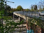
|
Stoltenbrücke (S711) The bridge is named after the Stoltenstrasse, which crosses the Autobahn 24 here . |
Street |
Marienthal ( 53 ° 33 ′ 49 ″ N, 10 ° 5 ′ 41 ″ E ) |
|

|
Streekbrücke A Streek stands in Low German for a dash, a line, a row or - as in this case - a section. |
Street |
Harvestehude , Winterhude ( 53 ° 35 ′ 1 ″ N, 9 ° 59 ′ 43 ″ E ) |
|
|
Süderstraßenbrücke With this bridge, the street of the same name crosses the flood basin in Hammerbrook. |
Street |
Hammerbrook ( 53 ° 32 ′ 44 ″ N, 10 ° 1 ′ 54 ″ E ) |
T
| photo | Name, brief description | use | (First) construction | District, location |
|---|---|---|---|---|

|
Tannenwegbrücke The name of this bridge is reminiscent of a fir forest that was at this point. The bridge crosses the subway tracks. |
Street |
Langenhorn ( 53 ° 38 ′ 50 ″ N, 10 ° 1 ′ 2 ″ E ) |
|

|
Half of the Tarpen Bridge in Norderstedt |
Street |
Langenhorn ( 53 ° 39 ′ 58 ″ N, 9 ° 59 ′ 28 ″ E ) |
|

|
Tatenberger Brücke The Tatenberger Brücke connects Moorflet with Tatenberg. Here the Tatenberger Weg crosses the Dove Elbe. |
Street |
Moorfleet , Tatenberg ( 53 ° 29 ′ 57 ″ N, 10 ° 4 ′ 42 ″ E ) |
|

|
Tide Canal Bridge This bridge is named after the tide canal over which Moorfleeter Straße leads. |
Street |
Billbrook ( 53 ° 31 ′ 42 ″ N, 10 ° 5 ′ 38 ″ E ) |
|

|
Tiefstacker Bridge This bridge is named after the Tiefstack Canal, over which it leads the Ausschläger Alle. |
Street |
Billbrook , Rothenburgsort ( 53 ° 31 ′ 44 ″ N, 10 ° 4 ′ 5 ″ E ) |
|

|
Timmerlohbrücke This bridge is named after the peculiarities of the area. "Timme" means "pointed" and the word "Loh" means a forest. |
Footpath |
Langenhorn ( 53 ° 39 ′ 28 ″ N, 10 ° 0 ′ 59 ″ E ) |
|

|
Timmermannbrücke The lock redder crosses the Alster with this bridge. It is named after a family whose members presided over the parish of Wohldorf-Ohlstedt from 1882 to 1932. |
Street |
Duvenstedt , Wohldorf-Ohlstedt ( 53 ° 42 ′ 17 ″ N, 10 ° 7 ′ 5 ″ E ) |
|
|
Torontobrücke With this bridge the Manilaweg crosses the Jahnring. The bridges in City Nord are named after overseas trading centers. |
Footpath |
Winterhude ( 53 ° 36 ′ 2 ″ N, 10 ° 1 ′ 20 ″ E ) |
|

|
Travehafenbrücke The street leading over the bridge is named after the port, which in turn was named after the Schleswig-Holstein river Trave. |
Street |
Steinwerder ( 53 ° 31 ′ 11 ″ N, 9 ° 57 ′ 51 ″ E ) |
|

|
Triftwegbrücke The bridge is named after the Duvenstedter Triftweg. You cross the Alster with this street. |
Street |
Duvenstedt , Wohldorf-Ohlstedt ( 53 ° 42 ′ 25 ″ N, 10 ° 7 ′ 6 ″ E ) |
|

|
Trostbrücke (T175) The bridge is a listed building. |
Street |
Hamburg Old Town ( 53 ° 32 ′ 53 ″ N, 9 ° 59 ′ 32 ″ E ) |
|

|
Twietenkoppelbrücke The bridge crosses the Alster with the street of the same name. The bridge originally standing here was demolished in 1967 and replaced with a modern reinforced concrete pedestrian bridge. |
Street |
Lemsahl-Mellingstedt , Bergstedt ( 53 ° 40 ′ 31 ″ N, 10 ° 6 ′ 24 ″ E ) |
U / V
| photo | Name, brief description | use | (First) construction | District, location |
|---|---|---|---|---|

|
Überseebrücke The Überseebrücke is a port facility with a covered pedestrian bridge that leads in the Port of Hamburg from Vorsetzen to a pontoon in Niederhafen . |
Investors | 1927 |
Neustadt ( 53 ° 32 ′ 36 ″ N, 9 ° 58 ′ 40 ″ E ) |

|
Veddel Canal Bridge A steel arch bridge that crosses the Veddel Canal near Klütjenfeld Harbor. The bridge is a listed building. |
Street | 1933 |
Kleiner Grasbrook ( 53 ° 31 ′ 31 ″ N, 9 ° 58 ′ 56 ″ E ) |

|
Vierländer Bridge (V136) With the Vierländer Brücke, the Curslacker Neuer Deich road crosses the A 25 south of Bergedorf. |
Street |
Bergedorf , Curslack ( 53 ° 28 ′ 31 ″ N, 10 ° 12 ′ 20 ″ E ) |
|

|
Vogelhüttendeichbrücke With the Vogelhüttendeichbrücke the street of the same name in Wilhelmsburg crosses the Reiherstieger Wetter. |
Street |
Wilhelmsburg ( 53 ° 31 ′ 8 ″ N, 9 ° 58 ′ 55 ″ E ) |
|

|
Von Essen road bridge With the Von-Essen-Strasse Bridge, the Von-Essen-Strasse of the same name in the Hamburg district of Barmbek-Süd crosses the Eilbek Canal . The bridge is a listed building. |
Street | 1927 |
Barmbek-Süd ( 53 ° 34 ′ 19 ″ N, 10 ° 2 ′ 39 ″ E ) |
W.
| photo | Name, brief description | use | (First) construction | District, location |
|---|---|---|---|---|

|
Wagnerstrasse Bridge The street of the same name crosses the Eilbek Canal with this bridge. |
Street |
Barmbek-Süd ( 53 ° 34 ′ 15 ″ N, 10 ° 2 ′ 24 ″ E ) |
|

|
Wallstrasse Bridge The bridge was built in 1958 and named after Wallstrasse. Both are reminiscent of the former city fortifications that once protected the St. Georg district. |
Street |
Hamburg-Borgfelde , Hohenfelde ( 53 ° 33 ′ 23 ″ N, 10 ° 1 ′ 36 ″ E ) |
|

|
Walter Dudek Bridge (W481) Walter Dudek was mayor of Harburg between 1925 and 1933 and was a Hamburg senator after the war. The bridge named after him leads near the Harburg train station over the tracks of long-distance and S-Bahn trains. |
Street |
Harburg ( 53 ° 27 ′ 27 ″ N, 9 ° 59 ′ 29 ″ E ) |
|

|
Waltershofer Brücke The bridge separates the Waltershofer Hafen from the Rugenberger Hafen . The area, which also gave the harbor and the bridge its name, is possibly named after the Hamburg Senator Walter Beckhoff (1648–1727). |
Street |
Waltershof ( 53 ° 31 ′ 29 ″ N, 9 ° 55 ′ 41 ″ E ) |
|

|
Wandbereiterbrücke A bridge on the Kehrwieder Peninsula. Textile manufacturing trades were located here, which were settled on the Grasbrook from 1560–1567 due to the space requirements. The nearby Wandrahmsfleet bridge also refers to it, because the wall is derived from the drapery. |
Street |
HafenCity ( 53 ° 32 ′ 43 ″ N, 9 ° 59 ′ 50 ″ E ) |
|

|
Wandrahmsfleetbrücke A bridge on the Kehrwieder Peninsula. Textile manufacturing trades were located here, which were settled on the Grasbrook from 1560–1567 due to the space requirements. The nearby Wandbereiterbrücke also refers to it, because the wall is derived from the drapery. |
Street |
HafenCity ( 53 ° 32 ′ 44 ″ N, 9 ° 59 ′ 58 ″ E ) |
|

|
Wandrahmsteg The bridge is a listed building. |
Footpath |
Hamburg-Altstadt , HafenCity ( 53 ° 32 ′ 49 ″ N, 10 ° 0 ′ 8 ″ E ) |
|

|
Wandsbeker Alleebrücke With this bridge the street of the same name crosses the Wandse . |
Street |
Wandsbek ( 53 ° 34 ′ 33 ″ N, 10 ° 4 ′ 12 ″ E ) |
|

|
Wandsbeker Chausseebrücke The bridge leads the Wandsbeker Chaussee over the tracks of the S-Bahn and freight bypass, on it is also the only access to the S-Bahn station of the same name. |
Street |
Eilbek , Marienthal ( 53 ° 34 ′ 13 ″ N, 10 ° 3 ′ 35 ″ E ) |
|

|
Wartenaubrücke The bridge is a listed building. |
Street |
Uhlenhorst , Hohenfelde ( 53 ° 34 ′ 0 ″ N, 10 ° 1 ′ 54 ″ E ) |
|

|
Wendemuthstrasse Bridge Road bridge over which the Wendenmuthstrasse in the Hamburg district of Wandsbek crosses the Wandse. |
Street |
Wandsbek ( 53 ° 34 ′ 35 ″ N, 10 ° 4 ′ 23 ″ E ) |
|
|
Wendenbrücke The Wendenbrücke leads the street of the same name over the flood basin in the Hammerbrook district. |
Street |
Hammerbrook ( 53 ° 32 ′ 53 ″ N, 10 ° 1 ′ 47 ″ E ) |
|

|
Shipyard bridge The shipyard bridge built in 1899 was renewed in 1999. It leads the towpath directly on the Alster over the towpath canal . |
Street |
Winterhude ( 53 ° 35 ′ 7 ″ N, 9 ° 59 ′ 47 ″ E ) |
|

|
Wiesenbrücke Originally there were only meadows in this area, hence the name. The bridge leads the Brabandstraße over the Braband Canal . |
Street |
Alsterdorf ( 53 ° 36 ′ 56 ″ N, 10 ° 0 ′ 59 ″ E ) |
|

|
Wiesendammbrücke The street of the same name crosses the Goldbek Canal with this bridge. |
Street |
Winterhude ( 53 ° 35 ′ 22 ″ N, 10 ° 1 ′ 13 ″ E ) |
|

|
Wilhelm Grimm Road Bridge Wilhelm Grimm (around 1890) was a large landowner in Rahlstedt. This bridge got its name based on the street named after him. |
Street |
Rahlstedt ( 53 ° 36 ′ 3 ″ N, 10 ° 9 ′ 19 ″ E ) |
|

|
Wilhelminenbrücke The bridge is named after the former "Wilhelminenplatz". It crosses the Kehrwiederfleet near the Kehrwiederspitze. |
Street |
HafenCity ( 53 ° 32 ′ 35 ″ N, 9 ° 59 ′ 1 ″ E ) |
|

|
Wilhelmsburger Brücke (W483) At the Veddel-Ballinstadt S-Bahn station, this bridge crosses the Müggenburger Zollhafen . |
Street |
Veddel ( 53 ° 31 ′ 19 ″ N, 10 ° 0 ′ 54 ″ E ) |
|
|
Winsener Bridge A bridge over the Seevekanal. It is named after Winsener Straße, which leads from Harburg to Winsen. |
Street |
Harburg ( 53 ° 27 ′ 13 ″ N, 9 ° 59 ′ 30 ″ E ) |
|

|
Winterhuder Bridge The bridge is a listed building. |
Street |
Eppendorf , Winterhude ( 53 ° 35 ′ 35 ″ N, 9 ° 59 ′ 37 ″ E ) |
|

|
Wöhlerbrücke The bridge is named after Wöhlerstraße, which crosses the Billbrook Canal with it. |
Street |
Billbrook ( 53 ° 32 ′ 1 ″ N, 10 ° 4 ′ 54 ″ E ) |
|

|
Wolffson Bridge The street is named after Wolffsonweg. With this she crosses the Skagerrak Canal . |
Footpath |
Alsterdorf ( 53 ° 36 ′ 32 ″ N, 10 ° 0 ′ 2 ″ E ) |
|

|
Wördenmoorbrücke Between the underground stations Langenhorner Markt and Langenhorn-Nord this bridge crosses the underground tracks. |
Street |
Langenhorn ( 53 ° 39 ′ 17 ″ N, 10 ° 1 ′ 0 ″ E ) |
|

|
Wulffsbrücke (W410) The Wulffsbrücke crosses the Gose Elbe between Heinrich-Osterath-Straße and Reitbrooker Hinterdeich. |
Street |
Kirchwerder , Reitbrook ( 53 ° 27 ′ 38 ″ N, 10 ° 8 ′ 18 ″ E ) |
Z
| photo | Name, brief description | use | (First) construction | District, location |
|---|---|---|---|---|

|
The Citadel Bridge is a swing bridge that crosses the pilot channel in Harburg harbor. | Pedestrians and cyclists | 2016 |
Hamburg-Harburg ( 53 ° 28 ′ 2 ″ N, 9 ° 59 ′ 7 ″ E ) |

|
Zollenbrücke (Z044) The bridge is a listed building. |
Street | 1355 |
Hamburg Old Town ( 53 ° 32 ′ 52 ″ N, 9 ° 59 ′ 37 ″ E ) |

|
Second Amsinck Bridge The bridge leads the street of the same name over the Mittelkanal. Amsinckstrasse is named after the Hamburg Senate Syndicate Wilhelm Amsinck . |
Street |
Hammerbrook ( 53 ° 32 ′ 43 ″ N, 10 ° 1 ′ 0 ″ E ) |
|

|
Second Ausschläger Bridge This bridge leads the street of the same name over the South Canal and is a listed building. |
Street |
Hammerbrook ( 53 ° 32 ′ 54 ″ N, 10 ° 2 ′ 16 ″ E ) |
|

|
Second Borstelmann Bridge With this bridge, Borstelmannstraße, named after a local property owner, crosses the southern canal. |
Street |
Hamm ( 53 ° 32 ′ 55 ″ N, 10 ° 3 ′ 5 ″ E ) |
|
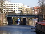
|
Second diagonal bridge The second diagonal bridge leads Diagonalstrasse over the Rückers Canal in Hamm-Süd. |
Street |
Hamm ( 53 ° 32 ′ 53 ″ N, 10 ° 3 ′ 39 ″ E ) |
|

|
Second Greven Bridge The name of the bridge goes back to the street name Grevenweg. The designation "Greven" points back to the former owners, the Counts of Holstein. |
Street |
Hammerbrook , Hamm ( 53 ° 32 ′ 57 ″ N, 10 ° 2 ′ 35 ″ E ) |
|

|
Second Hammerbrook Bridge The bridge crosses the Mittelkanal near the Hammerbrook S-Bahn station. |
Street |
Hammerbrook ( 53 ° 32 ′ 50 ″ N, 10 ° 1 ′ 24 ″ E ) |
|
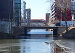
|
Second Heidenkampbrücke With this bridge the Heidenkampsweg crosses the Mittelkanal between Süderstrasse and Wendenstrasse. The First Heidenkamp Bridge no longer exists. It led over the north canal, which was filled in after the war (now Nordkanalstrasse). |
Street |
Hammerbrook ( 53 ° 32 ′ 55 ″ N, 10 ° 1 ′ 41 ″ E ) |
|
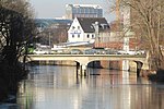
|
Second Luisenbrücke A bridge between Sorbenstrasse and Süderstrasse that crosses the southern canal in the Hamm district. The bridge is named after the Luisenweg. |
Street |
Hamm ( 53 ° 32 ′ 56 ″ N, 10 ° 2 ′ 47 ″ E ) |
|

|
Second Nagelsbrücke The bridge is named after the Nagelsweg, with which it crosses the central canal. |
Street |
Hammerbrook ( 53 ° 32 ′ 47 ″ N, 10 ° 1 ′ 12 ″ E ) |
|

|
Second Osterbrook Bridge crosses the southern canal with the street Osterbrook between Wendenstraße and Süderstraße. Formerly a road bridge, only rebuilt as a pedestrian bridge after the war. |
Footpath and bike path |
Hamm ( 53 ° 32 ′ 53 ″ N, 10 ° 3 ′ 18 ″ E ) |
|

|
Second Peuter Bridge The bridge is named after the Peutekanal , which it crosses with Hovestrasse. It is the southern of the two Peuter bridges. |
Street |
Veddel ( 53 ° 31 ′ 25 ″ N, 10 ° 1 ′ 41 ″ E ) |
|

|
The second cross channel bridge is the eastern of the two cross channel bridges and crosses the channel of the same name in the course of the Worth dam. |
Road, railroad |
Kleiner Grasbrook , Steinwerder ( 53 ° 31 ′ 57 ″ N, 9 ° 58 ′ 55 ″ E ) |
|
|
The second Rugenberg lock bridge led over the southern lock chamber , which had meanwhile been filled in |
Road, railroad |
Waltershof ( 53 ° 31 ′ 23 ″ N, 9 ° 56 ′ 4 ″ E ) |
literature
- Sven Bardua: Hamburg as a bridge metropolis. Architecture and technology history up to 1945. Dölling and Galitz Verlag, Hamburg 2009, ISBN 978-3-937904-88-7 .
- Horst Beckershaus: The Hamburg bridges. Their names - where they come from and what they mean. Convent Verlag, Hamburg 2007, ISBN 978-3-86633-007-8 .
- Friedhelm Grundmann, Michael Zapf: Hamburg. City of bridges. Medien-Verlag Schubert, Hamburg 2003, ISBN 3-929229-89-7 .
- Johann Hermann Maack: Bridges for Hamburg. Dingwort-Verlag, Hamburg 1983, ISBN 3-87166-028-0 .
- Eigel Wiese: The bridges of Hamburg. Illustrated book, European Publishing House, 2008
Web links
- Hamburg.de: Hamburg and its bridges
- Pro Wohnen: Bridges in Hamburg
- Private homepage: Bridges in Hamburg
- State Office for Roads, Bridges and Waters - Structural Engineering Division
- Brücken.web: Bridges in Hamburg
Individual evidence
- ^ Sven Bardua: Bridge metropolis Hamburg. Architecture - Technology - History up to 1945. Dölling and Galitz Verlag, Hamburg 2009, ISBN 978-3-937904-88-7 , p. 15.
- ^ Sven Bardua: Bridge metropolis Hamburg. Architecture - Technology - History up to 1945. Dölling and Galitz Verlag, Hamburg 2009, ISBN 978-3-937904-88-7 , p. 156.
- ↑ a b c d e Horst Beckershaus: The Hamburg bridges. Their names - where they come from and what they mean. Convent Verlag, Hamburg 2007, ISBN 978-3-86633-007-8 .
- ^ Sven Bardua: Bridge metropolis Hamburg. Architecture - Technology - History up to 1945. Dölling and Galitz Verlag, Hamburg 2009, ISBN 978-3-937904-88-7 , pp. 6, 31, 52 f.
- ^ Sven Bardua: Bridge metropolis Hamburg. Architecture - Technology - History up to 1945. Dölling and Galitz Verlag, Hamburg 2009, ISBN 978-3-937904-88-7 , pp. 40, 64.
- ^ Sven Bardua: Bridge metropolis Hamburg. Architecture - Technology - History up to 1945. Dölling and Galitz Verlag, Hamburg 2009, ISBN 978-3-937904-88-7 , p. 101 ff.
- ^ Sven Bardua: Bridge metropolis Hamburg. Architecture - Technology - History up to 1945. Dölling and Galitz Verlag, Hamburg 2009, ISBN 978-3-937904-88-7 , p. 159.
- ^ Sven Bardua: Bridge metropolis Hamburg. Architecture - Technology - History up to 1945. Dölling and Galitz Verlag, Hamburg 2009, ISBN 978-3-937904-88-7 , p. 119.
- ^ Sven Bardua: Bridge metropolis Hamburg. Architecture - Technology - History up to 1945. Dölling and Galitz Verlag, Hamburg 2009, ISBN 978-3-937904-88-7 , p. 175.
- ^ A b Sven Bardua: Bridge metropolis Hamburg. Architecture - Technology - History up to 1945. Dölling and Galitz Verlag, Hamburg 2009, ISBN 978-3-937904-88-7 , p. 154.
- ↑ Horst Beckershaus: The Hamburg bridges their names - where they come from and what they mean. Convent Verlag, Hamburg 2007, ISBN 978-3-86633-007-8 , p. 18.
- ↑ HafenCity: Inauguration of the Busan Bridge , accessed on October 22, 2016.
- ^ Sven Bardua: Bridge metropolis Hamburg. Architecture - Technology - History up to 1945. Dölling and Galitz Verlag, Hamburg 2009, ISBN 978-3-937904-88-7 , p. 101 f.
- ↑ Geoportal Hamburg
- ↑ Press release of the LSBG v. 2nd July 2015
- ↑ Short message in the Hamburger Abendblatt from February 26, 2013
