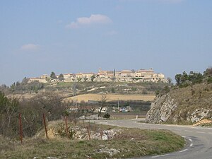
Lussan (Gard)
| Lussan | ||
|---|---|---|

|
|
|
| region | Occitania | |
| Department | Gard | |
| Arrondissement | Nîmes | |
| Canton | Alès-2 | |
| Community association | Pays d'Uzès | |
| Coordinates | 44 ° 9 ' N , 4 ° 22' E | |
| height | 110-345 m | |
| surface | 46.92 km 2 | |
| Residents | 486 (January 1, 2017) | |
| Population density | 10 inhabitants / km 2 | |
| Post Code | 30580 | |
| INSEE code | 30151 | |
| Website | http://www.gard-provencal.com/vv/lussan.htm | |
 Lussan |
||
Lussan is a municipality with 486 inhabitants (as of January 1, 2017) in the French department of Gard .
The tourist town is located on a hilltop above the valley of the river Aiguillon .
The 5.6 m high menhir La Pierre Plantée de Lussan (also called la Peyro Plantado or Occitan "la Leca" - in English "the stone") stands in the garrigue , away from the village.
Population development
| year | 1962 | 1968 | 1975 | 1982 | 1990 | 1999 | 2007 | 2017 |
|---|---|---|---|---|---|---|---|---|
| Residents | 271 | 268 | 294 | 331 | 357 | 402 | 450 | 486 |
| Sources: Cassini and INSEE | ||||||||
Web links
Commons : Lussan - collection of images, videos and audio files

