Sorel
| Sorel | ||
|---|---|---|

|
|
|
| region | Hauts-de-France | |
| Department | Somme | |
| Arrondissement | Péronne | |
| Canton | Péronne | |
| Community association | Haute Somme | |
| Coordinates | 50 ° 1 ' N , 3 ° 3' E | |
| height | 99-148 m | |
| surface | 7.94 km 2 | |
| Residents | 162 (January 1, 2017) | |
| Population density | 20 inhabitants / km 2 | |
| Post Code | 80240 | |
| INSEE code | 80737 | |
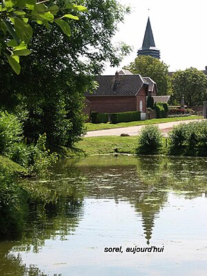
 The Church of Sorel |
||
Sorel (Picard: Soerel) is a French municipality with 162 inhabitants (at January 1, 2017) in the department of Somme in the region of Hauts-de-France in northern France. The municipality belongs to the canton of Péronne .
geography
The municipality is located between Fins and Heudicourt on the D222 department road and south of the D58 department road, which is part of the Chaussée Brunehaut system .
history
The Sohier von Vermand built a fortress in the area of the municipality, which is mentioned in documents in 1214, and around which a settlement developed. The hospital hospice built here became a ruin around 1550. In 1748 the lordship was elevated to a county. The community, which was destroyed in the First World War and whose reconstruction was directed by the architect Louis Faille , was awarded the Croix de guerre 1914–1918.
Residents
| 1962 | 1968 | 1975 | 1982 | 1990 | 1999 | 2006 | 2010 |
|---|---|---|---|---|---|---|---|
| 236 | 223 | 197 | 184 | 187 | 163 | 163 | 173 |
administration
Mayor (maire) has been Bernard Dazin since 1995.
Attractions
- Saint-Gervais church from 1932, stained glass windows by Louis Barillet
