
Swabia (Bavaria)
| Swabia | |||
|---|---|---|---|
|
|||
| State : | Germany | ||
| State : | Bavaria | ||
| Administrative headquarters : | augsburg | ||
| Biggest cities: |
1. Augsburg 2. Kempten (Allgäu) 3. Neu-Ulm 4. Kaufbeuren |
||
| Area : | 9,992.03 km² | ||
| Residents : | 1,899,442 (December 31, 2019) | ||
| Population density : | 190 inhabitants per km² | ||
| District President: | Martin Sailer ( CSU ) | ||
| District President: | Erwin Lohner | ||
| Website : | |||
  Location in Bavaria and Germany |
|||


Swabia is an area in the Free State of Bavaria that - as usual in Bavaria - is administered both as a state administrative district and as a municipal district . The administrative seat of the government district and the district is Augsburg .
Name - origin and meaning
The name Bavarian Swabia is also widespread , as the area only comprises a little more than a third of the area that is perceived as Swabia today. This "total Swabia" is no longer territorially tangible, but has its origin in the earlier political structures, namely the early modern Swabian district and the medieval Duchy of Swabia . Bavarian Swabia is easily confused with this entire Swabian region. Similarly, what is now perceived as "the other half" of Swabia, namely Württemberg , is often incorrectly equated with the Swabian area as a whole.
Bavarian Swabia is currently the only political territory that uses the name Swabia. Although there are also smaller areas in Bavarian Swabia that belong to the Bavarian dialect area (see section on linguistic delimitation ), the tourism industry advertises with the motto “Where Bavaria talks Swabian”.
structure
Swabia comprises four independent cities and ten rural districts :
One district cities

Rathausplatz in Augsburg

Downtown Kempten
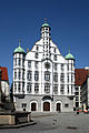
Town hall in Memmingen

Downtown Kaufbeuren


Counties
- Aichach-Friedberg district
- District of Augsburg
- District of Dillingen on the Danube
- Donau-Ries district
- District of Günzburg
- District of Lindau (Lake Constance)
- District of Neu-Ulm
- District of Oberallgäu
- District of Ostallgäu
- District of Unterallgäu
Former county names:
- In the transition period from July 1, 1972 to April 30, 1973, the district of Aichach-Friedberg was called the district of Augsburg-Ost.
- In the transition period from July 1, 1972 to April 30, 1973, the Augsburg district was called the Augsburg-West district.
- In the transition period from July 1, 1972 to April 30, 1973, the district of Donau-Ries was called the district of Nördlingen-Donauwörth. The seat of the district administration was in Nördlingen.
- The district of Günzburg was called Günzkreis in the transition period from July 1, 1972 to April 30, 1973.
- The district of Neu-Ulm was called Illerkreis in the transition period from July 1, 1972 to April 30, 1973.
- In the transition period from July 1, 1972 to April 30, 1973, the district of Ostallgäu was called the district of Marktoberdorf.
- In the transition period from July 1, 1972 to April 30, 1973, the district of Unterallgäu was called the district of Mindelheim.
Outline before the district reform

Before the district reform on July 1, 1972, Swabia had ten independent cities and 20 districts:
District-free cities before the district reform
- augsburg
- Dillingen an der Donau (today a large district town in the district of Dillingen an der Donau )
- Günzburg (today a major district town in the Günzburg district )
- Kaufbeuren
- Kempten (Allgäu)
- Lindau (today a large district town in the Lindau district )
- Memmingen
- Neuburg an der Donau (today a large district town in the district of Neuburg-Schrobenhausen )
- Neu-Ulm (today a major district town in the Neu-Ulm district )
- Nördlingen (today a major district town in the Donau-Ries district )
Counties before the district reform
- District of Augsburg
- District of Dillingen on the Danube
- District of Donauwörth (today part of the LKR Donau-Ries )
- District Friedberg (today part of the LKR Aichach-Friedberg )
- District of Füssen (today part of the LKR Ostallgäu )
- District of Günzburg
- District Illertissen (split today; the southern half went to the LKR Unterallgäu , the northern half to the LKR Neu-Ulm )
- Kaufbeuren district (today part of the Ostallgäu district)
- District of Kempten (Allgäu) (today part of the district of Oberallgäu)
- District of Krumbach (Swabia) (today part of the LKR Günzburg )
- District of Lindau (Lake Constance)
- Marktoberdorf district (today part of the Ostallgäu district )
- District of Memmingen (today part of the district of Unterallgäu )
- District of Mindelheim (today part of the district of Unterallgäu )
- District of Neuburg an der Donau (today largely part of the district of Neuburg-Schrobenhausen (Upper Bavaria))
- District of Neu-Ulm
- District of Nördlingen (today part of the district of Donau-Ries )
- District of Schwabmünchen (today part of the district of Augsburg )
- District of Sonthofen (today part of the district of Oberallgäu)
- District of Wertingen (today split; the southern half went to the district of Augsburg , the northern half to the district of Dillingen an der Donau )
history


In 1803 the Bavarian Province of Swabia was formed under a regional directorate in Ulm from Swabian areas that fell to Bavaria through the Reichsdeputationshauptschluss . Parts of it only became Bavarian two years later with the Peace of Pressburg . Other parts such as Höchstädt on the Danube have belonged to Bavaria since the Middle Ages when Ludwig the Strict inherited his nephew Conradin of Swabia , or later to Pfalz-Neuburg . In the new Kingdom of Bavaria , these parts were divided into three districts in 1808 ( Oberdonaukreis , Lechkreis , Illerkreis ), which were combined in 1817 to form the Oberdonaukreis with the administrative seat of Augsburg. In 1837, based on the Duchy of Swabia , the former eastern part of which it forms, it was renamed the District of Schwaben and Neuburg , with the District Court of Neuburg an der Donau being added to the district, while the District Courts of Aichach , Friedberg and Rain fell back to Upper Bavaria . Rain returned to the district in 1879. In 1900, as part of a reorganization of the districts, the Schwabmünchen district office was established by dividing the Augsburg district office . In 1929 the district office of Zusmarshausen was dissolved. The municipalities of this district office were then assigned to the district offices of Augsburg and Wertingen . In the Weimar Republic, beginning with the revolution in 1918, the region was the scene of intense labor disputes and strikes - statistics from the historian Claus-Peter Clasen count a total of 131 strikes and lockouts, primarily in the textile and metal industries, but also in the construction industry. The wage strikes were a continuation of the activity of the workers' movement , which increased with World War II and the Revolution and sought to improve living conditions for the working population. This movement came to an end in 1933 - social democracy and trade unions were also banned in Bavarian Swabia, and strikes were illegal. In 1938 the name Schwaben und Neuburg was shortened to Schwaben . In 1939, the district offices were renamed “uniformly across the empire” as rural districts. In 1940, the city of Donauwörth lost its status as a city in the immediate vicinity of a district. In 1944, the Friedberg district passed from the Upper Bavarian administrative region to the Swabian administrative region. The district of Lindau was removed from the area as part of the French occupation zone in 1945 , but reintegrated in a referendum in 1955. During that time it had the historic German license plate FBY for "French Bavaria". In 1972, the city and the main part of the district of Neuburg ad Donau as well as the Fuchstal communities of the previous district of Kaufbeuren fell to Upper Bavaria and the main part of the previous district of Aichach to Swabia.
geography
The Bavarian Swabia landscape lies in the southwest of Bavaria and extends from Ries in the north to the Bavarian Allgäu in the south. In the west, Bavarian Swabia is largely bounded by the Iller , in the south partly by Lake Constance and in the east by the Lech or Lechrain . It borders in the north on Middle Franconia , in the east on Upper Bavaria , in the south on Tyrol and Vorarlberg in Austria , in Lake Constance on the canton of St. Gallen in Switzerland and in the west on Baden-Württemberg . The geographical center is in the village of Eppishausen . The highest peak is the Hochfrottspitze in the Allgäu Alps .
Natural units
- Nördlinger Ries as part of the Swabian Keuper-Lias-Land
- Swabian Alb
- Donau-Iller-Lech-Platte
- Bavarian Alpine Foreland
- Northern Limestone Alps
Landscapes
- Allgäu
- Donauried
- Lechfeld
- Upper Swabia # Central Swabia
- North Swabia (Bavaria)
- Augsburg Nature Park - Western Forests
- Nördlinger Ries
- Upper Swabia
- Swabian Donaumoos
Rivers
- Brenz
- Danube
- Egau
- Gunz
- Iller
- Comb
- Kessel (Danube)
- Lech
- Mindel
- Nau
- Pair
- Schmutter
- Singold
- Wertach
- Wörnitz
- Vils (Lech)
- Together
Lakes
- Alatsee
- Alpsee (near Füssen)
- Großer Alpsee (near Immenstadt)
- Motorway lake in the city of Augsburg
- Bannwaldsee
- Lake Constance
- Forggensee
- Grüntensee
- Hopfensee
- Ilsesee (Bavaria) in Augsburg
- Kuhsee in Augsburg
- Niedersonthofener See
- Rottachsee
- Schwansee
- Stempflesee in Augsburg
- Weißensee (lake in the Allgäu)
economy
In comparison with the gross domestic product of the European Union, expressed in purchasing power standards, Swabia achieved an index of 123 (EU-28 = 100) (2015).
- Industry
- Textile industry
- tourism
- chemical industry
- mechanical engineering
In contrast to the rest of Bavaria, the electricity in the area is provided by RWE AG.
In 2017 the unemployment rate according to Eurostat definition was 2.6%. Swabia is one of the areas with the lowest unemployment in the entire European Union.
traffic
Significant long-distance trade routes ran through Swabia in the pre-industrial era. These included, for example, the famous Via Claudia in Roman times or medieval trade routes across the Alps to Venice. These and other roads contributed significantly to the flourishing of trade in Swabia and the development of the cities.
With the beginning of the industrial revolution , a dense railway network was built in Swabia by the turn of the century. The subsequent construction of modern highways in the first half of the 20th century also gave the administrative district an efficient regional road network.
The second half of the 20th century was characterized by steady growth in traffic and transport services. At the same time, there was a shift from rail to road and air traffic also gained in importance in Swabia. As a result, the existing highways and the two airfields in Augsburg and Memmingen were expanded and railway lines were closed, especially in rural areas. On January 1, 1979, the route network of the German Federal Railroad in Swabia comprised around 680 kilometers of main line and 395 kilometers of secondary line .
Religions
The inhabitants of Swabia are (like the old Bavaria ) predominantly Catholic , although there is an important Protestant minority, which is mainly in the Nördlinger Ries and the former imperial city territories of Ulm and Memmingen. Except in the former imperial cities of Augsburg, Lindau, Memmingen, Nördlingen, Kaufbeuren and Kempten, the Lutheran denomination only survived in a few places that were once imperial knighthoods ( Bächingen an der Brenz , Burtenbach , Haunsheim ). The Catholic Christians are mainly represented by the diocese of Augsburg , in the district of Donau-Ries partly also by the diocese of Eichstätt . The inhabitants of the Allgäu are almost exclusively Catholic.
There is also a Jewish community in Augsburg. There are also Muslim communities in the larger cities such as Augsburg, Kempten, Memmingen, Neu-Ulm or Kaufbeuren . Members of various Orthodox Christian churches also live here .
According to the 2011 census , 60.8% of the population were Catholic, 16.5% Protestant, 1.5% Orthodox and 0.5% Evangelical-Free Church Christians, 0.1% were of Jewish faith, 3.1% belonged to others and 17, 5% do not participate in any religious community under public law.
Protected areas
In Bavarian Swabia there are 59 nature reserves , 115 landscape protection areas , 120 FFH areas , twelve EU bird protection areas and at least 233 geotopes (as of April 2016). The largest nature reserve in the area is the Ammergau Alps .
See also:
- List of nature reserves in Swabia (Bavaria)
- List of landscape protection areas in Swabia (Bavaria)
- List of FFH areas in Swabia (Bavaria)
- List of EU bird sanctuaries in Swabia (Bavaria)
- List of geotopes in Swabia (Bavaria)
Linguistic demarcation

The area fell to Bavaria in the years after secularization in 1803. Only the later district of Aichach-Friedberg belonged to Bavaria from the beginning (since the 6th century). Apart from the old Bavarian Aichach, Swabian-Alemannic dialects are spoken, but Swabian echoes can also be found in and around Aichach (“Konnsch, muasch” for can / must), as it is a transitional dialect typical in western Old Bavaria. In spite of this dialectal peculiarity, however, the Aichach people see themselves as Upper Bavaria.
Due to the dialect continuum, the language colors differ from the Swabian dialects spoken in Württemberg . The eastern linguistic border compared to the Bavarian local dialects is the Lech with some shifts around Augsburg, Landsberg / Lech, Schongau and Füssen. This is even visible on a map: Many places west of the Lech end in the Swabian-Alemannic -ingen while many places east of the Lech with the Bavarian -ing ending.
The vocabulary of the dialects of Bavarian Swabia is recorded and described in the Swabian dictionary . The language geography of the various local dialects is shown in the language atlas of Bavarian Swabia .
district
The district of Swabia, together with the other Bavarian districts, forms the third municipal level in the state. The core tasks of the district are in the social and cultural area. The organs of the district are the district council , the district committee and the district council president ( Art. 21 district regulations ).
history
The Kingdom of Bavaria was still to Prussia divided into circles its territory 1806th From 1828 to 1919 there was a district councilor (h) as a representative body for Swabia ( Upper Danube district until 1837), from 1919 to 1945 the corresponding term was district council or district association day , as the name "district" was aligned with the Prussian name "district" during the Nazi era has been. In 1939 the “district offices” were renamed uniformly throughout the empire into “districts”, which the Constitution of the Free State of Bavaria ignored shortly after the Second World War. The local parliaments, called district days despite the provisions in the constitution, were re-elected in 1954 for the first time after the Second World War .
District day
| choice | CSU | SPD | FW | Green | FDP | The left | REP | ödp | NPD | GDP¹ | BP | Pirates | AfD | total |
|---|---|---|---|---|---|---|---|---|---|---|---|---|---|---|
| 2018 | 13 | 3 | 5 | 6th | 2 | 1 | 1 | 1 | 4th | 36 | ||||
| 2013 | 13 | 4th | 3 | 2 | 1 | 2 (up to 2017: 1) | 1 | 1 | 0 (up to 2017: 1) | 27 | ||||
| 2008 | 13 | 4th | 4th | 2 | 2 | 1 | 26th | |||||||
| 2003 | 18th | 4th | 2 | 2 | 26th | |||||||||
| 1998 | 17th | 8th | 2 | 1 | 1 | 29 | ||||||||
| 1994 | 18th | 7th | 2 | 1 | 1 | 29 | ||||||||
| 1990 | 18th | 7th | 2 | 1 | 1 | 29 | ||||||||
| 1986 | 19th | 7th | 2 | 1 | 29 | |||||||||
| 1982 | 20th | 8th | 1 | 29 | ||||||||||
| 1978 | 20th | 8th | 1 | 29 | ||||||||||
| 1974 | 20th | 8th | 1 | 29 | ||||||||||
| 1970 | 19th | 9 | 1 | 29 | ||||||||||
| 1966 | 16 | 10 | 1 | 2 | 29 | |||||||||
| 1962 | 16 | 9 | 1 | 2 | 1 | 29 | ||||||||
| 1958 | 16 | 7th | 1 | 3 | 2 | 29 | ||||||||
| 1954 | 14th | 7th | 1 | 3 | 4th | 29 |
¹ 1954 and 1958 GB / BHE
President of the District Council (until 1919), District Assembly or District Association (1919 to 1945) and District Assembly (from 1954)
- Josef Mundig, 1829
- Anton Anselm Prince Fugger von Babenhausen , 1830–1832, 1833–1835
- Friedrich Karl Freiherr von Eyb, 1833
- Franz Graf von Paumgarten, 1836–1837
- Marquard Freiherr von Stain, 1838–1845
- Joseph von Weiß, 1846–1851
- Ernst von Stetten, 1852–1863
- Ulrich von Zoller, 1864
- Oskar von Stobäus , 1865–1867
- Julius von Röck, 1868–1883
- Oskar von Lossow, 1884-1893
- Balthasar von Reiger, 1894–1898
- Adolf Horchler, 1899-1919
- Otto Merkt , 1919–1945
- Albert Kaifer ( CSU ), 1954–1958
- Josef Fischer (CSU), 1958–1974
- Georg Simnacher (CSU), 1974-2003
- Jürgen Reichert (CSU), 2003–2018
Martin Sailer ( CSU ) has been the District Assembly President since November 8, 2018 . His deputy is Barbara Holzmann ( Greens ). Further deputies are Johann Fleschhut ( FW ), Edgar Rölz and Alfons Weber (both CSU ). (Sources below)
coat of arms
The coat of arms was approved by the Bavarian State Ministry of the Interior on October 15, 1965.
Blazon : “Under a golden shield head, inside a growing, red-armored and gold nimbed black double-headed eagle, split; at the front split by red and silver, at the back five times at an angle to the left split by silver and red, covered with a golden pole. "
The eagle of the old empire is not only intended to symbolize the Swabian imperial cities of Augsburg, Kaufbeuren, Memmingen, Kempten, Lindau, Donauwörth, Nördlingen, and (with some areas) Ulm, but also the extensive former imperial estate of the Hohenstaufen and the territories of the imperial knighthood. The shield of the Augsburg bishopric, split in red and silver, is representative of the spiritual territories up to 1803, among which the prince monastery Kempten , the abbeys Ottobeuren, Irsee, Roggenburg, Wettenhausen, Ursberg, Kaisheim and Elchingen, as well as the ladies monastery Lindau should be mentioned. The Hochstiftisch-Augsburg areas stretched from the area south of Neresheim to the Allgäu Alps, so that this symbol directly addresses a wide strip of land to the left of the Lech.
With the old coat of arms of the margraviate of Burgau , Central Swabia in particular is represented in the district's emblem with parts of the districts of Günzburg, Illertissen, Neu-Ulm and Krumbach. In addition, it is intended to commemorate all immediate secular territories in the Swabian area up to the end of the old empire, e.g. B. to the widely scattered Fuggerian areas, the property complex of the lines of the House of Oettingen around Nördlingen and finally to the old Wittelsbach areas on the Lech and Danube, as well as Wemding, Schwangau and Mindelheim. Instead of heraldic references to the Wittelsbachers, the Swabian peculiarity of the present case was the coat of arms of the margraviate of Burgau, which was part of the Upper Austrian margraviate up to 1805, which also makes a good artistic reference to the Augsburg bishopric coat of arms, which is related in color.
flag
The flag is striped red and yellow with the district coat of arms.
Partnerships
Regional partnerships exist between the Swabian district and the Mayenne department in France (since 1987) and Bukovina in Romania and the Ukraine (1997).
Facilities
The district has set up the municipal company District Clinics Swabia and maintains vocational schools, district homeland maintenance, research and advice centers for traditional costumes and clothing culture as well as for folk music. He is also the sponsor of the KulturLand Ries Museum (formerly Rieser Bauernmuseum Maihingen) and the Oberschönenfeld Museum and, through a special-purpose association, is involved in the Swabian Farm Museum in Illerbeuren .
Administrative district
The administrative district of Swabia is geographically identical to the district of Swabia. He is the area of responsibility of the state middle authority government of Swabia .
District President
General Commissioners of the Upper Danube District (until 1837) and District President of Swabia
| Surname | Term of office (beginning) | Term of office (end) |
|---|---|---|
| Karl Ernst von Gravenreuth | April 1, 1817 | September 29, 1826 |
| Karl Joseph von Drechsel | January 1, 1827 | 1828 |
| Ludwig zu Oettingen-Wallerstein | April 14, 1828 | December 31, 1831 |
| Franz Arnold Linck | January 1, 1832 | January 18, 1838 |
| Carl Albert Leopold von Stengel | February 1, 1838 | November 30, 1843 |
| Anton von Fischer | December 1, 1843 | June 30, 1849 |
| Georg Karl von Welden | July 1, 1849 | July 24, 1857 |
| Ernst von Lerchenfeld | January 1, 1858 | September 23, 1868 |
| Theodor von Zwehl | September 24, 1868 | September 10, 1870 |
| Winfried Hörmann from Hörbach | September 11, 1870 | February 28, 1887 |
| Wilhelm von Pechmann | March 1, 1887 | May 21, 1887 |
| Joseph von Kopp | July 1, 1887 | September 30, 1897 |
| Wilhelm von Lermann | October 6, 1897 | May 31, 1906 |
| Paul von Praun | June 1, 1906 | September 30, 1923 |
| Heinrich von Spreti | October 1, 1923 | June 30, 1933 |
| Otto Dorn (acting) | July 1, 1933 | June 15, 1934 |
| Karl Wahl | July 5, 1934 | April 28, 1945 |
| Otto Schwaab (acting) | April 28, 1945 | May 24, 1945 |
| Konrad Kreißelmeyer | May 25, 1945 | December 31, 1948 |
| Hans Martini | July 1, 1949 | July 31, 1955 |
| Michael Fellner | August 1, 1955 | November 30, 1966 |
| Frank Sieder | 1st December 1966 | May 31, 1984 |
| Rudolf Dörr | June 1, 1984 | May 31, 1993 |
| Ludwig Schmid | June 1, 1993 | August 31, 2008 |
| Karl Michael Scheufele | September 1, 2008 | April 14, 2018 |
| Erwin Lohner | 1st May 2018 | in office |
literature
- Rainer Jedlitschka, Marita Krauss (ed.): Administrative elite and region. The regional presidents of Swabia from 1817 to 2017 , Volk Verlag, Munich 2017.
- Walter Heubach: Schwaben 1987. An administrative district introduces itself . Globel-Verlag, Möglingen 1987.
- Swabia . Text booklet for the wall newspaper “Society and State”, Munich 1994.
- Dietrich Bessler: The district - partner of its citizens. In: Bavarian Swabia. Stadler Verlag, Konstanz 1996, pp. 265-275.
- Claus-Peter Clasen: Strike statistics for Bavarian Swabia 1919 to 1934. In: Work - Movement - History , Issue 3/2017, pp. 130-145.
- Dieter Draf et al. (Ed.): Swabia - Bavaria - Europe. Future perspectives of the Bavarian districts . Festschrift for Georg Simnacher. EOS Verlag, St. Ottilien 1992.
- Pankraz Fried : Bavarian Swabia. Principles of the historical development . Munich 1994.
- Bernhard Hagel among others: History of the Schwaben District Assembly . Volumes I – V, Augsburg 1978 to 1987.
- Bernhard Hagel, Peter Klimm: The Swabian District: From District Councilor to Modern Self-Administration. In: ebbes 2/1994, pp. 20-22.
- Johann M. Hübler: Bavarian Swabia and Neuburg and its neighboring areas. A country and folklore . Hobbing & Büchle, Stuttgart 1901 (digitized version )
- Stefan Heinze: The Bavarian Swabia region. Studies on Swabian regionalism in the 19th and 20th centuries. Publishing house of the Swabian Research Association , Augsburg 1995.
- Georg Simnacher: Swabia and Europe. In: Bavarian Swabia. Konstanz 1996, pp. 101-110.
- Georg Simnacher: 150 years of Bavarian districts - an anniversary at the beginning of full self-government. In: Swabia - Tradition and Progress. Konrad Verlag, Weißenhorn 1997, pp. 1-10.
- Georg Simnacher: University of Augsburg and Swabia District. In: Swabia - Tradition and Progress. Konrad Verlag, Weißenhorn 1997, pp. 11-16.
- Theo Stammen : Enviable: The district, the third municipal level in Bavaria. In: ebbes 2/1994, p. 23.
- Wolfgang Wüst , Georg Kreuzer, David Petry (eds.): Crossing borders. The foreign relations of Swabia in the Middle Ages and modern times (Journal of the Historical Association for Swabia 100). Wißner Verlag, Augsburg 2000, ISBN 978-3-89639-674-7 .
- Life pictures from Bavarian Swabia. So far 19 volumes (as of 2019). Publications of the Swabian Research Foundation at the Commission for Bavarian State History, Munich et al. 1952 ff.
- Thomas Pfundner: Historical landmarks in Bavarian Swabia - inventory of an infinite field . Konrad Verlag, Weißenhorn 2015, ISBN 978-3-87437-568-9 .
- Paul Hoser : History of the District of Swabia from the Post-War Period to 2003 , will be published on June 22, 2017 in the Schwaben District Home Care series on history and culture
Web links
- Swabia (Bavaria): Official statistics of the LfStat
- Bavarian Swabia - (Tourismusverband Allgäu / Bavarian Swabia e.V.)
- BSAktuell - Bayerisch-Schwaben-Aktuell - (online portal for the Bavarian Swabia region)
- Talking language atlas of Bavaria - audio documents from 70 locations, 12 of them from Bavarian Swabia
Individual evidence
- ↑ "Data 2" sheet, Statistical Report A1200C 202041 Population of the municipalities, districts and administrative districts 1st quarter 2020 (population based on the 2011 census) ( help ).
- ↑ http://www.bayerisch-schwaben.de/ (February 14, 2015)
- ↑ Claus-Peter Clasen: Strike statistics for Bavarian Swabia 1919 to 1934. In: Work - Movement - History , Issue 3/2017, pp. 130–145.
- ↑ The surveying administration presents the geographical center of Swabia
- ↑ Eurostat. (PDF) Retrieved August 22, 2018 .
- ↑ Unemployment rate, by NUTS 2 regions. Retrieved November 5, 2018 .
- ↑ Walther Zeitler, Helge Hufschläger: The railway in Swabia . Motorbuch Verlag, Stuttgart, 1980, ISBN 3-87943-761-0 , page 7.
- ↑ results.zensus2011.de
- ↑ bekreis-schwaben.de
- ↑ District elections in Bavaria since 1954. In: wahlen.bayern.de. Retrieved September 16, 2013 .
- ↑ Information on the pages of the district. (Accessed January 29, 2019)
- ^ Suffrage - News - District elections in Bavaria: CSU gets 10 seats "too many" because of d'Hondt. In: Wahlrecht.de. Retrieved September 16, 2013 .
- ^ Bernhard Hagel: From the district administrator of the Upper Danube district to the district council of Swabia (1828–1987). AV-Verlag, Augsburg 1988.
- ^ Page “District President” on the district's website
- ^ Directory of the district's facilities .
Coordinates: 48 ° 9 ' N , 10 ° 28' E