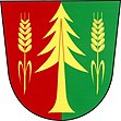
Zálesí
| Zálesí | ||||
|---|---|---|---|---|
|
||||
| Basic data | ||||
| State : |
|
|||
| Region : | Jihomoravský kraj | |||
| District : | Znojmo | |||
| Area : | 717.8837 ha | |||
| Geographic location : | 48 ° 57 ' N , 15 ° 47' E | |||
| Height: | 431 m nm | |||
| Residents : | 169 (Jan. 1, 2019) | |||
| Postal code : | 671 02 | |||
| License plate : | B. | |||
| traffic | ||||
| Street: | Šumná - Dešov | |||
| structure | ||||
| Status: | local community | |||
| Districts: | 1 | |||
| administration | ||||
| Mayor : | Marie Neubauerová (as of 2015) | |||
| Address: | Zálesí 27 671 02 Šumná |
|||
| Municipality number: | 595152 | |||
| Website : | www.obec-zalesi.cz | |||
Zálesí , until 1949 Šreflová , (German Schröffelsdorf ) is a municipality in the Czech Republic . It is located 23 kilometers northwest of Znojmo and belongs to the Okres Znojmo .
geography
The village of Zálesí, surrounded by extensive forests, is located on a hill above the headwaters of the Záleský creek in the Jevišovická pahorkatina ( Jaispitzer hill country ). To the northeast rises the Hvozdec (444 m nm), in the south the Petrův vrch (466 m nm), west of the Stříbrný kopec ( Silberberg , 523 m nm) and the Suchá hora (571 m nm) and in the northwest the Skalka (560 m) nm). The Thayatal, flooded with the Vranov reservoir, is just under two kilometers south . State road II / 408 between Znojmo and Jemnice runs through the village .
Neighboring towns are Dvur Augustov, Nimpšov , Nové Syrovice , Láz and Častohostice in the north, Prostředeček, Blížkovice , Ctidružice , Grešlové Mýto and Pavlice in the Northeast, Vranovská Ves and Hostěrádky the east, Olbramkostel , Štítary , Lesná and Onšov in the southwest, Vranov , Lančov , Lančovský Dvůr and Jazovice in the south, Podhradí nad Dyjí , Farářka and Bítov in the south-west, Chvalatice and Zblovice in the west and Malý Dešov, Dešov , Černá Blata, Kojatice and Spetice in the north-west.
history
The village was founded by the Moravian provincial chamberlain Ignaz Maria Schröfl Freiherr von Mansperg next to the Jamnitzer Poststrasse on the corridors of the Meierhof bei der Schupfen in the Znojmo free forest, which was dissolved in 1779 and belongs to the Znojmo Obergut Schidrowitz . The new settlers were ten farming families from the surrounding areas. The village, initially called Mansberg and Schröfelsdorf after its founder, was first mentioned in writing in 1786. In 1793, 78 people lived in Schröfelsdorf . In the first half of the 19th century the place was also called Kuliv and Kůlna .
In 1834 Schröfelsdorf consisted of 17 houses with 111 predominantly German-speaking residents. The village was the seat of a forest district. Immediately to the south-west was the settlement Neuhof ( Nový Dvůr ) with 48 inhabitants, subject to the rule of Vöttau and inscribed in Chwallatitz ; it consisted of a sheep farm, a bulk box, farm buildings with apartments for an officer and the staff of the sheep farm, the forest inn on the Znojmo commercial route and five chalets. The parish was Chwallatitz. Until the middle of the 19th century Schröfelsdorf remained subject to the upper estate of the Znojmo urban estates.
After the abolition of patrimonial formed Schrodinger Rock Village / Šrefelsdorf 1849 a district of the municipality Chwallatitz in the judicial district Frain. In 1868 the village became part of the Znojmo region. The spelling Schröffelsdorf was used since 1872 , about a decade later the Czech name form Šreflová was created . In 1880 115 people lived in the village, 94 of them Germans and 21 Czechs. In 1889 a one-class elementary school was established. At the 1900 census there were 149 people in Schröffelsdorf, 93 of them were Germans and 56 were Czechs. After the establishment of Czechoslovakia, there was a large influx of Czechs into the place. The Neuhof settlement was expanded along the district road and gradually grew together with Schröffelsdorf. In 1924 Schröffelsdorf / Šreflová broke up with Neuhof / Nový Dvůr and Augustenhof / Augustov von Chwallatitz and formed its own community. In 1930 there were 295 inhabitants in the 55 houses of the community, including 238 Czechs and 52 Germans. After the Munich Agreement , Schröffelsdorf was added to the German Reich in 1938 and belonged to the Znojmo district until 1945 . In 1939 Schröffelsdorf was merged with Chwallatitz and Vöttau to form a community Waldsee (Thaja) . After the end of the Second World War, Šreflová came back to Czechoslovakia. The municipality of Waldsee (Thaja) was abolished again in 1945. In June 1945 the German residents were expelled from Šreflová . In 1949 the name was changed to Zálesí . In 1961 Zálesí had 344 inhabitants and consisted of 65 houses. In 2006, 186 people lived in the community.
Community structure
No districts are shown for the municipality of Zálesí. Zálesí includes the locality Nový Dvůr ( Neuhof ) and the single layer Dvůr Augustov ( Augustenhof ).
Attractions
- Wooden bell tower of hll. Kyrill und Method, erected in 1948 next to three protected linden trees
- Former Ausspanne (house number 32), monument
- Natural monument Žleby, north of the village by the Doubravka brook
Web links
Individual evidence
- ↑ http://www.uir.cz/obec/595152/Zalesi
- ↑ Český statistický úřad - The population of the Czech municipalities as of January 1, 2019 (PDF; 7.4 MiB)
- ↑ Předpis č. 3/1950 Sb.
- ^ Gregor Wolny : The Margraviate Moravia topographically, statistically and historically described , III. Volume: Znaimer Kreis (1837), pp. 78, 560


