Arue (Landes)
| Arue | ||
|---|---|---|
|
|
||
| region | Nouvelle-Aquitaine | |
| Department | Country | |
| Arrondissement | Mont-de-Marsan | |
| Canton | Haute Lande Armagnac | |
| Community association | Landes d'Armagnac | |
| Coordinates | 44 ° 4 ′ N , 0 ° 21 ′ W | |
| height | 47-113 m | |
| surface | 48.11 km 2 | |
| Residents | 348 (January 1, 2017) | |
| Population density | 7 inhabitants / km 2 | |
| Post Code | 40120 | |
| INSEE code | 40014 | |
| Website | www.arue.fr | |
 Arue Town Hall |
||
Arue is a French municipality with 348 inhabitants (at January 1, 2017) in the department of land in the region Nouvelle-Aquitaine (before 2016: Aquitaine ). The municipality belongs to the arrondissement of Mont-de-Marsan and the canton of Haute Lande Armagnac (until 2015: canton of Roquefort ).
The name in the Gascognic language is Arua . It is derived from the name of the Gallo-Roman village of Atora , which was located in the same place.
The inhabitants are called attrébates .
geography
Arue is located about 25 km northeast of Mont-de-Marsan in the Landes de Gascogne forest in the historic province of Gascogne on the northern edge of the department.
Arue is surrounded by the neighboring communities:
| Lencouacq | Retjons | |
|
Cachen Bélis |

|
Saint-Gor |
| Maillères |
Roquefort Pouydesseaux |
Arue lies in the catchment area of the Adour River .
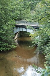
The Douze , also called Doulouze here, flows through the territory of the municipality as well as its tributaries,
- the Estampon with its tributaries,
- the Ruisseau de Ribarrouy and
- the Ruisseau de Nabias, which rises in Arue,
- the Ruisseau du Moulin d'Arue, which rises in Arue, and
- the Gouaneyre .
history
The origins go back at least to the Gallo-Roman times, because the community was formerly a village called Atora . Numerous sarcophagi have been found in Arue and the surrounding area, which suggests that there was a production facility in the Merovingian period. Arue was mentioned in the records in 1306 because the village was the seat of an archpriesthood of the diocese of Aire-sur-l'Adour and had been transformed into a bastide . The archpriesthood comprised eleven parishes and two commanderies in 1572 . No information is available on the history between the 16th and 20th centuries, but it can be assumed that Arue, as the seat of an archpriesthood during the Huguenot Wars and during the French Revolution, had the same hardships as the neighboring parishes. In the 20th century, the economy based on a paper industry flourished.
Population development
After records began, the population rose to a peak of around 820 in the middle of the 19th century. In the following period, the size of the community fell to around 285 inhabitants with short recovery phases until the 1990s, before a phase of growth began that is still today persists.
| year | 1962 | 1968 | 1975 | 1982 | 1990 | 1999 | 2006 | 2010 | 2017 |
|---|---|---|---|---|---|---|---|---|---|
| Residents | 471 | 425 | 347 | 294 | 290 | 286 | 295 | 309 | 348 |
Attractions
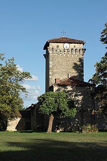
- Parish church in Le Ginx, dedicated to the Apostle Peter . The Romanesque church was built in the 12th century in a clearing in what is now Le Ginx, about 6 km southwest of the center of Arue. Le Ginx used to be a subsidiary of Cachen. Part of the nave and the apse of the original building have survived through the centuries. The latter was originally semicircular, today it has a polygonal finish on the outside, which is supported by two thick buttresses . The church is built of clayey limestone from dumes and shell-containing sandstone , which comes from a quarry in the district of Duraga, whose operation has since been closed. The massive bell tower was probably added to the nave in the 14th century. It was designed as a fortified tower , because loopholes and corbels for holding hurdles are still visible today . The two-storey entrance porch with arched entrance doors to the north and south dates from the 19th century. The house on the south side of the long building is undoubtedly the former rectory . On the north side, the long building is flanked by the sacristy . The church is consecrated to the Apostle Peter, but its unadorned interior contains no depictions of the saint. The nave with a nave is provided with a plaster ceiling, the semicircular choir with a false boiler vault. The church houses furnishings from the 18th to 20th centuries that are registered as national cultural assets. On one side of the church, the residents have set up a museum in a wooden structure that exhibits tools and old things from the late 19th and early 20th centuries.
- Parish church in Arue, dedicated to St. Clarus. The former parish church, dedicated to the Assumption of Mary , was built in the 13th century and was the seat of the archpriesthood. Today's church is a new Romanesque building from 1897 to 1902 in the same place. The cemetery that had surrounded the church was moved on the occasion. The single long house having a length of four yokes is formed by two side bands flanked than Transept and extended by a three-wall apse, be connected to the sides of which two Sacristies. The nave and the side chapels are covered with a groin vault, the choir with a false ribbed vault . In the western part there is an entrance porch the same width as the nave with a bell tower, the octagonal helmet of which is covered with slate . The building shows an irregular interlocking on the corners of the wall with ashlar and beveled buttresses on all sides. Three stained glass windows are by the glass painter Gustave Pierre DAGRANT from Bordeaux that arose in 1902 during the construction of the church. Other items of equipment date from the 18th to 20th centuries and are registered as national cultural assets.
- Sarcophagi. In the Merovingian times, the Duraga quarry was probably connected to a production facility for sarcophagi that processed the sand-lime brick. Not far from the former quarry there is a farm that has a piece of wall or a buttress from the 12th century. It is believed that there was a medieval castle on this site. In one corner, a Merovingian sarcophagus has sunk into the earth on the side of an earlier wall. Its lid has been lost.
Economy and Infrastructure
The municipality's economy is based on agriculture as well as trade and services.

total = 39
education
The municipality has a public pre-school with 19 students in the 2017/2018 school year.
sport and freetime
- The long-distance hiking trail GR 654 from Namur in Belgium via Vézelay to Saint-Jean-Pied-de-Port leads through part of the municipality. It follows the Via Lemovicensis, one of the four Camino de Santiago in France.
- The lagoon of Nabias is ideal for walks and fishing in spring and summer. Information boards provide information about the lagoon and the history of the railways in this part of the Landes.
traffic
Arue can be reached via Routes départementales 9, 626 (former Route nationale 626 ) and 932 (former Route nationale 132 ).
The Autoroute A65 , called Autoroute de Gascogne , crosses the municipality. The Aire de Repos de la Porte d'Armagnac rest area is connected to exit 3, which is designed as a right-hand trumpet and serves Arue and Roquefort .
A railway line from the Compagnie des chemins de fer du Midi , which connected Mont-de-Marsan with Marmande in the Lot-et-Garonne department , also ran through part of the municipality. Operations ceased after the Second World War and the former railway line is now partially used as a hiking or cycling route.
Web links
Individual evidence
- ↑ Arue ( fr ) Gasconha.com. Retrieved January 10, 2018.
- ↑ a b Arue ( fr ) Conseil régional d'Aquitaine. Archived from the original on January 10, 2018. Info: The archive link was inserted automatically and has not yet been checked. Please check the original and archive link according to the instructions and then remove this notice. Retrieved January 10, 2018.
- ↑ Landes ( fr ) habitants.fr. Retrieved January 10, 2018.
- ^ Ma commune: Arue ( fr ) Système d'Information sur l'Eau du Bassin Adour Garonne. Retrieved January 10, 2018.
- ↑ Notice Communale Arue ( fr ) EHESS . Retrieved January 10, 2018.
- ↑ Populations légales 2015 Commune d'Arue (40014) ( fr ) INSEE . Retrieved January 10, 2018.
- ^ Église Saint-Pierre de Ginx ( fr ) Conseil régional d'Aquitaine. Archived from the original on January 10, 2018. Info: The archive link was inserted automatically and has not yet been checked. Please check the original and archive link according to the instructions and then remove this notice. Retrieved January 10, 2018.
- ↑ église paroissiale Saint-Pierre ( fr ) Ministry of Culture and Communication . Retrieved January 10, 2018.
- ↑ Patrimoine ( fr ) Arue community. December 6, 2011. Retrieved January 10, 2018.
- ↑ église paroissiale Saint-Clair ( fr ) Ministry of Culture and Communication . Retrieved January 10, 2018.
- ↑ Sarcophage mérovingien d'Arue ( fr ) Regional Council d'Aquitaine. Archived from the original on January 10, 2018. Info: The archive link was inserted automatically and has not yet been checked. Please check the original and archive link according to the instructions and then remove this notice. Retrieved January 10, 2018.
- ↑ Caractéristiques des établissements en 2015 Commune d ְ 'Arue (40014) ( fr ) INSEE . Retrieved January 10, 2018.
- ^ École maternelle ( fr ) National Ministry of Education. Retrieved January 10, 2018.
- ↑ La voie de Vézelay ( fr ) Agence de Coopération Interrégionale et Réseau “Chemins de Saint-Jacques de Compostelle”. Retrieved January 10, 2018.
- ↑ a b Sentier des lagunes de Nabias ( fr , PDF) Comité régional de tourisme d'Aquitaine. Retrieved January 10, 2018.


