Friedrichsgraben
| coat of arms | Germany map | |
|---|---|---|

|
Coordinates: 54 ° 16 ' N , 9 ° 25' E |
|
| Basic data | ||
| State : | Schleswig-Holstein | |
| Circle : | Rendsburg-Eckernförde | |
| Office : | Hohner Harde | |
| Height : | 1 m above sea level NHN | |
| Area : | 5.39 km 2 | |
| Residents: | 47 (Dec 31, 2019) | |
| Population density : | 9 inhabitants per km 2 | |
| Postal code : | 24799 | |
| Area code : | 04339 | |
| License plate : | RD, ECK | |
| Community key : | 01 0 58 055 | |
| Office administration address: | Hohe Strasse 4 24806 Hohn |
|
| Website : | ||
| Mayoress : | Linda Derner | |
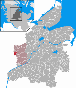
| Location of the municipality Friedrichsgraben in the district of Rendsburg-Eckernförde | ||
Friedrichsgraben ( Danish: Frederiksgrave , Plattdt .: Vossbarg ) is a municipality in the Eider-Treene lowlands in the Rendsburg-Eckernförde district in Schleswig-Holstein . Hohner ferry is in the municipality.
Geography and traffic
Friedrichsgraben is located about 15 km west of Rendsburg on the Harthstorper Moor and the Untereider . The federal highway 202 runs to the north from Rendsburg to Eiderstedt , to the south the federal highway 203 runs from Rendsburg to Heide .
history
It was founded in 1762 as part of the moor colonization and after the Danish King Frederick V named.
Until the completion of the Nordfeld Eider Lock near Drage , the site was threatened several times by floods due to dyke breaches on the Eider. With the construction of the Eider Lock, the sturgeon also disappeared from the upper reaches of the river.
politics
Community meeting
Since fewer than 70 people live in the community, it has, according to § 54 of the Schleswig-Holstein Municipal Code attend no elected local council, but a community meeting where all voting citizens.
coat of arms
Blazon : "In green a slanting left silver wave bar, accompanied by a silver royal crown at the top and a standing silver fox at the bottom."
economy
The municipal area is mainly used for agriculture.
Web links
Individual evidence
- ↑ North Statistics Office - Population of the municipalities in Schleswig-Holstein 4th quarter 2019 (XLSX file) (update based on the 2011 census) ( help on this ).
- ↑ Schleswig-Holstein topography. Vol. 3: Ellerbek - Groß Rönnau . 1st edition Flying-Kiwi-Verl. Junge, Flensburg 2003, ISBN 978-3-926055-73-6 , p. 154 ( dnb.de [accessed April 22, 2020]).
- ↑ Schleswig-Holstein's municipal coat of arms

