Eisendorf
| coat of arms | Germany map | |
|---|---|---|

|
Coordinates: 54 ° 12 ' N , 9 ° 52' E |
|
| Basic data | ||
| State : | Schleswig-Holstein | |
| Circle : | Rendsburg-Eckernförde | |
| Office : | Nortorfer Land | |
| Height : | 27 m above sea level NHN | |
| Area : | 5.49 km 2 | |
| Residents: | 282 (Dec. 31, 2019) | |
| Population density : | 51 inhabitants per km 2 | |
| Postal code : | 24589 | |
| Area code : | 04392 | |
| License plate : | RD, ECK | |
| Community key : | 01 0 58 045 | |
| Office administration address: | Niedernstrasse 6 24589 Nortorf |
|
| Website : | ||
| Mayor : | Bernd Irps (KWG) | |
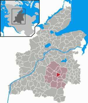
| Location of the municipality of Eisendorf in the Rendsburg-Eckernförde district | ||
Eisendorf is a municipality in the Rendsburg-Eckernförde district in Schleswig-Holstein .
Geography and traffic
Eisendorf is located about 18 km north of Neumünster and 18 km southeast of Rendsburg in the Westensee Nature Park and on the Brahmsee . The place can be reached via the federal highway 205 , the federal highway 7 and the railway line from Rendsburg to Neumünster.
history
Archaeological finds and barrows , of which only remains have survived, prove that the municipality was settled in the Stone Age , Bronze Age and Iron Age .
Eisendorf was first mentioned in 1335 as Eyzendorpe . The place name probably refers to the occurrence of lawn iron ore . A smelting also point slag residues.
politics
Community representation
Since the municipal elections in 2013, the KWG electoral community has all nine seats in the municipal council.
coat of arms
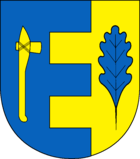
Blazon : "Split by blue and gold in a clapboard cut, on the right a golden stone ax, on the left a blue oak leaf."
economy
The community is predominantly agricultural. A holiday home area has developed at Brahmsee.
Sand is mined in the municipality. A new groundwater-fed lake is to be created within the mining area.
Web links
Individual evidence
- ↑ North Statistics Office - Population of the municipalities in Schleswig-Holstein 4th quarter 2019 (XLSX file) (update based on the 2011 census) ( help on this ).
- ↑ Allocation of seats after local elections in 2013
- ↑ Schleswig-Holstein's municipal coat of arms
- ↑ Schleswig-Holstein topography. Vol. 2: Boren - Ellerau . 1st edition Flying-Kiwi-Verl. Junge, Flensburg 2002, ISBN 978-3-926055-68-2 , p. 349 ( dnb.de [accessed June 11, 2020]).

