
Haby
| coat of arms | Germany map | |
|---|---|---|

|
Coordinates: 54 ° 24 ' N , 9 ° 49' E |
|
| Basic data | ||
| State : | Schleswig-Holstein | |
| Circle : | Rendsburg-Eckernförde | |
| Office : | Hüttener Mountains | |
| Height : | 16 m above sea level NHN | |
| Area : | 5.79 km 2 | |
| Residents: | 564 (Dec. 31, 2019) | |
| Population density : | 97 inhabitants per km 2 | |
| Postcodes : | 24361, 24363 | |
| Area code : | 04356 | |
| License plate : | RD, ECK | |
| Community key : | 01 0 58 069 | |
| Office administration address: | Mühlenstrasse 8 24361 Groß Wittensee |
|
| Website : | ||
| Mayoress : | Gesche Clasen ( SPD ) | |
| Location of the municipality of Haby in the Rendsburg-Eckernförde district | ||
 |
||

Haby is a circular community in the Rendsburg-Eckernförde district in Schleswig-Holstein .

Geography and traffic
Haby is located about 14 km northeast of Rendsburg and 8 km southwest of Eckernförde near the Wittensee .
The federal highway 203 runs to the west from Rendsburg to Eckernförde.
The districts of the municipality of Haby are Lehmsiek (partially), Stillbek, Ropahl, Quellental, Profit (partially) and Colmorgen.
Haby belongs to the parish Sehestedt on.
history
The meaning of the place name is not clear. The place was first mentioned in 1283; the entry in the Kiel city register was in Latin and read Hagebe . The stylized rose hip in the coat of arms of the place indicates this origin (full translation of the relevant passage: “Nicolaus, called the Friese, from Hagebe, has his house and property on Haßstrasse, whose owner was previously Mrs. Hanna von Russee, Mr. Nanno sold by Krummendiek. ”) The name has changed again and again over the centuries: Habuy , Habye , Haabuy , Habue , Haby . In old documents the name Habui appears as the owner of the land there, so that one can assume that this could be the founder of the village.
In 1856 there was a major fire in which several houses and barns were destroyed, so that their owners founded new farms outside the village.
The community was originally called Haby-Lehmsiek . The name was changed in 1932.
In 1930, by donations and in-house performance memorial for the fallen soldiers of World War I built one from concrete blocks placed translated Monument with an eagle as a conclusion. It was blown up in 1962 and, by volunteers (including the fire brigade), it was replaced by a new monument: a stone cross made of Swedish granite . It was inaugurated on November 18, 1962. The costs at that time were 6,000 DM .
politics
Community representation
With a gap of 14 votes, the SPD won the 2018 local elections ahead of the Habyer voter community (HWG) . This gave the SPD five of the nine seats in the Habyer community council (plus 1 compared to 2013) and the HWG four (minus 1).
coat of arms
Blazon : "Under a green shield head, in it three silver horseshoes with downward facing studs, in silver three fan-shaped, crossed green stems of the wild rose, of which the middle one has two red hips, the two outer five green leaves each."
Craft and economy
Haby is dominated by agriculture , but structural change has also left its mark here. In 1906 there were still 21 so-called property holdings; today there are still three farms.

The oldest known crafts are blacksmith and wheel maker ; they were mentioned in a document as early as 1856. This is still evident today from an agricultural machinery business that opened its business in 1946 on the site of the former dairy from 1866. Furthermore, there was a long time a flour mill , a carpentry and roofing , whose specialty was the thatch to make use of the Habyer floodplains. A nursery from 1880 still exists today, as well as a furniture store that was built in 1968 and closed in 2018, as well as a country inn in the center and a restaurant in the Lehmsiek district.
Until 1968, Haby had its own savings and loan fund , which, after the merger with the savings and loan fund Holtsee, continued to operate as a branch for a number of years and finally became a supra-regional Volks- and Raiffeisenbank .
From the end of the 18th century until 1972 there was a separate elementary and secondary school (so-called elementary school ), a dwarf school . It was initially located in the center of the village (Düsternbrook) until a new school building was built on the northeastern outskirts in 1908. There was still taught up to the 9th grade until 1972, after which it was a primary school until its closure in 1975 under the direction of main teacher Ernst Lüthge, who had been the only teacher at the school since April 1, 1954, with the exception of the first three years . Today the primary school students attend the school in neighboring Holtsee and the secondary schools in Eckernförde.
traffic
A citizen bus service runs between Haby and Eckernförde on Wednesdays and Saturdays .
Associations and associations
Volunteer firefighter
The Haby Voluntary Fire Brigade was founded in 1931. A hand- operated syringe operated by four men was the first equipment. It was not until 1966 that the fire brigade received the first fire engine , for which a new fire station was built in 1973 .
German Red Cross
Emerging from the Patriotic Women's Association of 1933, the Habyer local association of the DRK has existed since 1947 .
Rifle Guild
The Haby Rifle Guild was founded in 1957.
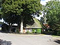
Impressions

Well-preserved half-timbered house (2011)
First school building in Düsternbrook (2012)

School building from 1908 (2012)

Fire station from 1973 (2017)

Furniture store from 1968 (2017)

Cenotaph (2007)

View into the Habyer Auen (2012)


Web links
Individual evidence
- ↑ North Statistics Office - Population of the municipalities in Schleswig-Holstein 4th quarter 2019 (XLSX file) (update based on the 2011 census) ( help on this ).
- ↑ Schleswig-Holstein topography. Vol. 4: Groß Sarau - Holstenniendorf . 1st edition Flying-Kiwi-Verl. Junge, Flensburg 2004, ISBN 978-3-926055-75-0 , p. 75 ( dnb.de [accessed on May 1, 2020]).
- ↑ Eckernförder Zeitung of May 7, 2018, page 11
- ↑ Schleswig-Holstein's municipal coat of arms
- ↑ Hütti's market bus. (PDF) The citizens' bus in the Hüttener mountains. In: amt-huettener-berge.de. Retrieved October 28, 2018 .
Backguard | Ahlefeld-Bistensee | Alt Duvenstedt | Altenhof | Altenholz | Arpsdorf | Cinderella | Aukrug | Bargstall | Bargstedt | Barkelsby | Beldorf | Bendorf | Beringstedt | Bite | Blumenthal | Böhnhusen | Bokel | Bordesholm | Borgdorf-Seedorf | Borgstedt | Bornholt | Bovenau | Brammer | Bredenbek | Pulpwood | Brekendorf | Brinjahe | Brodersby | Bruges | Büdelsdorf | Bünsdorf | Christiansholm | Damendorf | Damp | Dänischenhagen | Dätgen | Dörphof | Eckernförde | Ehndorf | Eisendorf | Ellerdorf | Elsdorf-Westermühlen | Embühren | Emkendorf | Field | Felm | Fleckeby | Flintbek | Fockbek | Friedrichsgraben | Friedrichsholm | Gammelby | Gettorf | Gnutz | Gokels | Goosefeld | Grauel | Grevenkrug | Groß Buchwald | Groß Vollstedt | Groß Wittensee | Güby | Haale | Haby | Hamdorf | Hamweddel | Hanerau-Hademarschen | Hassmoor | Heinkenborstel | Hofeld | Hohenwestedt | Scorn | Holtsee | Holzbunge | Holzdorf | Hearst | Hummelfeld | Huts | Year village | Jevenstedt | Karby | Klein Wittensee | King's Hill | Kosel | Crogaspe | Kronshagen | Curvilinear | Long tail | Lindau | Lohe-Föhrden | Loop | Loose | Luhnstedt | Lütjenwestedt | Meezen | Melsdorf | Mielkendorf | Molfsee | Mörel | Mühbrook | Negenharry | Neudorf-Bornstein | New Duvenstedt | Neuwittenbek | Nienborstel | Nindorf | Noer | Nortorf | Nübbel | Oldenbüttel | Oldenhütten | Osdorf | Ostenfeld (Rendsburg) | Osterby | Osterrönfeld | Osterstedt | Ottendorf | Owschlag | Padenstedt | Prince's Moor | Quarnbek | Rade b. Hohenwestedt | Rade b. Rendsburg | Reesdorf | Remmels | Rendsburg | Rickert | Rieseby | Rodenbek | Rumohr | Schacht-Audorf | Schierensee | Schinkel | Schmalstede | Schönbek | Schönhorst | Schülldorf | Schülp b. Nortorf | Schülp b. Rendsburg | Schwedeneck | Seefeld | Sehestedt | Sophienhamm | Sören | Stafstedt | Steenfeld | Beaches | Tackesdorf | Tappendorf | Techelsdorf | Thaden | Thumby | Timmaspe | Todenbüttel | Tüttendorf | Waabs | Wapelfeld | Warder | Wasbek | Wattenbek | Westensee | Westerrönfeld | Windeby | Winnemark