
Borgstedt
| coat of arms | Germany map | |
|---|---|---|

|
Coordinates: 54 ° 20 ' N , 9 ° 43' E |
|
| Basic data | ||
| State : | Schleswig-Holstein | |
| Circle : | Rendsburg-Eckernförde | |
| Office : | Hüttener Mountains | |
| Height : | 9 m above sea level NHN | |
| Area : | 9.15 km 2 | |
| Residents: | 1604 (Dec. 31, 2019) | |
| Population density : | 175 inhabitants per km 2 | |
| Postal code : | 24794 | |
| Area code : | 04331 | |
| License plate : | RD, ECK | |
| Community key : | 01 0 58 024 | |
| LOCODE : | DE BYT | |
| Office administration address: | Mühlenstrasse 8 24361 Groß Wittensee |
|
| Website : | ||
| Mayor : | Gero Neidlinger ( CDU ) | |
| Location of the municipality of Borgstedt in the Rendsburg-Eckernförde district | ||
 |
||

Borgstedt ( Danish Borgsted ) is a municipality in the district of Rendsburg-Eckernförde in Schleswig-Holstein .
Geography and traffic
Borgstedt is located 5 km northeast of Rendsburg on the north bank of the Kiel Canal .

The Exbek , formerly a tributary of the Eider, flows through the municipality . Due to the inclusion of the Eider in the Eider Canal in the 18th century, the stream flows north of the Rader Island near Borgstedter Enge into the former canal bed created by the straightening of the Kiel Canal between 1912 and 1914.
The districts of Lehmbek, Diekshof and Borgstedtfelde are located in the municipality.
Important traffic connections are the A 7 and the B 203 as well as the Rendsburg infrastructure with train station and port .
history
The first planned settlement of today's municipality took place around 1250. The municipality was first mentioned in documents in 1375. Military actions around the Rendsburg fortress in the 16th and 17th centuries prevented a further increase in the population.
Only with the construction of the Eider Canal between 1777 and 1784 did the population grow. In 1880 283 people lived in Borgstedt. In 1912 the canal was straightened and the Borgstedter Enge was created.
Incorporations
On October 1, 1975, the municipality of Lehmbek was incorporated.
politics
Community representation
Of the 13 seats in the municipal council, the SPD has had six seats since the local elections in 2003, the CDU five and the Voting Association Independent Voting Association UWG two. Since the local elections in 2008, the CDU had nine seats and the Open List Voting Association Borgstedt OLB and UWG two each.
Of the 13 seats in the municipal council, the CDU had seven seats since the 2013 local elections and the UWG and SPD three seats each. Since the local elections in 2018, the CDU has eight, the UWG three and the SPD two.
coat of arms
Blazon : “In green a slanting left silver wave bar, accompanied above by a golden thing stick , below by a golden wheel with eight spokes. The Dingstock consists of a short shaft that ends at the top in three eyelets, through each of which a ring is pulled. "
Economy and Infrastructure
On March 29, 2019 it was announced that Amazon would like to build a distribution center and a logistics hall with a building area of 7800 square meters in the Borgstedtfelde industrial park directly on the A7. The modular distribution center is scheduled to start operating by Christmas 2019, and the logistics center is scheduled to be completed in 2020. 330 jobs, 20 of them in administration, are to be created. Work there around the clock, six days a week.

Borgstedt with lake and Rader high bridge

Chapel in Borgstedt

War memorial in Borgstedt
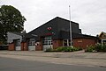
Borgstedt fire station


schools
- Elementary School Borgstedt (124 students)
Social facilities
- kindergarten
- Retirement and nursing home
- Retirement home
sport and freetime
- sports ground
- two soccer fields
- two tennis courts
- Gym at the elementary school
- Bathing area on the Eider
- Riding and running paths on the Eider
- youth club
- Marina
Web links
- Borgstedt community
- Political history of the community since 1928 with numerous data tables and pictures. In: spd-borgstedt.de. : "Excerpts from: Borgstedt, Eine Chronik von Alfred Hoffmann , pp. 24-26 and 29 (1992) as well as records and minutes of the SPD-OV Borgstedt"
Individual evidence
- ↑ North Statistics Office - Population of the municipalities in Schleswig-Holstein 4th quarter 2019 (XLSX file) (update based on the 2011 census) ( help on this ).
- ↑ Schleswig-Holstein topography. Vol. 2: Boren - Ellerau . 1st edition Flying-Kiwi-Verl. Junge, Flensburg 2002, ISBN 978-3-926055-68-2 , p. 9 ( dnb.de [accessed June 11, 2020]).
- ↑ Schleswig-Holstein topography. Vol. 2: Boren - Ellerau . 1st edition Flying-Kiwi-Verl. Junge, Flensburg 2002, ISBN 978-3-926055-68-2 , p. 9 ( dnb.de [accessed June 12, 2020]).
- ^ Federal Statistical Office (ed.): Historical municipality directory for the Federal Republic of Germany. Name, border and key number changes in municipalities, counties and administrative districts from May 27, 1970 to December 31, 1982 . W. Kohlhammer GmbH, Stuttgart / Mainz 1983, ISBN 3-17-003263-1 , p. 184 .
- ↑ Allocation of seats after local elections in 2013. (PDF) Archived from the original on December 20, 2013 ; accessed on January 14, 2018 .
- ↑ Local council / other committees. In: gemeinde-borgstedt.de. Retrieved March 29, 2019 .
- ↑ Schleswig-Holstein's municipal coat of arms
- ↑ Ulrich Metschies: Amazon comes to Schleswig-Holstein. In: kn-online.de. March 29, 2019, accessed March 29, 2019 .
- ↑ Our profile. In: Website of the elementary school Borgstedt. Retrieved October 5, 2019 .
Backguard | Ahlefeld-Bistensee | Alt Duvenstedt | Altenhof | Altenholz | Arpsdorf | Cinderella | Aukrug | Bargstall | Bargstedt | Barkelsby | Beldorf | Bendorf | Beringstedt | Bite | Blumenthal | Böhnhusen | Bokel | Bordesholm | Borgdorf-Seedorf | Borgstedt | Bornholt | Bovenau | Brammer | Bredenbek | Pulpwood | Brekendorf | Brinjahe | Brodersby | Bruges | Büdelsdorf | Bünsdorf | Christiansholm | Damendorf | Damp | Dänischenhagen | Dätgen | Dörphof | Eckernförde | Ehndorf | Eisendorf | Ellerdorf | Elsdorf-Westermühlen | Embühren | Emkendorf | Field | Felm | Fleckeby | Flintbek | Fockbek | Friedrichsgraben | Friedrichsholm | Gammelby | Gettorf | Gnutz | Gokels | Goosefeld | Grauel | Grevenkrug | Groß Buchwald | Groß Vollstedt | Groß Wittensee | Güby | Haale | Haby | Hamdorf | Hamweddel | Hanerau-Hademarschen | Hassmoor | Heinkenborstel | Hofeld | Hohenwestedt | Scorn | Holtsee | Holzbunge | Holzdorf | Hearst | Hummelfeld | Huts | Year village | Jevenstedt | Karby | Klein Wittensee | King's Hill | Kosel | Crogaspe | Kronshagen | Curvilinear | Long tail | Lindau | Lohe-Föhrden | Loop | Loose | Luhnstedt | Lütjenwestedt | Meezen | Melsdorf | Mielkendorf | Molfsee | Mörel | Mühbrook | Negenharry | Neudorf-Bornstein | New Duvenstedt | Neuwittenbek | Nienborstel | Nindorf | Noer | Nortorf | Nübbel | Oldenbüttel | Oldenhütten | Osdorf | Ostenfeld (Rendsburg) | Osterby | Osterrönfeld | Osterstedt | Ottendorf | Owschlag | Padenstedt | Prince's Moor | Quarnbek | Rade b. Hohenwestedt | Rade b. Rendsburg | Reesdorf | Remmels | Rendsburg | Rickert | Rieseby | Rodenbek | Rumohr | Schacht-Audorf | Schierensee | Schinkel | Schmalstede | Schönbek | Schönhorst | Schülldorf | Schülp b. Nortorf | Schülp b. Rendsburg | Schwedeneck | Seefeld | Sehestedt | Sophienhamm | Sören | Stafstedt | Steenfeld | Beaches | Tackesdorf | Tappendorf | Techelsdorf | Thaden | Thumby | Timmaspe | Todenbüttel | Tüttendorf | Waabs | Wapelfeld | Warder | Wasbek | Wattenbek | Westensee | Westerrönfeld | Windeby | Winnemark