Crogaspe
| coat of arms | Germany map | |
|---|---|---|

|
Coordinates: 54 ° 8 ' N , 9 ° 56' E |
|
| Basic data | ||
| State : | Schleswig-Holstein | |
| Circle : | Rendsburg-Eckernförde | |
| Office : | Nortorfer Land | |
| Height : | 27 m above sea level NHN | |
| Area : | 11.82 km 2 | |
| Residents: | 438 (Dec. 31, 2019) | |
| Population density : | 37 inhabitants per km 2 | |
| Postal code : | 24644 | |
| Area code : | 04392 | |
| License plate : | RD, ECK | |
| Community key : | 01 0 58 091 | |
| Office administration address: | Niedernstrasse 6 24589 Nortorf |
|
| Website : | ||
| Mayor : | Nils Höfer (ADW) | |
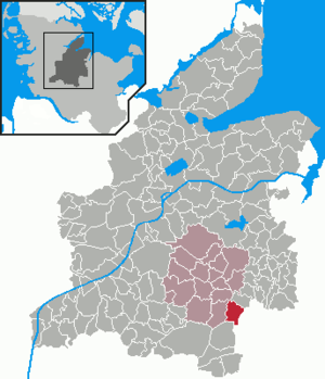
| Location of the municipality of Krogaspe in the Rendsburg-Eckernförde district | ||
Krogaspe is a municipality on Ochsenweg in the Rendsburg-Eckernförde district in Schleswig-Holstein . Amalienhof, Autobahnmeisterei (Am Aalbek), Bast-Hof, Heinrichshof, Hof Farrenfeld, Hof Seeblick, Hof Vossberg and Wilhelmsruh are located in the municipality.
Geography and traffic
Krogaspe is located directly northwest of Neumünster on the federal highway 7 and the former federal highway 205 to Rendsburg . The Neumünster-Nord motorway exit and the Krogaspe motorway station with the motorway maintenance facility and the motorway police are in the municipality. The Aspe station on the Neumünster – Flensburg line was located roughly in the middle between the centers of Krogaspe and Timmaspe .
history
The place was first mentioned in 1200. The place name probably means remote Espendorf in an angle . An aspen is an aspen. The “Krog” part of the definition indicates that it was originally a remote piece of land - in Low German “Krog, Kroch, Krooch” etc. Both parts of the name, which refer to the location of the place and its trees, indicate that Krogaspe is a high medieval settlement in the midst of trembling aspen trees, back then a little remote.
The community is located on the old military and trade route, the Ochsenweg (today: Ossenweg Plattdeutsch ). Every year thousands of oxen were driven south through Schleswig-Holstein to the Elbe via this important cattle drift .
The Schleswig-Holstein Infantry Regiment No. 163 from Neumünster held its target practice here.
There is a village chronicle from 1979, which was written by the old farmer Hinrich Plambeck.
politics
Community representation
Of the nine seats in the municipal administration, the ADW community of voters has five seats since the 2013 local elections and the KWG four.
coat of arms
Blazon : "In silver under three upright, stemmed green aspen leaves standing next to each other, the goalless red gable end of a Lower Saxony farmhouse with black half-timbering."
economy
The municipal area is predominantly agricultural, but there are also some businesses.
Web links
Individual evidence
- ↑ North Statistics Office - Population of the municipalities in Schleswig-Holstein 4th quarter 2019 (XLSX file) (update based on the 2011 census) ( help on this ).
- ↑ Schleswig-Holstein topography. Vol. 5: Holt - Krokau . 1st edition Flying-Kiwi-Verl. Junge, Flensburg 2005, ISBN 978-3-926055-79-8 , pp. 355 ( dnb.de [accessed on July 21, 2020]).
- ↑ Schleswig-Holstein's municipal coat of arms

