Tappendorf
| coat of arms | Germany map | |
|---|---|---|

|
Coordinates: 54 ° 6 ' N , 9 ° 42' E |
|
| Basic data | ||
| State : | Schleswig-Holstein | |
| Circle : | Rendsburg-Eckernförde | |
| Office : | Mittelholstein | |
| Height : | 60 m above sea level NHN | |
| Area : | 6.69 km 2 | |
| Residents: | 328 (Dec. 31, 2019) | |
| Population density : | 49 inhabitants per km 2 | |
| Postal code : | 24594 | |
| Area code : | 04871 | |
| License plate : | RD, ECK | |
| Community key : | 01 0 58 159 | |
| LOCODE : | DE TRY | |
| Office administration address: | Am Markt 15 24594 Hohenwestedt |
|
| Website : | ||
| Mayoress : | Kerstin Hattendorf-Selchow (KWG) | |
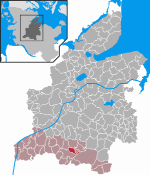
| Location of the municipality of Tappendorf in the Rendsburg-Eckernförde district | ||
Tappendorf (Low German: Tabbendkör) is a municipality in the Rendsburg-Eckernförde district in Schleswig-Holstein . Kaaksburg is in the municipality.
Geography and traffic
Tappendorf is about 20 km west of Neumünster and 22 km south of Rendsburg in the Aukrug Nature Park . The federal highways B 77 from Rendsburg to Itzehoe and B 430 from Neumünster in the direction of Schenefeld (Steinburg district) cross southwest of Tappendorf . The nearest shops are in the neighboring community of Hohenwestedt .
The landscape around Tappendorf is hilly and wooded. The Hasselbek flows through the municipality .
history
The name Tappendorf indicates a personal name ("Tabbe" or "Tabbo") and developed from the first mention as "Tabbendorp" in 1375 to Tappendorf today. The village was built on a long village street with short side streets.
A village school was founded in 1759 and was taught by a full-time teacher until the 1970s. Due to the establishment of a village community school in Hohenwestedt , it was closed like all other village schools in the area and is now used as a residential building. The former school yard in front of the existing building, on which there is a playground, is named after the long-time teacher Dürrholz.
Only the buildings of the dairy and brickworks founded in 1894 still exist. The restaurant, which opened in 1904, was closed in 2010.
politics
Community representation
Of the nine seats in the municipal council, the KWG has had all seats since the 2018 local elections.
coat of arms
Blazon : “A red bar covered with a gold crown, the six prongs of which are studded with a pearl. Above this a red wall crown with six battlements, below it a blue key with the beard on the top right.
Associations and associations
The volunteer fire brigade is operated jointly with the neighboring community of Rade . In Tappendorf there is a local association of the German Red Cross , a football club and a shooting club.
Web links
Individual evidence
- ↑ North Statistics Office - Population of the municipalities in Schleswig-Holstein 4th quarter 2019 (XLSX file) (update based on the 2011 census) ( help on this ).
- ↑ Schleswig-Holstein topography. Vol. 9: Schönberg - Tielenhemme . 1st edition Flying-Kiwi-Verl. Junge, Flensburg 2007, ISBN 978-3-926055-91-0 , p. 335 ( dnb.de [accessed on August 6, 2020]).
- ↑ Allocation of seats after the 2018 local elections ( memento of the original from December 20, 2013 in the Internet Archive ) Info: The archive link was inserted automatically and has not yet been checked. Please check the original and archive link according to the instructions and then remove this notice.
- ↑ Schleswig-Holstein's municipal coat of arms

