
Starnberg district
| coat of arms | Germany map |
|---|---|

|

Coordinates: 48 ° 1 ' N , 11 ° 17' E |
| Basic data | |
| State : | Bavaria |
| Administrative region : | Upper Bavaria |
| Administrative headquarters : | Starnberg |
| Area : | 487.71 km 2 |
| Residents: | 136,667 (Dec. 31, 2019) |
| Population density : | 280 inhabitants per km 2 |
| License plate : | STA, WOR |
| Circle key : | 09 1 88 |
| NUTS : | DE21L |
| Circle structure: | 14 municipalities |
| Address of the district administration: |
Strandbadstrasse 2 82319 Starnberg |
| Website : | |
| District Administrator : | Stefan Frey ( CSU ) |
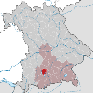
| Location of the district of Starnberg in Bavaria | |
  |
|
The district of Starnberg is located in the southwest of the Bavarian administrative district of Upper Bavaria .


With a purchasing power index of 144.0 percent of the national average (100 percent) or 33,102 euros per inhabitant, the Starnberg district has the highest per capita income of all districts in the Federal Republic of Germany (as of 2018). It also has the highest life expectancy in Germany (as of 2013/15).
geography
location
The Starnberg district is part of the “ Fünfseenland ” cultural landscape , as it includes the northwestern stretch of Lake Starnberg , the Weßlinger See , the Wörthsee , the Pilsensee and parts of the eastern Ammersee .
Between the Starnberger See (584 m) and the Ammersee (533 m), the hilly landscape of the Wurm-Ice Age side and terminal moraines extend , which have their highest elevation in the district area in the Berndorfer Buchet (750 m) near Obertraubing (west of Tutzing).
The Ilkahöhe (726 m) near Tutzing is a well-known vantage point with a view of Lake Starnberg and the Alps . The Würm leaves Lake Starnberg on its north bank . She has dug a narrow river bed and is leaving the district near Krailling in the direction of Munich .
Neighboring areas
The district borders in a clockwise direction to the north, starting with the districts of Fürstenfeldbruck , Munich , Bad Tölz-Wolfratshausen , Weilheim-Schongau and Landsberg am Lech .
Protected areas
There are ten nature reserves , six landscape protection areas , eleven FFH areas and at least twelve geotopes designated by the Bavarian State Office for the Environment (as of April 2016) in the district.
See also
- List of nature reserves in the Starnberg district
- List of landscape protection areas in the Starnberg district
- List of FFH areas in the Starnberg district
- List of geotopes in the Starnberg district
history
district Court
The Starnberg district has long been part of Bavaria. In 1803 the Starnberg district court was established, which belonged to the Isar district , which was renamed Upper Bavaria in 1838 .
District Offices

In 1862 the area of the district court became part of the district office of Munich on the left of the Isar and in 1880 of the district office of Munich II. On October 1, 1902, a separate district office of Starnberg was established from 40 communities from the dissolved district office of Munich II .
district
On January 1, 1939, the uniform imperial designation Landkreis was introduced. So the district office of Starnberg became.
As part of the regional reform in Bavaria , the Starnberg district was expanded to include the communities of Bachhausen and Höhenrain as well as the community-free area of Wadlhauser Gräben of the dissolved Wolfratshausen district on July 1, 1972 .
Population development
The district is popular as a local recreation area and has seen strong immigration from the Munich area.
The district of Starnberg gained around 19,000 residents between 1988 and 2008 or grew by around 17%. Between 1988 and 2018 the district grew from 110,867 to 136,092 by 25,225 inhabitants or by 22.8%.
The population figures from 1840 onwards refer to the territorial status on May 25, 1987.
| year | 1840 | 1871 | 1900 | 1925 | 1939 | 1950 | 1961 | 1970 | 1987 | 1991 |
| population | 11,048 | 13,011 | 19,020 | 29,363 | 36,449 | 65,463 | 73,704 | 86,674 | 108,889 | 116.082 |
|---|
| year | 1995 | 2000 | 2005 | 2010 | 2015 |
| population | 119,523 | 124,956 | 129.091 | 130.283 | 133,621 |
|---|
Architectural monuments
See monuments in the Starnberg district
Economy and Infrastructure
economy
The district's purchasing power index is 144.0 percent of the national average (100 percent) or 33,102 euros per inhabitant (as of 2018). Thus the district of Starnberg has the highest per capita income of all districts in the Federal Republic of Germany.
13.5 percent of employees in the Starnberg district have a university or technical college degree - twice as many as the national average.
In the Future Atlas 2016 , the district of Starnberg was ranked 8th out of 402 districts, municipal associations and independent cities in Germany, making it one of the regions with "top future opportunities". In the 2019 edition, it was again ranked 8th out of 401.
tourism
The district of Starnberg was previously designated as part of the Starnberg Five Lakes region , but since 2019 it has been recorded by the Bavarian State Office for Statistics in the notation “Starnberg Ammersee” as part of the Starnberg-Ammersee tourist region .
The society for economic and tourism development in the district of Starnberg mbH (gwt Starnberg GmbH) markets the region in the spelling "StarnbergAmmersee" and was "founded as an interface between companies, administration, politics and citizens". In addition to marketing aspects in general as a business location, the gwt also acts as a tourism association whose website, among other things, advertises holiday destinations within the region and allows accommodation to be booked. The shareholders of the gwt are the district, the municipalities of the district and four neighboring communities on the lakes of three other districts ( Bernried am Starnberger See , Dießen am Ammersee , Münsing , Seeshaupt ), as well as the Federation of Self-Employers - Gewerbeverband Bayern eV and the employers' association for economic development (UWS ).
traffic
The Starnberg district is served by two S-Bahn lines of the Munich Transport and Tariff Association and three federal highways.
rail
The ![]() achieved on the 1854 from Pasing-Starnberg railway built route from Munich forth across Gauting in Starnberg the western shore of the lake; then it continues on the section to Tutzing , which, like the extensions to Weilheim and Penzberg, was added by the Weilheim city railway in 1865/66 .
achieved on the 1854 from Pasing-Starnberg railway built route from Munich forth across Gauting in Starnberg the western shore of the lake; then it continues on the section to Tutzing , which, like the extensions to Weilheim and Penzberg, was added by the Weilheim city railway in 1865/66 .
It ![]() uses the railway line that was put into operation in 1903 by the Bavarian State Railway from Pasing to Herrsching.
uses the railway line that was put into operation in 1903 by the Bavarian State Railway from Pasing to Herrsching.
Street
![]() The Autobahn 96 Munich – Lindau opens up the western district.
The Autobahn 96 Munich – Lindau opens up the western district.
![]() The Autobahn 95 Munich – Garmisch-Partenkirchen runs around 13 km near the eastern border of the district.
The Autobahn 95 Munich – Garmisch-Partenkirchen runs around 13 km near the eastern border of the district.
![]() The almost 5 km long motorway 952 , which branches off the A95 at the Starnberg motorway triangle, ends near the northern tip of Lake Starnberg on the eastern outskirts of Starnberg.
The almost 5 km long motorway 952 , which branches off the A95 at the Starnberg motorway triangle, ends near the northern tip of Lake Starnberg on the eastern outskirts of Starnberg.
politics
District council
| year | CSU | SPD | GREEN | FDP | FW | ÖDP | LEFT | AfD | total | WB in% |
|---|---|---|---|---|---|---|---|---|---|---|
| 2020 | 20th | 5 | 18th | 5 | 8th | 2 | 1 | 1 | 60 | 62.4 |
| 2014 | 24 | 9 | 10 | 6th | 9 | 2 | - | - | 60 | 59.0 |
| 2008 | 23 | 9 | 10 | 7th | 9 | 2 | - | - | 60 | 63.1 |
| 2002 | 28 | 11 | 6th | 4th | 9 | 2 | - | - | 60 | 63.8 |
District Administrator
Since May 1, 2020, Stefan Frey (CSU) has been the successor to Karl Roth (CSU) as the district administrator of the Starnberg district. Deputy District Administrator is Matthias Vilsmayer (Free Voters) and the second Deputy District Administrator Britta Hundesrügge ( FDP ). The CSU, Free Voters and the FDP together form a coalition .
badges and flags
|
|
Blazon : "Ontop ofthe Bavarian diamond shield , a striding golden lion , below a one-headed golden eagle ." |
| Reasons for the coat of arms: The coat of arms goes back to the Counts of Andechs-Meranien . |
A white and blue flag with the county coat of arms is used as the unofficial county flag .
Communities
(Residents on December 31, 2019)
No markets.
|
Other communities |
  |
Municipalities of the district before the territorial reform 1971/78
Up until the regional reform in 1971/78, the Starnberg district had 40 communities (see list below).
In the west, the district bordered on the district of Landsberg am Lech , in the north on the district of Fürstenfeldbruck , in the east on the districts of Munich and Wolfratshausen, and in the south and southwest on the district of Weilheim in Upper Bavaria .
On 1 October 1937, the community was Kempfenhausen by mountain incorporated. On July 8, 1952, the name of the Oberalting community was changed to Oberalting-Seefeld and the Erling community was renamed Erling-Andechs on April 30, 1956 .
The municipalities of the Starnberg district before the municipality reform in 1971/78. (The churches that still exist today are in bold .)
| former parish | today's parish | today's district |
|---|---|---|
| Argelsried | Gilching | Starnberg district |
| Ash ring | Poecking | Starnberg district |
| mountain | mountain | Starnberg district |
| Breitbrunn am Ammersee | Herrsching am Ammersee | Starnberg district |
| Book at the Ammersee | Inning a.Ammersee | Starnberg district |
| Buchendorf | Gauting | Starnberg district |
| Rossling | Seefeld | Starnberg district |
| Erling-Andechs | Andechs | Starnberg district |
| Etterschlag | Woerthsee | Starnberg district |
| Feldafing | Feldafing | Starnberg district |
| Frieding | Andechs | Starnberg district |
| Gauting | Gauting | Starnberg district |
| Gilching | Gilching | Starnberg district |
| Hadorf | Starnberg | Starnberg district |
| Hanfeld | Starnberg | Starnberg district |
| Hechendorf a.Pilsensee | Seefeld | Starnberg district |
| Herrsching am Ammersee | Herrsching am Ammersee | Starnberg district |
| High city | Weßling | Starnberg district |
| Inning a.Ammersee | Inning a.Ammersee | Starnberg district |
| Krailling | Krailling | Starnberg district |
| Leutstetten | Starnberg | Starnberg district |
| Powerful | Andechs | Starnberg district |
| Maising | Poecking | Starnberg district |
| Meiling | Seefeld | Starnberg district |
| Oberalting-Seefeld | Seefeld | Starnberg district |
| Oberbrunn | Gauting | Starnberg district |
| Oberpfaffenhofen | Weßling | Starnberg district |
| Percha | Starnberg | Starnberg district |
| Perchting | Starnberg | Starnberg district |
| Poecking | Poecking | Starnberg district |
| Söcking | Starnberg | Starnberg district |
| Starnberg (city) | Starnberg | Starnberg district |
| Steinebach am Wörthsee | Woerthsee | Starnberg district |
| Traubing | Tutzing | Starnberg district |
| Tutzing | Tutzing | Starnberg district |
| Uning | Seefeld | Starnberg district |
| Unterbrunn | Gauting | Starnberg district |
| Cheeks 1 | Starnberg | Starnberg district |
| Weßling | Weßling | Starnberg district |
| Ariesberg | Herrsching am Ammersee | Starnberg district |
1 : had only been an independent municipality since 1952
Partner counties
License Plate
On July 1, 1956, the district was assigned the distinctive sign STA when the vehicle registration number that is still valid today was introduced . It is still issued today. The distinctive symbol WOR (Wolfratshausen) has also been available since July 10, 2013 .
Web links
- Website of the Starnberg District Office
- Entry on the coat of arms of the district of Starnberg in the database of the House of Bavarian History
Individual evidence
- ↑ "Data 2" sheet, Statistical Report A1200C 202041 Population of the municipalities, districts and administrative districts 1st quarter 2020 (population based on the 2011 census) ( help ).
- ↑ a b GfK Purchasing Power Germany 2018. December 12, 2017, accessed on May 4, 2019 .
- ↑ BBSR Homepage - Federal Institute for Building, Urban and Spatial Research (BBSR) - Research and policy advice - Where life expectancy is highest in Germany. Retrieved October 22, 2019 .
- ↑ Bavarian State Office for the Environment : 53 Fünfseenland , profile of the cultural landscape as part of a draft of a cultural landscape structure of Bavaria as a contribution to biodiversity, status 2011, PDF file, online at lfu.bayern.de
- ^ Wilhelm Volkert (ed.): Handbook of Bavarian offices, communities and courts 1799–1980 . CH Beck, Munich 1983, ISBN 3-406-09669-7 , p. 97 .
- ^ Ordinance on the reorganization of Bavaria into rural districts and independent cities of December 27, 1971
- ↑ Statistics for the district , accessed on August 12, 2016
- ↑ Purchasing power 2014: Germans have an average of 586 euros more . Society for Consumer Research (GfK). Press release of December 3, 2013. Accessed April 7, 2014.
- ↑ Future Atlas 2016. Archived from the original on October 2, 2017 ; accessed on March 24, 2018 .
- ↑ PROGNOS future atlas. Handelsblatt, accessed on December 10, 2019 .
- ↑ Bavarian State Office for Statistics : Tourism regions in Bavaria , PDF file, status: January 1, 2017, online at statistik.bayern.de
- ↑ Bavarian State Office for Statistics : Tourism regions in Bavaria , PDF file, status: January 1, 2019, online at statistik.bayern.de
- ↑ Home page of the StarnbergAmmersee region , online at starnbergammersee.de
- ↑ Economy , website of the Starnberg District Office, online at lk-starnberg.de
- ↑ About us , with information about the shareholders of gwt Starnberg GmbH , online at starnbergammersee.de
- ↑ Entry on the coat of arms of the district of Starnberg in the database of the House of Bavarian History , accessed on September 4, 2017 .
- ↑ Entry on the district of Starnberg on the website kommunalflaggen.eu
- ↑ "Data 2" sheet, Statistical Report A1200C 202041 Population of the municipalities, districts and administrative districts 1st quarter 2020 (population based on the 2011 census) ( help ).
- ^ Official register of places for Bavaria 1964
- ^ Wilhelm Volkert (ed.): Handbook of Bavarian offices, communities and courts 1799–1980 . CH Beck, Munich 1983, ISBN 3-406-09669-7 , p. 576 .
- ^ Wilhelm Volkert (ed.): Handbook of Bavarian offices, communities and courts 1799–1980 . CH Beck, Munich 1983, ISBN 3-406-09669-7 , p. 576 .
- ↑ Michael Rademacher: German administrative history from the unification of the empire in 1871 to the reunification in 1990. Starnberg district. (Online material for the dissertation, Osnabrück 2006).
- ↑ BayernViewer of the Bavarian Surveying Administration (accessed on July 20, 2010)
Districts:
Aichach-Friedberg |
Altötting |
Amberg-Sulzbach |
Ansbach |
Aschaffenburg |
Augsburg |
Bad Kissingen |
Bad Toelz-Wolfratshausen |
Bamberg |
Bayreuth |
Berchtesgadener Land |
Cham |
Coburg |
Dachau |
Deggendorf |
Dillingen on the Danube |
Dingolfing-Landau |
Danube Ries |
Ebersberg |
Eichstätt |
Erding |
Erlangen-Höchstadt |
Forchheim |
Freising |
Freyung-Grafenau |
Fürstenfeldbruck |
Fürth |
Garmisch-Partenkirchen |
Gunzburg |
Hatred Mountains |
Yard |
Kelheim |
Kitzingen |
Kronach |
Kulmbach |
Landsberg am Lech |
Landshut |
Lichtenfels |
Lindau (Lake Constance) |
Main-Spessart |
Miesbach |
Miltenberg |
Mühldorf am Inn |
Munich |
Neuburg-Schrobenhausen |
Neumarkt in the Upper Palatinate |
Neustadt an der Aisch-Bad Windsheim |
Neustadt an der Waldnaab |
Neu-Ulm |
Nuremberg Country |
Oberallgäu |
Ostallgäu |
Passau |
Pfaffenhofen an der Ilm |
Rain |
Regensburg |
Rhön-Grabfeld |
Rosenheim |
Roth |
Rottal-Inn |
Schwandorf |
Schweinfurt |
Starnberg |
Straubing Arch |
Tirschenreuth |
Traunstein |
Unterallgäu |
Weilheim-Schongau |
Weißenburg-Gunzenhausen |
Wunsiedel in the Fichtel Mountains |
Wurzburg
Independent cities:
Amberg |
Ansbach |
Aschaffenburg |
Augsburg |
Bamberg |
Bayreuth |
Coburg |
Erlangen |
Fürth |
Hof (Saale) |
Ingolstadt |
Kaufbeuren |
Kempten (Allgäu) |
Landshut |
Memmingen |
Munich |
Nuremberg |
Passau |
Regensburg |
Rosenheim |
Schwabach |
Schweinfurt |
Straubing |
Willows in the Upper Palatinate |
Wurzburg