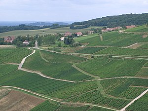
Menetru-le-Vignoble
| Menetru-le-Vignoble | ||
|---|---|---|
|
|
||
| region | Bourgogne-Franche-Comté | |
| Department | law | |
| Arrondissement | Lons-le-Saunier | |
| Canton | Poligny | |
| Community association | Bresse Haute Seille | |
| Coordinates | 46 ° 46 ′ N , 5 ° 37 ′ E | |
| height | 267-550 m | |
| surface | 5.88 km 2 | |
| Residents | 159 (January 1, 2017) | |
| Population density | 27 inhabitants / km 2 | |
| Post Code | 30210 | |
| INSEE code | 39321 | |
 Menetru-le-Vignoble |
||
Menétru-le-Vignoble is a French municipality with 159 inhabitants (at January 1, 2017) in the department of Jura in the region Bourgogne Franche-Comté . It belongs to the arrondissement of Lons-le-Saunier and the canton of Poligny . The municipality borders Frontenay to the north, Château-Chalon to the south and east and Domblans to the west .
economy
Part of the vineyards in Menétru-le-Vignoble belongs to the Côtes du Jura wine-growing region .
Population development
| 1962 | 1968 | 1975 | 1982 | 1990 | 1999 | 2008 |
|---|---|---|---|---|---|---|
| 173 | 151 | 127 | 125 | 138 | 138 | 156 |
Attractions
- Menétru-le-Vignoble Castle, built in the 15th and 16th centuries - Monument historique
- Village church from the 18th century
Web links
Commons : Menétru-le-Vignoble - collection of images, videos and audio files
Individual evidence
- ↑ Castle of Menétru-le-Vignoble in the Base Mérimée of the French Ministry of Culture (French)


