
Federal highway 661
| Bundesautobahn 661 in Germany | |||||||||||||||||||||||||||||||||||||||||||||||||||||||||||||||||||||||||||||||||||||||||||||||||||||||||||||||||||||||||

|
|||||||||||||||||||||||||||||||||||||||||||||||||||||||||||||||||||||||||||||||||||||||||||||||||||||||||||||||||||||||||
| map | |||||||||||||||||||||||||||||||||||||||||||||||||||||||||||||||||||||||||||||||||||||||||||||||||||||||||||||||||||||||||
 |
|||||||||||||||||||||||||||||||||||||||||||||||||||||||||||||||||||||||||||||||||||||||||||||||||||||||||||||||||||||||||
| Basic data | |||||||||||||||||||||||||||||||||||||||||||||||||||||||||||||||||||||||||||||||||||||||||||||||||||||||||||||||||||||||||
| Operator: |
|
||||||||||||||||||||||||||||||||||||||||||||||||||||||||||||||||||||||||||||||||||||||||||||||||||||||||||||||||||||||||
| Start of the street: |
Oberursel ( 50 ° 13 ′ N , 8 ° 34 ′ E ) |
||||||||||||||||||||||||||||||||||||||||||||||||||||||||||||||||||||||||||||||||||||||||||||||||||||||||||||||||||||||||
| End of street: |
Egelsbach ( 49 ° 58 ′ N , 8 ° 40 ′ E ) |
||||||||||||||||||||||||||||||||||||||||||||||||||||||||||||||||||||||||||||||||||||||||||||||||||||||||||||||||||||||||
| Overall length: | 37 km | ||||||||||||||||||||||||||||||||||||||||||||||||||||||||||||||||||||||||||||||||||||||||||||||||||||||||||||||||||||||||
|
State : |
|||||||||||||||||||||||||||||||||||||||||||||||||||||||||||||||||||||||||||||||||||||||||||||||||||||||||||||||||||||||||
|
Course of the road
|
|||||||||||||||||||||||||||||||||||||||||||||||||||||||||||||||||||||||||||||||||||||||||||||||||||||||||||||||||||||||||


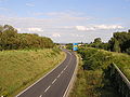
The Bundesautobahn 661 (abbreviation: BAB 661 ) - short form: Autobahn 661 (abbreviation: A 661 ) - also called Osttangente Frankfurt , Taunusschnellweg and Feldbergzubringer - leads from Oberursel (Taunus) via Bad Homburg vor der Höhe , Frankfurt am Main , Offenbach am Main , Neu-Isenburg and Langen (Hessen) to Egelsbach .
history
Northern part
Today's A 661 was opened with the section between Bad Homburg (today junction 3) and Frankfurt-Bonames (former AS 5b). While the continuation to Oberursel-Nord could take place quickly, the further construction to Frankfurt-Eckenheim was delayed considerably. For several years there was initially a provisional end on the border between Bonames and Eschersheim near Bonameser Platz . In the mid-1970s it was extended to the Friedberger Landstraße junction , where the motorway from the north ended for many years. The Bonames junction (5b), which was closed on July 21, 2005, was only dismantled in early 2019.
Beginning at Oberursel

Exit accident clinic (towards Oberursel)

Seckbach Gallery


Gap closure
Only half of the planned route between Frankfurt-Friedberger Landstrasse and Frankfurt-Ost had been built by 1995, mainly because of the necessary bridge on the Bornheimer slope . Only the eastern carriageway was completed, which the lanes in the direction of Oberursel and Egelsbach have to share.
There is also a special building between Bornheim and Seckbach. The Seckbacher Landstrasse Gallery , built in 1995, serves on the one hand as a bridge over the Seckbacher Landstrasse and Heinz-Herbert-Karry- Strasse as a bridge over the motorway. On the other hand, the half-open tunnel structure was also built to protect the neighboring Seckbach district from noise . A small park was created above the tunnel , which forms the end of Berger Straße . The ramps of the planned triangle F-Seckbach have already been prepared inside and to the west of this structure.
The final expansion of this section intends to double the width of the motorway to six lanes in the course of the connection to the A 66 and to build another bridge over the Seckbacher Tal (270 m) and the Erlenbruch (200 m). Construction began in November 2007. According to the construction site information signs on the motorway, which have since been dismantled, the work should be completed by the end of 2011, but this will be delayed until 2023, due to pending permits. The Erlenbruch motorway triangle , to which the planned Riederwald tunnel will connect, has been under construction since 2014.
The Frankfurt-Seckbach motorway triangle was also planned, from where the A 66 should be extended through the Alleentunnel under the northern part of the Frankfurter Alleenring to the current end on Miquelallee. The planning of the tunnel and the Alleenspange, an above-ground connection from the planned triangle to the Friedberger Landstrasse - Rat-Beil-Strasse intersection, have since been abandoned. The area kept free for the Alleenspange is to be built with a new residential quarter.
On November 13, 2019, the city of Frankfurt and the state of Hesse signed an administrative agreement for the joint construction of an enclosure. The motorway is to be built over for about one kilometer. Green spaces and up to 3,000 apartments are to be created on the area gained.
Southern part
The southern section between Offenbach and Egelsbach was also built, but still as the southern part of the federal motorway 49 , which at that time was still planned as a motorway between Kassel and Darmstadt . Appropriate entrances and exits to / from Darmstadt have already been built at today's end of the motorway. An extension is no longer planned, the corresponding planning was given up in 1980. This section was then rededicated to the A 661 and the already existing Kaiserleibrücke later integrated. This was built in the 1960s as part of the road connecting Offenbach-Kaiserlei and Frankfurt-Ostend. The A 661 ended after the connection of the southern section at the Frankfurt Ratswegkreisel.
Special
- On July 15, 2007, high temperatures caused problems with the road surface. On the A 661 near Dreieich ( Offenbach district ), the heat pushed concrete slabs one on top of the other. The expansion joints were not enough, reported the police. Several cars were damaged. The place at the exit towards Oberursel had to be closed and the cars had to be diverted via the parallel lane.
- Because of the motorway, the then second division club FSV Frankfurt , whose Frankfurter Volksbank Stadium is right next to the motorway, was not allowed to erect a video wall in its stadium for a long time until July 2009 after the stadium renovation. The mobile video wall in the guest gallery was removed without replacement at the end of the 2009/10 season. The city of Frankfurt feared that this could distract drivers and cause accidents. In 2010, however, the FSV got permission after a long dispute with the city. For the stadium, the building permit for floodlights was not initially granted as a prerequisite for approval as a stadium for the second Bundesliga, as there was fear of possible dazzling of road users on the neighboring A 661. After a few tests, which also included the full closure of the motorway, clearance was granted.
- In December 2012 the ADAC published statistics in which the A661 is one of the ten most dangerous motorways for wrong-way drivers . In 2010 and 2011 there were 50 reports of wrong-way drivers on this motorway. In absolute numbers it is ahead of all others, the A 98 (Weil am Rhein - Tiengen) follows with 30 reports of wrong-way drivers and the A 643 with 23 reports of wrong-way drivers. Extrapolated to 100 km and per year there are statistically 67.0 wrong-way driver reports, here the A 661 benefits from the length of 37.3 km, as it takes the last place in the statistical order.
- A 110 kV overhead line runs parallel to the motorway between Offenbach-Taunusring and Dreieich . As a hybrid line, the masts lead two three-phase systems of the Westnetz from Offenbach to Dreieich and on to the Urberach substation as well as two traction current systems of Deutsche Bahn from Offenbach Hbf to the junction at Messel. The line follows the curved course of the autobahn, which is why, for technical reasons, rarer angular pylons are used throughout .
- Although the end of the autobahn in Egelsbach was only designed as a transition into a two-lane road and there is therefore no way to leave the main lane, it is signposted as a normal junction when coming from the north. Originally it was planned as a left-hand trumpet , the preliminary construction work can still be seen.
Individual evidence
- ↑ Thomas Stillbauer: Asphalt becomes green again. In: fr.de. January 21, 2019, accessed November 15, 2019 .
- ↑ Completion of A 661 - Osttangente Frankfurt | Hessen Mobil - A 66 Riederwald tunnel / A 661 east bypass Frankfurt. Retrieved April 15, 2018 .
- ↑ Miriam Keilbach: Ernst-May-Viertel: space for 10,000 people. In: fr.de. April 11, 2016. Retrieved October 7, 2017 .
- ↑ A661 is partially built over for new living space. In: faz.net. November 13, 2019, accessed November 15, 2019 .
- ↑ Wrong-way drivers in Germany: The ten most dangerous motorways ( Memento from April 12, 2016 in the Internet Archive )
- ↑ Route of the high voltage line on OpenStreetMap. Retrieved November 12, 2015 .
Web links
- Detailed route description of the federal highway 661
- Bundesautobahn 661. In: Structurae
- Action Alliance Inhuman Motorway: www.molochautobahn.de
- Official website of the major project "A 66 / A 661 construction of the Riederwald tunnel"
