
Bad Tölz-Wolfratshausen district
| coat of arms | Germany map |
|---|---|

|

Coordinates: 47 ° 44 ' N , 11 ° 29' E |
| Basic data | |
| State : | Bavaria |
| Administrative region : | Upper Bavaria |
| Administrative headquarters : | Bad Tölz |
| Area : | 1,110.69 km 2 |
| Residents: | 127,917 (Dec. 31, 2019) |
| Population density : | 115 inhabitants per km 2 |
| License plate : | TÖL, WOR |
| Circle key : | 09 1 73 |
| NUTS : | DE216 |
| Circle structure: | 21 municipalities |
| Address of the district administration: |
Prof.-Max-Lange-Platz 1 83646 Bad Tölz |
| Website : | |
| District Administrator : | Josef Niedermaier ( FW ) |
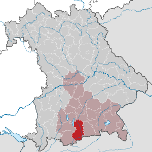
| Location of the Bad Tölz-Wolfratshausen district in Bavaria | |
  |
|


The district of Bad Tölz-Wolfratshausen ( Bavarian Däiz-Woifratshausn ) is located in the south of the administrative district of Upper Bavaria in Bavaria . The current double district was created in 1972, mainly through the merging of the former Bad Tölz and Wolfratshausen districts . After Traunstein , Rosenheim and Eichstätt , it is one of the largest of the 20 districts in Upper Bavaria in terms of area and, with the Schafreuter ( 2102 m above sea level ), it has one of the highest elevations on the Vorkarwendel . The district is designated as an independent tourism region “Tölzer Land” within Bavaria (→ see also section: Tourism ).
The district in the Bavarian Oberland is traversed from southwest to north by the Isar , which in it changes from a mountain river to a broad pre-Alpine stream and flows off at Icking towards Munich .
The district town of Bad Tölz is the district town , but various offices and authorities have been retained in the former district town of Wolfratshausen . The economic center and largest town in the district is the town of Geretsried , which emerged after the Second World War .
geography
location
The district belongs to the Oberland region and is characterized by the river valleys of the Isar and Loisach and many lakes. It encompasses both alpine and pre-alpine terrain. The Schafreuter in the Karwendel is at 2102 m the highest mountain in the district.
Neighboring areas
The district borders in a clockwise direction in the southwest on the districts of Garmisch-Partenkirchen , Weilheim-Schongau , Starnberg , Munich and Miesbach . In the south it borders on the Schwaz district of the state of Tyrol in Austria .
history
Offices as well as regional and nursing courts until 1800
The area of today's Bad Tölz-Wolfratshausen district was part of the historical inventory of the Duchy of Bavaria. In the High Middle Ages , the eastern part of today's district was assigned to the “Sundergau”, to the west of the Isar was the “Huosigau”; the boundaries were fluid. Between the years 1000 and 1100, the area was under the control of the Counts of Ebersberg, who died out in 1045, and the Wolfratshausen County of the Andechs-Meranians , who went out in 1248. Successors were the Wittelsbachers , who had received the ducal dignity in 1180. The inheritance of the noble free von Tölz, who died out in 1265, also fell to the Wittelsbach family. They also obtained bailiwick rights over the important monasteries Schäftlarn , Tegernsee and Benediktbeuern and their judicial districts. The castles Wolfratshausen and Tölz developed into new central locations and served as ducal bases. The land registry offices there - from 1281 at the latest, Tölz is named as one of the most important offices of the Duchy of Bavaria in the state land registry - formed the first structures of a developing administration, which was followed by the caste offices and later the Wolfratshausen and Tölz regional and nursing courts , which followed up to secularization in existed in 1802/1803. There were also the court brands Hohenburg, Greiling - Reichersbeuern - Sachsenkam , Harmating , Ascholding , Hechenberg , Königsdorf , Eurasburg and Hornstein . At the same time, the Benediktbeuern monastery developed its power as a monastery court from the middle of the 12th century .
Regional courts
After the secularization and dissolution of the monasteries in 1803, the district courts of the older order Tölz and Wolfratshausen were formed in what is now the district area . From 1808 they belonged to the Isarkkreis (capital Munich) and from 1838 to Upper Bavaria .
District Offices
In 1862 the district office of the same name was established from the Tölz district court . The district court district Wolfratshausen was initially assigned to the district office of Munich on the right of the Isar, and from 1879/80 to the district office of Munich II. The latter was dissolved in 1902. Then the Wolfratshausen District Office was established.
Counties
On January 1, 1939, as everywhere in the German Reich, the designation district was introduced. The district offices became Bad Tölz and Wolfratshausen.
Bad Tölz-Wolfratshausen district
During the regional reform in Bavaria on July 1, 1972, the Bad Tölz district and most of the Wolfratshausen district were combined to form the new Bad Tölz district; in addition there was the community Schlehdorf of the district of Weilheim . Some communities in the Wolfratshausen district came to the Munich, Starnberg and Miesbach districts. On May 1, 1973, the new Bad Tölz district was given its current name, Bad Tölz-Wolfratshausen district .
Population development
The Bad Tölz-Wolfratshausen district gained over 20,000 inhabitants between 1988 and 2008, or grew by around 20%. Between 1988 and 2018, the district grew from 100,433 to 127,227 by 26,794 inhabitants or 26.7%.
The following figures refer to the territorial status on May 25, 1987.
| Population development | ||||||||||||||
|---|---|---|---|---|---|---|---|---|---|---|---|---|---|---|
| year | 1840 | 1900 | 1939 | 1950 | 1961 | 1970 | 1987 | 1991 | 1995 | 2000 | 2005 | 2010 | 2015 | |
| Residents | 22,262 | 27,886 | 42,830 | 67,521 | 69,526 | 85.060 | 98,579 | 106,262 | 110.995 | 116.017 | 120,633 | 121,801 | 124.930 | |
Religions
According to the 2011 census, 56.3 percent of the population were Roman Catholic , 15.1 percent Protestant while 28.6 percent either belonged to other denominations or religions or were non-denominational. According to statistics from the Archdiocese of Munich-Freising, 57,838 Catholics out of a total of 127,277 inhabitants (45.4 percent) lived in the district in 2018.
politics
District administrators
- 1972–1996: Otmar Huber ( CSU )
- 1996-2008: Manfred Nagler (CSU)
- Since May 1, 2008: Josef Niedermaier ( Free Voters )
- Deputy District Administrator is Thomas W. Holz (CSU)
- Another deputy district administrator is Klaus Koch ( Bündnis 90 / Die Grünen )
District council
The district council consists of 60 members:
|
District election 2020
Turnout: 59.2%
% 40 30th 20th 10
0
34.33%
22.66%
20.84%
7.08%
3.85%
3.84%
2.29%
2.14%
1.70%
1.25%
Gains and losses
|
coat of arms
|
|
Blazon : “Under the blue head of a shield, inside a striding, red-tongued and red-armored golden lion, split; in front the Bavarian diamonds, behind in red two diagonally crossed silver abbot's bars with the curves facing. " |
|
Reasons for the coat of arms: The coat of arms connects the coat of arms of the former Bad-Tölz district with the Wolfratshausen lion.
The coat of arms was designed by the employee in the district office of Marianne Madl. |
Economy and Infrastructure
The income taxpower per inhabitant in 2004 was 329 euros (national average 216). The purchasing power per inhabitant in 2005 was 9,761 euros (national average 8,523). In July 2020, the unemployment rate in the district was 3.0% and thus significantly below the national average.
In the Future Atlas 2016 , the Bad Tölz-Wolfratshausen district was ranked 61st out of 402 districts and independent cities in Germany, making it one of the places with "high future opportunities".
tourism
The Bad Tölz-Wolfratshausen district is designated as an independent tourist region “Tölzer Land” within Bavaria , which is advertised, among other things, with its own web presence.
traffic
The A 95 runs through the western district for a length of around 15 kilometers . Sections of four federal roads also open up the district. The B 11 runs roughly in a north-south direction from Icking via Wolfratshausen and Geretsried to the B 472, from which it branches off again at Bichl via Kochel am See, Kesselberg to the district border south of the Walchensee . The B 13 also comes from the north near Sachsenkam in the district, runs via Bad Tölz and Lenggries to the Sylvenstein reservoir , where it joins the B 307. The B 472 crosses the district from east to west and passes Bad Tölz. The B 307 leads from the east along the Sylvenstein Dam to Vorderriß .
Communities


(Residents on December 31, 2019)
Unregulated areas
|
Other communities
|
License Plate
On August 5, 1974, the district was assigned the TÖL , which had been valid since July 1, 1956 for the Bad Tölz district. It is still issued today.
Since July 10, 2013 , the distinctive symbol WOR of the former Wolfratshausen district has been available.
Protected areas
There are eleven nature reserves , 20 landscape protection areas , 16 FFH areas and at least 55 designated geotopes in the district . (As of April 2016)
See also
- List of the municipalities in the Bad Tölz-Wolfratshausen district
- List of places in the Bad Tölz-Wolfratshausen district
- Lists of the architectural monuments in the Bad Tölz-Wolfratshausen district
- List of nature reserves in the Bad Tölz-Wolfratshausen district
- List of landscape protection areas in the Bad Tölz-Wolfratshausen district
- List of FFH areas in the Bad Tölz-Wolfratshausen district
- List of geotopes in the Bad Tölz-Wolfratshausen district
literature
- Andreas Höger: The Bad Tölz-Wolfratshausen district. Land on the Isar and Loisach. A history book , Bad Tölz 2008.
Web links
- Entry on the coat of arms of the Bad Tölz-Wolfratshausen district in the database of the House of Bavarian History
- The book End and New Beginning - The Nazi Era in the Altlandkreis Wolfratshausen
- Literature from and about the Bad Tölz-Wolfratshausen district in the catalog of the German National Library
- Bad Tölz-Wolfratshausen district: Official statistics of the LfStat
Individual evidence
- ↑ "Data 2" sheet, Statistical Report A1200C 202041 Population of the municipalities, districts and administrative districts 1st quarter 2020 (population based on the 2011 census) ( help ).
- ↑ a b Bavarian State Office for Statistics : Tourism regions in Bavaria Status: January 1, 2017, online at statistik.bayern.de
- ^ Georg Westermayer: Chronicle of the castle and the market of Tölz. Verlag Günther Aehlig, 3rd edition 1976, p. 63 ff.
- ^ Andreas Höger: The district of Bad Tölz-Wolfratshausen - Land on Isar and Loisach - A history book. Published by the Bad Tölz-Wolfratshausen district, Bad Tölz 2008.
- ^ Wilhelm Volkert (ed.): Handbook of Bavarian offices, communities and courts 1799–1980 . CH Beck, Munich 1983, ISBN 3-406-09669-7 , p. 97 .
- ↑ Bad Tölz-Wolfratshausen district population in regional comparison by religion -in% -
- ↑ Leaving the Church There are many reasons for frustration
- ↑ Links and information on local elections - Bad Toelz-Wolfratshausen district. Retrieved July 27, 2020 .
- ↑ Entry on the coat of arms of the Bad Tölz-Wolfratshausen district in the database of the House of Bavarian History , accessed on September 4, 2017 .
- ↑ A cake for the 40th birthday. In: merkur.de . July 26, 2012, accessed December 9, 2013.
- ↑ Statistics from the Federal Employment Agency, https://statistik.arbeitsagentur.de/Auswahl/raeumlicher-Geltungsbereich/Politische-Gebietsstruktur/Kreise/Bayern/09173-Bad-Toelz-Wolfratshausen.html?nn=25856&year_month=202007
- ↑ Future Atlas 2016. (No longer available online.) Archived from the original on October 2, 2017 ; accessed on March 23, 2018 . Info: The archive link was inserted automatically and has not yet been checked. Please check the original and archive link according to the instructions and then remove this notice.
- ↑ Website of the "Tölzer Land Tourismus (SG 15 TOUR) at the Bad Tölz-Wolfratshausen District Office" , online at toelzer-land.de
- ↑ "Data 2" sheet, Statistical Report A1200C 202041 Population of the municipalities, districts and administrative districts 1st quarter 2020 (population based on the 2011 census) ( help ).
Districts:
Aichach-Friedberg |
Altötting |
Amberg-Sulzbach |
Ansbach |
Aschaffenburg |
Augsburg |
Bad Kissingen |
Bad Toelz-Wolfratshausen |
Bamberg |
Bayreuth |
Berchtesgadener Land |
Cham |
Coburg |
Dachau |
Deggendorf |
Dillingen on the Danube |
Dingolfing-Landau |
Danube Ries |
Ebersberg |
Eichstätt |
Erding |
Erlangen-Höchstadt |
Forchheim |
Freising |
Freyung-Grafenau |
Fürstenfeldbruck |
Fürth |
Garmisch-Partenkirchen |
Gunzburg |
Hatred Mountains |
Yard |
Kelheim |
Kitzingen |
Kronach |
Kulmbach |
Landsberg am Lech |
Landshut |
Lichtenfels |
Lindau (Lake Constance) |
Main-Spessart |
Miesbach |
Miltenberg |
Mühldorf am Inn |
Munich |
Neuburg-Schrobenhausen |
Neumarkt in the Upper Palatinate |
Neustadt an der Aisch-Bad Windsheim |
Neustadt an der Waldnaab |
Neu-Ulm |
Nuremberg Country |
Oberallgäu |
Ostallgäu |
Passau |
Pfaffenhofen an der Ilm |
Rain |
Regensburg |
Rhön-Grabfeld |
Rosenheim |
Roth |
Rottal-Inn |
Schwandorf |
Schweinfurt |
Starnberg |
Straubing Arch |
Tirschenreuth |
Traunstein |
Unterallgäu |
Weilheim-Schongau |
Weißenburg-Gunzenhausen |
Wunsiedel in the Fichtel Mountains |
Wurzburg
Independent cities:
Amberg |
Ansbach |
Aschaffenburg |
Augsburg |
Bamberg |
Bayreuth |
Coburg |
Erlangen |
Fürth |
Hof (Saale) |
Ingolstadt |
Kaufbeuren |
Kempten (Allgäu) |
Landshut |
Memmingen |
Munich |
Nuremberg |
Passau |
Regensburg |
Rosenheim |
Schwabach |
Schweinfurt |
Straubing |
Willows in the Upper Palatinate |
Wurzburg