
Risum-Lindholm
| coat of arms | Germany map | |
|---|---|---|

|
Coordinates: 54 ° 46 ' N , 8 ° 52' E |
|
| Basic data | ||
| State : | Schleswig-Holstein | |
| Circle : | North Friesland | |
| Office : | Südtondern | |
| Height : | 2 m above sea level NHN | |
| Area : | 36.03 km 2 | |
| Residents: | 3796 (Dec. 31, 2019) | |
| Population density : | 105 inhabitants per km 2 | |
| Postcodes : | 25920, 25899 (guest port) |
|
| Area code : | 04661 | |
| License plate : | NF | |
| Community key : | 01 0 54 109 | |
| LOCODE : | DE RSU | |
| Office administration address: | Marktstrasse 12 25899 Niebüll |
|
| Website : | ||
| Mayor : | Hans Bruhn (FWG) | |
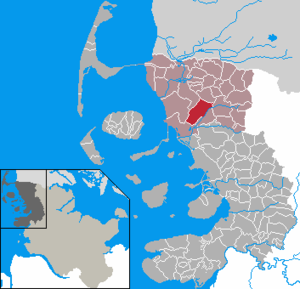
| Location of the municipality Risum-Lindholm in the district of North Friesland | ||
  |
||

Risum-Lindholm ( North Frisian : Risem-Loonham or Risem-Lunham ) is a municipality in the district of North Friesland on the west coast of Schleswig-Holstein .
geography
Geographical location
The elongated municipality of Risum-Lindholm is located in the landscape area of the Bökingharde . It is deposited directly to the southeast of the urban area of Niebüll . Large areas of land in the southern part of the municipality near the Lecker Au are part of the North Frisian Marsch landscape area . These are located around sea level , which is why the main receiving water is largely dammed .
When the Duchy of Schleswig belonged to the entire Danish state , the area was part of the lowest administrative district of the Bökingharde . This area was only made permanently settable by dikes between the 15th and 17th centuries. The area now includes shares in the following keds : (in brackets: years of dike):
- Klixbüller Koog (1466)
- Great Kohldammer Koog (1466)
- Little Kohldammer Koog (1554)
- Risummooringer Kornkoog (1580)
- Maasbüller Herrenkoog (1641)
- Hundebüller Koog (1714) (a few individual areas)
Before the dyke was built, the marshland was counted among the extensive Uthlands .
Community structure

The municipality emerged in 1969 from the formerly independent municipalities Risum and Lindholm. Since the municipality extends over several kilometers, the districts of Maasbüll (nf: Moosbel , Danish: Masbøl ), Risum (nf: Risem ), Lindholm (nf: Lunham ), Klockries (nf: Klookriis , Danish: Klokris ) , Wegacker (nf: Wäieeker ) and Kremperhaus (Danish: Krempehus ) (next to Broweg (nf: Bruwäi ), Läiged, Legerade (nf: Läigeroos ) and Herrenkoog (nf: Hiirnekuch , Danish: Herrekog ), which are not directly on the elongated Dorfstrasse), just for the sake of better orientation in the village, great importance remains unchanged. In local parlance, the actual municipality name is rarely used, but rather the name of the respective district.
Neighboring communities
The neighboring municipalities of Risum-Lindholm are:
| Niebüll | Klixbull | |
| Galmsbull |
.svg)
|
leak |
| Dagebüll | Stedesand |
history
Risum is mentioned together with Lindholm in the Waldemar-Erdbuch as part of the Bökingharde . The two villages and Niebüll and Deezbüll located on a glacial Sander island after the present there in the Middle Ages bog Risummoor was called. After the sea penetrated to this island after the first great mandrank in 1362, the endangered parts were sealed. This area was later called Risummoorer Kornkoog . In 1580 the medieval dike was reinforced.
In the 15th century, the construction of a dam to Stedesand created the Große Kohldammer-Koog , which is divided into Lindholm-Kohldammer-Koog and Risum-Kohldammer-Koog , and in 1544 the Kleine Kohldammer-Koog . Its dike broke at the second mandrank , which killed 402 people. The gap was closed again only when the Maasbüller Herrenkoog was extracted in 1641.
politics
Community representation
In the local elections on May 6, 2018, the CDU received five, the SPD four, the SSW two and the Free Voting Association FWG six. The turnout was 55.3 percent.
mayor
In the constituent meeting of the newly elected representation on June 25, 2018, Hans Bruhn (FWG) was elected as mayor.
coat of arms
Blazon : "In the blue head of the shield there are four staggered silver linden leaves, underneath a growing red Friesian gable, covered with three silver windows arranged one above the other, as well as a golden roof adjoining the head of the shield."
Culture and sights
Frisian
Risum-Lindholm is known nationwide as the cultural center of the mainland North Frisians. In contrast to most other places in North Frisia, in Risum-Lindholm the North Frisian language in the local Ostermooringer dialect still has a significant number of speakers and a corresponding importance in families and in the public. The language is taught in the three local schools, the Danish Risum Skole / Risem Schölj , the Risumer Elementary School and the Nis Albrecht Johannsen School in Lindholm. All street names in the new development areas are Frisian. The community has already received the " Language-friendly community " award twice .
The Andersen House, a Uthland Frisian house from 1723 in the district of Klockries, is the seat of the Ostermooriger Friesenverein and a popular venue for markets, concerts and private parties.
Church building
Both the St. Sebastián Church in Risum and the Michaeliskirche in Lindholm owe their present form to the 18th century - but their origins go back to the 13th century. Both have free-standing stacks of bells and some of the interior has medieval church furnishings.
Sports
In 2003, SV Frisia 03 Risum-Lindholm was created from the merger of the clubs MTV Frisia Lindholm and TSV Viktoria Risum-Maasbüll .
Economy and Public Infrastructure
Established businesses
The area of the municipality is strongly agricultural. In the outdoor areas today, renewable energy generation with its wind power and biogas systems also dominates . They often operate as citizens' energy companies or are operated by local farmers.
The institutional facility of the Deich- und Hauptsielverband Südwesthörn-Bongsiel is also located in the village . There is also a branch of the agricultural machinery manufacturer Claas , as well as VR Bank Nord .
traffic
Local public transport
The municipality is crossed in the western part of the Lindholm district by the Marschbahn (Hamburg-Altona -) Elmshorn - Westerland (Sylt). The railway line has since the 1980s, however, not have its own train station with passenger train stopping it after the branching here railway Flensburg-Soft-Lindholm shut down had been. The station is only still in operation as a depot (block post with barrier post). However, in 2005 it was signposted in two languages ("Risum-Lindholm / Risem-Lonham"). However, there is a demand stop in the Maasbüll district on the railway line between Niebüll and Dagebüll . This is approached every hour in both directions by the North German Railway Company . In the network map of the Schleswig-Holstein local transport network, the RB 65 trains run here .
Motorized private transport
Due to the location of Lindholm, the federal road 5 runs in the section between Heide and the federal border to Denmark south of Tondern . In the south west of Dithmarschen's district town, this merges directly into the federal motorway 23 to continue to Hamburg. The elongated locality is crossed by the village street that branches off on both sides. To the west, the street is dedicated as state road 10. This also opens up the Maasbüller Herrenkoog in the west of the town and continues via Norder- Waygaard to Waygaard-Deich.
Sons and daughters of the church
- Momme Andresen (1857–1951), chemist, pioneer of photography, co-founder of the Agfa company
- Sönke Nissen (1870–1923), railway engineer and German industrialist
- Johannes Oldsen (1894–1958), Frisian minority politician ( SSW ), Member of the State Parliament ( Schleswig-Holstein )
- Berthold Bahnsen (1913–1971), Frisian minority politician ( SSW ), Member of the State Parliament ( Schleswig-Holstein )
Web links
Individual evidence
- ↑ North Statistics Office - Population of the municipalities in Schleswig-Holstein 4th quarter 2019 (XLSX file) (update based on the 2011 census) ( help on this ).
- ^ As stated in Harry Kunz / Albert Panten : Die Köge Nordfrieslands. 2nd edition, Verlag Nordfriisk Instituut , Bredstedt, 1992
- ↑ Schleswig-Holstein topography. Vol. 8: Pölitz - Schönbek . 1st edition Flying-Kiwi-Verl. Junge, Flensburg 2007, ISBN 978-3-926055-89-7 , pp. 182 ( dnb.de [accessed on July 23, 2020]).
- ^ Nordfriisk Instituut: Nordfriesland Karte, Bräist / Bredstedt 2011
- ^ Videnskabernes Selskab: Kaart over den sydlige del af Slesvig , Copenhagen 1864
- ↑ Web editor: Results of the 2018 municipal elections in the South Tondern office. In: www.amt-suedtondern.de. Office Südtondern, accessed on July 3, 2018 .
- ↑ Schleswig-Holstein's municipal coat of arms
Achtrup | Ahrenshöft | Ahrenviöl | Ahrenviölfeld | Alkersum | Almdorf | Arlewatt | Aventoft | Bargum | Behrendorf | Bohmstedt | Bondelum | Bordelum | Borgsum | Bosbull | Braderup | Bramstedtlund | Bredstedt | Breklum | Dagebüll | Drage | Drelsdorf | Dunsum | Elisabeth-Sophien-Koog | Ellhöft | Emmelsbüll-Horsbüll | Narrow Sands | Fresendelf | Friedrich-Wilhelm-Lübke-Koog | Friedrichstadt | Galmsbüll | Garding | Garding, parish | Goldebek | Goldelund | Gröde | Grothusenkoog | Haselund | Hattstedt | Hattstedtermarsch | Högel | Spar | Hooge | Hörnum (Sylt) | Horstedt | Hude | Humptrup | Husum | Immenstedt | Joldelund | Kampen (Sylt) | Karlum | Katharinenheerd | Klanxbüll | Klixbull | Koldenbüttel | Kolkerheide | Kotzenbüll | Ladelund | Langeneß | Langenhorn | Leak | Lexgaard | List on Sylt | Löwenstedt | Lütjenholm | Midlum | Mildstedt | Fog | Neukirchen | Nieblum | Niebüll | Norddorf on Amrum | Norderfriedrichskoog | North beach | Norstedt | Ockholm | Oevenum | Oldenswort | Oldersbek | Olderup | Oldsum | Ostenfeld (Husum) | Oster-Ohrstedt | Osterhever | Pellworm | Poppenbüll | Ramstedt | Rantrum | Reußenköge | Risum-Lindholm | Rodenäs | Sankt Peter-Ording | Schwabstedt | Schwesing | Seeth | Simonsberg | Sollwitt | Sönnebüll | Sprakebull | Stadum | Stedesand | Struckum | South end | Süderhöft | Süderlügum | South March | Sylt | Tating | Tetenbull | Tinningstedt | Tönning | Tümlauer-Koog | Uelvesbüll | Uphusum | Utersum | Viöl | Vollerwiek | Vollstedt | World | Wenningstedt-Braderup (Sylt) | Wester-Ohrstedt | Westerhever | Westre | Winnert | Wipe | Witsum | Wittbek | Wittdün on Amrum | Joke word | Wobbenbüll | Wrixum | Wyk on Föhr