Jevenstedt
| coat of arms | Germany map | |
|---|---|---|

|
Coordinates: 54 ° 14 ' N , 9 ° 40' E |
|
| Basic data | ||
| State : | Schleswig-Holstein | |
| Circle : | Rendsburg-Eckernförde | |
| Office : | Jevenstedt | |
| Height : | 6 m above sea level NHN | |
| Area : | 45.55 km 2 | |
| Residents: | 3318 (Dec. 31, 2019) | |
| Population density : | 73 inhabitants per km 2 | |
| Postal code : | 24808 | |
| Area code : | 04337 | |
| License plate : | RD, ECK | |
| Community key : | 01 0 58 086 | |
| LOCODE : | DE 69G | |
| Office administration address: | Meiereistraße 5 24808 Jevenstedt |
|
| Website : | ||
| Mayor : | Sönke Schwager ( CDU ) | |
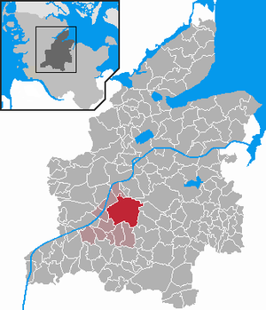
| Location of the community of Jevenstedt in the Rendsburg-Eckernförde district | ||
Jevenstedt is a municipality near Rendsburg on Ochsenweg in the Rendsburg-Eckernförde district . The municipality is the administrative seat of the Jevenstedt office . Altenkattbek, Barkhorn, Bramkamp, Dammstedt, Jevenstedterteich, Kolshorn, Kreuzkoppel, Nienkattbek, Pollhorn, Schwabe and Spannan are located in the municipality.
Geography and traffic
The community is located on the B 77 on the edge of the 380 km² Aukrug nature park with meadows and fields, heather, moors, ponds and small rivers. The Jevenau flows through Jevenstedt . The Jevenstedter ponds are located in the municipality. From 1901 to 1957 there was a train station of the Rendsburger Kreisbahn in Jevenstedt .
history
An Iron Age settlement of the municipality can be proven by urn graves.
The place was first mentioned in 1190 as Gjievenstedt ( site on the Gjieve ). Gjieve is the old name of Jevenau, from which the place name is derived today. The place was originally in a wooded area. However, the forest was largely cut down when Rendsburg was expanded in the 17th century. The church was originally a hall, which was shaped like a cross by the two side buildings from 1605 (north transverse arm) and 1765 (south transverse arm). The shape of the cross is no longer recognizable because an organ was installed in the east behind the altar. There is a baptismal angel in the church . In 1559 the Danish King Christian II visited the place for a consultation about the conquest of Dithmarschen .
During the Thirty Years' War Jevenau was one of the points from which the fortress Rendsburg was besieged. When Wallenstein moved through the village on the Ochsenweg, there were skirmishes with the residents, during which all buildings in the village were destroyed by fire.
On January 31, 1864, Crown Prince Friedrich Wilhelm, later Emperor Friedrich III. , here his first headquarters in the German-Danish War, in a farmhouse. In the evening he wrote - coming from Hamburg - in his diary: “So we are on the eve of the decision, and God will guide our weapons with his blessing, so that we will have success straight from home and thus find an ally in happiness, who is of great importance to us. "
Incorporations
On January 1, 1974, the communities Altenkattbek, Nienkattbek and Schwabe were incorporated.
politics
Of the 17 seats in the municipal council, the SPD has seven seats since the 2013 local elections, the CDU six and the constituency AWJ has four.
coat of arms
Blazon : “Divided by silver and red in a wave cut. Above is a resisting lindworm covered with a golden sword , below a göpel in confused colors. ”The coat of arms is based on the church seal from 1528, which shows St. George on the dragon.
economy
Due to the proximity to Rendsburg there are many residential areas, as well as an own industrial area. In addition to craft businesses, taxi companies and service companies, riding facilities and riding schools in particular are located in Jevenstedt.
Attractions
The list of cultural monuments in Jevenstedt includes the cultural monuments entered in the list of monuments of Schleswig-Holstein. The Jevenstedt Blacksmith Museum is a local history museum that has existed since 1995 .
Web links
Individual evidence
- ↑ North Statistics Office - Population of the municipalities in Schleswig-Holstein 4th quarter 2019 (XLSX file) (update based on the 2011 census) ( help on this ).
- ^ Kaiser Friedrich III .: Diaries 1848–1866. Leipzig 1929, p. 239
- ^ Federal Statistical Office (ed.): Historical municipality directory for the Federal Republic of Germany. Name, border and key number changes in municipalities, counties and administrative districts from May 27, 1970 to December 31, 1982 . W. Kohlhammer GmbH, Stuttgart / Mainz 1983, ISBN 3-17-003263-1 , p. 184 .
- ↑ Schleswig-Holstein's municipal coat of arms


