Pierrefontaine-lès-Blamont
| Pierrefontaine-lès-Blamont | ||
|---|---|---|

|
|
|
| region | Bourgogne-Franche-Comté | |
| Department | Doubs | |
| Arrondissement | Montbeliard | |
| Canton | Maîche | |
| Community association | Pays de Montbéliard agglomeration | |
| Coordinates | 47 ° 23 ' N , 6 ° 50' E | |
| height | 490-835 m | |
| surface | 8.96 km 2 | |
| Residents | 468 (January 1, 2017) | |
| Population density | 52 inhabitants / km 2 | |
| Post Code | 25310 | |
| INSEE code | 25452 | |
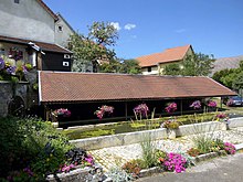
 Mairie Pierrefontaine-lès-Blamont |
||
Pierrefontaine-lès-Blamont is a French municipality with 468 inhabitants (as of January 1 2017) in Doubs in the region Bourgogne Franche-Comté .
geography
Pierrefontaine-lès-Blamont is located at 560 m, about 16 kilometers south of the city of Montbéliard (as the crow flies). The village extends in the northern Jura , at the northern foot of the Lomont chain and on the edge of the wide plateau of the Table Jura , east of the Doube valley , near the border with Switzerland .
The area of the 8.96 km² municipal area covers a section of the northern French Jura. The northern part of the area is taken up by the slightly undulating Tafeljura plateau, which averages 550 m and rises slightly to the south. The high plateau is predominantly made up of arable and meadow land. There are no surface rivers here because the rainwater seeps into the karstified subsoil. Below the village, the basin of a side valley of the Creuse (source stream of the Gland) begins. The eastern boundary runs in the valley section of the Noire Combe , in which the Tante Arie cave is also located.
To the south, the community area extends over the wooded slope to the crest of the Lomont. From a geological and tectonic point of view, this ridge forms an anticline of the Jura folds , which is oriented in a west-east direction according to the direction of the mountain range in this region. At 842 m, the highest point in Pierrefontaine-lès-Blamont is reached on the ridge at Fort du Lomont. In the west, the municipality reaches almost to the edge of the Doubs valley.
Pierrefontaine-lès-Blamont includes the hamlet of La Marnière (560 m) on the southern edge of the high plateau of Blamont and a few individual farms. Neighboring municipalities of Pierrefontaine-lès-Blamont are Autechaux-Roide and Blamont in the north, Villars-lès-Blamont in the east, Chamesol and Montécheroux in the south and Pont-de-Roide-Vermondans in the west.
history
Pierrefontaine has belonged to the Blamont domain since the Middle Ages . After the village came under the sovereignty of the Counts of Montbéliard in 1506, the Reformation was introduced. As part of the Blamont dominion, which formed one of the four dominions of the Principality of Montbéliard and was annexed by France in 1699, Pierrefontaine finally came under contract to France in 1748. In the relevant treaty, France had given the previous sovereign, the Duke of Württemberg, a. a. the status quo of the Lutheran Church assured. To avoid confusion with other communities of the same name, Pierrefontaine was officially renamed Pierrefontaine-lès-Blamont in 1962. Today the municipality is part of the community association of the Pays de Montbéliard Agglomération .
Attractions
The Lutheran village church of Pierrefontaine-lès-Blamont (Église luthérienne) was built in 1781 as one of twenty churches in the county and once dependent territories that were rebuilt or renovated with the support of Charles Eugen during his long reign. It was replaced by a chapel that was consecrated to the apostles Peter and Paul in the pre-Reformation period (here 1539). In the center of the village there are some farmhouses in the characteristic style of Franche-Comté from the 17th to 19th centuries. The Fort du Lomont (built from 1875 to 1879) and the Tour Carrée, which are part of the Lomont fortification system, are located on the ridge of the Lomont.
 |
population
| Population development | |
|---|---|
| year | Residents |
| 1962 | 174 |
| 1968 | 201 |
| 1975 | 190 |
| 1982 | 190 |
| 1990 | 235 |
| 1999 | 304 |
| 2006 | 381 |
| 2016 | 462 |
With 468 inhabitants (as of January 1, 2017), Pierrefontaine-lès-Blamont is one of the small communities in the Doubs department. After the population had decreased significantly in the first half of the 20th century (343 people were still counted in 1886), strong population growth has been recorded since the mid-1980s. Since then the number of inhabitants has more than doubled.
Economy and Infrastructure
Until well into the 20th century, Pierrefontaine-lès-Blamont was primarily a village characterized by agriculture (arable farming, fruit growing and cattle breeding) and forestry. In addition, there are now a number of local small businesses, including a company in the packaging industry. In the meantime, the village has turned into a residential community thanks to its attractive location. Many workers are therefore commuters who do their work in the Montbéliard agglomeration.
The village is located away from the major thoroughfares on a department road that leads from Pont-de-Roide to Porrentruy . The closest connection to the A36 motorway is around 17 kilometers away. Further road connections exist with Blamont and Montécheroux.
Web links
Individual evidence
- ↑ See "Histoire Religieuse" , on: "Bienvenue à Villars les Blamont" , accessed on January 25, 2016.
- ↑ Georges-Frédéric Goguel, Précis historique de la Réformation et des églises protestantes dans l'ancien comté de Montbéliard et ses dépendances , Paris: Marc-Aurel frères, 1841, p. 148.
- ↑ See "Pierrefontaine: l'église luthérienne" , on: Les temples ou églises luthériennes de France , accessed on January 23, 2016.

