
Vyt-lès-Belvoir
| Vyt-lès-Belvoir | ||
|---|---|---|

|
|
|
| region | Bourgogne-Franche-Comté | |
| Department | Doubs | |
| Arrondissement | Montbeliard | |
| Canton | Bavans | |
| Community association | Pays de Sancey-Belleherbe | |
| Coordinates | 47 ° 21 ' N , 6 ° 37' E | |
| height | 516-845 m | |
| surface | 7.54 km 2 | |
| Residents | 188 (January 1, 2017) | |
| Population density | 25 inhabitants / km 2 | |
| Post Code | 25430 | |
| INSEE code | 25635 | |
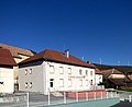
 Church of St. Peter and Paul |
||

V yt-lès-Belvoir is a French municipality with 188 inhabitants (as of January 1 2017) in Doubs in the region Bourgogne Franche-Comté .
geography
Vyt-lès-Belvoir is located at 570 m , seven kilometers north-northeast of Sancey-le-Grand and about 22 kilometers southwest of the city of Montbéliard (as the crow flies). The village extends in the Jura , at the southern foot of the Lomont range , in a depression that connects the Sancey basin and the Barbèche valley.
The area of the 7.54 km² municipality covers a section of the French Jura. The central part of the area is occupied by the almost 2 km wide and 4 km long depression, which is an average of 570 m. Topographically it belongs to the catchment area of the Barbèche (left tributary of the Doubs ). This area is mostly made up of arable and meadow land. In the south it is flanked by the high plateau of Mont de Belvoir (up to 660 m). To the north, the community area extends over a relatively steep, wooded slope up to the ridge of the Lomont chain. From a geological and tectonic point of view, this ridge forms an anticline of the Jura folds and is oriented in a west-east direction. The highest point of Vyt-lès-Belvoir is reached here at 845 m.
Neighboring municipalities of Vyt-lès-Belvoir are Anteuil , Hyémondans and Dambelin in the north, Valonne in the east, Vernois-lès-Belvoir and Belvoir in the south and Vellerot-lès-Belvoir in the west.
history
In the Middle Ages, Vyt belonged to the domain of Neuchâtel-Urtière . Together with Franche-Comté , the village came to France with the Peace of Nijmegen in 1678.
Attractions
The village church of Saint-Pierre-et-Paul was rebuilt in 1833. It houses a depiction of Jesus' Descent from the Cross from the 17th century. On the western outskirts there is a chapel, which was inaugurated in 1871.
population
| Population development | |
|---|---|
| year | Residents |
| 1962 | 111 |
| 1968 | 115 |
| 1975 | 124 |
| 1982 | 163 |
| 1990 | 145 |
| 1999 | 172 |
| 2006 | 166 |
| 2016 | 187 |
With 188 inhabitants (as of January 1, 2017), Vyt-lès-Belvoir is one of the small communities in the Doubs department. After the population had decreased markedly in the first half of the 20th century (249 people were counted in 1881), an overall increase in population has been recorded since the beginning of the 1970s.
school


Economy and Infrastructure
Until well into the 20th century, Vyt-lès-Belvoir was predominantly a village characterized by agriculture (arable farming, fruit growing and cattle breeding). In addition, there are now some local small businesses. Many workers are also commuters who work in the larger towns in the area.
The village is off the main thoroughfares on a departmental road that leads from Sancey-le-Grand to Noirefontaine. There are other road connections with Vellerot-lès-Belvoir and Vernois-lès-Belvoir.