
Auckland
|
Auckland Auckland Council Māori: Tāmaki Makaurau Ākarana |
|
| logo | |
|
Auckland Council logo |
|
| Geographical location | |
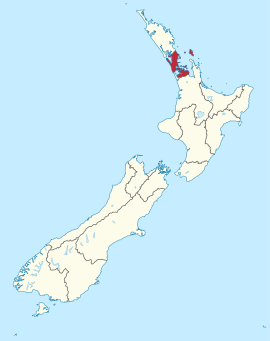  |
|
| Photo from Auckland | |
 |
|
| Local authority | |
| Country | New Zealand |
| island | North island |
| Local authority | Unitary Authority |
| Council | Auckland Council |
| mayor | Phil Goff |
| founding | 1840 |
| Post Code | 0600-2699 |
| Telephone code | +64 (0) 9 |
| UN / LOCODE | NZ AKL |
| Website | www.aucklandcouncil.govt.nz |
| presentation | |
 coat of arms |
|
| nickname | City of Sails ( City of Sails ) |
| geography | |
| Region ISO | NZ-AUK |
| Coordinates | 36 ° 50 ′ S , 174 ° 48 ′ E |
| Highest elevation | 688 m |
| Lowest point | Height of sea level |
| surface | 4th 938 km 2 |
| Residents | 1 415 550 (2013) |
| Population density | 286.66 inhabitants per km 2 |
| Statistical data | |
| Public revenue | NZ $ 2,064.9 million (2015) |
| Public expenditure | NZ $ 2,034.2 million (2015) |
| Number of households | 509 625 (2013) |
| Ø income | NZ $ 29,600 (2013) |
| Māori population | 10.1% (2013) |
| Remarks | |
| The Auckland Council was formed on November 1, 2010 from the cities of Auckland City , North Shore City , Waitakere City , Manukau City and the districts of Papakura District , Franklin District and Rodney District . |
|

Auckland [ ˈɔːklənd ], official name Auckland Council , in Māori : Tāmaki Makaurau or Ākarana , is a large city and also a Unitary Authority on the North Island of New Zealand . With just over 1.4 million people, it is New Zealand's largest city, home to around a third of New Zealand's population. The Māori designation Tāmaki Makaurau , means "A young beauty with 100 lovers" while akarana is adapted to the volume level of the Māori version of "Auckland" is.
The landscape of multicultural Auckland is shaped by 53 inactive volcanoes , between which the city extends. The city owes them extensive parks that extend right into the center. The location on sheltered sea bays also contributes significantly to the image of Auckland , not least due to the numerous sailing boats that earned the city the nickname City of Sails .
On November 1, 2010, the Auckland metropolitan area ( English : Greater Auckland or Auckland Metropolitan Area ), with the previously administratively independent cities of Auckland City , Manukau City , North Shore City and Waitakere City , the districts Franklin District , Papakura District and Rodney District and the Auckland Regional Council , the Auckland Council , which, as planned, is to solve the problems of the greater Auckland area from a uniform and centrally organized administrative structure. The Auckland Council was politically legitimized by local elections on October 9, 2010 and since then has brought together all previous administrative units under the government of a mayor and 20 city councilors.
In a ranking of the cities with the highest quality of life worldwide, Auckland took third place in 2018.
Origin of name
The city of Auckland was given its name in 1840 by the then Governor William Hobson , who named it after him in honor of Lord Auckland , from whom Hobson had taken command of the frigate HMS Rattlesnake. Lord Auckland was the first Lord of the British Admiralty at the time and was Governor General of India from 1835 to 1842. In his honor a statue was erected in Calcutta in 1848 , which was given as a gift from the government of West Bengal to the city of Auckland in 1969 , where it was placed in front of the Civic Center building.
geography
Geographical location
Auckland is located on the 380 km long and up to 80 km wide northern headland of the North Island of New Zealand. The urban area borders on the Northland region to the north and the Waikato region to the south . In the west the Tasman Sea forms the natural border and in the east the Pacific Ocean , whereby the islands of Great Barrier Island and the islands between it and Auckland and the sea area of the Hauraki Gulf are part of the urban area. The newly formed urban area in 2010 covers a land area of 4938 km².
The highest point in the city is the 688 m high Kohukohunui , which is located in the Hunui Ranges in the extreme southeast of the city. Another mountain range lies west of the city center on the west coast. The Waitakere Ranges rise there up to 474 m . The land area of Auckland narrows in the middle of the north-south extension to a few kilometers, as Manukau Harbor protrudes from the west and Waitemata Harbor from the east as well as the wide estuary of the Tamaki River into the urban area.
geology

Large parts of New Zealand are under the direct influence of the Pacific Ring of Fire , including the area in and around Auckland . The city was built on a volcanic field consisting of basalt , the Auckland Volcanic Field . This consists of 53 no longer active volcanoes . They shaped the landscape insofar as they either protruded from the sea as islands or formed hills, lakes or lagoons. The first eruptions began around 60,000 to 140,000 years ago, while the last two major eruptions around 550 and 600 years ago formed the largest surviving volcano, the Rangitoto off the east coast of the city (see map). Rangi means "sky" and Toto means "blood", which suggests that the island got its name from Māori , who witnessed the last eruption. Even today only a few birds and insects live on this island because of the strongly acidic soil, which is mainly overgrown with plants that have been able to adapt to the black, stony soil conditions.
Many of the other former volcanoes were removed or their surface structure changed significantly in order to create space for level buildings or to create parks. Even today you can see numerous hills and terraces in the landscape that point to the volcanoes. In recent years, various district administrations have campaigned with the New Zealand government to put the unique scenic and cultural diversity of the volcanoes on the country's provisional list of UNESCO World Heritage candidates.
climate
Auckland is under the influence of a subtropical oceanic climate. The temperature fluctuations over the year are small. The climate is characterized by long, warm, humid summers and cooler, fairly humid winters. Average January temperatures fluctuate between 24 ° C and 30 ° C, with February often being even warmer, while average maximum temperatures in July range between 14 ° C and 20 ° C. Although it rains more in the summer months than in Wellington or Christchurch , for example , most of the precipitation falls in the winter months. The average annual precipitation is over 1243 mm.
Although the city's climate is highly dependent on geographic points such as hills, ocean currents or air currents, the temperature rarely exceeds 35 ° C. On July 27, 1939, Auckland recorded its only officially confirmed snowfall, whereby snow is not uncommon for various places in the country, especially on the South Island , for example Christchurch , and there regularly reaches sea level. Overall, Auckland is New Zealand's climatically mildest city.
|
Average monthly temperatures and rainfall for Auckland
Source: Database: monthly averages from 1961–1990
|
||||||||||||||||||||||||||||||||||||||||||||||||||||||||||||||||||||||||||||||||||||||||||||||||||||||||||||||||||||||||||||||||||||||||||||||||||||||||||||||||||||||||||||||||||||||||||||||||||||||||||||||||||
history
Settlement by the Māori

Tāmaki Makaurau , now known as Auckland , was first settled by the Māori , the indigenous people of New Zealand, around 1350. On the remains of the volcanoes they built fortified villages, so-called Pā . At the height of the pre-colonial settlement, the area of today's big city Auckland had around 20,000 inhabitants; with this number one could later obtain city rights under New Zealand law. The terrace-like structures of this early settlement can still be partially recognized today on the larger hills, such as Mount Eden or One Tree Hill .
The main reasons for the settlement of this area were the good opportunities to obtain food as well as the strategic advantages compared to other settlement areas. The fertile, extremely productive soils made agriculture flourish and the access to two large natural harbors made fishing easier. In addition, the fortified settlements on the volcanic hills and the sheltered position on the isthmus made defense easy.
The Ngāti Whātua and Waikato-Tainui were originally the two predominant Māori tribes ( Iwi ). When the Europeans arrived in New Zealand, they used, among other things, weapons as barter goods , which upset the balance of power among the tribes and inevitably degenerated into armed conflict. Diseases, especially smallpox and tuberculosis , introduced by the Europeans as a result of these clashes , significantly reduced the number of Māori in the area.
In the following time Māori “sold” more and more land, for example today's city center to William Hobson , the first governor of the country (then still Lieutenant-Governor ), and agreed on the contract on March 20 in the Bay of Islands to sign from Waitangi . The Ngāti Whātua tribe hoped for better access to the newly created port facilities in order to be able to bring their goods from the Waikato and Hauraki Plains to the markets in the former convict colony of Australia and especially to Sydney .
The hour of birth of today's city
After signing the Treaty of Waitangi , which bound New Zealand to the United Kingdom (at that time New Zealand was officially a "colony" of New South Wales ), William Hobson had to find a suitable location for the country's new capital. At that time, the majority of European settlement was concentrated in the Bay of Islands in what is now the Far North District ( Northland region ). But the Bay of Islands' geographic location made it difficult to reach and extremely remote from the rest of the country.

At first glance, Port Nicholson , now Wellington Harbor , seemed like a good choice for the capital. Port Nicholson was very conveniently located on the southern tip of the North Island, thus close to the South Island and also with a large population growth. And the city was at the time of the New Zealand Company and the Wakefield -Brüdern , pioneers of the colonization of New Zealand, controlled and had for illegal possession of Māori -Land a pretty bad reputation.
On the recommendation of several personalities, most notably the missionary Henry Williams and the colony's chief surveyor, Felton Mathew , and because of the abandonment of land by the Ngāti Whātua , Hobson chose the south bank of Waitemata Harbor as the location for the new capital while he was Okiato (also known as Old Russell ), seven kilometers south of present-day Russell in the Bay of Islands as the temporary capital. After William Cornwallis Symonds , a close confidante of Hobson and the magistrate in this area , had acquired further land from the Ngāti Whātua , the founding ceremony of the city of Auckland was held on September 18, 1840 at 1:00 p.m., probably in what is now Upper Queen Street . He named the city after George Eden, 1st Earl of Auckland , who was one of his patrons and friends. On November 26, 1842, the New Zealand Gazette officially announced the city name " Auckland ".
From this point on, a steady stream of immigrants reached the new capital. At the beginning it was mostly people from other parts of New Zealand and ships from the "mother colony" New South Wales , but in 1842 the first immigrant ships coming directly from Great Britain entered the port of Auckland . While the eastern areas of the city were reserved for members of the government, mainly craftsmen and artists settled in the western area of the city. This social gradient has persisted to this day.
In 1862 Port Nicholson finally became the capital of the country and has retained this status - now known as Wellington - to this day. A central position on the Cook Strait became extremely important at that time to stop separatist movements in the South Island. These germinated because gold was found in the Otago region on the South Island and slaughter meat from the South Island could safely be brought to Great Britain as chilled meat because of the invention of the refrigerator .
Rise to the big city

The city of Auckland served from 1860 as the starting point for the then Governor George Gray to push the Māori ever further south during the New Zealand Wars. One of his tactics was the infrastructural development of the areas south of Auckland . This also included the Great South Road (large parts of New Zealand State Highway 1 have the same route), which made it possible to reach the Waikato region more quickly with armed troops. This road also attracted other settlers to the area previously known as South Auckland or Manukau and thus significantly expanded the Pākehā's sphere of influence .
In the mid-19th century, settlement in New Zealand was mainly concentrated on the South Island. Nevertheless, Auckland gradually developed into the economic center of the country. While the Great South Road opened up the south of Auckland economically , rubber extraction from Kauri trees was an important economic sector of the Waitakere Ranges in the west.
After all, Auckland was the largest city in the country as early as 1900 . This started an era of building. For example, an electrified tram was opened in 1919 . This consisted of nine lines and had to compete with private city buses over the next few years, until in 1926 the state decided on a kind of "transport monopoly" in local public transport. This year 63,000,000 passengers were carried with the tram. About ten years after the introduction of the tram, operations were gradually discontinued.

The Great Depression of 1929 also had a major impact on the city of Auckland . With Michael Joseph Savage a supporter of the Labor Party became Prime Minister of New Zealand for the first time . In the following decades, up to the 1950s, he had countless houses built for the financially disadvantaged population in Auckland at state expense . The houses were usually built on very large lots - usually a quarter of an acre (about 1,000 square meters ). The size of the plots around the small houses has hardly changed since then, which leads to an immense amount of space being consumed and to great inefficiency in local public transport .
After the Second World War , another building boom set in, especially with regard to improvements to the infrastructure. The Auckland Harbor Bridge, for example, opened in 1959 and widened ten years later due to chronic congestion. This bridge connects Auckland city center with the northern suburb of North Shore and thus spans Waitemata Harbor . Furthermore , the new airport was officially inaugurated in 1966 south of Mangere , a district of the former Manukau City , in order to relieve the airfields in Ardmore and Whenuapai, which had flown to after the flying boat services were discontinued .
In 1998 the central business district was without power for a full five weeks. On January 20, the first (40-year-old) underground power cable failed due to unusually hot weather conditions, and the remaining three followed by February 20. Until power could be restored five weeks later, many companies that the incident was estimated to cost around NZ $ 60,000 a week temporarily relocated their offices to suburbs, other New Zealand cities, or even Australia . A total of around 60,000 to 74,000 workers and 6,000 residents were affected. (see also Auckland electricity crisis of 1998 )
Formation of the Auckland Council
The starting point for the idea of amalgamating all cities and districts in the Auckland region was to provide the rapidly growing Auckland metropolitan area with a government and administration that could quickly and efficiently solve all of the metropolis’s infrastructure problems. With a regional council, four councils of independent cities and three district councils, which in turn had a further 30 local community boards as subdivisions, it was believed that the problems of the fast-growing Auckland region could no longer be adequately solved.
As early as 2002, through the Local Government Act 2002, the various councils in the region were given the authority to work together across the board for structural planning. In 2004, the Auckland Regional Transport Authority and the Auckland Regional Holdings were founded with the Local Government Auckland Amendment Act 2004 with the aim of planning and working across the entire region in matters of transport and rainwater management. In the same year the “one region approach” was developed.
After three years of discussion, a Royal Commission was finally established in 2007 and charged with examining the merger of the cities and districts of the Auckland region . In March 2009 the commission issued a very detailed report recommending that the Auckland region be viewed politically and administratively as one city and that the eight independent councils be dissolved. In the same month the government decided to largely follow the recommendation of the commission. In May 2009, the Auckland Transition Agency (ATA) was founded to implement the plan , which took 16 months to prepare the merger politically and organizationally in accordance with the specifications of the New Zealand government.
With the public election on October 9, 2010, the citizens of the Auckland region ultimately had the task and the opportunity to give the Auckland Council and its bodies political legitimacy. With the approval of the citizens, the Auckland Council finally started its work on November 1, 2010. The Auckland Transition Agency (ATA) was thus suspended.
population
Population development
Although the greater Auckland area has been the country's largest metropolitan area since 1900, it had just over 150,000 inhabitants at the time. It was not until 1996 that the agglomeration exceeded the million mark . On June 30, 2003, 1,199,300 people lived in the country's largest metropolitan area. Finally, three years later, in 2006, the number of residents was already 1,320,700 according to the census and the 2013 census counted 1,415,550 residents. From an administrative point of view, the greater Auckland area has also been a city since 2010, making it New Zealand's only megacity. Forecasts estimate the population for the year 2050 to be over two million.
Of the population counted in 2013, 142,767 were of Māori origin (10.1%). This means that 23.9% of the country's Māori population lived in Auckland .
When asked about ethnic group membership in the 2013 census, 59.3% said they were European, 10.7% said they had Māori roots, 14.6% came from the Pacific Islands and 23 , 1% came from Asia (multiple answers were possible). 39.1% of the population said they were born overseas. 4.4% of the population spoke Samoan as the second most common language after English. the third most common language was Māori and was spoken by 3.7% of the population, among the Māori it was 17.9%. The median income for the population in 2013 was NZ $ 29,600 compared to NZ $ 28,500 national average.
Origin and languages

Auckland is home to many different cultures. Most of the residents have European , primarily British, ancestors. But there are also large communities of Māori , Asians and people from the Pacific Islands. No other major city in the world has as many Polynesians as Auckland . A large proportion of the population has Asian origins. Most of the immigrants here come from East Asia as well as from South Asia . The reason for this cultural diversity despite the relative remoteness of the city is the country's extremely permissive immigration policy. A large proportion of the immigrants to New Zealand move to Auckland , making it by far the most multicultural city in the country.
The 2013 census for Auckland found the following ethnicity :
- 59.3% of the population belonged to the European population group,
- 23.1% of the population belonged to the Asian population group,
- 14.6% of the population belonged to the Pacific population group,
- 10.7% of the population belonged to the Māori population group and
- 3.1% of the population belonged to other population groups.
Note: In the New Zealand census it is possible to assign yourself to several ethnic groups.
religion
A comparatively large number of non-denominational people live in Auckland . Almost 40% of the total population do not belong to any religion . According to the 2001 census, less than 10% of religious residents regularly attend church services. Overall, a larger percentage of immigrant Polynesians attend church services on a regular basis than New Zealanders themselves. However, this noticeability subsides from the second generation onwards.
There are numerous religious communities in Auckland , such as Christianity , Buddhism , Hinduism and Islam . Jewish communities have existed since the beginning .

For the most part, Auckland is shaped by many different Christian denominations. The largest Christian communities are the Anglican Church , the Presbyterian Church and the Roman Catholic Church . The city has been a Catholic bishopric since 1848 with the Cathedral of St. Patrick and St. Joseph (1885/1908). New Zealand's National Roman Catholic Seminary, Holy Cross College , founded in Mosgiel in 1900 , has been based in Auckland since 1997 . There are also a small number of Lutherans in the city . The Pentecostal movement and the Charismatic Church recorded the greatest increases . The equally charismatic and fundamentalist Destiny Church , which was founded in 1998 and has its headquarters in Auckland , has around 300 followers and now operates 20 church buildings throughout New Zealand and even in Australia.
politics
administration
The Auckland Council consists of 20 Councilors and a Mayor . You rule the city. In addition, the city is divided into 21 so-called local boards , in which the elected representatives of the various city districts discuss and decide on issues with local relevance and in some cases are heard on overarching decision-making processes. The 21 local boards include:
| No. | Local Board | population |
|---|---|---|
| 1. | Albert-Eden |
94,695
|
| 2. | Devonport - Takapuna |
55,467
|
| 3. | Franklin |
65,319
|
| 4th | Great Barrier |
939
|
| 5. | Henderson-Massey |
107,685
|
| 6th | Hibiscus and Bays |
89,832
|
| 7th | Howick |
127.125
|
| 8th. | Kaipatiki |
82,494
|
| 9. | Mangere-Otahuhu |
70,959
|
| 10. | Manurewa |
82,242
|
| 11. | Maungakiekie-Tāmaki |
70.002
|
| 12. | Orākei |
79,539
|
| 13. | Otara papatoetoe |
75,663
|
| 14th | Papakura |
45,636
|
| 15th | Puketāpapa |
52,938
|
| 16. | Rodney |
54,879
|
| 17th | Upper Harbor |
53,670
|
| 18th | Waiheke |
8,340
|
| 19th | Waitākere Ranges |
48,396
|
| 20th | Waitematā |
77,136
|
| 21st | Whau |
72,594
|
Town twinning
The Auckland Council has signed 19 town twinning agreements of varying degrees with towns or other administrative units in other countries:
| city | country | consists | status |
|---|---|---|---|
| Brisbane |
|
since 1988 | Sister City |
| Busan |
|
since 1996 | Sister City |
| Cook Islands |
|
since 2012 | Memorandum for a cooperation |
| Fukuoka |
|
since 1986 | Sister City |
| Galway |
|
since 2002 | Friendship City |
| Guangzhou |
|
since 1989 | Sister City |
| Hamburg |
|
since 2007 | strategic partnership |
| Kakogawa |
|
since 1992 | Sister City |
| los Angeles |
|
since 1971 | Sister City |
| Nadi |
|
since 2006 | Cooperation agreement |
| Ningbo |
|
since 1998 | Sister City |
| Pohang |
|
since 2008 | Friendship City |
| Qingdao |
|
since 2008 | Sister City |
| Samoa |
|
since 2012 | Memorandum for a cooperation |
| Shinagawa |
|
Since 1993 | Friendship City |
| Taichung |
|
since 1996 | Sister City |
| Tomioka |
|
since 1983 | Friendship City |
| Tonga |
|
since 2012 | Memorandum for a cooperation |
| Utsunomiya |
|
since 1982 | Sister City |
economy

Auckland has always been not only the infrastructural, but also the economic center of New Zealand. Two particularly important factors in Auckland's economy make the metropolitan area the most important city in the country: On the one hand, foreign trade and, on the other hand, finance . Especially recently, tourism has also become increasingly important. The International Port of Auckland is responsible for 68% of all imports and 33% of all exports in the country (as of 2004). The unemployment rate stood at an average of 3.3% below the national average of 3.6% (2004). Many national credit institutions are headquartered in Auckland and many foreign banks have branches in the city. Since the country's extremely liberal economic policies, Australian banks have often held majority stakes in former New Zealand credit institutions. Examples include the Australia and New Zealand Banking Group (ANZ), the Bank of New Zealand or the Auckland Savings Bank (ASB).
In total, almost 70,000 people work in the city's Central Business District (CBD) alone , which corresponds to around 13% of all jobs in the city.
Infrastructure
traffic
Road traffic
In Auckland , as in all of New Zealand, private road transport has a higher priority than local public transport. This becomes clear, for example, from the fact that the metropolitan area has an extremely extensive road network for its size. On the other hand, the highway network was planned at the height of the road construction era and until today (2006) has still not been fully implemented according to the plans of that time. Roughly speaking, the basic network consists of a very important north-south connection, which at the moment runs from Orewa (former Rodney District ) in the north to just before Papakura in the south and is a section of New Zealand State Highway 1 . The second important route - an east-west tangent - runs from Waitakere in the east to the intersection with the north-south route in the center of the city. A long-planned continuation to the east, the Eastern Transport Corridor initially failed in 2004 due to the high costs of NZ $ 4,000,000,000 . The intersection of the two motorways has been expanded, making the Central Motorway Junction the largest motorway junction in the country. In addition, the Northern Motorway Extension will extend the northern motorway beyond Orewa .
The Auckland Harbor Bridge , which connects the city center with the North Shore , is of outstanding importance in the city's road network . The lanes that were added on both sides of the bridge in 1969 due to extremely heavy traffic became ailing over time and were repaired for the time being, but will have to be completely renewed in the future. Until then, there are plans to relieve the building, which is suffering from chronic congestion, either with another bridge or with an underground connection.
Public transport

Auckland suffers from extremely heavy traffic, which is responsible for miles of traffic jams in different parts of the city every day. The various approaches to solving the problem decided, among other things, one of the last mayoral elections. Since 2003, when the Britomart Transport Center was opened as a link between train, bus and ferry, public transport in Auckland has been operating under a single name: MAXX . Gradually, all buses, ferries, trains, stations, etc. will be provided with the network's logo in order to make the entire system more customer-friendly and to better link the three modes of transport. However, the entire system is still relatively unfriendly to the customer as there is no network tariff. A separate ticket has to be purchased for each of the twelve transport companies, so that using buses, trains and ferries is in most cases very unattractive, especially since the maintenance of a motor vehicle is very inexpensive.
To better regulate the business practices of private operators of local public transport, the Auckland region founded the interdistrict ARTA organization (ARTA = Auckland Regional Transport Authority ) in 2004 .
Bus transport

Buses make up by far the largest part of Auckland public transport . A total of five different bus companies operate in the urban area with different, not combinable, complicated tariff systems.
A very large project is the Northern Busway Project . A bus lane will be built along the planned Northern Motorway Extension , which is currently under construction , which is permanently reserved for local public transport. Since the parallel motorway is chronically congested in rush hour traffic, this line is used as one of very few of a significant number of passengers.
In the last few years some practical special lines have been introduced. One of them is the so-called NiteRider , a late line that runs to the most important stops on weekends until 3 a.m. There is also the Link Bus , which connects various stations in the city center and, lastly, the City Circuit ; this line is served every ten minutes and runs clockwise through the city center. Because it is free, it is very popular. Buses here are partly operated with hybrid technology and are therefore somewhat more environmentally friendly.
Rail transport
Long-distance transport
Auckland's long-distance train station is located in the Britomart Transport Center . A passenger train departs from here three times a week, which travels as Northern Explorer via Hamilton and Palmerston North to Wellington . In 1976 long-distance passenger services on the line north of Auckland towards Whangarei were discontinued. Since then, only freight trains have been running on this route.
Local transport

In previous years, plans for a light rail system were drawn up in Auckland . At this point in time, however, it is extremely unlikely that it will be implemented soon. Almost no money has been invested in the rail infrastructure, i.e. the tracks, the stations and the train units, for years. A turnaround marked the opening of the Britomart Transport Center in 2003, a station located in the middle of the city center and offering an easy transition to the buses and harbor ferries. The current rail network, which is more like a suburban train than an S-Bahn , consists of five lines, all of which start at the Britomart Center : The western line ( Western Line ) leads beyond Waitakere , the southern line ( Southern Line ) ends in Pukekohe , while the Eastern Line leads back to the southwest after the stop at Glen Innes and joins the southern line. Two lines use branch lines that branch off from the Southern Line: the line to Onehunga ( Onehunga Line ) and into the center of the former city of Manukau City .
Since mid-2005, around 40 existing stops have been modernized in a uniform design. However, these improvements are by no means sufficient to make the system in Auckland , which is lagging behind in all respects in a worldwide comparison of different cities of similar size, more attractive, although the passenger numbers have been around 10 to 40% above the previous year every month since the investment began (in February 2006: 423,000 journeys, in March 2006: 545,000 journeys). The ARTA consortium regularly publishes the latest developments and plans for the near future as well as for a medium-term period. In various documents, the following investments are given high priority: On the one hand, the authorities attached great importance to future electrification of the entire network, without, however, responding specifically to previous studies. Furthermore, a new line is to develop parallel to the SH20 in the southwest of the city. A connection to the airport both from the north and to a western continuation of the Manukau line, which is yet to be built, is also included in the expansion plan. A first step towards the establishment of an airport-inner-city line marked the reopening of the Onehunga Line, which had been fallow since 1973, in March 2007. A railway connection from North Shore is at most in the distant due to the unfavorable geographical location beyond Waitemata Harbor Possible future. So that a supply cycle of five minutes is possible at peak times and to make the Britomart Center , which is actually planned as a through station , but which is currently a terminus station , more efficient, another project is of primary importance for ARTA and is already in - albeit in the medium term - Planning phase: From the Britomart Center , an underground line with up to five stations is to open up the center ( Central Business District ), reduce travel times to Waitakere and make the Britomart Center a through station. The entire efficiency of the ARTA plans depends on this subway line, for which electrification is imperative. With all these expansions, the maximum annual carrying capacity would increase to 67.9 million people. In the greater Auckland area, there is also a movement for improved and greener public transport, the Campaign for Better Transport (CBT). This organization is committed to various improvements in train traffic. Among other things, she is responsible for the reopening of the Onehunga Line .
2007 marked an important year in Auckland's railroad history . On May 17, 2007 it was publicly announced that the New Zealand government was funding the electrification of the Auckland suburban railway . The cost, around $ 1 billion NZ , will be used for station conversions, power lines and new train units. All rail systems were electrified by 2013 and all suburban railways have been electrically operated since 2015.
Air traffic

The city of Auckland has with the airport Auckland has the largest airport in the country. This is located about 21 kilometers south of the city center in Mangere , the former city of Manukau . In 2004 over 11 million passengers were handled - 6 million of them with international destinations. Forecasts estimate the number of passengers in 2050 to be over 50 million. For years - especially since 2004 - the airport has been expanded step by step. For example, the terminals will be expanded or new parking facilities will be created. The total area of the arrival hall, which has existed since 1977, was around 12,000 m². In the meantime it has increased almost eightfold and is around 100,000 m². Overall, the airport, which is the most important hub for Air New Zealand , Freedom Air , and Pacific Blue , is served by over 30 airlines .
In addition, a feasibility study is being carried out for the establishment of a second international airport near Whenuapai , which is northwest of Waitakere , as the Royal New Zealand Air Force plans to relocate its main base , which is still located there, to Ohakea near Palmerston North . There are also two other airports in or around Auckland: Ardmore Airport - Mountain Air's base - and Dairy Flat , both of which are only served by smaller aircraft. The city's first airport in Mechanics Bay is now only used as a heliport .
Ferry traffic

Ferries are much more important for local transport in Auckland than in Wellington, for example . There are only two lines there, while in Auckland there are numerous different connections. Most popular are the ferry connections between Auckland City and North Shore , as the completely congested Auckland Harbor Bridge can be bypassed here. However, the islands off the east coast, which also belong to the urban area, are called by numerous ferries every day. There are connections e.g. B. to Half Moon Bay and to the islands of Rangitoto Island and Waiheke Island .
Maritime shipping
Auckland is New Zealand's main port city. In Auckland there are extensive port facilities for the handling of containers, general cargo and a major terminal for cruise ships. The majority of the ports is from the Auckland Council owned Ports of Auckland Authority operated.
Infrastructure for major events

Auckland has numerous venues for all kinds of sports and concerts. The city is home to Eden Park, the largest sports stadium in the whole country, where the 2011 rugby World Cup final took place. After renovations, there would have been space for 60,000 people. Cricket games can also be held thanks to the optionally oval playing field . After lengthy debates in 2006, possible new stadiums either in Waitakere or in the port area in the city center were rejected and the renovation of the Eden Park Stadium was decided. The North Harbor Stadium is the home ground of the New Zealand Knights , the New Zealand representative of the highest Australian football league, the eight-team A-League . There is also the Ericsson Stadium with a capacity of 25,000 .
Apart from the two ice hockey halls in the city, there are no venues for ice sports . These two halls cannot be measured against international standards. Despite its practically snow and frost-free location, the Vector Arena , a multifunctional hall with 12,000 seats in which sports such as ice hockey but also basketball or motocross races can take place, was opened in Auckland in 2007 .
education

In Auckland have three New Zealand universities headquartered: The University of Auckland , the Auckland University of Technology (AUT) and the Unitec Institute of Technology .
The oldest of the universities of Auckland is the founded in 1883 University of Auckland . In 2011 there were more than 40,000 students enrolled at the University of Auckland . It sees itself as a " research-based university " (for example: research-oriented university; comparable to a university in Germany) and offers a variety of courses in the faculties of engineering, law, medicine, art, economics, social, educational and natural sciences. A theological faculty is also affiliated. The main campus of Auckland University is located just southeast of downtown Auckland City . She has also five more about it: the largest is located in the Auckland City belonging district Tamaki , the medical school and other health sciences faculties are against the Auckland Hospital , close to the City campus in the district of Grafton settled, another campus is located in to North Shore belonging Takapuna district . Since the merger with the Auckland College of Education in 2004, the campus in Epsom and the branch in Whangarei have been part of the university.
The Auckland University of Technology (AUT), founded in 2000, is New Zealand's youngest university, although it goes back to the Auckland Technical School founded in 1895 . In 2014, 28,314 students were enrolled. The AUT is comparable to a technical university in Germany. The AUT are also located southeast of the city center. It also has a campus in the district Akoranga in North Shore .
The Unitec Institute of Technology was founded in 1976. In 2012 over 16,000 students were enrolled. Your status is comparable to that of a technical university or university of applied sciences in Germany. It is located in the Mt Albert neighborhood and has a branch in the Henderson neighborhood of Waitakere .
In addition, other New Zealand universities have campuses or branch offices in the Auckland metropolitan area . The University of Otago , which is mainly based in Dunedin , has a building on Queen Street in downtown Auckland, and Massey University also has a campus in Albany ( North Shore ) in addition to Palmerston North and Wellington .
The Manukau Institute of Technology (MIT), founded in 1970, is located in the Otara district . There has been a partnership with the University of Auckland since 1996 . According to its own website, over 25,000 students study at MIT
Culture
The Auckland metropolitan area attracts people for a variety of reasons. The mild climate of the region, the good job opportunities, numerous educational institutions and the many recreational opportunities are some of them. According to the city ranking by Mercer Consulting from 2012, Auckland has the third highest quality of life of all major cities in the world.
music
Auckland is home to the Auckland Philharmonia Orchestra , New Zealand's second largest professional orchestra. The orchestra plays works from symphonic classical music to opera and popular music. The New Zealand electro-pop band The Naked and Famous also comes from Auckland .
Festivals
The Polyfest , founded in Otara in 1976, is one of the largest Polynesian festivals.
leisure

Auckland is often referred to as the "City of Sails" as there are countless marinas along the coast. Westhaven Marina near the Auckland Harbor Bridge is not only the largest marina in the city, but also in the entire southern hemisphere, with around 1400 boat spaces. In addition, in no other city in the world there are as many sailboats per inhabitant as in Auckland. In the Viaduct Basin , a district that was redesigned in the late 1990s, the America's Cup has already taken place twice - in 2000 and 2003 . This formerly run-down harbor district has been converted into a lifestyle center with restaurants, apartments close to the center and public spaces. This area is now one of the centers of the city's nightlife with its cafes and bars.
Auckland has numerous bathing beaches. The most famous of these are on the east coast and are called Mission Bay , Devonport , Takapuna , Long Bay and Maraetai. In contrast to the white sandy coastline in the east, the beaches on the west coast to the Tasman Sea consist of black sand. The most popular sections are Piha and Muriwai Beach . Many of these beaches are protected by lifeguards from Surf Life Saving New Zealand , which emerges from the Australian Surf Life Saving .
Housing situation
Most of the people of Auckland live in their own homes. These are mostly single-storey wooden buildings and are located on a "quarter acre ", ie about 1000 square meters of land. The city consists largely of suburbs with mostly flat buildings. Auckland is the fastest growing city in the country. Because of the advancing and rapid urban sprawl, the administration is trying to stop this development and is relying on taller town houses, terraced houses or apartments to achieve the "increase in population density".
Sports
Auckland is home to the Royal New Zealand Yacht Squadron (RNZYS) , an old and leading New Zealand yacht club . He became known through successful participation in the America's Cup .
Every year in March since 1972, the 8.4 kilometer one-day round the Bays race has been held in Auckland , which mainly runs along the coast. The city has several stadiums for rugby union and cricket , venues for motor sports , tennis , badminton , swimming , soccer , rugby league and many more. Auckland even has two ice hockey stadiums.
The city's football club is called Auckland City FC and is the record champions of the country's top football league, the New Zealand Football Championship , founded in 2004 , with six titles and also eight titles in the OFC Champions League . But rugby plays a much bigger role, especially rugby union . The Blues , so the Blues , taking with fourteen other teams from New Zealand, Australia and South Africa at the Super Rugby championship and some have already been three times champion, most recently in 2003. The home games wearing the Blues in Eden Park from, with a capacity the largest stadium in the country with an audience of 50,000. In addition, the Auckland Rugby Football Union provincial team , which takes part in the ITM Cup , also plays its home games in Eden Park. This is the most successful provincial team in New Zealand with 16 championship titles and a record defense of the Ranfurly Shield . The North Harbor Rugby Union (NHRU) is also based in the northern part of the Auckland metropolitan area . Its rugby union team also plays in the national championship ITM Cup and plays its home games at North Harbor Stadium in Albany .
Since 2012, the Speedway World Championship Grand Prix of New Zealand has been taking place at the Western Springs Stadium in Auckland as part of the Speedway Individual World Championship.
Attractions

The actual city center of Auckland is south of the harbor in Waitemata Harbor along Queen Street. Worth seeing and a good starting point for boat tours in the Hauraki Gulf, for example on Rangitoto Island or Waiheke Island or Little or Great Barrier Island , is the port with the Ferry Building built in 1912. Immediately to the west is the Viaduct Basin, which hosted the America's Cup races in 2000 and 2003 . The Aotea Center and the Town Hall form an important cultural center in the city center. Not far from there are the Auckland City Gallery and the associated New Gallery.
Another interesting museum is the Auckland War Memorial Museum, located in the Auckland Domain Park, which houses collections on the history and culture of the Māori as well as New Zealand's nature. You can get an insight into the still existing fauna of the country in the city zoo . Free views over large parts of the metropolitan area can be obtained on the volcanic hills of Mount Eden and One Tree Hill. The best view of the area is obtained from the observation deck of the Sky Tower . This tower, opened in 1997, is the tallest building in the southern hemisphere at 328 meters .
East of the city center is Kelly Tarlton's Antarctic Encounter & Underwater World, a huge aquarium with an Antarctic exhibit. In the vicinity of the city there are numerous beautiful beaches that invite you to relax, swim and surf.
West of the city center next to the zoo is the Museum of Transport and Technology (MOTAT for short). In it you can see, among other things, a moving tram, various vintage cars, airplanes, but also various computers and digital games.
Numerous structures in Auckland have been protected as cultural monuments since the passage of the Historic Places Act 1993 . The New Zealand Historic Places Trust classified the following buildings in Category I:
- Auckland Ferry Terminal
- Auckland Grammar School
- Auckland Railway Station
- Auckland Savings Bank Building
- Auckland Town Hall
- Auckland War Memorial Museum
- New Zealand Maritime Museum Hui Te Anaui A Tangaroa
- Colonial Ammunition Company
- Dilworth Building
- Grafton Bridge
- Mount Eden Prisons
- Old Synagogue
- One Tree Hill
- St Matthew's
- St Patrick's Cathedral
- St Paul's Church
- Victoria Park Market


Personalities
Well-known personalities of the city include the mountaineer Edmund Hillary , the racing driver Bruce McLaren , the politician John Key and the actor Lawrence Makoare .
Others
Auckland is a city of millions and thus by far the largest city in New Zealand and accordingly occupies a dominant position in New Zealand society. This status as a “secret capital” leads to a certain rivalry with the actual capital Wellington . Furthermore, the lifestyle differs significantly from that of the rest of the country, especially in the predominantly rural regions. This difference leads to the fact that the city and the rest of the country see each other as not representative of the country, which is reflected in statements such as " New Zealand begins beyond the Bombay Hills " (New Zealand begins behind the Bombay Hills; a range of hills in the south of Auckland) or the designation as " Hillbilly " (hillbilly) for non-Aucklanders and " Jafa " for Aucklanders. The last name is an acronym for Just Another Fucking Aucklander (German: just another damned Aucklander) and is sometimes ironically, sometimes positively reinterpreted (e.g. as Just Another Friendly Aucklander - just another friendly Aucklander) meanwhile also used by Aucklanders themselves.
literature
- New Zealand Government (Ed.): Making Auckland Greater . Wellington 2009, ISBN 978-0-478-29486-6 (English).
- Auckland Transition Agency (Ed.): Auckland: Your Council. Your vote. . Auckland August 2010 (English).
Web links
- Homepage . Auckland Council,accessed November 29, 2015.
- Homepage . Auckland Tourism, Events and Economic Development Ltd,accessed November 29, 2015(Auckland Counciltourismwebsite).
Individual evidence
- ^ Phil Goff elected Mayor of Auckland. The New Zealand Herald, October 8, 2016, accessed June 22, 2017 .
- ↑ a b c d 2013 Census QuickStats about a place : Auckland - Population and dwellings . Statistics New Zealand , accessed August 13, 2016 .
- ↑ a b c d e f Auckland Council . In: Local Councils . Department of Internal Affairs , accessed August 13, 2016 .
- ↑ 2013 Census QuickStats about a place: Auckland . Statistics New Zealand , accessed April 21, 2017 .
- ↑ Malcolm McKinnon : Place names - Māori and Pākehā names . In: Te Ara - the Encyclopedia of New Zealand . Ministry for Culture & Heritage , November 24, 2008, accessed April 21, 2017 .
- ^ Bruce W. Hayward, Jill A. Kenny, Huge R. Grenfell : More Volcanoes recognized in Auckland Volcanic Field . In: Geoscience Society of New Zealand (ed.): Newsletter . Number 5 , November 2011, ISSN 1179-7983 (English, online [PDF; 7.0 MB ; accessed on April 19, 2016]).
- ↑ Mercer's 2018 Quality of Living Rankings. Retrieved July 30, 2018 .
- ^ Margaret McClure : Auckland region - The founding of Auckland: 1840–1869 . In: Te Ara - the Encyclopedia of New Zealand . Ministry for Culture & Heritage , August 5, 2016, accessed April 21, 2017 .
- ↑ Memorial plaque in front of the statue
- ↑ a b Topo250 maps - Auckland, Hamilton, Coromandel . Land Information New Zealand , accessed April 21, 2017 .
- ^ Weather Information for Auckland . World Meteorological Organization , accessed April 21, 2017 .
- ^ Royal Commission on Auckland Governance (ed.): Report: Royal Commission on Auckland Governance . Auckland 2009, ISBN 978-0-9864509-0-7 (English).
- ^ Auckland Transition Agency (ATA) . New Zealand Government , accessed December 10, 2010 .
- ^ Report - Census in Auckland . Auckland Council , accessed January 10, 2015 .
- ↑ 2013 Census QuickStats about a place : Auckland - Cultural diversity . Statistics New Zealand , accessed August 13, 2016 .
- ^ Georgina te Heuheu : Auckland hosts world's biggest Polynesian festival . New Zealand Government , March 13, 2009, accessed April 21, 2017 .
- ↑ Auckland Profile - Initial results from the 2013 Census . (PDF; 693 kB) Auckland Council , May 2014, accessed on January 10, 2015 (English).
- ↑ 2013 Census QuickStats about a place : Auckland Region - Local Boards Area - Population and dwellings . Statistics New Zealand , accessed August 13, 2016 .
- ↑ Global partnerships and strategy . Auckland Council , accessed April 21, 2017 .
- ^ Rail Services to Onehunga for 2009 . Auckland Regional Transport Authority , archived from the original on September 28, 2007 ; Retrieved on August 14, 2012 (English, original website no longer available, link to WaybackMachine from September 28, 2007).
- ↑ Mathew Dearnaley : $ 1b Auckland rail upgrade powers ahead . New Zealand Herald , May 21, 2007, accessed April 21, 2017 .
- ^ The best cities in the world for environment and infrastructure . City Mayors , December 6, 2012, accessed April 21, 2017 .
- ↑ Homepage. Museum of Transport and Technology Auckland, accessed September 29, 2019 .
North Island :
Auckland * |
Hamilton |
Lower Hutt |
Napier |
Palmerston North |
Porirua |
Tauranga |
Upper Hutt |
Wellington
South Island :
Christchurch |
Dunedin |
Invercargill |
Nelson *
North Island : Northland | Auckland * | Waikato | Bay of Plenty | Gisborne * | Hawke's Bay | Taranaki | Manawatu-Wanganui | Wellington
South Island : Tasman * | Marlborough * | Nelson * | West Coast | Canterbury | Otago | Southland
Other islands: Chatham Islands *
Northland :
Far North District •
Kaipara District •
Whangarei District
Auckland Council (Unitary Authority)
Waikato :
Thames-Coromandel District •
Hauraki District •
Waikato District •
Matamata-Piako District •
Hamilton City •
Waipa District •
Otorohanga District •
Rotorua Lakes 40% •
Waitomo District 95% •
Taupo District 75%
Bay of Plenty :
Western Bay of Plenty District •
Tauranga City •
Opotiki District •
Whakatāne District •
Rotorua Lakes 60% •
Kawerau District •
Taupo District 10%
Gisborne District (Unitary Authority)
Hawke's Bay :
Wairoa District •
Taupo District 10% •
Hastings District •
Napier City •
Central Hawke's Bay District •
Rangitikei District 10%
Taranaki :
New Plymouth District •
Stratford District 70% •
South Taranaki District
Manawatu-Wanganui :
Taupo District 5% •
Waitomo District 5% •
Ruapehu District •
Stratford District 30% •
Rangitikei District 90% •
Whanganui District •
Manawatu District •
Palmerston North City •
Tararua District 97% •
Horowhenua D istrict
Wellington :
Tararua District 3% •
Masterton District •
Kapiti Coast District •
Carterton District •
South Wairarapa District •
Upper Hutt City •
Porirua City •
Hutt City •
Wellington City
Tasman District ( Unitary Authority )
Nelson City ( Unitary Authority )
Marlborough District ( Unitary Authority )
West Coast :
Buller District •
Gray District •
Westland District
Canterbury :
Kaikoura District •
Hurunui District •
Selwyn District •
Waimakariri District •
Christchurch City •
Ashburton District •
Mackenzie District •
Timaru District •
Waitaki District 55% •
Waimate District
Otago :
Queenstown-Lakes District •
Central Otago District •
Waitaki District 45% •
Dunedin City •
Clutha District
Southland :
Southland District •
Gore District 70% •
Invercargill City