
Backguard
| coat of arms | Germany map | |
|---|---|---|

|
Coordinates: 54 ° 19 ′ N , 9 ° 58 ′ E |
|
| Basic data | ||
| State : | Schleswig-Holstein | |
| Circle : | Rendsburg-Eckernförde | |
| Office : | Backguard | |
| Height : | 29 m above sea level NHN | |
| Area : | 15.65 km 2 | |
| Residents: | 1052 (Dec. 31, 2019) | |
| Population density : | 67 inhabitants per km 2 | |
| Postal code : | 24239 | |
| Area code : | 04340 | |
| License plate : | RD, ECK | |
| Community key : | 01 0 58 001 | |
| LOCODE : | DE AWR | |
| Office administration address: | Inspektor-Weimar-Weg 17 24239 Achterwehr |
|
| Website : | ||
| Mayoress : | Anne Katrin Kittmann ( SPD ) | |
| Location of the municipality of Achterwehr in the Rendsburg-Eckernförde district | ||
 |
||

Achterwehr is a municipality in the Rendsburg-Eckernförde district in Schleswig-Holstein . It is located west of the state capital Kiel . Large areas of the community belong to the Westensee Nature Park . The river Eider meanders on the edge of the town center .
geography
The community includes the Schönwohld district and the Marutendorf and Hohenschulen estates. The Ahrensee and the Poolsee lie south of the Achterwehr . The historic Achterwehr shipping canal connects the Kiel Canal with the Eider. There is a 500 year old oak in Achterwehr and an even older yew tree in Schönwohld .
history
Achterwehr was first mentioned in 1375 in the document book of the city of Lübeck . The place name is Low German and means "behind the weir". Around 1900 the Achterwehr had 229 inhabitants; There was a post office, a steam sawmill, an inn, a merchant, a blacksmith and five craftsmen in the village. The majority of the remaining residents worked on the estate.
Good high schools
The estate was originally a Meierhof of the Klein-Nordsee estate in Brandsbek (today part of the municipality of Felde ) and was only separated as an independent unit in 1801. Today's manor house and dairy were built around 1802. Under its first owner, OJD Wulff, it was officially accepted into the circle of noble estates in Holstein. The aforementioned Wulff (1801–1816) was followed by Georg vd Steenhof (1816–1822), Schreiber v. Cronstern (1823–1868) and - as the most prominent owner - the Upper President of Schleswig-Holstein, Count Karl von Scheel-Plessen (1868–1892). Since 1948 it has been used as an experimental farm for the Institute for Plant Cultivation and Plant Breeding at the Christian Albrechts University in Kiel .
politics
Local council, mayor
The community council, consisting of eleven members, has been made up of four members of the CDU , three members of the SPD and four members of the "Lebendige Gemeinde" civic association since May 2018 . The incumbent mayor has been Anne Katrin Kittmann (SPD) since 2013.
coat of arms
The coat of arms describes the function of a plank weir with different water heights and thus refers to the place name Achterwehr (behind the weir).
Blazon : “In blue a golden pole, accompanied on the right by a lowered, left by a raised silver wavy bar; A silver flower with three spatulate, pointed petals above the right and below the left wavy bar. "
For a better understanding: Coats of arms are always described in the direction of the shield wearer's gaze and not the viewer. Therefore, seen from the observer, the left side is heraldically right and vice versa.
Partner municipality
- Blowatz (Mecklenburg-Western Pomerania)
Attractions
The list of cultural monuments in Achterwehr includes the cultural monuments entered in the list of monuments of Schleswig-Holstein.
There is a gallery for contemporary art in which various exhibitions take place.
traffic
The Achterwehr stop is on the Husum – Kiel line . It hold regional trains in every hour . The 210 motorway runs north through the municipality, and the 215 motorway to the east of the municipality .
photos
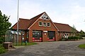
Achterwehr fire station

Web links
Individual evidence
- ↑ North Statistics Office - Population of the municipalities in Schleswig-Holstein 4th quarter 2019 (XLSX file) (update based on the 2011 census) ( help on this ).
- ↑ Aasbüttel - Bordesholm . In: Wolfgang Henze (ed.): Schleswig-Holstein topography: cities and villages of the country . 1st edition. tape 1 . Flying-Kiwi-Verl. Junge, Flensburg 2001, ISBN 3-926055-58-8 , p. 15 .
- ↑ Schleswig-Holstein topography. Vol. 1: Aasbüttel - Bordesholm . 1st edition Flying-Kiwi-Verl. Junge, Flensburg 2001, ISBN 978-3-926055-58-3 ( dnb.de [accessed April 13, 2020]).
- ^ Document book of the city of Lübeck, Vol. IV, p. 260
- ↑ Henning Oldekop: Topography of the Duchy of Holstein, 1st volume, Kiel: 1908, p. 54
- ^ Henning Oldekop: Topography of the Duchy of Holstein, 1st volume, Kiel: 1908, pp. 53–54
- ↑ Schleswig-Holstein's municipal coat of arms
- ↑ Heraldry: right and left. Retrieved April 24, 2018 .
- ↑ Schleswig-Holstein topography. Vol. 1: Aasbüttel - Bordesholm . 1st edition Flying-Kiwi-Verl. Junge, Flensburg 2001, ISBN 978-3-926055-58-3 , p. 15 ( dnb.de [accessed on July 29, 2020]).
- ^ Gallery for current art. Retrieved May 4, 2015 .
Backguard | Ahlefeld-Bistensee | Alt Duvenstedt | Altenhof | Altenholz | Arpsdorf | Cinderella | Aukrug | Bargstall | Bargstedt | Barkelsby | Beldorf | Bendorf | Beringstedt | Bite | Blumenthal | Böhnhusen | Bokel | Bordesholm | Borgdorf-Seedorf | Borgstedt | Bornholt | Bovenau | Brammer | Bredenbek | Pulpwood | Brekendorf | Brinjahe | Brodersby | Bruges | Büdelsdorf | Bünsdorf | Christiansholm | Damendorf | Damp | Dänischenhagen | Dätgen | Dörphof | Eckernförde | Ehndorf | Eisendorf | Ellerdorf | Elsdorf-Westermühlen | Embühren | Emkendorf | Field | Felm | Fleckeby | Flintbek | Fockbek | Friedrichsgraben | Friedrichsholm | Gammelby | Gettorf | Gnutz | Gokels | Goosefeld | Grauel | Grevenkrug | Groß Buchwald | Groß Vollstedt | Groß Wittensee | Güby | Haale | Haby | Hamdorf | Hamweddel | Hanerau-Hademarschen | Hassmoor | Heinkenborstel | Hofeld | Hohenwestedt | Scorn | Holtsee | Holzbunge | Holzdorf | Hearst | Hummelfeld | Huts | Year village | Jevenstedt | Karby | Klein Wittensee | King's Hill | Kosel | Crogaspe | Kronshagen | Curvilinear | Long tail | Lindau | Lohe-Föhrden | Loop | Loose | Luhnstedt | Lütjenwestedt | Meezen | Melsdorf | Mielkendorf | Molfsee | Mörel | Mühbrook | Negenharry | Neudorf-Bornstein | New Duvenstedt | Neuwittenbek | Nienborstel | Nindorf | Noer | Nortorf | Nübbel | Oldenbüttel | Oldenhütten | Osdorf | Ostenfeld (Rendsburg) | Osterby | Osterrönfeld | Osterstedt | Ottendorf | Owschlag | Padenstedt | Prince's Moor | Quarnbek | Rade b. Hohenwestedt | Rade b. Rendsburg | Reesdorf | Remmels | Rendsburg | Rickert | Rieseby | Rodenbek | Rumohr | Schacht-Audorf | Schierensee | Schinkel | Schmalstede | Schönbek | Schönhorst | Schülldorf | Schülp b. Nortorf | Schülp b. Rendsburg | Schwedeneck | Seefeld | Sehestedt | Sophienhamm | Sören | Stafstedt | Steenfeld | Beaches | Tackesdorf | Tappendorf | Techelsdorf | Thaden | Thumby | Timmaspe | Todenbüttel | Tüttendorf | Waabs | Wapelfeld | Warder | Wasbek | Wattenbek | Westensee | Westerrönfeld | Windeby | Winnemark