S-Bahn station
(former name)
|
route
|
Line (s)
|
location
|
admission
|
attitude
|

|

|
Remarks
|
image
|
Adlershof
(until 1935 Adlershof = Alt-Glienicke )
|
Görlitz Railway
|


|
Adlershof
( Treptow-Köpenick )
52 ° 26 ′ 5 ″ N, 13 ° 32 ′ 29 ″ E
|
Nov 6, 1928
|
|
|
|
|

|
|
Ahrensfelde
|
Wriezener Bahn
|

|
Marzahn
( Marzahn-Hellersdorf )
52 ° 34 ′ 18 ″ N, 13 ° 33 ′ 54 ″ E
|
Dec. 30, 1982
|
|
×
|
|
|

|
|
Albrechtshof
|
Hamburg Railway
|
|
Staaken
( Spandau )
52 ° 32 ′ 58 ″ N, 13 ° 7 ′ 42 ″ E
|
Aug 14, 1951
|
Oct 9, 1961
|
|
|
|

|
|
Alexanderplatz
|
Light rail
|


|
Center
( center )
52 ° 31 ′ 17 "N, 13 ° 24 ′ 43" E
|
June 11, 1928
|
|
×
|
×
|
|

|
Alt-Reinickendorf
(until 1994 Reinickendorf )
|
Kremmener Bahn
|

|
Reinickendorf
( Reinickendorf )
52 ° 34 ′ 40 ″ N, 13 ° 21 ′ 2 ″ E
|
March 16, 1927
May 28, 1995
|
Jan. 9, 1984
|
|
|
|

|
|
Altglienicke
|
Grünauer Kreuz – BER
|
|
Altglienicke
( Treptow-Köpenick )
52 ° 24 ′ 26 ″ N, 13 ° 33 ′ 32 ″ E
|
Feb. 26, 1962
|
|
|
|
|

|
|
Anhalter Bahnhof
|
Anhalter Bahn
Dresdener Bahn
north-south tunnel
|


|
Kreuzberg
( Friedrichshain-Kreuzberg )
52 ° 30 ′ 11 ″ N, 13 ° 22 ′ 55 ″ E
|
Oct 9, 1939
June 2, 1946
|
April 1945
|
|
|
1945–1946 closed due to war damage
|

|
Attilastraße
(until 1992 Mariendorf )
|
Dresden Railway
|
|
Tempelhof
( Tempelhof-Schöneberg )
52 ° 26 ′ 52 ″ N, 13 ° 21 ′ 39 ″ E
|
May 15, 1939
|
|
|
|
|

|
Babelsberg
(until 1938 Nowawes )
|
Wannseebahn
|
|
Babelsberg
( Potsdam )
52 ° 23 ′ 29 ″ N, 13 ° 5 ′ 32 ″ E
|
June 11, 1928
Apr. 1, 1992
|
Oct 9, 1961
|
|
|
1961–1992 no electrical operation
due to the construction of the wall |

|
|
Baumschulenweg
|
Görlitzer Bahn
connection line Baumschulenweg – Neukölln
|

|
Baumschulenweg
( Treptow-Köpenick )
52 ° 28 ′ 3 ″ N, 13 ° 29 ′ 23 ″ E
|
Nov 6, 1928
|
|
|
|
|

|
|
Bellevue
|
Light rail
|
|
Hansaviertel
( center )
52 ° 31 ′ 12 ″ N, 13 ° 20 ′ 52 ″ E
|
June 11, 1928
|
|
|
|
|

|
|
Bergfelde (b Berlin)
|
Outer ring
|
|
Bergfelde
( Hohen Neuendorf )
52 ° 40 ′ 13 ″ N, 13 ° 19 ′ 13 ″ E
|
May 27, 1962
|
|
|
|
|

|
|
Bernau (b Berlin)
|
Szczecin Railway
|
|
Bernau near Berlin
52 ° 40 ′ 34 ″ N, 13 ° 35 ′ 35 ″ E
|
Aug 8, 1924
|
|
×
|
|
|

|
|
Bernau-Friedenstal
|
Szczecin Railway
|
|
Bernau near Berlin
52 ° 40 ′ 7 ″ N, 13 ° 33 ′ 53 ″ E
|
Sep 30 1997
|
|
|
|
|

|
|
Rummelsburg depot
|
Silesian Railway
|
|
Rummelsburg
( Lichtenberg )
52 ° 29 ′ 38 ″ N, 13 ° 29 ′ 52 ″ E
|
June 11, 1928
Jan. 5, 1948
|
April 1945
|
|
|
public stop from 1948
|

|
Schöneweide depot
(until 1945 Niederschöneweide operating stop )
|
Görlitz Railway
|
|
Niederschöneweide
( Treptow-Köpenick )
52 ° 26 ′ 48 ″ N, 13 ° 31 ′ 26 ″ E
|
Nov 6, 1928
|
|
|
|
from 1945 public stop
|

|
|
Beusselstrasse
|
Ringbahn
|
 
|
Moabit
( center )
52 ° 32 ′ 4 ″ N, 13 ° 19 ′ 46 ″ E
|
Feb. 1, 1929
Dec. 19, 2002
|
Sep 18 1980
|
|
|
Closed in 1980 as a result of the Reichsbahn strike
|

|
|
Biesdorf
|
Eastern Railway
|
|
Biesdorf
( Marzahn-Hellersdorf )
52 ° 30 ′ 47 ″ N, 13 ° 33 ′ 19 ″ E
|
Nov 6, 1928
|
|
|
|
|

|
|
Birch stone
|
Eastern Railway
|
|
Dahlwitz-Hoppegarten
( Hoppegarten )
52 ° 30 ′ 57 ″ N, 13 ° 38 ′ 51 ″ E
|
Dec 21, 1992
|
|
|
|
|

|
|
Birkenwerder (b Berlin)
|
North runway
|
|
Birkenwerder
52 ° 41 ′ 19 ″ N, 13 ° 17 ′ 20 ″ E
|
June 5, 1925
|
|
×
|
|
|

|
|
Blankenburg
|
Szczecin Railway
|
|
Blankenburg
( Pankow )
52 ° 35 ′ 29 ″ N, 13 ° 26 ′ 37 ″ E
|
Aug 8, 1924
|
|
|
|
|

|
|
Blankenfelde (Kr Teltow-Fläming)
|
Dresden Railway
|
|
Blankenfelde-Mahlow
52 ° 20 ′ 13 ″ N, 13 ° 24 ′ 58 ″ E
|
Oct 8, 1950
Aug 31, 1992
|
Sep 12 1961
|
×
|
|
1961–1992 no electrical operation due to the construction of the wall.
1992 built platform northeast of the former S-Bahn platform
|

|
|
Borgsdorf
|
North runway
|
|
Borgsdorf
( Hohen Neuendorf )
52 ° 42 ′ 56 ″ N, 13 ° 16 ′ 35 ″ E
|
Oct. 4, 1925
|
|
|
|
|

|
|
Bornholmer Strasse
|
Northern Railway
Szczecin Railway
|
|
Prenzlauer Berg
( Pankow )
52 ° 33 ′ 16 ″ N, 13 ° 23 ′ 53 ″ E
|
Oct. 1, 1935
Dec. 22, 1990
|
Aug 13, 1961
|
|
|
1961 closed due to the construction of the wall .
1990–2001 additional makeshift platform
|

|
|
Botanical Garden
|
Wannseebahn
|
|
Lichterfelde
( Steglitz-Zehlendorf )
52 ° 26 ′ 53 ″ N, 13 ° 18 ′ 26 ″ E
|
May 15, 1933
Feb. 1, 1985
|
Sep 18 1980
|
|
|
Closed in 1980 as a result of the Reichsbahn strike
|

|
Brandenburg Gate
(until 2009 Unter den Linden )
|
North-South tunnel
|
|
Center
( center )
52 ° 30 ′ 59 ″ N, 13 ° 22 ′ 51 ″ E
|
July 27, 1936
June 2, 1946
Sep 1. 1990
|
Apr. 1945
Aug. 13, 1961
|
|
×
|
Closed in
1961 due to the construction of the wall |

|
|
book
|
Szczecin Railway
|
|
Buch
( Pankow )
52 ° 38 ′ 9 ″ N, 13 ° 29 ′ 30 ″ E
|
Aug 8, 1924
|
|
|
|
|
|
|
Buckower Chaussee
|
Dresden Railway
|
|
Marienfelde
( Tempelhof-Schöneberg )
52 ° 24 ′ 37 ″ N, 13 ° 22 ′ 58 ″ E
|
May 15, 1946
|
|
|
|
|

|
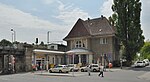
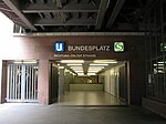
Bundesplatz
(until 1938 Wilmersdorf-Friedenau )
(1938–1993 Wilmersdorf )
|
Ringbahn
|
|
Wilmersdorf
( Tempelhof-Schöneberg )
52 ° 28 ′ 39 ″ N, 13 ° 19 ′ 43 ″ E
|
Nov 6, 1928
Dec 17, 1993
|
Sep 18 1980
|
|
×
|
Closed in 1980 as a result of the Reichsbahn strike
|
|
|
Charlottenburg
|
Stadtbahn
Wetzlarer Bahn
|
|
Charlottenburg
( Charlottenburg-Wilmersdorf )
52 ° 30 ′ 17 ″ N, 13 ° 18 ′ 12 ″ E
|
June 11, 1928
|
|
×
|
×
|
|

|
|
Dahlewitz
|
Dresden Railway
|
|
Dahlewitz
( Blankenfelde-Mahlow )
52 ° 19 ′ 34 ″ N, 13 ° 25 ′ 12 ″ E
|
Oct 6, 1940
|
Sep 12 1961
|
×
|
|
In 1961, as a result of the construction of the Wall, the S-Bahn traffic ceased.
In operation for regional traffic.
|

|
| Dreilinden
|
Cemetery railway
|
|
Dreilinden
( Kleinmachnow )
52 ° 24 ′ 14 ″ N, 13 ° 10 ′ 42 ″ E
|
July 10, 1928
Sep 11. 1954
|
Jan. 19, 1953
Aug. 13, 1961
|
|
|
Closed in 1961 due to the construction of the wall .
|

|
Düppel
(1951–1973 Düppel-Kleinmachnow )
|
Trunk line
|
|
Zehlendorf
( Steglitz-Zehlendorf )
52 ° 25 ′ 17 ″ N, 13 ° 13 ′ 36 ″ E
|
June 15, 1948
|
Sep 18 1980
|
|
|
|

|
|
Ebersstrasse
|
Ringbahn
|
|
Schöneberg
|
Nov 6, 1928
|
March 1, 1933
|
|
|
Replacement by Schöneberg
|
|
Eichborndamm
(until 1994 Eichbornstrasse )
|
Kremmener Bahn
|
|
Reinickendorf
( Reinickendorf )
52 ° 34 ′ 39 ″ N, 13 ° 19 ′ 1 ″ E
|
March 16, 1927
May 28, 1995
|
Jan. 9, 1984
|
|
|
|

|
| Eichkamp
|
Wetzlar Railway
|
|
Grunewald
( Charlottenburg-Wilmersdorf )
52 ° 29 ′ 51 ″ N, 13 ° 16 ′ 24 ″ E
|
June 6, 1928
|
23 Aug 1928
|
|
|
Replacement by Eichkamp (today Messe Süd )
|
|
Eichwalde
(until 1953 Eichwalde [Kr Teltow] )
|
Görlitz Railway
|
|
Eichwalde
52 ° 22 ′ 17 ″ N, 13 ° 36 ′ 55 ″ E
|
Apr 30, 1951
|
|
|
|
|

|
|
Erkner
|
Silesian Railway
|
|
Erkner
52 ° 25 ′ 47 ″ N, 13 ° 45 ′ 5 ″ E
|
June 11, 1928
Sep 1. 1948
|
April 1945
|
×
|
|
Closed in
1945 due to reparations |

|
|
Falkensee
|
Hamburg Railway
|
|
Falkensee
52 ° 33 ′ 38 ″ N, 13 ° 5 ′ 12 ″ E
|
Aug 14, 1951
|
Oct 9, 1961
|
×
|
|
In 1961, as a result of the construction of the Wall, the S-Bahn traffic ceased.
In operation for regional traffic.
|
|
|
Feuerbachstrasse
|
Wannseebahn
|
|
Steglitz
( Steglitz-Zehlendorf )
52 ° 27 ′ 49 ″ N, 13 ° 19 ′ 57 ″ E
|
May 15, 1933
Feb. 1, 1985
|
Sep 18 1980
|
|
|
Closed in 1980 as a result of the Reichsbahn strike
|

|
|
Berlin-Brandenburg Airport
|
Grünauer Kreuz – BER
|
|
Schönefeld
52 ° 22 ′ 0 ″ N, 13 ° 30 ′ 12 ″ E
|
not yet opened
|
|
×
|
|
Airport train station
|

|
Berlin-Schönefeld Airport
(until 1976 Central Airport Berlin-Schönefeld )
|
Grünauer Kreuz – BER
|
|
Schönefeld
52 ° 23 ′ 29 ″ N, 13 ° 30 ′ 46 ″ E
|
Feb. 26, 1962
|
|
×
|
|
after the opening of BER : renaming to Schönefeld and discontinuation of regional traffic
|

|
Frankfurter Allee
(1949–1961 Stalinallee )
|
Ringbahn
|
|
Friedrichshain
( Friedrichshain-Kreuzberg )
52 ° 30 ′ 54 ″ N, 13 ° 28 ′ 27 ″ E
|
Feb. 1, 1929
|
|
|
×
|
|

|
|
Fredersdorf (b Berlin)
|
Eastern Railway
|
|
Fredersdorf-Vogelsdorf
52 ° 31 ′ 35 ″ N, 13 ° 45 ′ 45 ″ E
|
Sep 1 1948
|
|
|
|
|

|
|
Friedenau
|
Wannseebahn
|
|
Schöneberg
( Tempelhof-Schöneberg )
52 ° 28 ′ 12 ″ N, 13 ° 20 ′ 26 ″ E
|
May 15, 1933
Feb. 1, 1985
|
Sep 18 1980
|
|
|
Closed in 1980 as a result of the Reichsbahn strike
|

|
|
Friedrichsfelde East
|
Eastern Railway
|

|
Berlin-Marzahn
( Marzahn-Hellersdorf )
52 ° 30 ′ 51 ″ N, 13 ° 31 ′ 11 ″ E
|
Nov 6, 1928
|
|
|
|
|

|
|
Friedrichshagen
|
Silesian Railway
|
|
Friedrichshagen
( Treptow-Köpenick )
52 ° 27 ′ 27 ″ N, 13 ° 37 ′ 24 ″ E
|
June 11, 1928
Apr. 30, 1948
|
April 1945
|
|
|
Closed in
1945 due to reparations |

|
|
Friedrichstrasse
|
Light rail
north-south tunnel
|
|
Center
( center )
52 ° 31 ′ 13 ″ N, 13 ° 23 ′ 13 ″ E
|
June 11, 1928
|
|
×
|
×
|
|
|
Frohnau
(until 1938 Frohnau [Mark] )
|
North runway
|
|
Frohnau
( Reinickendorf )
52 ° 37 ′ 57 ″ N, 13 ° 17 ′ 25 ″ E
|
June 5, 1925
Oct. 1, 1984
|
Jan. 9, 1984
|
|
|
|

|
|
Garden field
|
Siemensbahn
|
|
Siemensstadt
( Spandau )
52 ° 32 ′ 48 ″ N, 13 ° 14 ′ 58 ″ E
|
Dec 18, 1929
|
Aug 19, 1980
|
|
|
|

|
|
Gehrenseestrasse
|
Outer ring
|
|
Neu-Hohenschönhausen
( Lichtenberg )
52 ° 33 ′ 24 ″ N, 13 ° 31 ′ 28 ″ E
|
December 20, 1984
|
|
|
|
Working title garden city
|

|
|
Healthy well
|
Ringbahn
Szczecin Railway
|
|
Gesundbrunnen
( center )
52 ° 32 ′ 55 ″ N, 13 ° 23 ′ 22 ″ E
|
Aug 8, 1924
May 1, 1984
|
Jan. 9, 1984
|
×
|
×
|
Ring platform closed in 1980 as a result of the Reichsbahn strike;
Ring platform reopened in 2001
|

|
Greifswalder Strasse
(until 1946 Weißensee )
(1986–1993 Ernst-Thälmann-Park )
|
Ringbahn
|
|
Prenzlauer Berg
( Pankow )
52 ° 32 ′ 24 ″ N, 13 ° 26 ′ 26 ″ E
|
Feb. 1, 1929
|
|
|
|
|

|
|
Griebnitzsee
|
Wannseebahn
|
|
Babelsberg
( Potsdam )
52 ° 23 ′ 40 ″ N, 13 ° 7 ′ 38 ″ E
|
Nov 6, 1928
Apr 1, 1992
|
Oct 9, 1961
|
×
|
|
Closed in 1961 due to the construction of the wall
|

|
Grünau
(until 1929 Grünau [Mark] )
|
Görlitz Railway
|
|
Grünau
( Treptow-Köpenick )
52 ° 24 ′ 45 ″ N, 13 ° 34 ′ 26 ″ E
|
Nov 6, 1928
|
|
|
|
|

|
|
Grünbergallee
|
Grünauer Kreuz – BER
|
|
Altglienicke
( Treptow-Köpenick )
52 ° 23 ′ 57 ″ N, 13 ° 32 ′ 30 ″ E
|
May 27, 1962
|
|
|
|
|

|
|
Grunewald
|
Wetzlar Railway
|
|
Grunewald
( Charlottenburg-Wilmersdorf )
52 ° 29 ′ 21 ″ N, 13 ° 15 ′ 41 ″ E
|
Nov 6, 1928
May 1, 1984
|
Jan. 9, 1984
|
|
|
|

|
Hackescher Markt
(until 1951 stock exchange )
(1951–1992 Marx-Engels-Platz )
|
Light rail
|
|
Center
( center )
52 ° 31 ′ 21 ″ N, 13 ° 24 ′ 8 ″ E
|
June 11, 1928
|
|
|
|
|
|
|
Halensee
|
Ringbahn
|
|
Halensee
( Charlottenburg-Wilmersdorf )
52 ° 29 ′ 46 ″ N, 13 ° 17 ′ 26 ″ E
|
Nov 6, 1928
Dec 17, 1993
|
Sep 18 1980
|
|
|
Closed in 1980 as a result of the Reichsbahn strike
|

|
Hauptbahnhof
(until 2002 Lehrter Stadtbahnhof )
(2002–2006 Hauptbahnhof – Lehrter Bahnhof )
|
Light rail
|
|
Moabit
( center )
52 ° 31 ′ 30 ″ N, 13 ° 22 ′ 10 ″ E
|
June 11, 1928
May 26, 2006
|
|
×
|
×
|
|

|
|
Heerstrasse
|
Spandau suburban railway
|
|
Westend
( Charlottenburg-Wilmersdorf )
52 ° 30 ′ 31 ″ N, 13 ° 15 ′ 31 ″ E
|
23 Aug 1928
16 Jan 1998
|
17 Sep 1980
|
|
|
Closed in 1980 as a result of the Reichsbahn strike
|

|
|
Hegermühle
|
Strausberg – Strausberg North
|
|
Strausberg
52 ° 32 ′ 56 ″ N, 13 ° 52 ′ 0 ″ E
|
Oct 5, 1984
|
|
|
|
|

|
Heidelberger Platz
(until 1993 Schmargendorf )
|
Ringbahn
|
|
Wilmersdorf
( Charlottenburg-Wilmersdorf )
52 ° 28 ′ 48 "N, 13 ° 18 ′ 43" E
|
Nov 6, 1928
Dec 17, 1993
|
Sep 18 1980
|
|
×
|
Closed in 1980 as a result of the Reichsbahn strike
|
|
|
Heiligensee
|
Kremmener Bahn
|
|
Heiligensee
( Reinickendorf )
52 ° 37 ′ 29 ″ N, 13 ° 13 ′ 45 ″ E
|
March 16, 1927
December 15, 1998
|
Jan. 9, 1984
|
|
|
|

|
|
Hennigsdorf (b Berlin)
|
Kremmener Bahn
|
|
Hennigsdorf
52 ° 38 ′ 17 ″ N, 13 ° 12 ′ 21 ″ E
|
March 16, 1927
December 15, 1998
|
Sep 20 1983
|
×
|
|
|
|
|
Hennigsdorf North
|
Kremmener Bahn
|
|
Hennigsdorf
52 ° 39 ′ 36 ″ N, 13 ° 12 ′ 12 ″ E
|
Aug 18, 1958
|
Sep 20 1983
|
|
|
|

|
|
Hermannstrasse
|
Ringbahn
|
|
Neukölln
( Neukölln )
52 ° 28 ′ 3 ″ N, 13 ° 25 ′ 52 ″ E
|
Nov 6, 1928
Dec 17, 1993
|
Sep 18 1980
|
|
×
|
Closed in 1980 as a result of the Reichsbahn strike
|

|
Hermsdorf
(until 1929 Hermsdorf [b Berlin] )
|
North runway
|
|
Hermsdorf
( Reinickendorf )
52 ° 37 ′ 4 ″ N, 13 ° 18 ′ 25 ″ E
|
June 5, 1925
Oct. 1, 1984
|
Jan. 9, 1984
|
|
|
|

|
|
Deer garden
|
Silesian Railway
|
|
Friedrichshagen
( Treptow-Köpenick )
52 ° 27 ′ 28 ″ N, 13 ° 36 ′ 12 ″ E
|
June 11, 1928
Apr. 30, 1948
|
April 1945
|
|
|
Closed in
1945 due to reparations |

|
|
Hohen Neuendorf (b Berlin)
|
North runway
|
|
Hohen Neuendorf
52 ° 40 ′ 6 ″ N, 13 ° 17 ′ 13 ″ E
|
June 5, 1925
|
|
|
|
|

|
|
Hohenschoenhausen
|
Outer ring
|
|
Neu-Hohenschönhausen
( Lichtenberg )
52 ° 33 ′ 59 ″ N, 13 ° 30 ′ 44 ″ E
|
December 20, 1984
|
|
×
|
|
|

|
|
Hohenschöpping
|
Kremmener Bahn
|
|
Velten
52 ° 40 ′ 12 ″ N, 13 ° 11 ′ 40 ″ E
|
Apr 13, 1938
|
Sep 20 1983
|
|
|
|

|
|
Hohenzollerndamm
|
Ringbahn
|
|
Halensee
( Charlottenburg-Wilmersdorf )
52 ° 29 ′ 19 ″ N, 13 ° 18 ′ 1 ″ E
|
Nov 6, 1928
Dec 17, 1993
|
Sep 18 1980
|
|
|
Closed in 1980 as a result of the Reichsbahn strike
|

|
|
Hoppegarten (Mark)
|
Eastern Railway
|
|
Dahlwitz-Hoppegarten
( Hoppegarten )
52 ° 31 ′ 6 ″ N, 13 ° 40 ′ 24 ″ E
|
March 7, 1947
|
|
|
|
|

|
|
Humboldthain
|
Szczecin Railway
|
|
Gesundbrunnen
( center )
52 ° 32 ′ 42 ″ N, 13 ° 22 ′ 46 ″ E
|
Jan 31, 1935
May 1, 1984
|
Jan. 9, 1984
|
|
|
|

|
|
Innsbrucker Platz
|
Ringbahn
|
|
Friedenau
( Tempelhof-Schöneberg )
52 ° 28 ′ 43 ″ N, 13 ° 20 ′ 38 ″ E
|
July 1, 1933
Sep. 30 1979
Dec 17, 1993
|
June 1, 1972
Sep 18. 1980
|
|
×
|
1972 closed due to the construction of the autobahn .
1980 closed due to the Reichsbahn strike
|
|
|
Jannowitz Bridge
|
Light rail
|
|
Middle
( middle )
 52.514638 13.418389 52.514638 13.418389
|
June 11, 1928
|
|
|
×
|
|

|
|
Julius-Leber-Bridge
|
Wannseebahn
|
|
Schöneberg
( Tempelhof-Schöneberg )
52.486268888889 13.360211944444
|
Apr 18, 1929
May 2, 2008
|
June 3, 1944
|
|
|
From 1929–1944 the Kolonnenstrasse station was located at the same location , approached via the Ringbahn ( Südringspitzkehre )
|

|
|
Jungfernheide
|
Ringbahn
Siemensbahn
|
|
Charlottenburg-Nord
( Charlottenburg-Wilmersdorf )
52 ° 31 ′ 49 ″ N, 13 ° 17 ′ 58 ″ E
|
Feb. 1, 1929
Apr. 15, 1997
|
Sep 18 1980
|
×
|
×
|
Closed in 1980 as a result of the Reichsbahn strike
|

|
Karl Bonhoeffer Psychiatric Clinic
(until 1994 Wittenau [Kremmener Bahn] )
|
Kremmener Bahn
|
|
Berlin-Reinickendorf
( Reinickendorf )
52 ° 34 ′ 42 ″ N, 13 ° 19 ′ 53 ″ E
|
March 16, 1927
May 28, 1995
|
Jan. 9, 1984
|
|
×
|
|
|
|
Karlshorst
|
Silesian Railway
|
|
Karlshorst
( Lichtenberg )
52 ° 28 ′ 51 ″ N, 13 ° 31 ′ 33 ″ E
|
June 11, 1928
Jan. 5, 1945
|
April 1945
|
×
|
|
Closed in
1945 due to reparations |

|
|
Karow
|
Northern Freight Outer Ring of the
Szczecin Railway
|
|
Karow
( Pankow )
52 ° 36 ′ 54 ″ N, 13 ° 28 ′ 9 ″ E
|
Aug 8, 1924
|
|
×
|
|
Platform-level change to regional train
|

|
|
Kaulsdorf
|
Eastern Railway
|
|
Kaulsdorf
( Marzahn-Hellersdorf )
52 ° 30 ′ 44 ″ N, 13 ° 35 ′ 25 ″ E
|
Nov 6, 1928
|
|
|
|
|

|
|
Köllnische Heide
|
Baumschulenweg – Neukölln connection railway
|
|
Neukölln
( Neukölln )
52 ° 28 ′ 10 ″ N, 13 ° 28 ′ 3 ″ E
|
Nov 6, 1928
Dec 17, 1993
|
Sep 18 1980
|
|
|
Closed in 1980 as a result of the Reichsbahn strike
|

|
|
King Wusterhausen
|
Görlitz Railway
|
|
Königs Wusterhausen
52 ° 17 ′ 48 ″ N, 13 ° 37 ′ 52 ″ E
|
Apr 30, 1951
|
|
×
|
|
|
|
Köpenick
(until 1933 Cöpenick )
|
Silesian Railway
|
|
Köpenick
( Treptow-Köpenick )
52 ° 27 ′ 31 ″ N, 13 ° 34 ′ 51 ″ E
|
June 11, 1928
Jan. 5, 1945
|
Apr. 1948
|
|
|
Closed in
1945 due to reparations |

|
Landsberger Allee
(1950–1992 Leninallee )
|
Ringbahn
|
|
Prenzlauer Berg
( Friedrichshain-Kreuzberg )
52 ° 31 ′ 46 ″ N, 13 ° 27 ′ 17 ″ E
|
Feb. 1, 1929
|
|
|
|
|
|
|
Lankwitz
|
Anhalter suburban train
|
|
Lankwitz
( Steglitz-Zehlendorf )
52.438611111111 13.341666666667
|
July 2, 1929
May 28, 1995
|
Sep 1 1984
|
|
|
|

|
|
Lehnitz
|
North runway
|
|
Lehnitz
( Oranienburg )
52 ° 44 ′ 28 ″ N, 13 ° 15 ′ 49 ″ E
|
Oct. 4, 1925
|
|
|
|
|

|
Lichtenberg
(until 1954 Lichtenberg-Friedrichsfelde )
|
Eastern Railway
|
|
Lichtenberg
( Lichtenberg )
52 ° 30 ′ 38 ″ N, 13 ° 29 ′ 47 ″ E
|
Nov 6, 1928
|
|
×
|
×
|
|

|
|
Lichtenrade
|
Dresden Railway
|
|
Lichtenrade
( Tempelhof-Schöneberg )
52.387146 13.396526
|
May 15, 1939
|
|
|
|
|

|
|
Lichterfelde East
|
Anhalter suburban train
|
|
Lichterfelde
( Steglitz-Zehlendorf )
52.43 13.328888888889
|
July 2, 1929
May 28, 1995
|
Jan. 9, 1984
|
×
|
|
|
|
|
Lichterfelde south
|
Anhalter suburban train from
Lichterfelde Süd – Teltow Stadt
|
|
Lichterfelde
( Steglitz-Zehlendorf )
52.41 13.308611111111
|
9 Aug 1943
25 Sep 1998
|
Jan. 9, 1984
|
|
|
|

|
|
Lichterfelde West
|
Wannseebahn
|
|
Lichterfelde
( Steglitz-Zehlendorf )
52 ° 26 ′ 36 ″ N, 13 ° 17 ′ 41 ″ E
|
May 15, 1933
Feb. 1, 1985
|
Sep 18 1980
|
|
|
Closed in 1980 as a result of the Reichsbahn strike
|

|
|
Mahlow
|
Dresden Railway
|
|
Blankenfelde-Mahlow
52.360230555556 13.408480555556
|
May 15, 1939
Aug 31, 1992
|
Sep 12 1961
|
|
|
|
|
|
Mahlsdorf
|
Eastern Railway
|
|
Mahlsdorf
( Marzahn-Hellersdorf )
52 ° 30 ′ 43 ″ N, 13 ° 36 ′ 36 ″ E
|
Dec 15, 1930
|
|
|
|
|
|
|
Marienfelde
|
Dresden Railway
|
|
Marienfelde
( Tempelhof-Schöneberg )
52.424166666667 13.374722222222
|
May 15, 1939
|
|
|
|
|

|
|
Marzahn
|
Wriezener Bahn
|
|
Marzahn
( Marzahn-Hellersdorf )
52 ° 32 ′ 37 ″ N, 13 ° 32 ′ 28 ″ E
|
Dec 30, 1976
|
|
|
|
|

|
Mehrower Allee
(until 1992 Otto-Winzer-Straße )
|
Wriezener Bahn
|
|
Marzahn
( Marzahn-Hellersdorf )
52 ° 33 ′ 27 ″ N, 13 ° 33 ′ 13 ″ E
|
Dec 15, 1980
|
|
|
|
|

|
Messe Nord / ICC
(until 2002 Witzleben )
|
Ringbahn
|
|
Charlottenburg
( Charlottenburg-Wilmersdorf )
52 ° 30 ′ 28 ″ N, 13 ° 16 ′ 54 ″ E
|
Feb. 1, 1929
Dec. 17, 1993
|
Sep 18 1980
|
|
×
|
In 1980, as a result of the Reichsbahn strike, the Kaiserdamm underground station
crossing was closed
|

|
Messe Süd
(until 1936 Eichkamp )
(1936–1946 Germany Hall )
(1946–2002 Eichkamp )
|
Spandau suburban railway
|
|
Westend
( Charlottenburg-Wilmersdorf )
52 ° 29 ′ 55 ″ N, 13 ° 16 ′ 13 ″ E
|
23 Aug 1928
16 Jan 1998
|
17 Sep 1980
|
|
|
Closed in 1980 as a result of the Reichsbahn strike
|

|
Mexikoplatz
(until 1958 Zehlendorf West
1958–1987 Lindenthaler Allee )
|
Wannseebahn
|
|
Zehlendorf
( Steglitz-Zehlendorf )
52 ° 26 ′ 15 ″ N, 13 ° 13 ′ 57 ″ E
|
May 15, 1933
Feb. 1, 1985
|
Sep 18 1980
|
|
|
Closed in 1980 as a result of the Reichsbahn strike
|

|
|
Mühlenbeck-Mönchmühle
|
Outer ring
|
|
Mühlenbecker Land
52 ° 39 ′ 17 ″ N, 13 ° 23 ′ 12 ″ E
|
Sep 2 1984
|
|
|
|
|

|
|
Neuenhagen (b Berlin)
|
Eastern Railway
|
|
Neuenhagen near Berlin
52 ° 31 ′ 15 ″ N, 13 ° 42 ′ 1 ″ E
|
Sep 1 1948
|
|
|
|
|

|
|
Neukölln
|
Ringbahn
connecting line Baumschulenweg – Neukölln
|
|
Neukölln
( Neukölln )
52 ° 28 ′ 10 ″ N, 13 ° 26 ′ 32 ″ E
|
Nov 6, 1928
Sep 18 1980
|
Dec 17, 1993
|
|
×
|
Closed in 1980 as a result of the Reichsbahn strike
|

|
|
Nikolassee
|
Wannsee
Railway Wetzlar Railway
|
|
Nikolassee
( Steglitz-Zehlendorf )
52 ° 25 ′ 54 ″ N, 13 ° 11 ′ 36 ″ E
|
Nov 6, 1928
May 1, 1984
|
Sep 1 1984
|
|
|
Wannsee platform closed from 1980 to 1985
|

|
Nöldnerplatz
( Neu-Lichtenberg until 1954 )
|
Eastern Railway
|
|
Rummelsburg
( Lichtenberg )
52 ° 30 ′ 14 ″ N, 13 ° 29 ′ 7 ″ E
|
Nov 6, 1928
|
|
|
|
|

|
Nordbahnhof
(until 1950: Stettiner Bahnhof )
|
North-South tunnel of the
Szczecin Railway
|
|
Center
( center )
52 ° 31 ′ 55 ″ N, 13 ° 23 ′ 16 ″ E
|
July 27, 1936
Nov 16, 1947
Sep 1 1990
|
Apr. 1945
Aug. 13, 1961
|
|
|
Tunnel station below the long-distance station
|

|
|
Oberspree
|
Branch line Schöneweide – Spindlersfeld
|
|
Niederschöneweide
( Treptow-Köpenick )
52 ° 27 ′ 9 ″ N, 13 ° 32 ′ 18 ″ E
|
Feb. 1, 1929
|
|
|
|
|

|
Olympiastadion
(until 1930 racetrack )
(1930–1935 Grunewald stadium racetrack )
(1935–1960 Reichssportfeld )
|
Spandau suburban railway
|
|
Westend
( Charlottenburg-Wilmersdorf )
52 ° 30 ′ 42 ″ N, 13 ° 14 ′ 33 ″ E
|
23 Aug 1928
16 Jan 1998
|
Sep 18 1980
|
|
|
additional ten-track terminus station for events; Closed in
1980 as a result of the Reichsbahn strike
|
|
|
Oranienburg
|
North runway
|
|
Oranienburg
52 ° 45 ′ 13 ″ N, 13 ° 14 ′ 59 ″ E
|
Oct. 4, 1925
|
|
×
|
|
|

|
|
Oranienburger Strasse
|
North-South tunnel
|
|
Middle
( middle )
52.525046 13.392924
|
July 27, 1936
Nov 16, 1947
Sep 1 1990
|
Apr. 1945
Aug. 13, 1961
|
|
|
|

|
|
Osdorfer Strasse
|
Hitchhiker's train
|
|
Lichterfelde
( Steglitz-Zehlendorf
52.41925 13.314555555556
|
25 Sep 1998
|
|
|
|
|

|
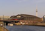
Ostbahnhof
(until 1950 Schlesischer Bahnhof )
(1987–1999 Hauptbahnhof )
|
Ostbahn
Schlesische Bahn
light rail
|
|
Friedrichshain
( Friedrichshain-Kreuzberg )
52 ° 30 ′ 36 ″ N, 13 ° 26 ′ 5 ″ E
|
June 11, 1928
|
|
×
|
|
|

|
Ostkreuz
(until 1933 Stralau-Rummelsburg )
|
Ostbahn
Ringbahn
Schlesische Bahn
|
|
Friedrichshain
( Friedrichshain-Kreuzberg )
52 ° 30 ′ 11 ″ N, 13 ° 28 ′ 8 ″ E
|
June 11, 1928
June 21, 1945
|
April 1945
|
|
|
|

|
Pankow
(until 1954 Pankow-Schönhausen )
|
Szczecin Railway
|
|
Pankow
( Pankow )
52 ° 34 ′ 0 ″ N, 13 ° 24 ′ 40 ″ E
|
Aug 8, 1924
|
|
|
×
|
|

|
|
Pankow-Heinersdorf
|
Szczecin Railway
|
|
Pankow
( Pankow )
52 ° 34 ′ 42 "N, 13 ° 25 ′ 47" E
|
Aug 8, 1924
|
|
|
|
|

|
Petershagen North
(until 1967 Giebelsee )
|
Eastern Railway
|
|
Petershagen / Eggersdorf
52 ° 31 ′ 45 ″ N, 13 ° 47 ′ 28 ″ E
|
Oct 31, 1948
|
|
|
|
|

|
|
Perleberger Bridge
|
S21
|

|
Moabit
( middle )
52.536325 13.359096
|
not yet opened
|
|
|
|
|
|
|
Pichelsberg
|
Spandau suburban railway
|
|
Westend
( Charlottenburg-Wilmersdorf )
52 ° 30 ′ 37 ″ N, 13 ° 13 ′ 38 ″ E
|
23 Aug 1928
16 Jan 1998
|
Sep 18 1980
|
|
|
Closed in 1980 as a result of the Reichsbahn strike
|

|
|
Plänterwald
|
Görlitz Railway
|
|
Plänterwald
( Treptow-Köpenick )
52 ° 28 ′ 43 ″ N, 13 ° 28 ′ 24 ″ E
|
June 3, 1956
|
|
|
|
|

|
Poelchaustraße
(until 1992 Karl-Maron-Straße )
|
Wriezener Bahn
|
|
Marzahn
( Marzahn-Hellersdorf )
52 ° 32 ′ 8 ″ N, 13 ° 32 ′ 8 ″ E
|
28 Sep 1979
|
|
|
|
|

|
|
Potsdam train station
|
Trunk line
|
|
Tiergarten
( center )
52 ° 30 ′ 28 ″ N, 13 ° 22 ′ 37 ″ E
|
May 15, 1933
|
Feb. 1945
|
×
|
×
|
|
|
|
Potsdamer Platz
|
North-South tunnel
|
|
Middle
( middle )
52.509444444444 13.375833333333
|
Apr 15, 1939
June 2, 1946
March 1, 1992
|
Apr. 1945
Aug. 13, 1961
|
×
|
×
|
|

|
|
Potsdam Ringbahnhof
|
Anhalter suburban railway
Südringspitzkehre
|
|
Zoo
( middle )
|
Apr 18, 1929
Aug 6, 1945
|
July 3, 1944
July 27, 1946
|
×
|
×
|
|
|
Potsdam Hauptbahnhof
(until 1960 Potsdam )
(1960–1999 Potsdam city )
|
Wannseebahn
|
|
Potsdam
52 ° 23 ′ 30 ″ N, 13 ° 4 ′ 0 ″ E
|
Nov 6, 1928
Apr 1, 1992
|
Oct 9, 1961
|
×
|
|
1961–1992 no electrical operation due to the construction of the wall
|

|
|
Prenzlauer Allee
|
Ringbahn
|
|
Prenzlauer Berg
( Pankow )
52 ° 32 ′ 41 ″ N, 13 ° 25 ′ 34 ″ E
|
Feb. 1, 1929
|
|
|
|
|

|
|
Priest path
|
Anhalter suburban railway
Dresdener Bahn
|
|
Schöneberg
( Tempelhof-Schöneberg )
52.4601 13.3563
|
Oct 7, 1928
|
|
|
|
|

|
|
Rahnsdorf
|
Silesian Railway
|
|
Rahnsdorf
( Treptow-Köpenick )
52 ° 27 ′ 6 ″ N, 13 ° 41 ′ 23 ″ E
|
June 11, 1928
Sep 1. 1948
|
April 1945
|
|
|
Closed in
1945 due to reparations |

|
|
Rangsdorf
|
Dresden Railway
|
|
Rangsdorf
( Rangsdorf )
52 ° 17 ′ 40 ″ N, 13 ° 25 ′ 50 ″ E
|
Oct 6, 1940
|
Sep 12 1961
|
×
|
|
|

|
Raoul-Wallenberg-Strasse
(until 1992 Bruno-Leuschner-Strasse )
|
Wriezener Bahn
|
|
Marzahn
( Marzahn-Hellersdorf )
52 ° 33 ′ 3 ″ N, 13 ° 32 ′ 51 ″ E
|
Dec 15, 1980
|
|
|
|
|

|
Rathaus Steglitz
(until 1992 Steglitz )
|
Wannseebahn
|
|
Steglitz
( Steglitz-Zehlendorf )
52 ° 27 ′ 22 ″ N, 13 ° 19 ′ 18 ″ E
|
May 15, 1933
Feb. 1, 1985
|
Sep 18 1980
|
|
×
|
Closed in 1980 as a result of the Reichsbahn strike
|

|
|
X-ray valley
|
Szczecin Railway
|
|
Panke Valley
52 ° 38 ′ 55 ″ N, 13 ° 30 ′ 48 ″ E
|
Aug 8, 1924
|
|
|
|
|

|
|
Rummelsburg
|
Silesian Railway
|
|
Rummelsburg
( Lichtenberg )
52 ° 30 ′ 4 ″ N, 13 ° 28 ′ 44 ″ E
|
June 11, 1928
Jan. 5, 1948
|
April 1945
|
|
|
Closed in
1945 due to reparations |

|
|
Savignyplatz
|
Light rail
|
|
Charlottenburg
( Tempelhof-Schöneberg )
52.505277777778 13.318888888889
|
June 11, 1928
|
|
|
|
|

|
|
Schichauweg
|
Dresden Railway
|
|
Lichtenrade
( Tempelhof-Schöneberg )
52.398547 13.389372
|
Dec. 1, 1990
|
|
|
|
|

|
|
Schlachtensee
|
Wannseebahn
|
|
Nikolassee
( Steglitz-Zehlendorf )
52 ° 26 ′ 24 ″ N, 13 ° 12 ′ 55 ″ E
|
May 15, 1933
Feb. 1, 1985
|
Sep 18 1980
|
|
|
Closed in 1980 as a result of the Reichsbahn strike
|

|
|
Schöneberg
|
Ringbahn
Wannseebahn
|
|
Schöneberg
( Tempelhof-Schöneberg )
52 ° 28 ′ 46 ″ N, 13 ° 21 ′ 6 ″ E
|
March 1, 1933
December 17, 1993
|
Sep 18 1980
|
|
|
Closed in 1980 as a result of the Reichsbahn strike
|
|
Schöneweide
(until 1929 Niederschöneweide-Johannisthal )
|
Görlitzer Bahn
branch line Schöneweide – Spindlersfeld
|
|
Niederschöneweide
( Treptow-Köpenick )
52 ° 27 ′ 18 ″ N, 13 ° 30 ′ 34 ″ E
|
Nov 6, 1928
|
|
×
|
|
|

|
|
Schönfließ
|
Outer ring
|
|
Mühlenbecker Land
52 ° 39 ′ 53 ″ N, 13 ° 20 ′ 25 ″ E
|
Nov 19, 1961
|
|
|
|
|

|
|
Schönhauser Allee
|
Ringbahn
|
|
Prenzlauer Berg
( Pankow )
52 ° 32 ′ 57 ″ N, 13 ° 24 ′ 58 ″ E
|
Feb. 1, 1929
|
|
|
×
|
|
|
Schönholz
(until 1938 Schönholz-Reinickendorf )
|
Kremmener Bahn
Northern Railway
|
|
Reinickendorf
( Reinickendorf )
52 ° 34 ′ 17 ″ N, 13 ° 22 ′ 53 ″ E
|
June 5, 1925
Oct. 1, 1984
|
Jan. 9, 1984
|
|
|
The eponymous location is in the Pankow district
|

|
|
Schulzendorf (b Tegel)
|
Kremmener Bahn
|
|
Heiligensee
( Reinickendorf )
52 ° 36 ′ 46 ″ N, 13 ° 14 ′ 45 ″ E
|
March 16, 1927
December 15, 1998
|
Jan. 9, 1984
|
|
|
|

|
| Siemensstadt
|
Siemensbahn
|
|
Siemensstadt
( Spandau )
52 ° 32 ′ 21 ″ N, 13 ° 15 ′ 49 ″ E
|
Dec 18, 1929
|
Sep 18 1980
|
|
|
|

|
|
Siemensstadt-Fürstenbrunn
|
Hamburg Railway
|
|
Westend
( Charlottenburg-Wilmersdorf )
52 ° 31 ′ 41 ″ N, 13 ° 16 ′ 10 ″ E
|
Aug 28, 1951
|
Sep 18 1980
|
|
|
|

|
Sonnenallee
(until 1938 Kaiser-Friedrich-Straße )
(until 1947 Braunauer Straße )
|
Ringbahn
|
|
Neukölln
( Neukölln )
52 ° 28 ′ 22 ″ N, 13 ° 27 ′ 19 ″ E
|
Nov 6, 1928
Dec 18, 1997
|
Sep 18 1980
|
|
|
Closed in 1980 as a result of the Reichsbahn strike
|

|
Spandau
until 1997 Spandau West )
|
Spandau suburban railway
|
|
Spandau
( Spandau )
52 ° 32 ′ 5 ″ N, 13 ° 11 ′ 45 ″ E
|
Aug 23, 1928
Dec 30, 1998
|
Sep 18 1980
|
×
|
×
|
Change to underground station Rathaus Spandau; Closed in
1980 as a result of the Reichsbahn strike
|

|
|
Spindlersfeld
|
Branch line Schöneweide – Spindlersfeld
|
|
Köpenick
( Treptow-Köpenick )
52 ° 26 ′ 50 ″ N, 13 ° 33 ′ 41 ″ E
|
Feb. 1, 1929
|
|
|
|
|

|
|
Spring pool
|
Wriezener Bahn outer ring
|
|
Marzahn
( Marzahn-Hellersdorf )
52 ° 31 ′ 38 ″ N, 13 ° 32 ′ 11 ″ E
|
Dec 30, 1976
|
|
|
|
|

|
|
Staaken
|
Lehrter Bahn
|
|
Staaken
( Spandau )
52 ° 32 ′ 16 ″ N, 13 ° 8 ′ 29 ″ E
|
Aug 3, 1951
March 4, 1962
|
Aug 13, 1961
Sep 17 1980
|
×
|
|
|

|
Stahnsdorf
(until 1948 Stahnsdorf Reichsbahn )
|
Cemetery railway
|
|
Stahnsdorf
52 ° 23 ′ 14 ″ N, 13 ° 11 ′ 34 ″ E
|
July 10, 1928
May 27, 1948
Sep 11. 1954
|
May 27, 1948
Jan. 19, 1953
Aug. 13, 1961
|
|
|
Closed in 1961 due to the construction of the wall .
|

|
|
Szczecin suburban train station
|
Szczecin Railway
|
|
Center
( center )
52 ° 31 ′ 57 ″ N, 13 ° 23 ′ 5 ″ E
|
Aug 28, 1924
|
July 27, 1936
|
|
|
Suburban train station of the Szczecin train station
|

|
Stolpe Süd
(until 1959 Hennigsdorf Süd )
|
Kremmener Bahn
|
|
Stolpe-Süd
( Hennigsdorf )
52 ° 37 ′ 49 ″ N, 13 ° 13 ′ 24 ″ E
|
4th June 1954
|
Aug 14, 1961
|
|
|
public stop from 1958
|

|
|
Strausberg
|
Strausberg – Strausberg Nord
Ostbahn
|
|
Strausberg
52 ° 31 ′ 55 ″ N, 13 ° 50 ′ 13 ″ E
|
Oct 31, 1948
|
|
×
|
|
|

|
|
Strausberg North
|
Strausberg – Strausberg North
|
|
Strausberg
52 ° 35 ′ 25 ″ N, 13 ° 54 ′ 30 ″ E
|
June 3, 1956
|
|
|
|
|
|
|
Strausberg city
|
Strausberg – Strausberg North
|
|
Strausberg
52 ° 34 ′ 36 ″ N, 13 ° 53 ′ 16 ″ E
|
June 3, 1956
|
|
|
|
|

|
Storkower Straße
(until 1977 central cattle yard )
|
Ringbahn
|
|
Prenzlauer Berg
( Friedrichshain-Kreuzberg )
52 ° 31 ′ 26 ″ N, 13 ° 27 ′ 52 ″ E
|
Feb. 1, 1929
Aug. 1945
July 25, 1951
|
Apr. 1945
Nov. 2, 1947
|
|
|
|

|
Stresow
(until 1936 Spandau Hbf )
(1936–1997 Spandau )
|
Spandau suburban railway
|
|
Spandau
( Spandau )
52 ° 31 ′ 55 ″ N, 13 ° 12 ′ 32 ″ E
|
Aug 23, 1928
Dec 30, 1998
|
Sep 18 1980
|
|
|
Closed in 1980 as a result of the Reichsbahn strike
|

|
|
South end
|
Anhalter suburban train
|
|
Steglitz
( Steglitz-Zehlendorf )
52.448117 13.353646
|
July 2, 1929
May 28, 1995
|
Jan. 9, 1984
|
|
|
|

|
Südkreuz
(until 2006 Papestrasse )
|
Anhalter Vorortbahn
Dresdener Bahn
Ringbahn
|
|
Schöneberg
( Tempelhof-Schöneberg )
52 ° 28 ′ 32 "N, 13 ° 21 ′ 52" E
|
Nov 6, 1928
July 7, 2004
|
|
×
|
|
|

|
|
Sundgauer Strasse
|
Wannseebahn
|
|
Zehlendorf
( Steglitz-Zehlendorf )
52 ° 26 ′ 11 ″ N, 13 ° 16 ′ 26 ″ E
|
July 1, 1934 Feb. 1,
1985
|
|
|
|
Closed in 1980 as a result of the Reichsbahn strike
|

|
|
Tegel
|
Kremmener Bahn
|
|
Tegel
( Reinickendorf )
52 ° 35 ′ 19 ″ N, 13 ° 17 ′ 22 ″ E
|
March 16, 1927
May 28, 1995
|
Jan. 9, 1984
|
|
×
|
Crossing the Alt-Tegel underground station
|

|
|
Teltow
|
Anhalter suburban train
|
|
Teltow
52 ° 23 ′ 18 ″ N, 13 ° 18 ′ 0 ″ E
|
July 7, 1951
|
Aug 13, 1961
|
×
|
|
|

|
|
Teltow city
|
Lichterfelde south – Teltow city
|
|
Teltow
52.396878 13.276392
|
Feb 25, 2005
|
|
|
|
|

|
|
Tempelhof
|
Ringbahn
|
|
Tempelhof
( Tempelhof-Schöneberg )
52 ° 28 ′ 15 ″ N, 13 ° 23 ′ 7 ″ E
|
Nov 6, 1928
Dec 17, 1993
|
28 Sep 1980
|
|
×
|
|

|
|
Zoo
|
Light rail
|
|
Hansaviertel
( middle )
52.51444 13.33649
|
June 11, 1928
Nov. 11, 1996
|
Oct 30, 1994
|
|
|
|

|
Treptower Park
(until 1937 Treptow )
|
Ringbahn
|
|
Alt-Treptow
( Treptow-Köpenick )
52 ° 29 ′ 38 ″ N, 13 ° 27 ′ 41 ″ E
|
Nov 6, 1928
|
|
|
|
|

|
|
Velten (Mark)
|
Kremmener Bahn
|
|
Velten
52 ° 41 ′ 6 ″ N, 13 ° 10 ′ 20 ″ E
|
March 16, 1927
|
Sep 20 1983
|
×
|
|
|

|
|
Huntsmanship
|
North runway
|
|
Waidmannslust
( Reinickendorf )
52 ° 36 ′ 23 ″ N, 13 ° 19 ′ 16 ″ E
|
June 5, 1925
Oct. 1, 1984
|
Jan. 9, 1984
|
|
|
|

|
|
Wannsee
|
Wannsee
Railway Wetzlar Railway
|
|
Wannsee
( Steglitz-Zehlendorf )
52 ° 25 ′ 17 ″ N, 13 ° 10 ′ 45 ″ E
|
Nov 6, 1928
May 1, 1984
|
Jan. 9, 1984
|
×
|
|
Wannsee platform closed from 1980 to 1985
|

|
|
Wannsee station
|
Wannseebahn
|
|
Zoo
( middle )
|
May 15, 1933
|
Oct 8, 1939
|
×
|
×
|
|
|
|
Wassmannsdorf
|
Grünauer Kreuz – BER
|
|
Waßmannsdorf
Schönefeld
52 ° 22 ′ 5 ″ N, 13 ° 27 ′ 48 ″ E
|
not yet opened
|
|
|
|
|

|
|
Warschauer Strasse
|
Eastern Railway
Silesian Railway
|
|
Friedrichshain
( Friedrichshain-Kreuzberg )
52 ° 30 ′ 22 ″ N, 13 ° 27 ′ 1 ″ E
|
June 11, 1928
Nov. 5, 1945
|
April 1945
|
|
×
|
1948 Resumption of electrical operation on the Silesian Railway
|

|
|
Wartenberg
|
Outer ring
|
|
Neu-Hohenschönhausen
( Lichtenberg )
52 ° 34 ′ 23 ″ N, 13 ° 30 ′ 14 ″ E
|
Dec 20, 1985
|
|
|
|
|

|
|
Wedding
|
Ringbahn
|
|
Wedding
( center )
52 ° 32 ′ 33 ″ N, 13 ° 21 ′ 58 ″ E
|
Feb. 1, 1929
June 15, 2002
|
Sep 18 1980
|
|
×
|
Closed in 1980 as a result of the Reichsbahn strike
|

|
| Wernerwerk
|
Siemensbahn
|
|
Siemensstadt
( Spandau )
52 ° 32 ′ 4 ″ N, 13 ° 16 ′ 34 ″ E
|
Dec 18, 1929
|
Sep 18 1980
|
|
|
|

|
|
West end
|
Ringbahn
|
|
Charlottenburg
( Charlottenburg-Wilmersdorf )
52 ° 31 ′ 5 ″ N, 13 ° 17 ′ 4 ″ E
|
Feb. 1, 1929
Dec. 17, 1993
|
Sep 18 1980
|
|
|
Closed in 1980 as a result of the Reichsbahn strike
|

|
Westhafen
(until 1999 Putlitzstrasse )
|
Ringbahn
|
|
Moabit
( center )
52 ° 32 ′ 11 "N, 13 ° 20 ′ 38" E
|
Feb. 1, 1929
Dec. 19, 1999
|
Sep 18 1980
|
|
×
|
Closed in 1980 as a result of the Reichsbahn strike
|

|
Westkreuz
( exhibition until 1932 )
|
Ringbahn
Spandauer Vorortbahn
Wetzlarer Bahn
|
|
Charlottenburg
( Charlottenburg-Wilmersdorf )
52 ° 30 ′ 4 ″ N, 13 ° 17 ′ 2 ″ E
|
Dec 10, 1928
May 1, 1984
|
Jan. 9, 1984
|
|
|
Ring platform closed in 1980 as a result of the Reichsbahn strike.Re-
opening of the ring platform in 1993
|

|
|
Wildau
|
Görlitz Railway
|
|
Wildau
52 ° 19 ′ 12 ″ N, 13 ° 38 ′ 2 ″ E
|
Apr 30, 1951
|
|
|
|
|

|
|
Wilhelmshagen
|
Silesian Railway
|
|
Rahnsdorf
( Treptow-Köpenick )
52 ° 26 ′ 19 ″ N, 13 ° 43 ′ 20 ″ E
|
June 11, 1928
Sep 1. 1948
|
April 1945
|
|
|
Closed in
1945 due to reparations |

|
Wilhelmsruh
(until 1937 Reinickendorf-Rosenthal )
|
North runway
|
|
Reinickendorf
( Reinickendorf )
52 ° 34 ′ 53 ″ N, 13 ° 21 ′ 47 ″ E
|
June 5, 1925
Oct. 1, 1984
|
Jan. 9, 1984
|
|
|
eponymous district is located in the Pankow district
|

|
Wittenau (Wilhelmsruher Damm)
(until 1994 Wittenau [Nordbahn] )
|
North runway
|
|
Wittenau
( Reinickendorf )
52 ° 35 ′ 45 ″ N, 13 ° 20 ′ 12 ″ E
|
June 5, 1925
Oct. 1, 1984
|
Jan. 9, 1984
|
|
×
|
|
|
Wollankstrasse
(until 1937 Pankow [Nordbahn] )
|
North runway
|
|
Pankow
( Pankow )
52 ° 33 ′ 55 "N, 13 ° 23 ′ 32" E
|
June 5, 1925
Oct. 1, 1984
|
Jan. 9, 1984
|
|
|
East Berlin S-Bahn station with access to West Berlin
|

|
|
Wuhletal
|
Eastern Railway
|
|
Biesdorf
( Marzahn-Hellersdorf )
52 ° 30 ′ 45 ″ N, 13 ° 34 ′ 30 ″ E
|
July 1, 1989
|
|
|
×
|
Change to the U5 at the same platform
|

|
Wuhlheide
(until 1929 Sadowa )
|
Silesian Railway
|
|
Köpenick
( Treptow-Köpenick )
52 ° 28 ′ 8 ″ N, 13 ° 33 ′ 12 ″ E
|
June 11, 1928
Jan. 5, 1948
|
April 1945
|
|
|
Closed in
1945 due to reparations |

|
|
Yorckstrasse
|
Anhalter suburban railway
Dresdener Bahn
|
|
Schöneberg
( Tempelhof-Schöneberg )
52 ° 29 ′ 32 ″ N, 13 ° 22 ′ 20 ″ E
|
May 15, 1939
|
|
|
×
|
Stop of the S2 and S25
|

|
|
Yorckstrasse (Grossgörschenstrasse)
|
Wannseebahn
|
|
Schöneberg
( Tempelhof-Schöneberg )
52 ° 29 ′ 32 ″ N, 13 ° 22 ′ 4 ″ E
|
Oct 9, 1939
Feb 1, 1985
|
Sep 18 1980
|
|
×
|
Stop the S1
|

|
Zehlendorf
(until 1938 Zehlendorf Mitte )
|
Wannseebahn main line
|
|
Zehlendorf
( Steglitz-Zehlendorf )
52 ° 25 ′ 51 ″ N, 13 ° 15 ′ 30 ″ E
|
May 15, 1933
Feb. 1, 1985
|
Sep 18 1980
|
|
|
Closed in 1980 as a result of the Reichsbahn strike
|

|
|
Zehlendorf South
|
Trunk line
|
|
Zehlendorf
( Steglitz-Zehlendorf )
52 ° 25 ′ 32 ″ N, 13 ° 14 ′ 24 ″ E
|
Dec 20, 1972
|
Sep 18 1980
|
|
|
|

|
Zepernick (b Bernau)
(until 1960 Zepernick [Kr Niederbarnim] )
|
Szczecin Railway
|
|
Panke Valley
52 ° 39 ′ 35 ″ N, 13 ° 32 ′ 2 ″ E
|
Aug 8, 1924
|
|
|
|
|

|
|
Zeuthen
|
Görlitz Railway
|
|
Zeuthen
52 ° 20 ′ 55 ″ N, 13 ° 37 ′ 39 ″ E
|
Apr 30, 1951
|
|
|
|
|

|
|
Zoological Garden
|
Light rail
|
|
Charlottenburg
( Charlottenburg-Wilmersdorf )
52 ° 30 ′ 26 "N, 13 ° 19 ′ 57" E
|
June 11, 1928
|
|
×
|
×
|
|
|


.jpg)


_05_Bahnsteig.JPG)
.jpg)


.jpg)


.jpg)


.jpg)


.jpg)

.JPG)


.jpg)


(2).jpg)


_06_Bahnsteig.JPG)


-_Eingang_8.8.2013.jpg)


.jpg)


.jpg)


.jpg)


_Bahnsteig_(2).JPG)


.jpg)


.jpg)
_02_Prignitz-Express.JPG)


.jpg)


-_auf_Bahnsteig_zu_Gleis_4_7.8.2013.JPG)

